mail_outline sales@mediastorehouse.com
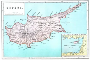
Map of CyprusVintage 19th Century map of Cyprus in the eastern Mediterranean Sea
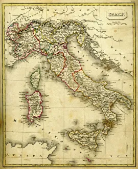
Antquie Map of ItalyVintage map of Italy fron 1837
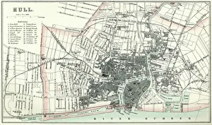
Map of HullVintage map from 1880 of Hull in the East Riding of Yorkshire, England. The city of Hull has served as market town, military supply port, trading hub, fishing and whaling centre
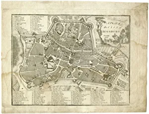
17th century city, plan of Augsburg, GermanyTypical fortifications and references. Rich in details, beautifully aged paperPublished by J. Stockdale, Piccadilly 1800
PapyrusEgyptian PapayrusMore of my photos:
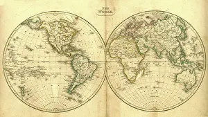
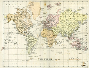
Vintage Map of the WorldVintage map of the world from 1837
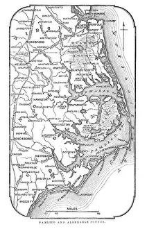
Map of Pamlico and Albemarle SoundsVintage engraving from 1863 of a map of Map of Pamlico and Albemarle Sounds at the time of the American Civil War
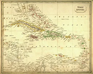
Antquie Map of The West IndiesVintage map of The West Indies from 1837
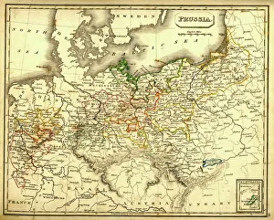
Antquie Map of PrussiaVintage map of Prussia from 1837
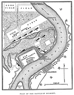
Battle of BelmontVintage engraving from 1863 of a map of the Battle of Belmont which was fought on November 7, 1861, in Mississippi County, Missouri. It was the first combat test in the American Civil War for Brig
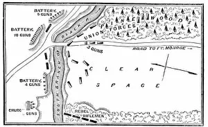
Battle of Big BethelVintage engraving from 1863 of a map of the Battle of Big Bethel also known as the Battle of Bethel Church or Great Bethel was an American Civil War battle that took place on June 10, 1861
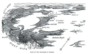
Blockade of BostonVintage engraving from 1861 showing the Plan of the Blockade of Boston during the American Revolutionary War
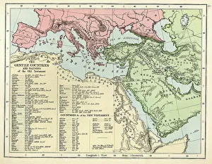
Old Testament MapVintage biblical map from 1879 showing the gentile countries and nations of the Old Testament
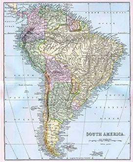
Map of South America 19th CenturyVintage map of South America from the 19th Century
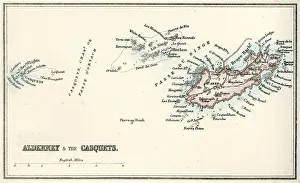
Map of Alderney and the Casquets" Vintage map from 1880 of Alderney and the Casquets. Alderney is the most northerly of the Channel Islands. It is part of the Bailiwick of Guernsey, a British Crown dependency
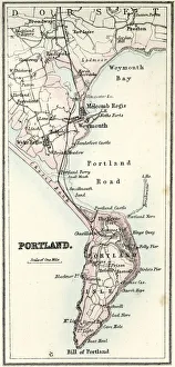
Map of Portland" Vintage map from 1880 of Portland a limestone tombolo or tied island, 6 kilometres long by 2.4 kilometres wide, in the English Channel."
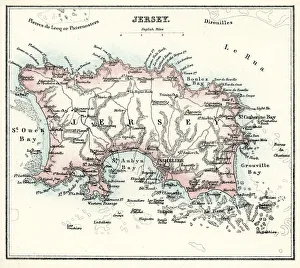
Map of Jersey" Vintage engraving from 1880 of Jersey a British Crown Dependency off the coast of Normandy, France. As well as the island of Jersey itself
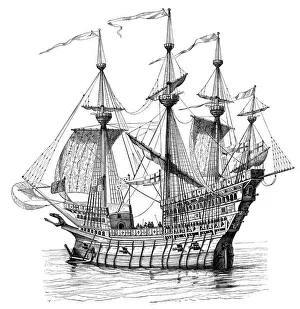
Henry VIIIs warshipVintage engraving from 1876 from an orginal by Holbain. A warship of Henry VIII King of England leaves Dover on route to France
Coat of ArmsVintage engraving by Albrecht DArer c.1513 showing a coat of arms
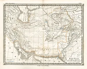
Antique Map of the Persian EmpireAntique Map from 1862 of the Persian Empire, the time of Alexander the Great. Maps text is written in Latin
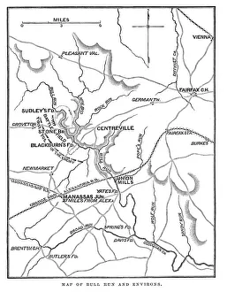
Battle of Bull RunVintage engraving from 1863 of a map of Bull Run and its environs at the time of the American Civil War. The First Battle of Bull Run
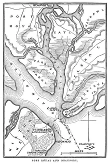
Battle of Port RoyalVintage engraving from 1863 of a map of the Battle of Port Royal which was one of the earliest amphibious operations of the American Civil War
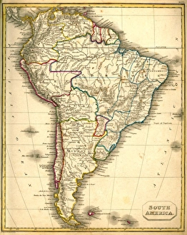
Antquie Map of South AmericaVintage map of South America from 1837
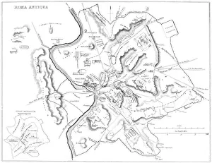
Map of Ancient RomeVintage engraving showing a plan of Ancient Rome
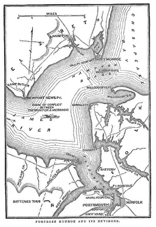
Fort Monroe and its environsVintage engraving from 1863 of a map of Fort Monroe and its environs. Fort Monroe played an important role in the American Civil War
Antique Map of the WorldVintage map of the World from 1884
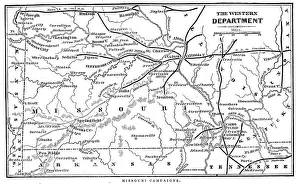
Missouri CampaignsVintage engraving from 1863 of a map of the Missouri Campaigns from the time of the American Civil War
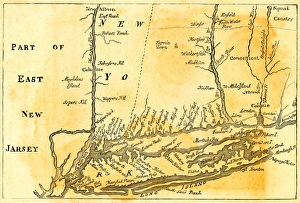
Vintage Map of New York at the beginning of the 18th Century. from 1880