mail_outline sales@mediastorehouse.com
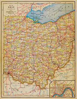
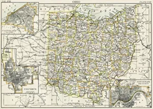
1883 Ohio State Map
Map of USA 1877Warrens Common School Geography 1877
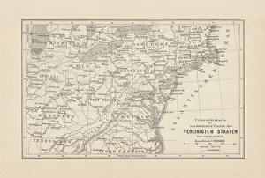
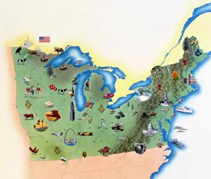
Map of Northeast United States, published in 1882Map of the Northeast United States of America. Wood engraving, published in 1882
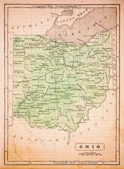
Ohio 1852 Map
Map of middle atlantic states USA 1895The Rand-McNally Grammar School Geography 1895 - Chicago & New York
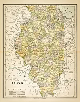
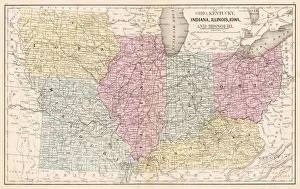
Map of Illinois 1883Map of the state of Illinois
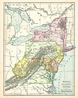
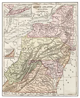
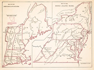
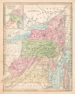
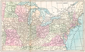
Map Middle atlantic states 1877Warrens Common School Geography 1877
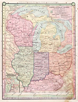
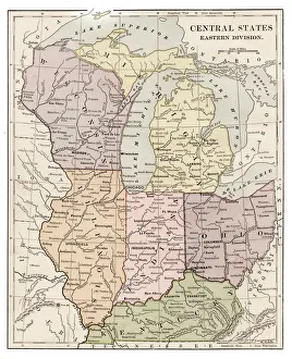
Map of Central states 1877Warrens Common School Geography 1877
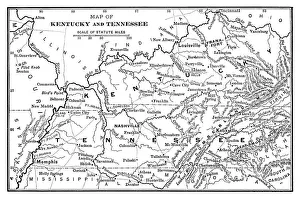
Map of Kentucky and Tennessee - Scanned 1886 Map
Middle Atlantic states 1889Indiana Educational Series The Complete Geography - Indianapolis 1889
North Central states map 1886North Central states map Maps Monteith Physical Geography 1886
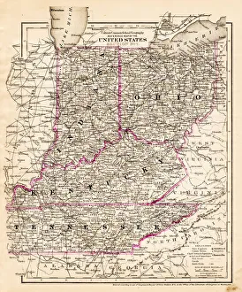
indiana Ohio Kentucky map 1881Coltons Common School Geography 1881 New York Sheldon and Co
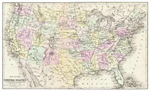
Antquie Map of the United StatesVintage map of the United States of America from 1837
USA, Northern States of America, map with illustrations showing distinguishing features
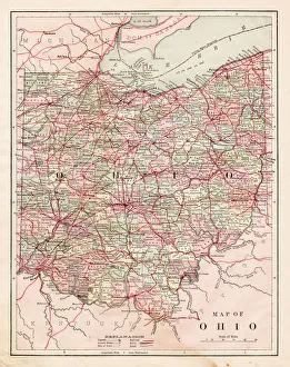
Ohio map 1884Encyclopedia Britannica 9th Edition New York Charles Scribners and Sonsl 1884 Vol XVII
Ohio map 1885Encyclopedia Britannica 9th Edition New York Charles Scribners and Sons 1885 Vol XXIV
Map of the Ohio state USA 1881Harpers School Geography, New York, Harpers and Brothers, 1881
Central states eastern division map 1889Indiana Educational Series The Complete Geography - Indianapolis 1889
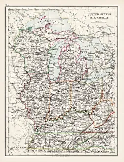
United States North East Central map 1897The World-Wide Atlas of Modern Geography, Political and Physical W. & A.K. Johnston - London 1897
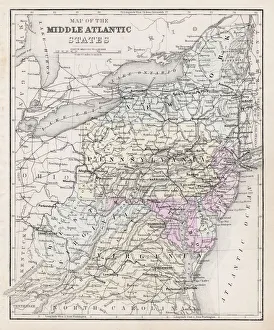
Map of Middle states USA 1883Warrens Common School Geography
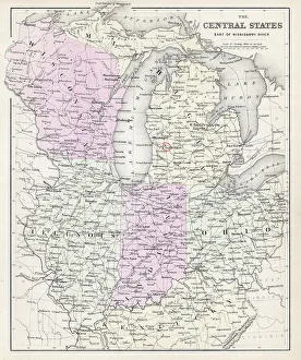
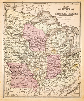
Map of Central States USA 1883Warrens Common School Geography
Southern States 1852 Map
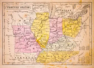
Western States 1852 Map
United States of America, Atlantic coast, lithograph, published in 1878United States of America, Atlantic coast. Lithograph, published in 1878
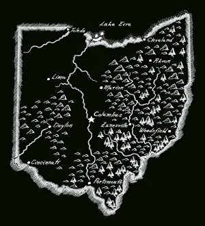
Antique OhioOhio Map, - Antique style. Includes mountains and water bodies. High detail - vector illustration
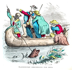
Washington descending the Ohio engraving 1859illustrated Life of George Washington
USA middle states map 1875The Independent Course Comprehensive Geography by James Monteith, A.S. Barnes & Co, New York & Chicago 1875
Routes of travel in the United States map 1875The Independent Course Comprehensive Geography by James Monteith, A.S. Barnes & Co, New York & Chicago 1875
Ohio Indiana Illinois map 1867Mitchellas Modern Atlas - Published by E.H. Butler and Co - Philadelphia 1867
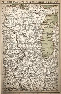
United States of America, Wisconsin, IllinoisAntique illustration of United States of America, Wisconsin, Illinois map
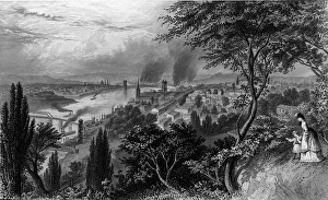
City Of CincinnatiIllustration of a woman and girl on a hillside near the Ohio River, Cincinnati, Ohio, circa 1872. Several steamboats with smoke emanation from their smokestacks travel along the river
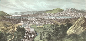
Illustration Of Cincinnati, OhioAerial view of the city of Cincinnati and steamboats on the Ohio River, Cincinnati, OH, 1860s. (Photo by Kean Collection/Getty Images)
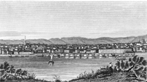
View Of The City Of CincinnatiIllustration of sailboats and steamboats on the Ohio River flowing through the city of Cincinnati, OH, 1850s. (Photo by Kean Collection/Getty Images)
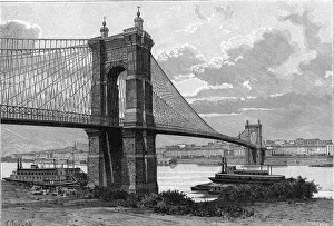
The Cincinnati BridgeIllustration of steamboats on traveling under the Cincinnati Bridge on the Ohio River with the citiy in the background, Cincinnati, Ohio, 1860s. (Photo by Kean Collection/Getty Images)
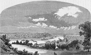
Birds Eye View Of CincinnatiIllustration of people with horses on a hillside enjoying an aerial view of the city of Cincinnati with steamboats traveling on the Ohio River, Cincinnati, OH, 1850s
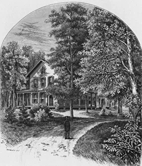
Spiegel Grove in Fremont, Ohio, the residence of Rutherford B. Hayes, 19th President of the United States, circa 1880. An engraving by Harley after G. Gibson. (Photo by Kean Collection/Getty Images)
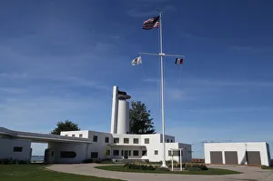
Historic Coast Guard Station, Cleveland, Ohio, USAAbandoned Historic Coast Guard Station on Whiskey Island, now a public park in the City of Cleveland