mail_outline sales@mediastorehouse.com
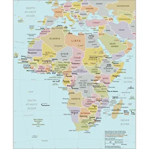
Political Map of AfricaVector Illustration of the policital map of Africa Reference map as created by the US Central Intelligence Agency
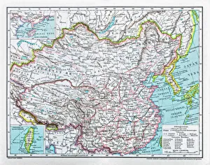
China mapillustration of a South Eastern Asia map
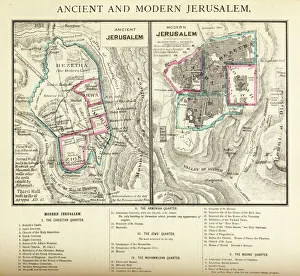
Ancient and Modern Jerusalem Map EngravingEngraved illustration of Ancient and Modern Jerusalem Map Engraving from The Popular Pictorial Bible, Containing the Old and New Testaments, Published in 1862. Copyright has expired on this artwork
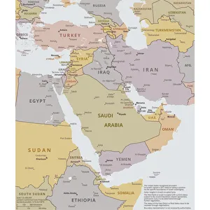
Political map of The Middle EastVector illustration of the policital map of The Middle East Reference map was created by the US Central Intelligence Agency
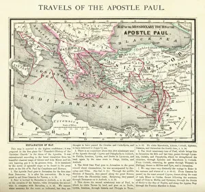
Travels of The Apostle Paul Map EngravingEngraved illustration of the Travels of The Apostle Paul Map Engraving from The Popular Pictorial Bible, Containing the Old and New Testaments, Published in 1862
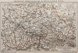
Kingdom of Saxony, Eastern partAntique illustration of a Kingdom of Saxony, Eastern part
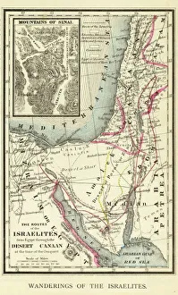
Wanderings of the Israelites Map EngravingEngraved illustration of Wanderings of the Israelites Map Engraving from The Popular Pictorial Bible, Containing the Old and New Testaments, Published in 1862. Copyright has expired on this artwork
The pineapple (Ananas comosus)illustration of a pineapple (Ananas comosus)
Silhouette of Hercules Tower at orange sunsetAn Unesco World Heritage site, Hercules Tower at night in A Coruna, a lighthouse in the north of Spain
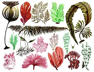
Marine plants, leaves and seaweed, coralCollection of marine plants, leaves and seaweed, coral
Origami cyclebicycle folded out of paper, origami style
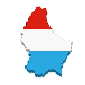
Outline and flag of Luxembourg, 3D
Perfect Golf Swing Sequencesequence, 165791086
Black and white digital illustration of maple leaf outline
Africa, artworkAfrica, computer artwork
South America, artworkSouth America, computer artwork
Atlantic Ocean, artworkAtlantic Ocean, computer artwork
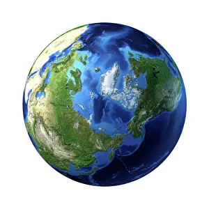
Arctic, artworkArctic, computer artwork
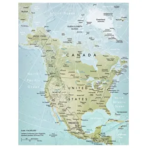
North America mapVector illustration of a detailed map of North America. Reference map was created by the US Central Intelligence Agency and is available as a public domain map at the University of Texas Libraries
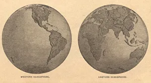
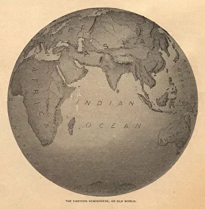
Old, Map of Eastern and Western Hemispheres, From 1875Old black and white illustration of the Eastern Hemisphere and the Western Hemisphere, from the 1800 s
Illustrated Flower Patternhttp://csaimages.com/images/istockprofile/csa_vector_dsp.jpg
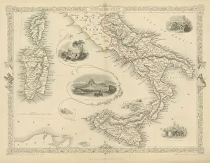
Southern Italy fine engravingSouthern Italy, 1851, Wonderful engraved map In outline color of Southern Italy with inset drawings of Naples and Vesuvius. The Carnival and Festival of the Vintage also depicted
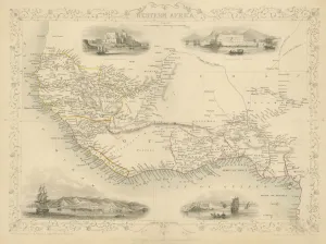
Map of Western Africa 1851Antique 1851 engraved map by J Rapkin, published by John Tallis. Original outline hand colour, decorative border, and attractive inset vignette views of Western Africa
Dead Vlei, Sossusvlei, NamibiaShadows form as the sun rises on Dead Vleis dry Acacia trees in the Namib Desert.Sunrise
Old, Black and White Illustration of Eastern Hemisphere, From 1800 sOld black and white illustration of the Old World (Eastern Hemisphere), from 1875
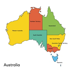
australia, map, country - geographic area, local landmark, color image, vector, illustrationVector illustration of the map of Australia with its regions and regions names
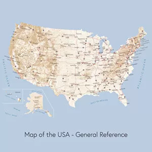
Map of the USA general referenceVector illustration of a map of the United States of America. The reference map used in the creation of this illustration is public domain map available at the University of Texas website: http
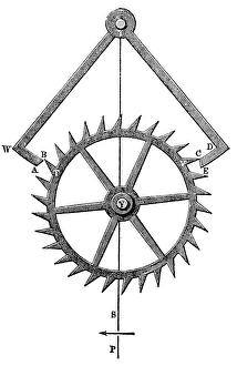
Anchor escapementIllustration of a vintage clock mechanism, Anchor escapement
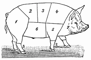
Cuts of Pork19th-century illustration engraving showing primal cuts of a pig
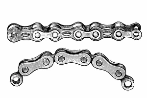
Bicycle chainAntique illustration of a bicycle chain
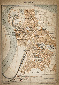
Belgrade map 1893Antique illustration of a Belgrade map 1893
Outline and flag of France, 3D
Outline and flag of Italy, 3D
Outline and flag of England, 3D
Outline and flag of Australia, 3D
Shape and national flag of Azerbaijan, 3D computer graphics
Shape and national flag of the Republic of Chad, 3D computer graphics
Origami magnifying glassmagnifying glass folded out of paper, origami style
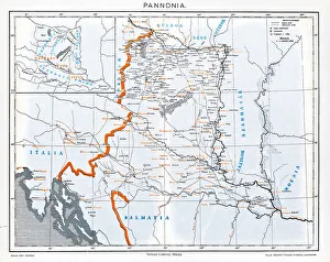
Pannonia is an ancient country of southern Europe that was south and west of the Danube River, in present-day Austria, Hungary, Slovenia, and Croatia
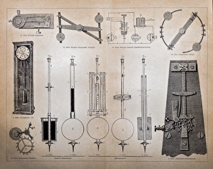
Duplex system watch structuresIllustration of a duplex system watch structures
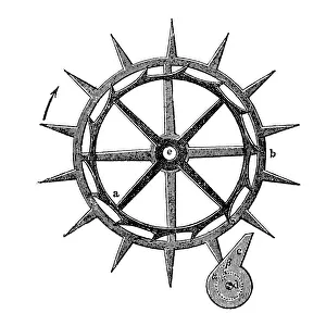
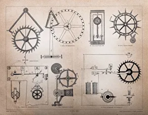
Vintage clock mechanismIllustration of a vintage clock mechanism
Hours structuresIllustration of a vintage clock mechanism
ScrewIllustration of a screw screwed in a wood
VictoriaAntique illustration of a goddess Victoria
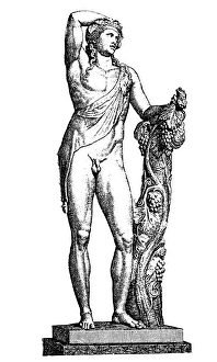
Dionysus god of the vineIllustration of a Dionysus god of the vine, grape harvest, winemaking, wine, ritual madness, religious ecstasy, and theatre
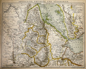
Abyssinia, Eritrea and South ArabiaAntique illustration of a Abyssinia, Eritrea and South Arabia