mail_outline sales@mediastorehouse.com
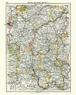
Antique map, Leicester, Warwick, Northampton, Oxford, Buckingham 19th CenturyVintage engraving of a Antique map, Leicester, Warwick, Northampton, Oxford, Buckingham. England 19th Century
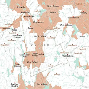
MA Worcester Oxford Vector Road Map. All source data is in the public domain. U.S. Census Bureau Census Tiger. Used Layers: areawater, linearwater, roads, rails, cousub, pointlm, uac10
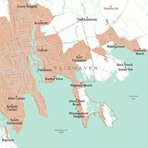
MA Bristol Fairhaven Vector Road Map. All source data is in the public domain. U.S. Census Bureau Census Tiger. Used Layers: areawater, linearwater, roads, rails, cousub, pointlm, uac10
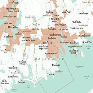
MA Bristol Dartmouth Vector Road Map. All source data is in the public domain. U.S. Census Bureau Census Tiger. Used Layers: areawater, linearwater, roads, rails, cousub, pointlm, uac10
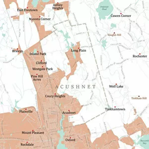
MA Bristol Acushnet Vector Road Map. All source data is in the public domain. U.S. Census Bureau Census Tiger. Used Layers: areawater, linearwater, roads, rails, cousub, pointlm, uac10
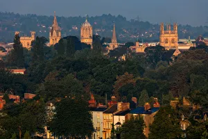
Southpark Views - Oxford SpiresThe spires of Oxford glowing golden in during an atmospheric sunrise as seen from South Park
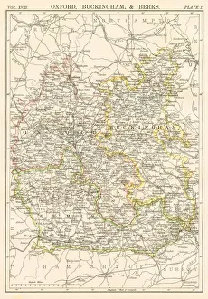
Oxford and Buckingham map 1885Encyclopedia Britannica 9th Edition New York Charles Scribners and Sons 1885 Vol XVIII
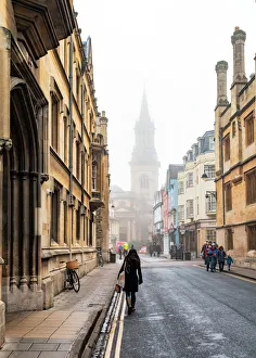
A Walk Down Turl StreetView down Turl Street towards All Saints Church tower with an ambient, winter mist
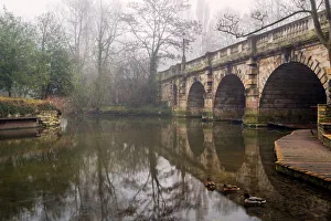
Oxford AmbienceView of the Magdalen Bridge in Oxford, UK during an ambient, winter mist
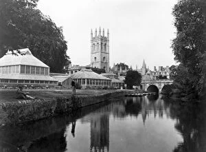
Oxfordcirca 1930: A pleasant riverbank in the university town of Oxford. (Photo by Hulton Archive/Getty Images)