mail_outline sales@mediastorehouse.com
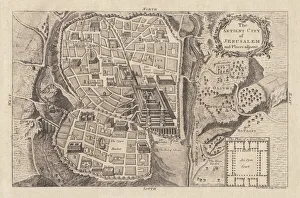
Map of the ancient Jerusalem, copperplate engraving, published in 1774Map of the ancient Jerusalem. Copperplate engraving, published in 1774
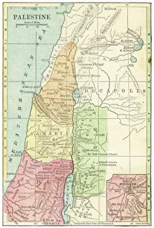
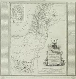
Palestine map 1875The Independent Course Comprehensive Geography by James Monteith, A.S. Barnes & Co, New York & Chicago 1875
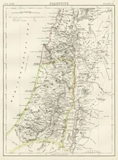
Palestine map 1885Encyclopedia Britannica 9th Edition New York Charles Scribners and Sons 1885 Vol XVIII
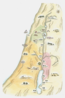
Map of Palestine in the time of Jesus ChristVintage engraving of Map of Palestine in the time of Jesus Christ
Historical map of Palestine with the twelve tribes of Israel. Colored steel engraving, published in 1886
Illustration of Palestinian flag, with three equal horizontal black, white and green stripes overlaid by red isosceles triangle at hoist
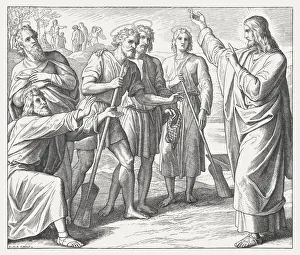
First disciples of Jesus (Matthew 4), wood engraving, published in1860The first disciples of Jesus. Wood engraving by Julius Schnorr von Carolsfeld (German painter, 1794 - 1872), published in 1860
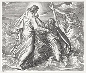
Jesus and the sinking Peter (Matthew 14), published in 1860Jesus and the sinking Peter on the lake. Wood engraving by Julius Schnorr von Carolsfeld (German painter, 1794 - 1872), published in 1860
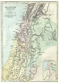
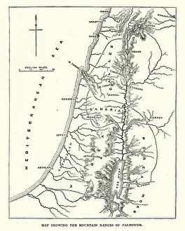
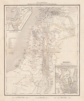
Map showing the mountain ranges of PalestineVintage engraving of Map showing the mountain ranges of Palestine, 19th Century
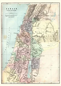
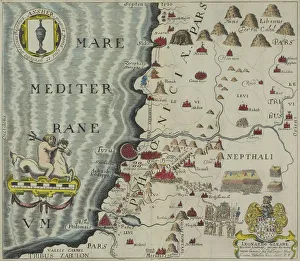
Map of Canaan as divided amoung the tribesVintage engraving of a Map of Canaan as divided amoung the tribes
Map of PalestineIllustration of a map of Palestine
Illustration of map of Judea, the area in which Jerusalem was situated, as it would have been at the time of Jesus
Crusaders, lithograph, published in 1890Crusaders. Lithograph, published in 1890
Antique map of the coast of Phoenicia
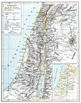
Map of Palestine, steel engraving, published in1861Ancient topographic map of Palestine and seperate map of Jerusalem in three eras: 1) Judges 2) Juda and Israel, 3) Maccabees to Titus (70 AD)
Antique map of Palestine
Antique map of the holy land of Sinai peninsula
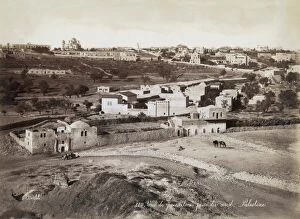
Ottoman JerusalemA view of Jerusalem from the north during the period of Ottoman control, circa 1870. The Russian church can be seen on the horizon to the left. (Photo by Felix Bonfils/Hulton Archive/Getty Images)