mail_outline sales@mediastorehouse.com
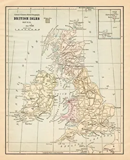
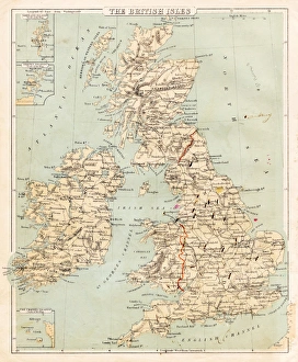
Biritsh Isles map 1881Coltons Common School Geography 1881 New York Sheldon and Co
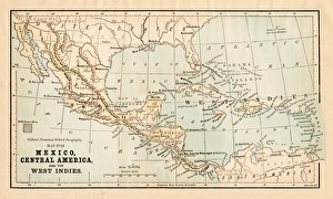
Mexico and Central America map 1881Coltons Common School Geography 1881 New York Sheldon and Co
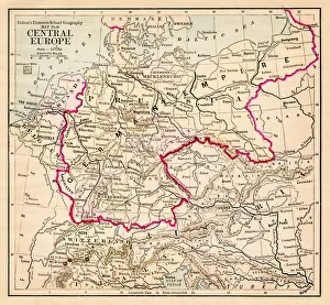
Central Europe map 1881Coltons Common School Geography 1881 New York Sheldon and Co
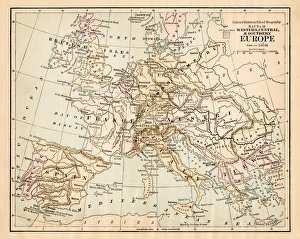
Europe map 1881Coltons Common School Geography 1881 New York Sheldon and Co
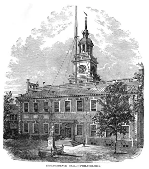
Independence hall Philadelphia 1881Coltons Common School Geography 1881 New York Sheldon and Co
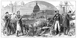
USA antique history engraving 1881Coltons Common School Geography 1881 New York Sheldon and Co
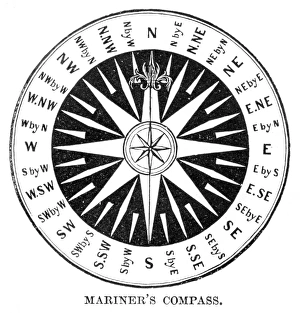
Old Compass Windrose 1881Coltons Common School Geography 1881 New York Sheldon and Co
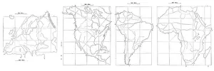
Map drawing technique 1881Coltons Common School Geography 1881 New York Sheldon and Co
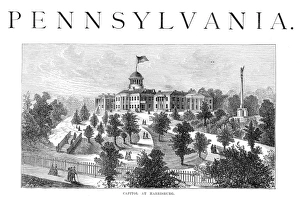
The Capitol at Harrisburg 1881Coltons Common School Geography 1881 New York Sheldon and Co
Geography earth engraving 1881Coltons Common School Geography 1881 New York Sheldon and Co
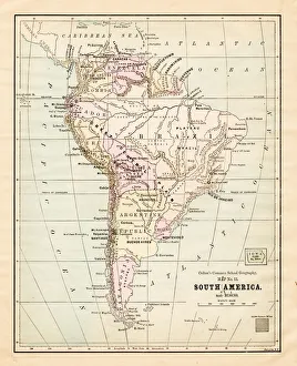
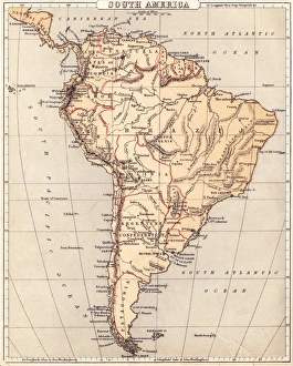
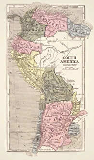
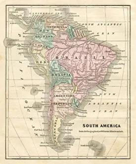
South America map 1881Coltons Common School Geography 1881 New York Sheldon and Co
Dominion of Canada map 1881Coltons Common School Geography 1881 New York Sheldon and Co
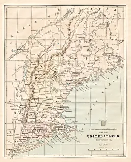
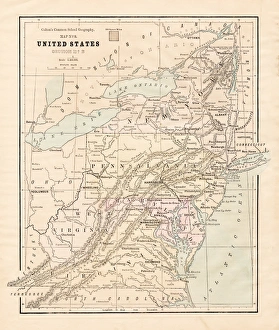
North Eastern States USA map 1881Coltons Common School Geography 1881 New York Sheldon and Co
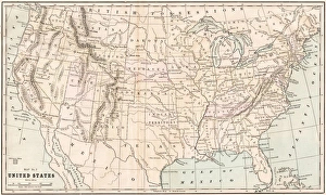
United States map 1881Coltons Common School Geography 1881 New York Sheldon and Co
New England States USA map 1881Coltons Common School Geography 1881 New York Sheldon and Co
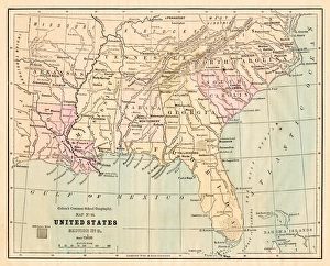
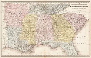
Souther States USA map 1881Coltons Common School Geography 1881 New York Sheldon and Co
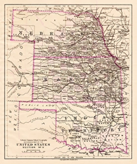
Kansas and Nebraska map 1881Coltons Common School Geography 1881 New York Sheldon and Co
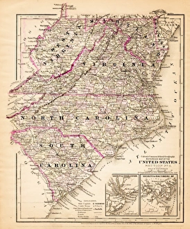
Virginia North Carolina map 1881Coltons Common School Geography 1881 New York Sheldon and Co
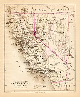
California Nevada map 1881Coltons Common School Geography 1881 New York Sheldon and Co
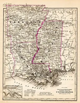
Arkansas Louisiana Pississippi map 1881Coltons Common School Geography 1881 New York Sheldon and Co
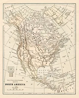
North America map 1881Coltons Common School Geography 1881 New York Sheldon and Co
Map of South America 1869Cornells Grammars-School Geography - S.S. Cornell - New York D. Appleton and Company 1869
USA Southern States 1867Mitchells Modern Atlas - Published by E.H. Buttler & Co - Philadelphia 1867
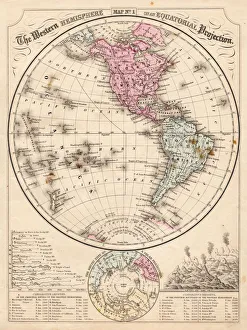
Western Hemisphere map 1867Mitchells Modern Atlas - Published by E.H. Buttler & Co - Philadelphia 1867
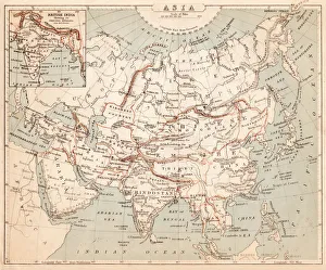
Map of Asia 1869Cornells Grammars-School Geography - S.S. Cornell - New York D. Appleton and Company 1869
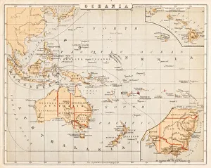
Map of Australia Oceania 1869Cornells Grammars-School Geography - S.S. Cornell - New York D. Appleton and Company 1869
Map of the British isles 1869Cornells Grammars-School Geography - S.S. Cornell - New York D. Appleton and Company 1869
Map of South America 1855System of Geography for the use of schools by Sidney E. Morse - Published by Harper & Brothers - New York 1855
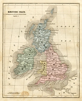
map of the British isles 1856Colton and Fitchs Modern School Geography by George W. Fitch - New York 1856
Map of South America 1856Colton and Fitchs Modern School Geography by George W. Fitch - New York 1856
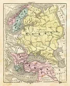
Map of Russia Turkey 1856Colton and Fitchs Modern School Geography by George W. Fitch - New York 1856
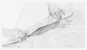
Black and white illustration of hands wrapping a bunch of dried flowers in newspaper (storing dried flowers)
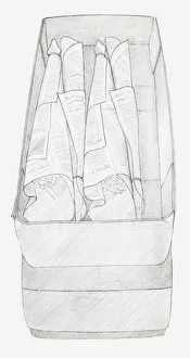
Black and white illustration of bunches of dried flowers wrapped up in newspaper and packed in a box, top to tail (storing dried flowers)
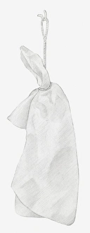
Black and white illustration of dried hydrangea flower hung up to dry, wrapped individually in tissue paper (storing dried flowers)
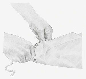
Black and white illustration of hands tying up a piece of string around dried hydrangea flower wrapped in tissue paper (storing dried flowers)
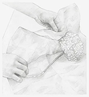
Black and white illustration of hands wrapping dried hydrangea flower in tissue paper (storing dried flowers)
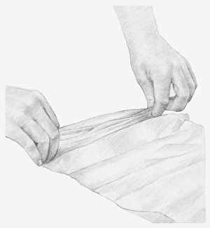
Black and white illustration of hands pleating a strip of tissue paper, to wrap a dried onion seed head in (storing dried flowers)
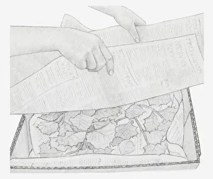
Black and white illustration of dried leaves in box, being covered with newspaper (storing dried plants)
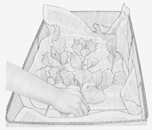
Black and white illustration of dried leaves being placed in box, on a layer of newspaper (storing dried plants)
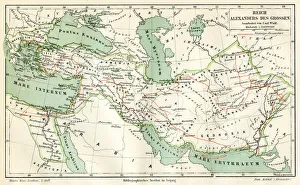
Map of the reign of Alexandre the Great 1895Meyers Konversations-Lexikon. Ein Nachschlagewerk des allgemeinen Wissens, 5th edition 17 volumes Bibliographisches Institut - Leipzig 1895-1897
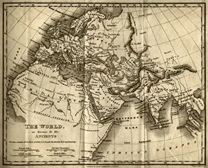
The World as Known to the Ancients (steel engraving)A creased and stained steel engraving of a map which shows The World as Known to the Ancientsa which aŠcontains all the Parts of which it is thought the Ancients had any knowledgea
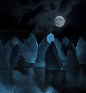
Paper moon-scapeA composite digital illustration of a photo of notes which were torn into shapes of jagged mountains reflected illuminated by a full moon
paper lungsA macro image of thin paper strips bent to form organic loops that can be seen as trees or lungs. Isolated on a black background
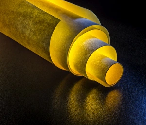
golden tunnelLight permeates a set of 4 sheets of yellow sticky notes rolled up around one another to form a telescopic tube, on a shiny, reflective black surface
paper swirlstable top macro photograph of curls of thick paper strips
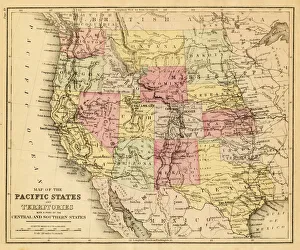
map of the Pacific states (California, Oregon, Washington) an territories with a part of central and souther states - USA (1883)
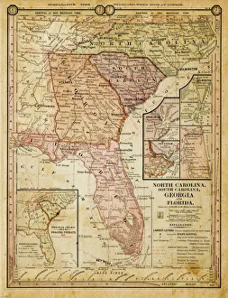
usa - southern states 1884map of north carolina, south carolina, georgia and florida 1884
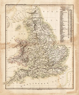
Map of great Britain 1831Antique map of great Britain 1870