mail_outline sales@mediastorehouse.com
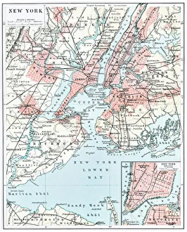
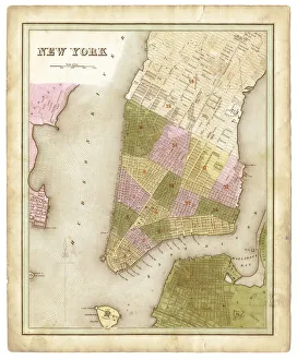
Map of New York city 1896Ilustration of a Map of New York city 1896
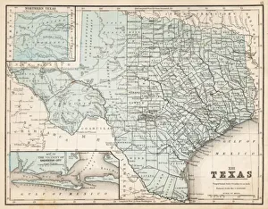
Map of Texas 1867Mitchells Modern Atlas - Published by E.H. Buttler & Co - Philadelphia 1867
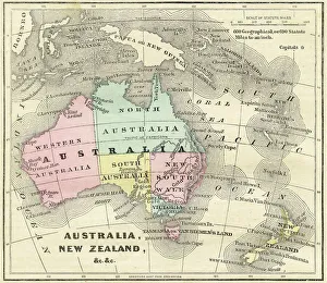
Map of Australia and New Zealand 1856Colton and Fitchs Modern School Geography by George W. Fitch - New York 1856
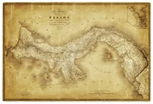
Map of Panama 1864Map of Panama - combined with 2 different texture overlays
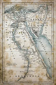
Map of EgyptIllustration of a Map of Egypt
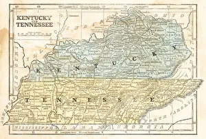
Map of Kentucky and Tennessee 1855System of Geography for the use of schools by Sidney E. Morse - Published by Harper & Brothers - New York 1855
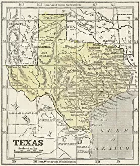
Map of Texas 1856Colton and Fitchs Modern School Geography by George W. Fitch - New York 1856
old map of european old map form 1883, showing european countries
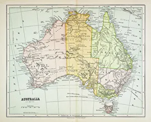
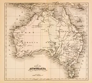
Map of Australia 1883Map of Australia
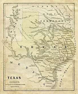
Map of Texas 1855System of Geography for the use of schools by Sidney E. Morse - Published by Harper & Brothers - New York 1855
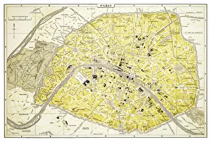
Map of Paris 1894map/plan of the city of Paris, France
western europe map 1883a map of Western europe from 1883
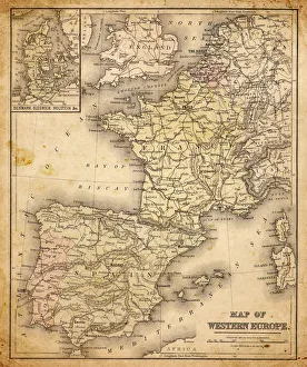
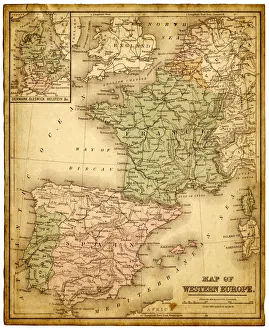
western europe 1867a map of Western europe from 1867, overlay with grunge burnt texture paper
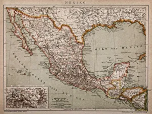
Mexico map 1897The World-Wide Atlas of Modern Geography, Political and Physical W. & A.K. Johnston - London 1897
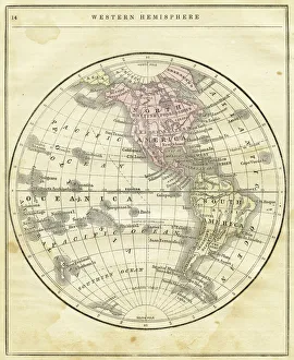
Western Hemisphere map 1856Colton and Fitchs Modern School Geography by George W. Fitch - New York 1856
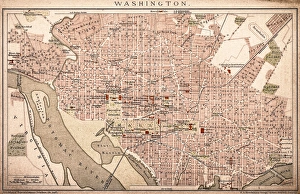
Map of Washington 1898Antique illustration of a Map of Washington 1898
Map of Australia 1874Map of Australia
old map of central european old map form 1870, showing central europe countries
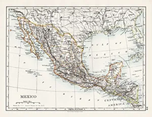
Map of MexicoAntique map of Mexico
map of new york city 1874very old map showing new york city, new jersey, and hoboken) 1874 - composite with grunge sepia paper
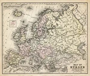
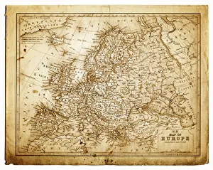
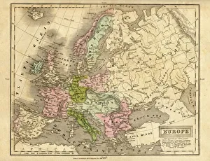
europe map 1829an old map form 1829, showing the whole europe
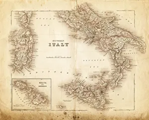
map of italy 1855an old map of southern italy (inset showing malta) - 1855
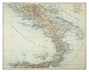
Map of southern Italy 1895
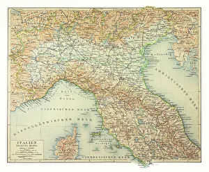
Map of northern Italy 1895
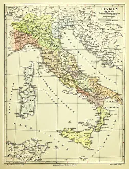
Map of Italy 1895
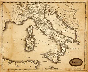
map of italy 1812an old map of italy - 1812
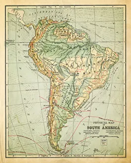
old map of south americaan old south american map (1881)
great britain and irelandmap from 1883 - great britain and ireland
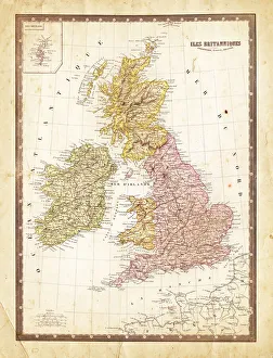
Map of Great Britain 1862French map of Great Britain 1862 - Scotland and Ireland map composed with two vintage stained papers
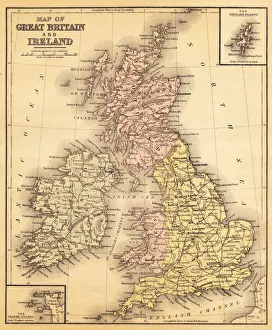
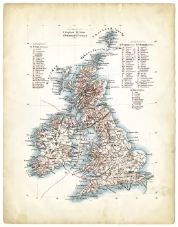
Antique map of Great Britain 1863Antique map of Great Britain, Ireland and Scotland
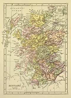
Map of Scotland 1894Map of Scotland
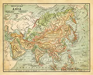
Physical map of asia - 1881
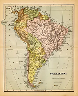
south america 1883an old south american map (1883)
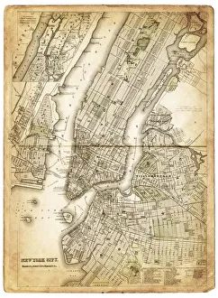
map of New York city 1838very old map showing New York city - composite with grunge sepia paper
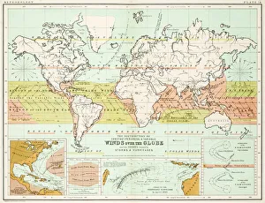
Winds - Map of the world 1861Map of the world - Winds over the globe - storms and hurricanes
the world 1877antique map of the world - 1877
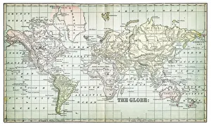
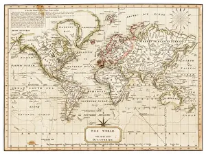
map of the world 1814antique map showing the world with all the latest discovery of 1814
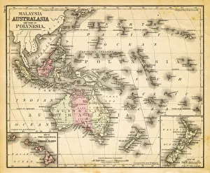
map of australia, malaysia and polynesiaold map of australia, malaysia and polynesia - 1883
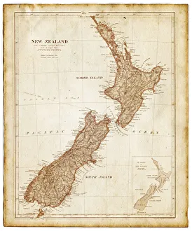
Old map of New Zealand and Tasmania 1899 - combined with textures overlay
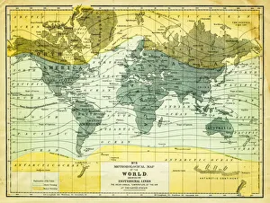
map of the world 1867meteorological map of the world 1867 - showing isothermal lines
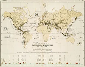
Map of the world 1861Map of the world - The distribution of Earthquakes and Volcanoes over the globe
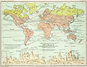
Animals - Map of the world 1861Map of the world - The distributions of animals
map of the world 1873antique map of the world - from a french atlas - 1872
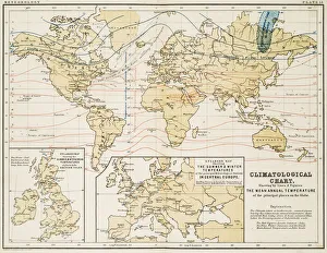
Climate map of the world 1861Map of the world - Climatological Chart
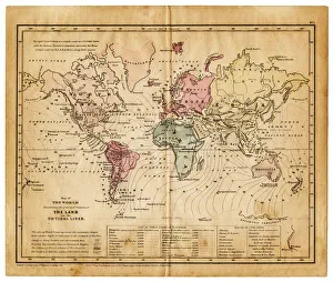
map of the world 1855map of the world illustrating the principal features of the land and the co-tidal lines - 1855
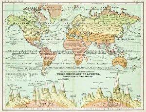
Agricultural Map of the world 1861map of the world showing the distribution of the most important Tress, Shrubs, Grains and Fruits according to zones of climate and moisture plants
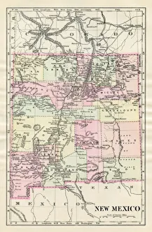
Map of New Mexico 1885Map of New Mexico
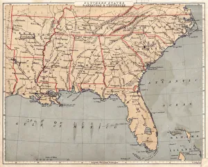
Map of USA Southern states 1869Cornells Grammars-School Geography - S.S. Cornell - New York D. Appleton and Company 1869