mail_outline sales@mediastorehouse.com
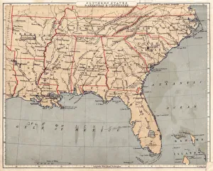
Map of USA Southern states 1869Cornells Grammars-School Geography - S.S. Cornell - New York D. Appleton and Company 1869
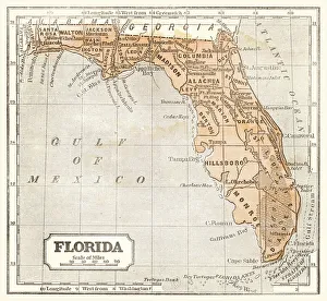
Map of Florida 1855System of Geography for the use of schools by Sidney E. Morse - Published by Harper & Brothers - New York 1855
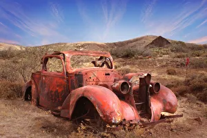
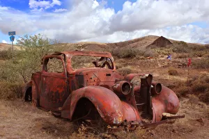
Old Car Rusting in Arizona DesertOld metal body of car from 1930s rusting in Arizona Desert between Phoenix and Prescott
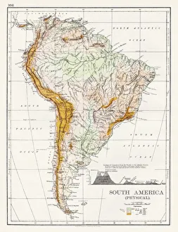
South America Physical map 1897The World-Wide Atlas of Modern Geography, Political and Physical W. & A.K. Johnston - London 1897
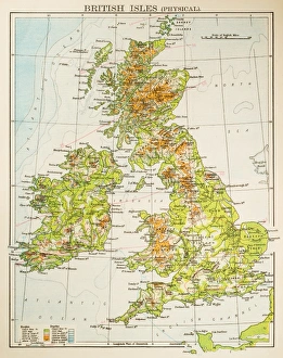
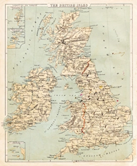
Map of British Isles 1897Map of British Isles
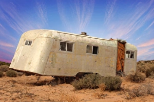
Old Trailer Rusting in Mexican DesertOld metal body of trailer from rusting in Mexican Desert near the Arizona border in Sonora
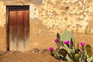
Adobe Wall and Wooden Door with Flowering cactus in OaxacaVintage door on Adobe Facade. Wooden front door of a home. Front view of a weathered Oaxaca adobe brick house with a flowering prickly pear cactus in front. Horizontal shot
Old car rusting in Desert Landscape with Barn in Background
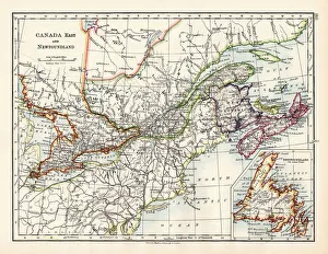
Canada map 1883The World-Wide Atlas of Modern Geography, Political and Physical W. & A.K. Johnston - London 1897
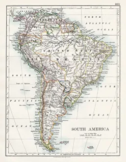
South America map 1897The World-Wide Atlas of Modern Geography, Political and Physical W. & A.K. Johnston - London 1897
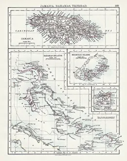
Jamaica Bahamas Trinidad map 1897The World-Wide Atlas of Modern Geography, Political and Physical W. & A.K. Johnston - London 1897
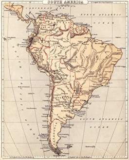
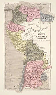
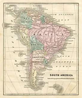
Map of South America 1869Cornells Grammars-School Geography - S.S. Cornell - New York D. Appleton and Company 1869
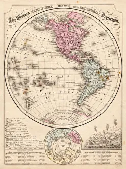
Western Hemisphere map 1867Mitchells Modern Atlas - Published by E.H. Buttler & Co - Philadelphia 1867
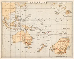
Map of Australia Oceania 1869Cornells Grammars-School Geography - S.S. Cornell - New York D. Appleton and Company 1869
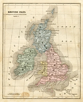
Map of the British isles 1869Cornells Grammars-School Geography - S.S. Cornell - New York D. Appleton and Company 1869
Map of South America 1855System of Geography for the use of schools by Sidney E. Morse - Published by Harper & Brothers - New York 1855
map of the British isles 1856Colton and Fitchs Modern School Geography by George W. Fitch - New York 1856
Map of South America 1856Colton and Fitchs Modern School Geography by George W. Fitch - New York 1856
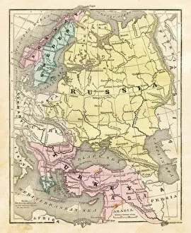
Map of Russia Turkey 1856Colton and Fitchs Modern School Geography by George W. Fitch - New York 1856
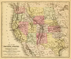
map of the Pacific states (California, Oregon, Washington) an territories with a part of central and souther states - USA (1883)
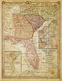
usa - southern states 1884map of north carolina, south carolina, georgia and florida 1884
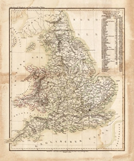
Map of great Britain 1831Antique map of great Britain 1870
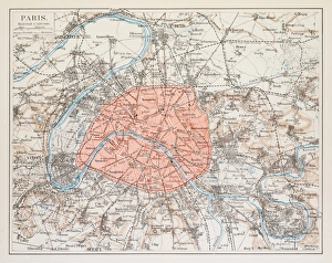
Map of Paris 1895map/plan of the city of Paris, France 1895
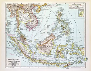
Map of Indochina 1895Map of Indochina and Malay Archipelago
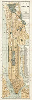
Map of New York City 1894Huge vertical panorama map of New York 1885
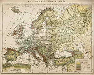
Rain map of EuropeAntique illustration of a rain map of Europe
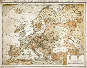
Population tightness map of Europe
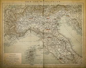
Upper and Central ItalyAntique illustration of a Upper and Central Italy
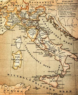
ItalyAntique illustration of Italy