mail_outline sales@mediastorehouse.com
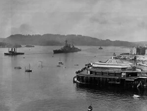
Off To seaAugust 1922: Battleship HMS Hood leaving Plymouth passes the pier. (Photo by Gill/Topical Press Agency/Getty Images)
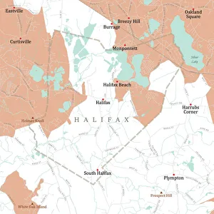
MA Plymouth Halifax Vector Road Map. All source data is in the public domain. U.S. Census Bureau Census Tiger. Used Layers: areawater, linearwater, roads, rails, cousub, pointlm, uac10
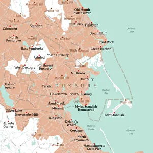
MA Plymouth Duxbury Vector Road Map. All source data is in the public domain. U.S. Census Bureau Census Tiger. Used Layers: areawater, linearwater, roads, rails, cousub, pointlm, uac10
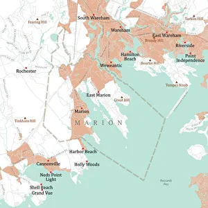
MA Plymouth Marion Vector Road Map. All source data is in the public domain. U.S. Census Bureau Census Tiger. Used Layers: areawater, linearwater, roads, rails, cousub, pointlm, uac10
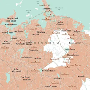
MA Plymouth Hingham Vector Road Map. All source data is in the public domain. U.S. Census Bureau Census Tiger. Used Layers: areawater, linearwater, roads, rails, cousub, pointlm, uac10
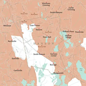
MA Plymouth Hanson Vector Road Map. All source data is in the public domain. U.S. Census Bureau Census Tiger. Used Layers: areawater, linearwater, roads, rails, cousub, pointlm, uac10
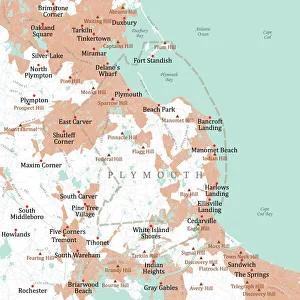
MA Plymouth Vector Road Map. All source data is in the public domain. U.S. Census Bureau Census Tiger. Used Layers: areawater, linearwater, roads, rails, cousub, pointlm, uac10
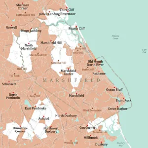
MA Plymouth Marshfield Vector Road Map. All source data is in the public domain. U.S. Census Bureau Census Tiger. Used Layers: areawater, linearwater, roads, rails, cousub, pointlm, uac10
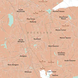
MA Plymouth Rockland Vector Road Map. All source data is in the public domain. U.S. Census Bureau Census Tiger. Used Layers: areawater, linearwater, roads, rails, cousub, pointlm, uac10
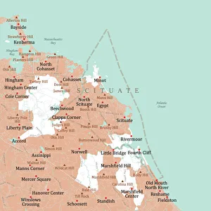
MA Plymouth Scituate Vector Road Map. All source data is in the public domain. U.S. Census Bureau Census Tiger. Used Layers: areawater, linearwater, roads, rails, cousub, pointlm, uac10
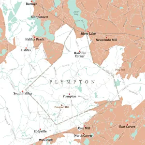
MA Plymouth Plympton Vector Road Map. All source data is in the public domain. U.S. Census Bureau Census Tiger. Used Layers: areawater, linearwater, roads, rails, cousub, pointlm, uac10
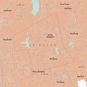
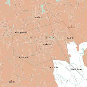
MA Plymouth Abington Vector Road Map. All source data is in the public domain. U.S. Census Bureau Census Tiger. Used Layers: areawater, linearwater, roads, rails, cousub, pointlm, uac10
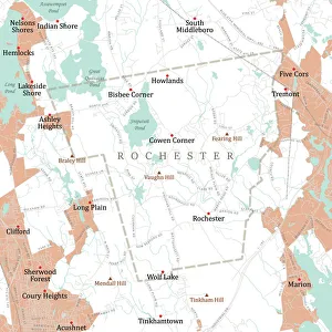
MA Plymouth Rochester Vector Road Map. All source data is in the public domain. U.S. Census Bureau Census Tiger. Used Layers: areawater, linearwater, roads, rails, cousub, pointlm, uac10
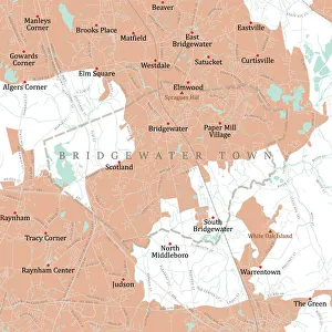
MA Plymouth Bridgewater Town Vector Road Map. All source data is in the public domain. U.S. Census Bureau Census Tiger. Used Layers: areawater, linearwater, roads, rails, cousub, pointlm, uac10
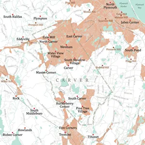
MA Plymouth Carver Vector Road Map. All source data is in the public domain. U.S. Census Bureau Census Tiger. Used Layers: areawater, linearwater, roads, rails, cousub, pointlm, uac10
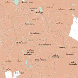
MA Plymouth Hanover Vector Road Map. All source data is in the public domain. U.S. Census Bureau Census Tiger. Used Layers: areawater, linearwater, roads, rails, cousub, pointlm, uac10
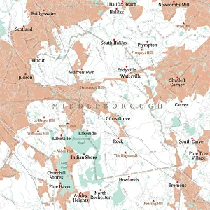
MA Plymouth Middleborough Vector Road Map. All source data is in the public domain. U.S. Census Bureau Census Tiger. Used Layers: areawater, linearwater, roads, rails, cousub, pointlm, uac10
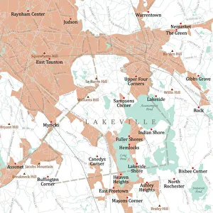
MA Plymouth Lakeville Vector Road Map. All source data is in the public domain. U.S. Census Bureau Census Tiger. Used Layers: areawater, linearwater, roads, rails, cousub, pointlm, uac10
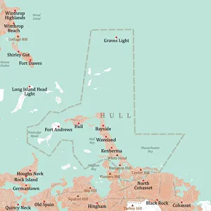
MA Plymouth Hull Vector Road Map. All source data is in the public domain. U.S. Census Bureau Census Tiger. Used Layers: areawater, linearwater, roads, rails, cousub, pointlm, uac10
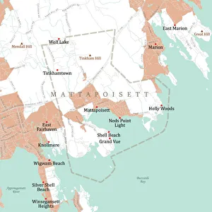
MA Plymouth Mattapoisett Vector Road Map. All source data is in the public domain. U.S. Census Bureau Census Tiger. Used Layers: areawater, linearwater, roads, rails, cousub, pointlm, uac10
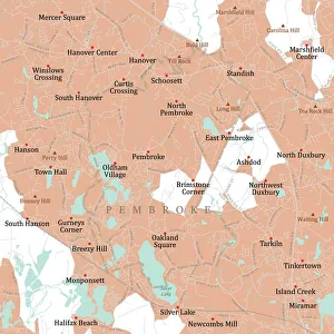
MA Plymouth Pembroke Vector Road Map. All source data is in the public domain. U.S. Census Bureau Census Tiger. Used Layers: areawater, linearwater, roads, rails, cousub, pointlm, uac10
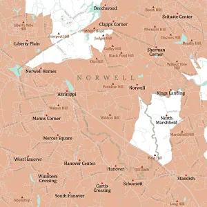
MA Plymouth Norwell Vector Road Map. All source data is in the public domain. U.S. Census Bureau Census Tiger. Used Layers: areawater, linearwater, roads, rails, cousub, pointlm, uac10
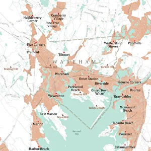
MA Plymouth Wareham Vector Road Map. All source data is in the public domain. U.S. Census Bureau Census Tiger. Used Layers: areawater, linearwater, roads, rails, cousub, pointlm, uac10
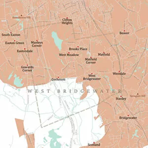
MA Plymouth West Bridgewater Vector Road Map. All source data is in the public domain. U.S. Census Bureau Census Tiger. Used Layers: areawater, linearwater, roads, rails, cousub, pointlm, uac10
MA Plymouth Whitman Vector Road Map. All source data is in the public domain. U.S. Census Bureau Census Tiger. Used Layers: areawater, linearwater, roads, rails, cousub, pointlm, uac10
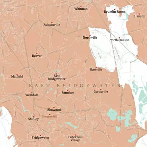
MA Plymouth East Bridgewater Vector Road Map. All source data is in the public domain. U.S. Census Bureau Census Tiger. Used Layers: areawater, linearwater, roads, rails, cousub, pointlm, uac10
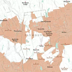
CT Litchfield Plymouth Vector Road Map. All source data is in the public domain. U.S. Census Bureau Census Tiger. Used Layers: areawater, linearwater, roads, rails, cousub, pointlm, uac10
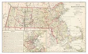
Map of Massachusetts 1877Warrens Common School Geography 1877
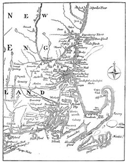
Vintage Map of New England at the beginning of the 18th century
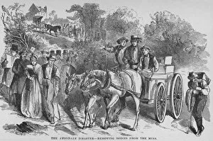
Avondale Mine DisasterIllustration of bodies being removed from the Avondale mine in Plymouth, Pennsylvania on September 06, 1869. A fire in the coal mine caused the death of 110 miners
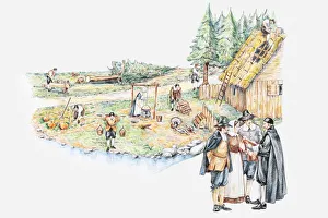
Illustration of daily life of pilgrim settlers and holding prayer meeting in Plymouth Massachusetts
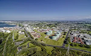
Cityscape of New Plymouth, industrial park, oil tanks, North Island, New Zealand
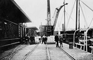
Plymouth Harbour8th June 1908: Strawberries arriving at Plymouth Harbour. (Photo by Topical Press Agency/Getty Images)
Plymouth Road16th October 1926: Cobourg Road in Plymouth, Devon, before being widened. (Photo by Topical Press Agency/Getty Images)
Transatlantic FlightJune 1919: Transatlantic plane at Plymouth, seen from a boat. (Photo by Topical Press Agency/Getty Images)
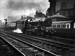
The King GeorgeJuly 1927: The King George V locomotive engine leaving Paddington Station for a non-stop trial run to Plymouth. (Photo by Kirby/Topical Press Agency/Getty Images)
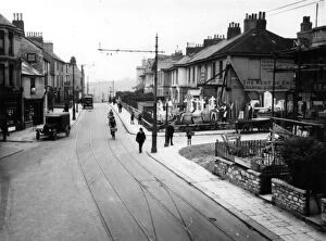
One-Way Streetcirca 1926: A street at Drake Circus, Plymouth, where traffic has been converted to a one-way system. (Photo by Topical Press Agency/Getty Images)
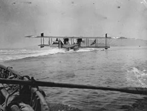
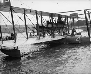
US Navy Curtiss NC4June 1919: A US Navy Curtiss NC-4 at Plymouth, one of three planes to attempt the first transatlantic crossing. (Photo by Topical Press Agency/Getty Images)
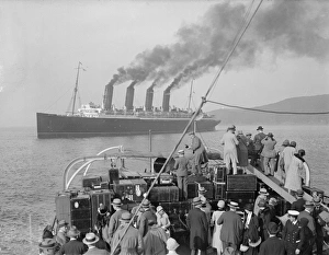
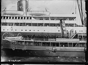
Bon VoyageAmerican passengers in a tender take a last look at the Cunard liner Mauretania after she drops them in Plymouth and sails on to Cherbourg and Southampton. (Photo by Gill/Getty Images)
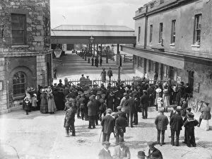
Titanic Wait at Plymouth Dock27th April 1912: Crowds wait at Plymouth dock for the arrival of the Lapland, after the Titanic disaster. The luxury steamship RMS Titanic sank in the early hours of April 15, 1912
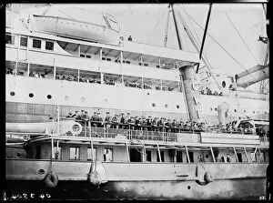
Titanic Survivors29th April 1912: Survivors of the Titanic disaster board a GWR (Great Western Railway) ferry at Plymouth after arriving in England on the SS Lapland. (Photo by Topical Press Agency/Getty Images)
Titanic SurvivorsAugust 1912: Survivors of the Titanic disaster arrive at Plymouth on board the SS Lapland and are transferred to a waiting tug. (Photo by Topical Press Agency/Getty Images)