mail_outline sales@mediastorehouse.com
RomaniaAntique map of Romania
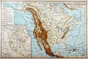
River and mountains map of North AmericaIllustration of a River and mountains map of North America
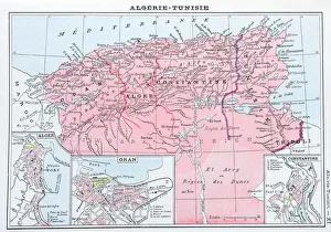
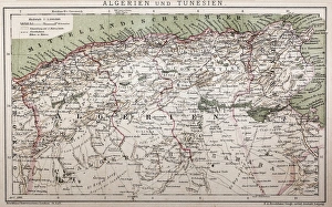
Antique map of Algeria and Tunisia
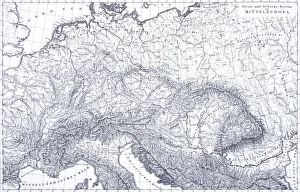
Engraving: Mountains and River Systems of EuropeEngraved illustrations of the Mountains and River Systems of Central Europe from Iconographic Encyclopedia of Science, Literature and Art, Published in 1851. Copyright has expired on this artwork
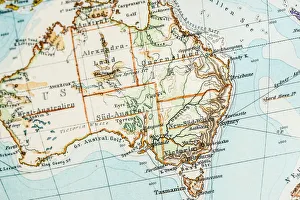
Antique German atlas map close up: Australia
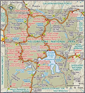
Yellowstone National ParkDetailed map of Yellowstone National Park
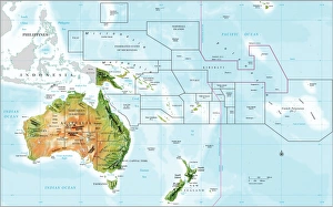
compass rose, equator, indian ocean, international dateline, map, melanesia, micronesia, new zealand, no people, oceania, pacific ocean, polynesia, relief map, topography, tropic of capricorn
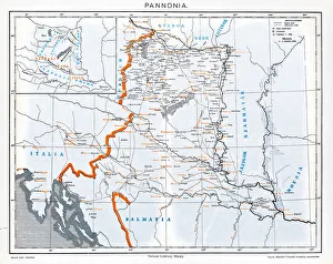
Pannonia is an ancient country of southern Europe that was south and west of the Danube River, in present-day Austria, Hungary, Slovenia, and Croatia
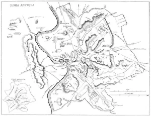
Map of Ancient RomeVintage engraving showing a plan of Ancient Rome
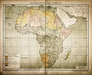
Ethnic map of AfricaAntique illustration of a ethnic map of Africa
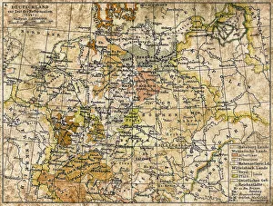
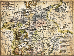
Germany until the Thirty Years War. (1493-1618)Illustration of a Germany until the Thirty Years War. (1493-1618)
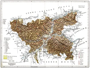
Brasov manIllustration of a Brasov map
Antique map of Algeria and TunisiaIllustration of a Antique map of Algeria and Tunisia
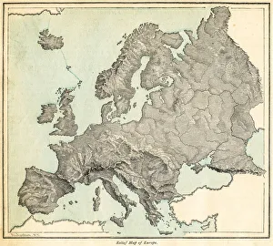
Europe relief map 1875The Independent Course Comprehensive Geography by James Monteith, A.S. Barnes & Co, New York & Chicago 1875
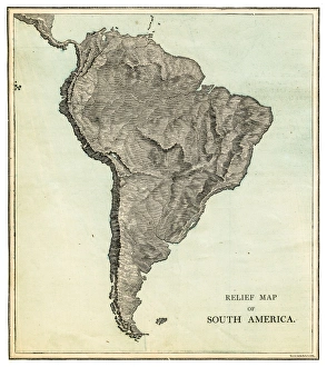
South America relief map 1875The Independent Course Comprehensive Geography by James Monteith, A.S. Barnes & Co, New York & Chicago 1875
North America relief map 1875The Independent Course Comprehensive Geography by James Monteith, A.S. Barnes & Co, New York & Chicago 1875
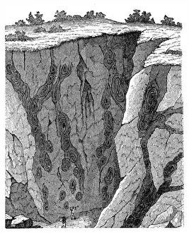
Veins in limestone on Monte CalviIllustration of a Veins in limestone on
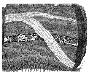
Section of a terrain, double vein
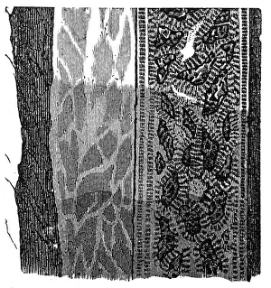
Part of a Freiberg ore mine: sulphur, quartz, gneissIllustration of a Freiberg ore mine: sulphur, quartz, gneiss
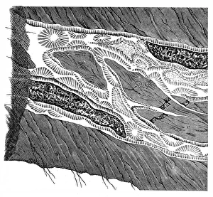
Section of a terrain, ramification and enforcement
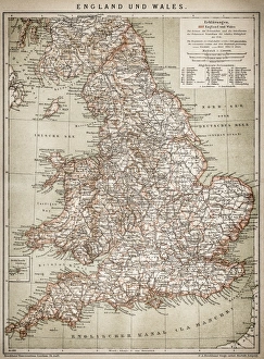
England and WalesAntique map of England and Wales
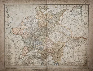
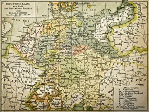
Antique map of Germany from 1815
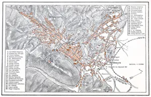
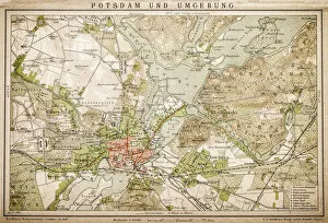
Potsdam and environmentAntique illustration of a Potsdam and environment
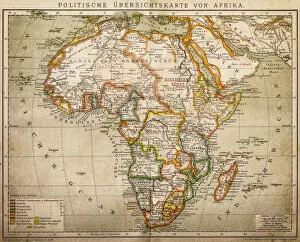
Political outline map of Africa from 1898
Germany 1547Antique map of Germany from 1547
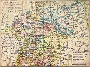
GermanyAntique map of Germany from 1648
Germany map from 1786Antique map of Germany from 1786
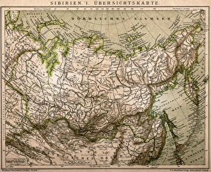
Siberia outline mapAntique illustration of Siberia outline map
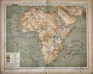
Map of AfricaAntique illustration of a map of Africa
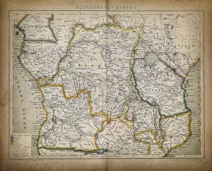
Equatorial AfricaAntique illustration of a equatorial Africa
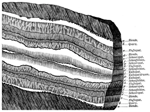
Section of a terrainSection of Freiberg with a symmetrical lay - out structure
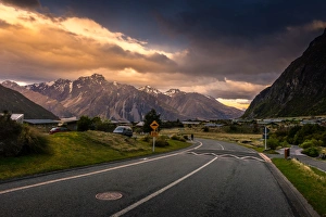
The Scenery of Village in Mount Cook, New ZealandThe scenery of village in Mount Cook National Park from South Island New Zealand