mail_outline sales@mediastorehouse.com
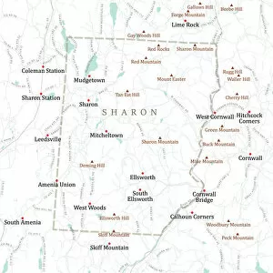
CT Litchfield Sharon Vector Road Map. All source data is in the public domain. U.S. Census Bureau Census Tiger. Used Layers: areawater, linearwater, roads, rails, cousub, pointlm, uac10
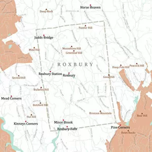
CT Litchfield Roxbury Vector Road Map. All source data is in the public domain. U.S. Census Bureau Census Tiger. Used Layers: areawater, linearwater, roads, rails, cousub, pointlm, uac10
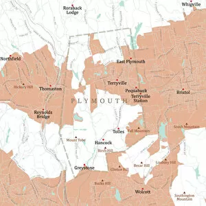
CT Litchfield Plymouth Vector Road Map. All source data is in the public domain. U.S. Census Bureau Census Tiger. Used Layers: areawater, linearwater, roads, rails, cousub, pointlm, uac10
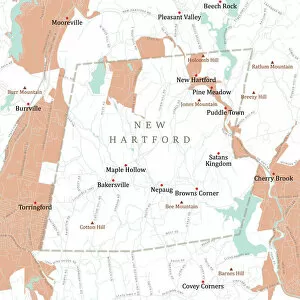
CT Litchfield New Hartford Vector Road Map. All source data is in the public domain. U.S. Census Bureau Census Tiger. Used Layers: areawater, linearwater, roads, rails, cousub, pointlm, uac10
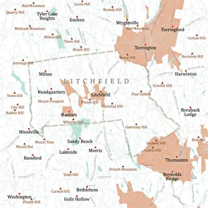
CT Litchfield Litchfield Town Vector Road Map. All source data is in the public domain. U.S. Census Bureau Census Tiger. Used Layers: areawater, linearwater, roads, rails, cousub, pointlm, uac10
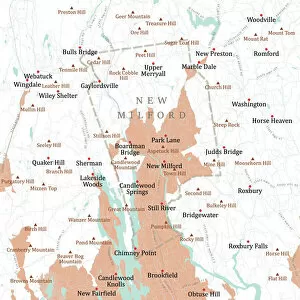
CT Litchfield New Milford Vector Road Map. All source data is in the public domain. U.S. Census Bureau Census Tiger. Used Layers: areawater, linearwater, roads, rails, cousub, pointlm, uac10
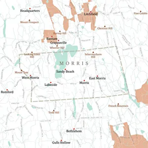
CT Litchfield Morris Vector Road Map. All source data is in the public domain. U.S. Census Bureau Census Tiger. Used Layers: areawater, linearwater, roads, rails, cousub, pointlm, uac10
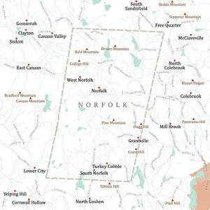
CT Litchfield Norfolk Vector Road Map. All source data is in the public domain. U.S. Census Bureau Census Tiger. Used Layers: areawater, linearwater, roads, rails, cousub, pointlm, uac10
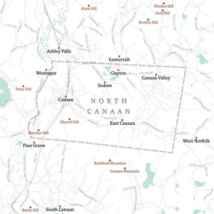
CT Litchfield North Canaan Vector Road Map. All source data is in the public domain. U.S. Census Bureau Census Tiger. Used Layers: areawater, linearwater, roads, rails, cousub, pointlm, uac10
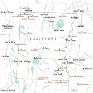
CT Litchfield Salisbury Vector Road Map. All source data is in the public domain. U.S. Census Bureau Census Tiger. Used Layers: areawater, linearwater, roads, rails, cousub, pointlm, uac10
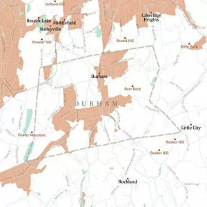
CT Middlesex Durham Vector Road Map. All source data is in the public domain. U.S. Census Bureau Census Tiger. Used Layers: areawater, linearwater, roads, rails, cousub, pointlm, uac10
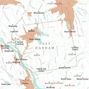
CT Middlesex East Haddam Vector Road Map. All source data is in the public domain. U.S. Census Bureau Census Tiger. Used Layers: areawater, linearwater, roads, rails, cousub, pointlm, uac10
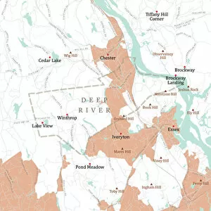
CT Middlesex Deep River Vector Road Map. All source data is in the public domain. U.S. Census Bureau Census Tiger. Used Layers: areawater, linearwater, roads, rails, cousub, pointlm, uac10
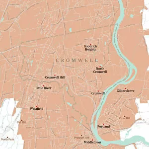
CT Middlesex Cromwell Vector Road Map. All source data is in the public domain. U.S. Census Bureau Census Tiger. Used Layers: areawater, linearwater, roads, rails, cousub, pointlm, uac10
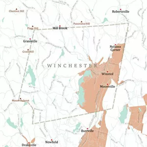
CT Litchfield Winchester Vector Road Map. All source data is in the public domain. U.S. Census Bureau Census Tiger. Used Layers: areawater, linearwater, roads, rails, cousub, pointlm, uac10
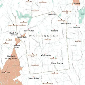
CT Litchfield Washington Vector Road Map. All source data is in the public domain. U.S. Census Bureau Census Tiger. Used Layers: areawater, linearwater, roads, rails, cousub, pointlm, uac10
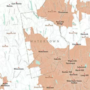
CT Litchfield Watertown Vector Road Map. All source data is in the public domain. U.S. Census Bureau Census Tiger. Used Layers: areawater, linearwater, roads, rails, cousub, pointlm, uac10
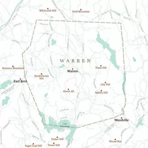
CT Litchfield Warren Vector Road Map. All source data is in the public domain. U.S. Census Bureau Census Tiger. Used Layers: areawater, linearwater, roads, rails, cousub, pointlm, uac10
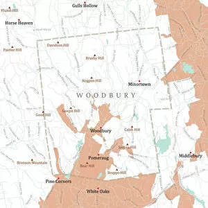
CT Litchfield Woodbury Vector Road Map. All source data is in the public domain. U.S. Census Bureau Census Tiger. Used Layers: areawater, linearwater, roads, rails, cousub, pointlm, uac10
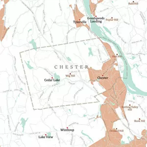
CT Middlesex Chester Vector Road Map. All source data is in the public domain. U.S. Census Bureau Census Tiger. Used Layers: areawater, linearwater, roads, rails, cousub, pointlm, uac10
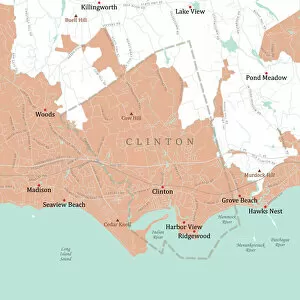
CT Middlesex Clinton Vector Road Map. All source data is in the public domain. U.S. Census Bureau Census Tiger. Used Layers: areawater, linearwater, roads, rails, cousub, pointlm, uac10
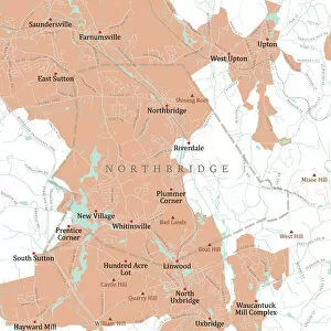
MA Worcester Northbridge Vector Road Map. All source data is in the public domain. U.S. Census Bureau Census Tiger. Used Layers: areawater, linearwater, roads, rails, cousub, pointlm, uac10
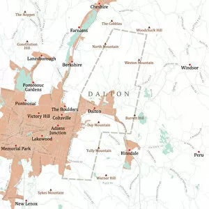
MA Berkshire Dalton Vector Road Map. All source data is in the public domain. U.S. Census Bureau Census Tiger. Used Layers: areawater, linearwater, roads, rails, cousub, pointlm, uac10
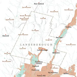
MA Berkshire Lanesborough Vector Road Map. All source data is in the public domain. U.S. Census Bureau Census Tiger. Used Layers: areawater, linearwater, roads, rails, cousub, pointlm, uac10
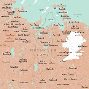
MA Norfolk Weymouth Town Vector Road Map. All source data is in the public domain. U.S. Census Bureau Census Tiger. Used Layers: areawater, linearwater, roads, rails, cousub, pointlm, uac10
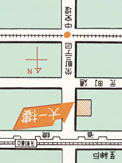
Oriental maphttp://csaimages.com/images/istockprofile/csa_vector_dsp.jpg
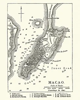
Map of Macau, 19th CenturyVintage engraving of a Map of Macau, 19th Century
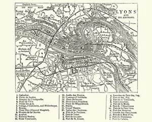
Map of Lyons, France, 19th CenturyVintage engraving of a Map of Lyons, France, 19th Century
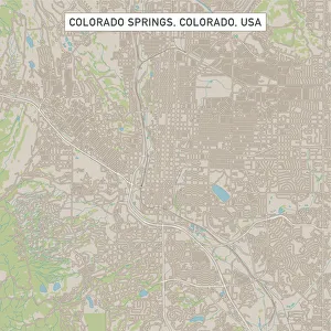
Colorado Springs Colorado US City Street MapVector Illustration of a City Street Map of Colorado Springs, Colorado, USA. Scale 1:60, 000. All source data is in the public domain. U.S
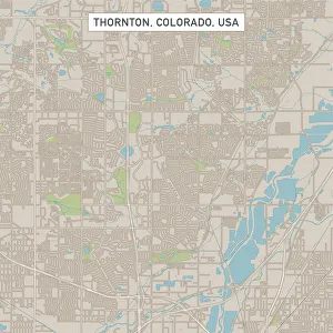
Thornton Colorado US City Street MapVector Illustration of a City Street Map of Thornton, Colorado, USA. Scale 1:60, 000. All source data is in the public domain. U.S
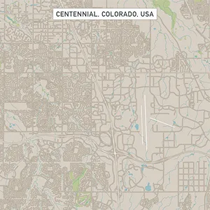
Centennial Colorado US City Street MapVector Illustration of a City Street Map of Centennial, Colorado, USA. Scale 1:60, 000. All source data is in the public domain. U.S
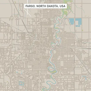
Fargo North Dakota US City Street MapVector Illustration of a City Street Map of Fargo, North Dakota, USA. Scale 1:60, 000. All source data is in the public domain. U.S
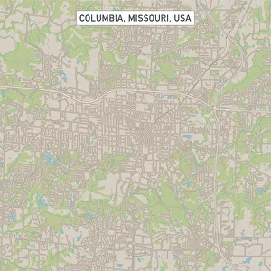
Columbia Missouri US City Street MapVector Illustration of a City Street Map of Columbia, Missouri, USA. Scale 1:60, 000. All source data is in the public domain. U.S
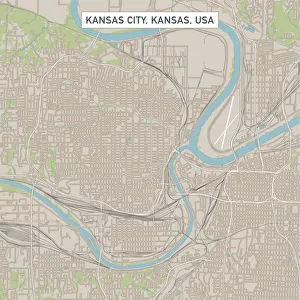
Kansas City Kansas US City Street MapVector Illustration of a City Street Map of Kansas City, Kansas, USA. Scale 1:60, 000. All source data is in the public domain. U.S
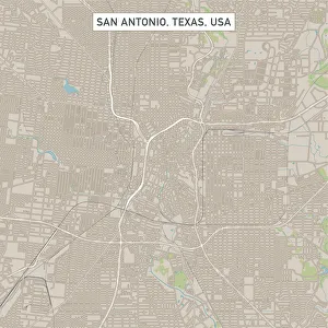
San Antonio Texas US City Street MapVector Illustration of a City Street Map of San Antonio, Texas, USA. Scale 1:60, 000. All source data is in the public domain. U.S
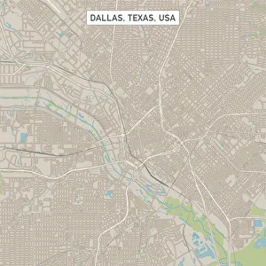
Dallas Texas US City Street MapVector Illustration of a City Street Map of Dallas, Texas, USA. Scale 1:60, 000. All source data is in the public domain. U.S
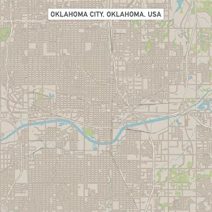
Oklahoma City Oklahoma US City Street MapVector Illustration of a City Street Map of Oklahoma City, Oklahoma, USA. Scale 1:60, 000. All source data is in the public domain. U.S
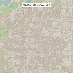
Arlington Texas US City Street MapVector Illustration of a City Street Map of Arlington, Texas, USA. Scale 1:60, 000. All source data is in the public domain. U.S
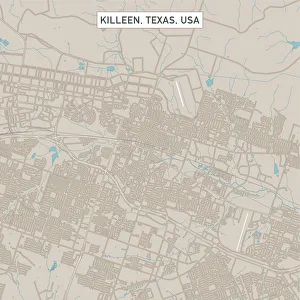
Killeen Texas US City Street MapVector Illustration of a City Street Map of Killeen, Texas, USA. Scale 1:60, 000. All source data is in the public domain. U.S
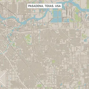
Pasadena Texas US City Street MapVector Illustration of a City Street Map of Pasadena, Texas, USA. Scale 1:60, 000. All source data is in the public domain. U.S
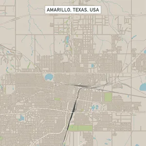
Amarillo Texas US City Street MapVector Illustration of a City Street Map of Amarillo, Texas, USA. Scale 1:60, 000. All source data is in the public domain. U.S
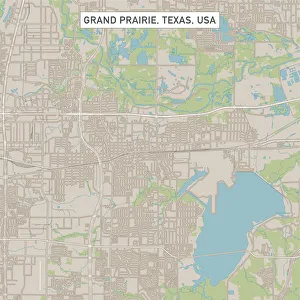
Grand Prairie Texas US City Street MapVector Illustration of a City Street Map of Grand Prairie, Texas, USA. Scale 1:60, 000. All source data is in the public domain. U.S
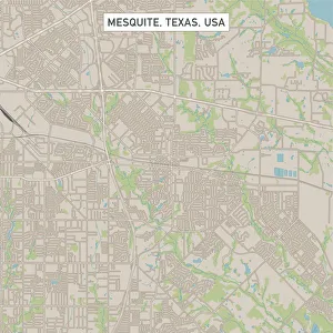
Mesquite Texas US City Street MapVector Illustration of a City Street Map of Mesquite, Texas, USA. Scale 1:60, 000. All source data is in the public domain. U.S
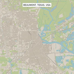
Beaumont Texas US City Street MapVector Illustration of a City Street Map of Beaumont, Texas, USA. Scale 1:60, 000. All source data is in the public domain. U.S
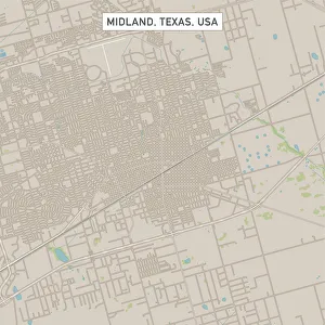
Midland Texas US City Street MapVector Illustration of a City Street Map of Midland, Texas, USA. Scale 1:60, 000. All source data is in the public domain. U.S
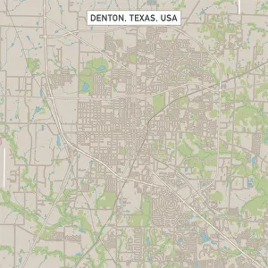
Denton Texas US City Street MapVector Illustration of a City Street Map of Denton, Texas, USA. Scale 1:60, 000. All source data is in the public domain. U.S
College Station Texas US City Street MapVector Illustration of a City Street Map of College Station, Texas, USA. Scale 1:60, 000. All source data is in the public domain. U.S
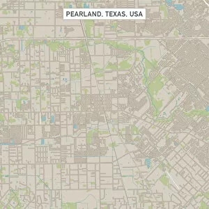
Pearland Texas US City Street MapVector Illustration of a City Street Map of Pearland, Texas, USA. Scale 1:60, 000. All source data is in the public domain. U.S