Animal Behaviour, Animal Themes, Architecture, Bird, Bizarre, Building Exterior, Cars, City Life, Close-Up, Day, Directly Above, Flying, Freedom, Full Length, Illustration and Painting
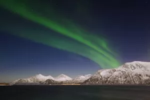
night, blue, green, no people, transportation, road, nature, sky, astronomy, star
Norway, Troms, View of Aurora Borealis near Tromso