mail_outline sales@mediastorehouse.com
Yellow finish flag on mast flying in the wind by side of road
Panoramic of the Colosseum at nightThe Roman Coliseum illuminated at night
Portland Oregon Downtown Cityscape in the FallOne beautiful Autumn day in Portland Oregon downtown from Vista Bridge with view of Mount Hood City Skyline and Trees with Fall Color Foliage
Early morning, beech-lined alley in Gasse near Gmund on Tegersee Lake, Upper Bavaria, Bavaria, Germany, Europe, PublicGround
Road with a yellow line markings, Arizona, USA
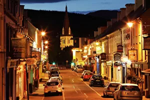
Kenmare, Ring of Kerry, County Kerry, Ireland, British Isles, Europe
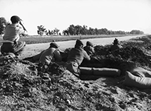
Port Said ParatroopersBritish Paratroopers dug in on the Canal Road in Port Said, 12th November 1956. The Egyptian position is 500 yards from this point. (Photo by Terry Fincher/Keystone/Getty Images)
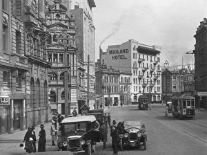
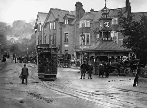
Lambton Quaycirca 1930: Cars park along the side of the road whilst trams rumble through the Lambton Quay area of Wellington, New Zealand, where hotels and guest houses line the streets. (Photo by S. C)
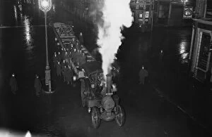
Girder Traincirca 1928: A traction engine towing a giant girder down Farringdon Street, London, in the early hours of the morning. (Photo by Topical Press Agency/Getty Images)
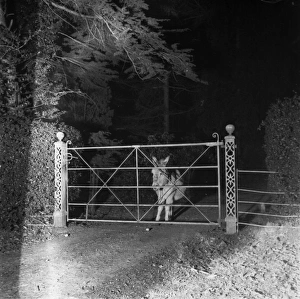
Lonesome Jackass31st March 1945: A donkey is caught in a cars headlights. Original Publication: Picture Post - 1936 - The Magic Lantern Of A Cars Headlights - pub
Crematorium in Troy in New York State
Track in a green field, cultivated landscape near Ermatingen, Switzerland, Europe
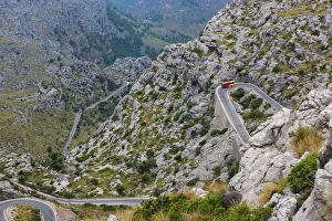
Winding mountain road to Sa Calobra, Tramuntana Mountains, Majorca, Balearic Islands, Spain, Europe
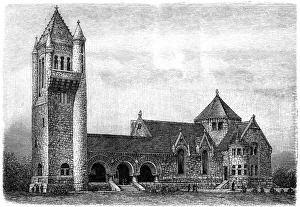
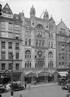
The Alhambracirca 1919: The Alhambra Music Hall theatre on Charing Cross Road, central London. It was demolished in 1936 to build the Odeon cinema, Leicester Square. (Photo by Topical Press Agency/Getty Images)
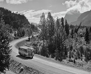
Tour BusA Skyline Tours bus on a road through the mountains circa 1950. (Photo by Archive Photos/Getty Images)
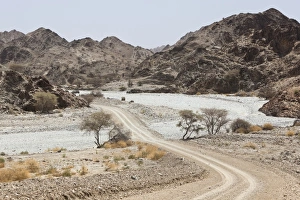
Dirt road in the Oman hinterland
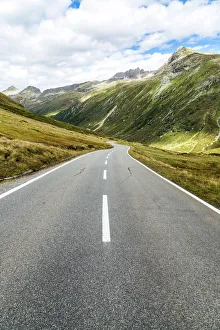
Silvretta High Alpine Road, Bielerhohe Pass, Paznauner valley, Tyrol, Austria
Matlock Bridge StreetOctober 1907: Matlock Bridge at the time of the floods. (Photo by Topical Press Agency/Getty Images)
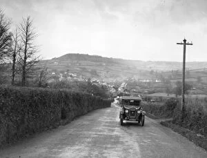
Sidford HillA car makes its way up a hill at Sidford in Devon
Food Convoy9th May 1926: Guarded by armoured cars and troops, a food convoy passes through Poplar after leaving Londons East India dock on its way to Hyde Park Depot during the General Strike
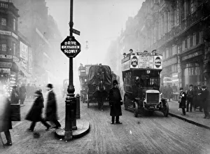
Ludgate Circus3rd January 1914: A policeman stops the traffic and helps pedestrians to cross the road at Ludgate Circus in London. (Photo by Topical Press Agency/Getty Images)
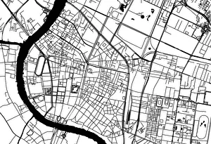
Road Map of Bangkok, ThailandGeographical/Road map of Bangkok, Thailand
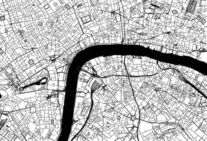
City of London Road MapBlack and white illustration of geographical, road map of London, UK
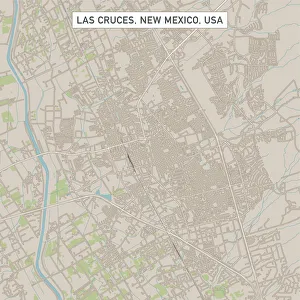
Las Cruces New Mexico US City Street MapVector Illustration of a City Street Map of Las Cruces, New Mexico, USA. Scale 1:60, 000. All source data is in the public domain. U.S
Roswell New Mexico US City Street MapVector Illustration of a City Street Map of Roswell, New Mexico, USA. Scale 1:60, 000. All source data is in the public domain. U.S
Westminster Colorado US City Street MapVector Illustration of a City Street Map of Westminster, Colorado, USA. Scale 1:60, 000. All source data is in the public domain. U.S
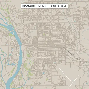
Bismarck North Dakota US City Street MapVector Illustration of a City Street Map of Bismarck, North Dakota, USA. Scale 1:60, 000. All source data is in the public domain. U.S
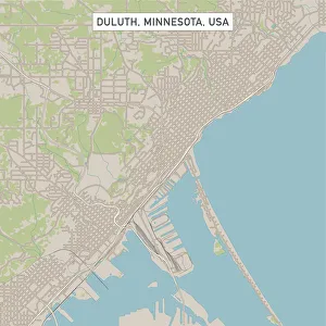
Duluth Minnesota US City Street MapVector Illustration of a City Street Map of Duluth, Minnesota, USA. Scale 1:60, 000. All source data is in the public domain. U.S
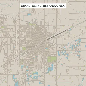
Grand Island Nebraska US City Street MapVector Illustration of a City Street Map of Grand Island, Nebraska, USA. Scale 1:60, 000. All source data is in the public domain. U.S
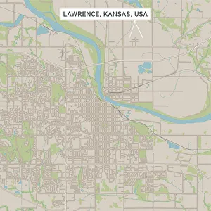
Lawrence Kansas US City Street MapVector Illustration of a City Street Map of Lawrence, Kansas, USA. Scale 1:60, 000. All source data is in the public domain. U.S
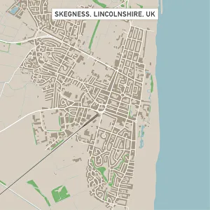
Skegness Lincolnshire UK City Street MapVector Illustration of a City Street Map of Skegness, Lincolnshire, UK. Included files are EPS (v10) and Hi-Res JPG. Data courtesy from Ordnance Survey: VectorMap District https
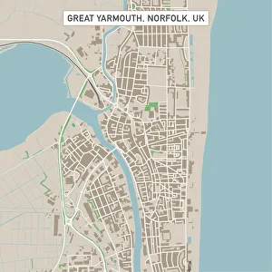
Great Yarmouth Norfolk UK City Street MapVector Illustration of a City Street Map of Great Yarmouth, Norfolk, UK. Included files are EPS (v10) and Hi-Res JPG. Data courtesy from Ordnance Survey: VectorMap District https
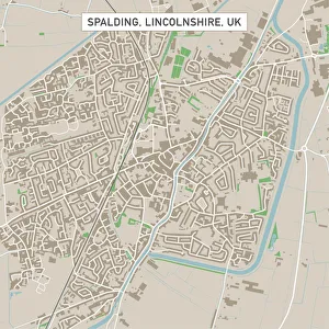
Spalding Lincolnshire UK City Street MapVector Illustration of a City Street Map of Spalding, Lincolnshire, UK. Included files are EPS (v10) and Hi-Res JPG. Data courtesy from Ordnance Survey: VectorMap District https
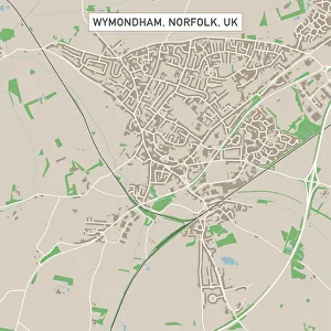
Wymondham Norfolk UK City Street MapVector Illustration of a City Street Map of Wymondham, Norfolk, UK. Included files are EPS (v10) and Hi-Res JPG. Data courtesy from Ordnance Survey: VectorMap District https
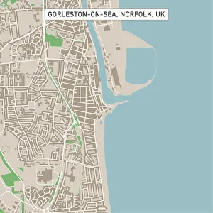
Gorleston-on-Sea Norfolk UK City Street MapVector Illustration of a City Street Map of Gorleston-on-Sea, Norfolk, UK. Included files are EPS (v10) and Hi-Res JPG. Data courtesy from Ordnance Survey: VectorMap District https
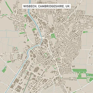
Wisbech Cambridgeshire UK City Street MapVector Illustration of a City Street Map of Wisbech, Cambridgeshire, UK. Included files are EPS (v10) and Hi-Res JPG. Data courtesy from Ordnance Survey: VectorMap District https
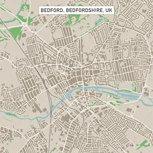
Bedford Bedfordshire UK City Street MapVector Illustration of a City Street Map of Bedford, Bedfordshire, UK. Included files are EPS (v10) and Hi-Res JPG. Data courtesy from Ordnance Survey: VectorMap District https
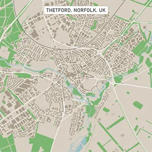
Thetford Norfolk UK City Street MapVector Illustration of a City Street Map of Thetford, Norfolk, UK. Included files are EPS (v10) and Hi-Res JPG. Data courtesy from Ordnance Survey: VectorMap District https
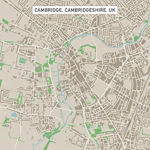
Cambridge Cambridgeshire UK City Street MapVector Illustration of a City Street Map of Cambridge, Cambridgeshire, UK. Included files are EPS (v10) and Hi-Res JPG. Data courtesy from Ordnance Survey: VectorMap District https
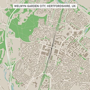
Welwyn Garden City Hertfordshire UK City Street MapVector Illustration of a City Street Map of Welwyn Garden City, Hertfordshire, UK. Included files are EPS (v10) and Hi-Res JPG
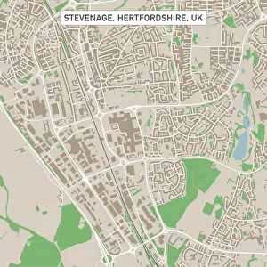
Stevenage Hertfordshire UK City Street MapVector Illustration of a City Street Map of Stevenage, Hertfordshire, UK. Included files are EPS (v10) and Hi-Res JPG. Data courtesy from Ordnance Survey: VectorMap District https
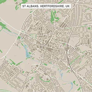
St Albans Hertfordshire UK City Street MapVector Illustration of a City Street Map of St Albans, Hertfordshire, UK. Included files are EPS (v10) and Hi-Res JPG. Data courtesy from Ordnance Survey: VectorMap District https
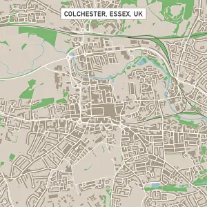
Colchester Essex UK City Street MapVector Illustration of a City Street Map of Colchester, Essex, UK. Included files are EPS (v10) and Hi-Res JPG. Data courtesy from Ordnance Survey: VectorMap District https
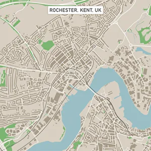
Rochester Kent UK City Street MapVector Illustration of a City Street Map of Rochester, Kent, UK. Included files are EPS (v10) and Hi-Res JPG. Data courtesy from Ordnance Survey: VectorMap District https
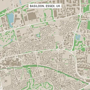
Basildon Essex UK City Street MapVector Illustration of a City Street Map of Basildon, Essex, UK. Included files are EPS (v10) and Hi-Res JPG. Data courtesy from Ordnance Survey: VectorMap District https
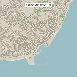
Ramsgate Kent UK City Street MapVector Illustration of a City Street Map of Ramsgate, Kent, UK. Included files are EPS (v10) and Hi-Res JPG. Data courtesy from Ordnance Survey: VectorMap District https
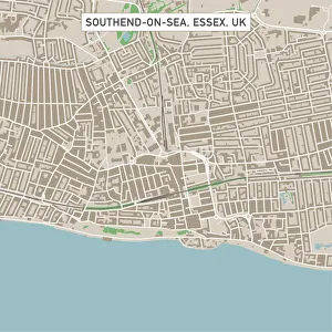
Southend-on-Sea Essex UK City Street MapVector Illustration of a City Street Map of Southend-on-Sea, Essex, UK. Included files are EPS (v10) and Hi-Res JPG. Data courtesy from Ordnance Survey: VectorMap District https
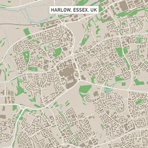
Harlow Essex UK City Street MapVector Illustration of a City Street Map of Harlow, Essex, UK. Included files are EPS (v10) and Hi-Res JPG. Data courtesy from Ordnance Survey: VectorMap District https