mail_outline sales@mediastorehouse.com
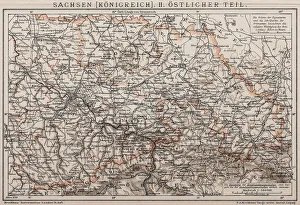
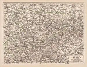
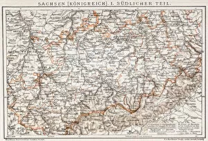
Kingdom of Saxony, Eastern partAntique illustration of a Kingdom of Saxony, Eastern part
Map of the German Confederation (1815-1866), lithograph, published in 1897Map of the German Confederation between 1815 and 1866. Lithograph, published in 1897
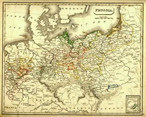
Antquie Map of PrussiaVintage map of Prussia from 1837
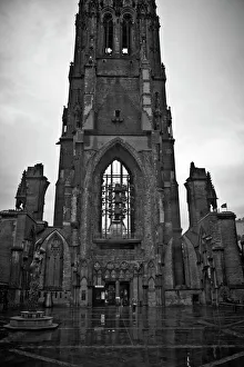
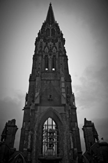
St Nicholas Church in HamburgFormerly one of the five Lutheran Hauptkirchen (main churches) in the city of Hamburg. The church lies now in ruins, with only its tower remaining
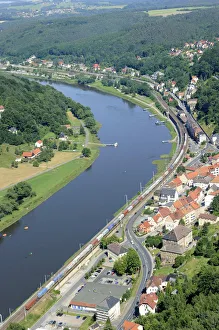
Festung Koenigstein fortress on the river Elbe, overlooking the town of Koenigstein, Elbsandsteingebirge Elbe Sandstone Mountains, Nationalpark Saechsische Schweiz national park, Saxon Switzerland
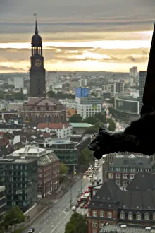
Hamburg Skyline From St. Nicholas ChurchFormerly one of the five Lutheran Hauptkirchen (main churches) in the city of Hamburg. The church lies now in ruins, with only its tower remaining
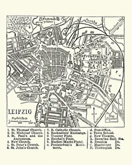
Map of Leipzig, Germany, 19th CenturyVintage engraving of a Map of Leipzig, Germany, 19th Century
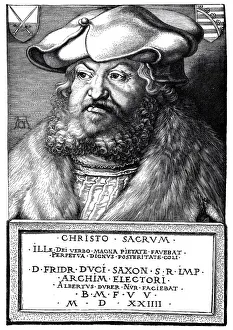
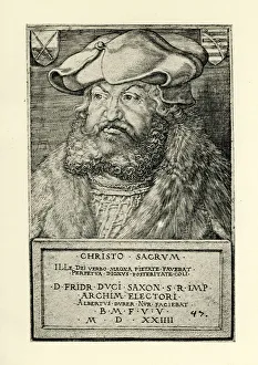
Frederick the Wise Duke of Saxony" Vintage engraving by Albert Durer 1498 showing Frederick the Wise Duke of Saxony. Frederick III of Saxony (1463 to 1525), also known as Frederick the Wise
Frederick the WiseVintage engraving by Albrech Durer, showing a Frederick the Wise, 1524. Frederick III of Saxony (1463 to 1525), also known as Frederick the Wise (Friedrich der Weise)
Albrecht DAOErer (1471-1528), German painter, wood engraving, published in 1881Albrecht Durer (1471 - 1528), famous German painter, printmaker, mathematician, and art theorist. Woodcut engraving after a painting (1500) by himself in Alte Pinakothek, Munich, published in 1881
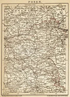
PoznanAncient map of Poznan from 1898
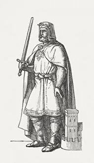
Henry I (c. 876-936), wood engraving, published in 1881Henry I (c. 876-936), from the noble family of Liudolfinger. He was Duke of Saxony from 912 and 919 to 936 King of East Francia
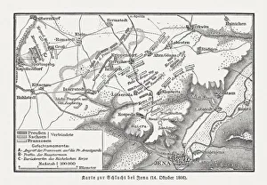
Battle of Jena and Auerstedt, 1806, wood engraving, published 1897Map of the Battle of Jena and Auerstedt on 14 October 1806 on the plateau west of the River Saale, Germany, between the forces of Napoleon I of France and Frederick William III of Prussia
Map of Europe at the Napoleonic Wars of Liberty (1813)Map of Central Europe at the beginning of the Napoleonic Wars of Liberty in 1813. Lithograph, published in 1897
The Gothic Revival Church of St. NicholasThe current condition of the Church of St. Nicholas is the result of the bombing of Hamburg in World War II, resultant demolition in 1951 and restoration work in the 1990s and 2012
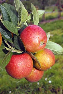
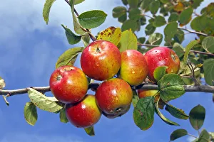
Braeburn Apples (Malus domestica) growing on an apple tree, fruit-growing region Altes Land, Lower Saxony, Hamburg, Germany, Europe
Cherry Laurel or Common Laurel -Prunus laurocerasus, Laurocerasus officinalis- flowers and leaves, ornamental shrub, native to the Mediterranean and Asia Minor, Saxony, Germany
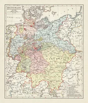
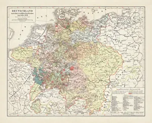
Map of Germany, after the Peace of Westphalia in 1648. Lithograph, published in 1897
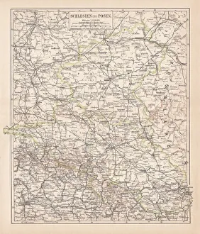
Silesia and Poznan, lithograph, published in 1878Ancient map of Silesia and Poznan, former territories of the German Empire, today Poland. Lithograph, published in 1878
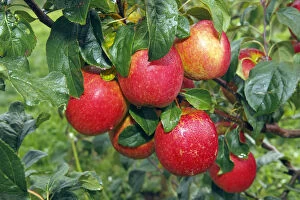
Apple (Malus domestica), Erwin Baur variety, on the tree, Altes Land area, Hamburg, Lower Saxony, Germany
Rewena Apples (Malus domestica) growing on an apple tree, fruit-growing region Altes Land, Lower Saxony, Hamburg, Germany, Europe
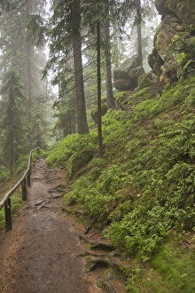
Trail to the Hickelhoehle cave in the Treppengrund, Saxon Switzerland, Elbsandsteingebirge Elbe Sandstone Mountains, Saxony, Germany, Europe
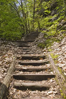
Trail between Obere Schleuse and Hermannseck, Saxon Switzerland, Elbsandsteingebirge Elbe Sandstone Mountains, Saxony, Germany, Europe
Common toad (Bufo bufo) on the forest floor in a lowland forest near Leipzig, Saxony, Germany, Europe
Hooded Crow -Corvus corone cornix- standing on a meadow, Leipzig, Saxony, Germany
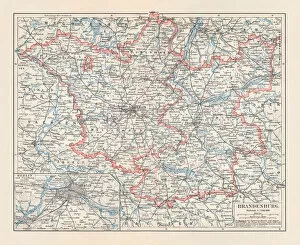
Brandenburg in Germany, mainland, province, and Berlin, lithograph, published 1897The state of Brandenburg in Germany, mainland, province, and Berlin. Lithograph, published in 1897
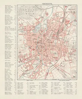
City map of Chemnitz, Germany, lithograph, published in 1897City map of Chemnitz with street directory, Saxony, Germany. Lithograph, published in 1897
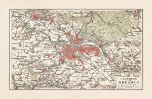
Map of Dresden and surroundings, Saxony, Germany, lithograph, published 1897Map of Dresden and surroundings - capital city of the German state Saxony. Lithograph, published in 1897
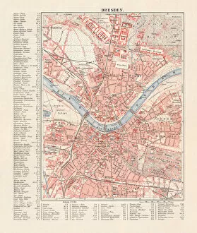
City map of Dresden, Saxony, Germany, lithograph, published in 1897City map of Dresden - capital city of the German state of Saxony (with street directory). Lithograph, published in 1897
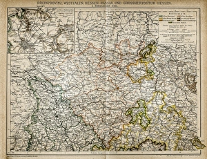
Westphalia, Hesse-nassau and Grand Duchy of Hesse Rhine ProvinceIllustration of a Westphalia, Hesse-nassau and Grand Duchy of Hesse Rhine Province
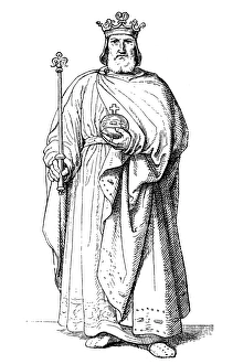
Lothair III, Holy Roman EmperorIllustration of a Lothair III, Holy Roman Emperor
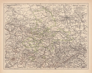
Province of Saxony, lithograph, published in 1878Province of Saxony, former territory of Prussia from 1816 to 1945. Lithograph, published in 1878
Kingdom of Saxony, lithograph, published in 1878Kingdom of Saxony. Lithograph, published in 1878
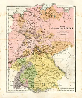
Antique map of Minor German StatesAntique map of the Minor German States from 1864
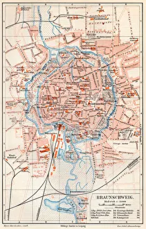
Brunswick city map 1895Meyers Konversations-Lexikon. Ein Nachschlagewerk des allgemeinen Wissens, 5th edition 17 volumes Bibliographisches Institut - Leipzig 1895-1897
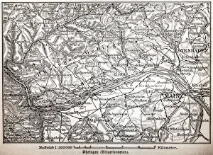
The Rheingau ( Rhine District )
Rhenish-Westphalia coals and industrial map
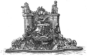
Fountain in Prinzenpalais, DresdenANtique illustration of Fountain in Prinzenpalais, Dresden
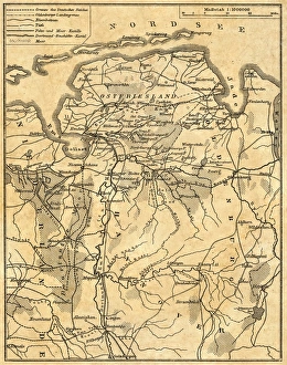
Map of Lower Saxony
Saxony kingdom mapAntique illusytration of a Saxony kingdom map
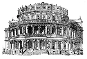
Semperoper in Dresden, GermanyAnique illustration of a Semperoper in Dresden, Germany
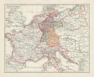
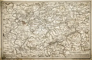
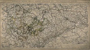
Kingdom of Saxony, province of Saxony (southern part) and Thuringian states
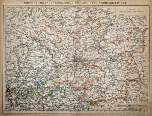
Province of Brandenburg, province of Saxony, northern partAntique illustration of a Province of Brandenburg, province of Saxony, northern part
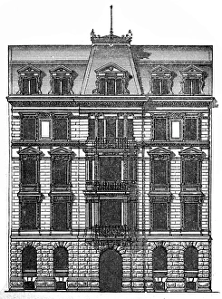
Facade of a residential building in DresdenAntique illustration engraving of facade of a residential building in Dresden
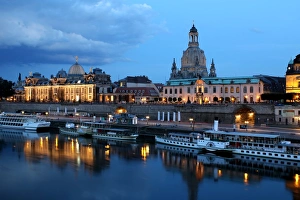
Dresden on the Elbe riverThe historic center of Dresden on the banks of the Elbe
Luftaufnahmen der Lausitzer Heide- und TeichlandschaftAerial photographs of the biosphere reserve Upper Lausitz Heath and Pond Landscape (Oberlausitzer Heide- und Teichlandschaft) between Hoyerswerda and Niesky in the Lausitz
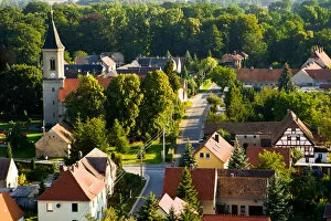
Luftaufnahme typische Darf in der Lausitz mit KircheAerial photographs of the biosphere reserve Upper Lausitz Heath and Pond Landscape (Oberlausitzer Heide- und Teichlandschaft) between Hoyerswerda and Niesky in the Lausitz