mail_outline sales@mediastorehouse.com
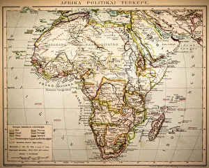
Africa Political MapAntique illustration of a Africa Political Map from 1893
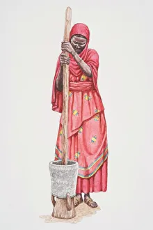
Standing African woman in traditional Somalian clothing pounding grain in a clay pot using a stick, front view
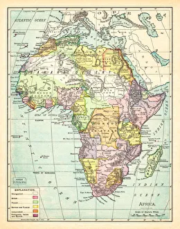
Map of Africa 1895The Rand-McNally Grammar School Geography 1895 - Chicago & New York
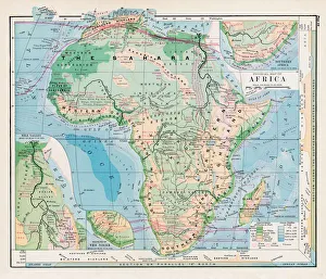
Map of Africa 1877Warrens Common School Geography 1877
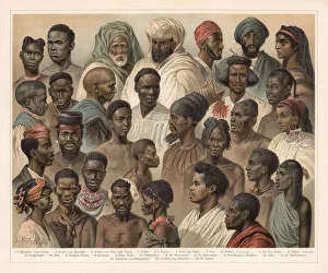
African Native People, lithograph, published in 1897African Native People: 1 - 2) Mpongwe people from Gabun; 3) Arab from Morocco; 4) Arab from the southern Tunisia; 5) Fellah; 6 - 7) Copts; 8) Koto from Niger; 9) Fang people; 10) Berber (Dachelaner)
africa, antique, arabian sea, archival, asia, borders, boundaries, cartography, countries, geography, gulf of aden, historic, horn, illustration, india, indian ocean, iran, key, legend, map