mail_outline sales@mediastorehouse.com
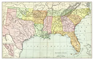
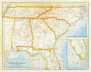
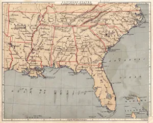
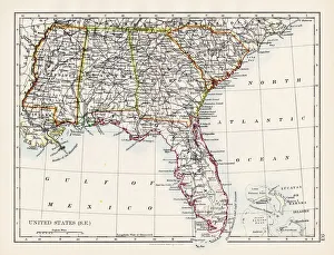
Map of Southern States USA 1895The Rand-McNally Grammar School Geography 1895 - Chicago & New York
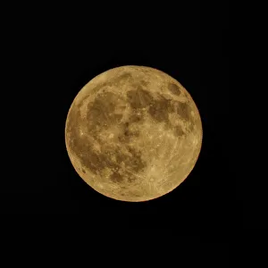
Orange Harvest MoonThe Harvest Moon gets its name from folklore. The saying is the light of the moon helped farmers gather crops when days became shorter and nights longer following the Autumnal Equinox
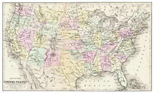
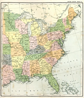
Map of USA 1877Warrens Common School Geography 1877
Myrtle Beach Boardwalk at dusk
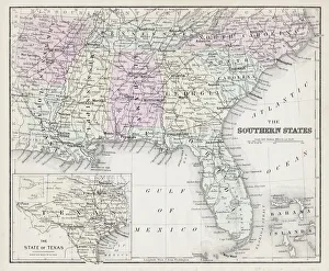
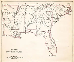
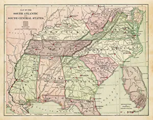
Map of Southern States USA 1877Warrens Common School Geography 1877
Magical SunriseA magical sunrise at Folly Beach
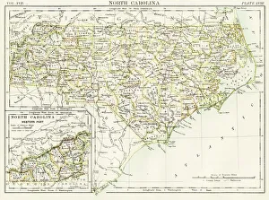
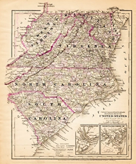
North Carolina map 1884Encyclopedia Britannica 9th Edition New York Charles Scribners and Sonsl 1884 Vol XVII
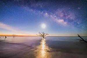
dreaming of the milky wayThe milky way shot with the moon rising and a dead tree in the center of the ocean
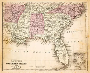
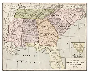
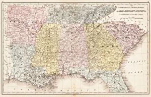
1883 Southern States Map
Map of Southern states USA 1883Warrens Common School Geography
Map of USA Southern states 1869Cornells Grammars-School Geography - S.S. Cornell - New York D. Appleton and Company 1869
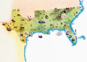
Map of Southern United States of America, with illustrations of distinguishing features and landmarks
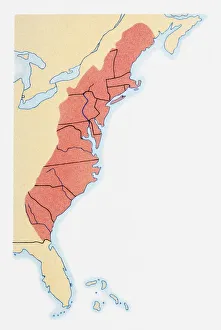
Illustration of states on East Coast of the USA
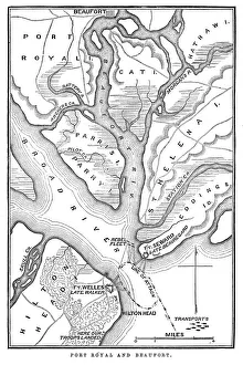
Battle of Port RoyalVintage engraving from 1863 of a map of the Battle of Port Royal which was one of the earliest amphibious operations of the American Civil War
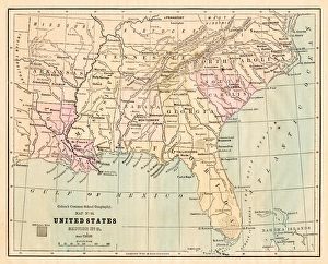
USA Southern states map 1889Indiana Educational Series The Complete Geography - Indianapolis 1889
Drawing Map of Southern states USA 1883Warrens Common School Geography
Antquie Map of the United StatesVintage map of the United States of America from 1837
Antique Map of Eastern USAAntique Map from 1867 of Eastern United States of America
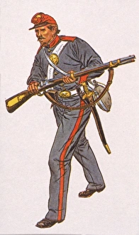
Charleston ZouavesIllustration of one of the Charleston Zouaves, a member of a South Carolina regiment of volunteer Civil War soldiers, 1860s
SunshineEdisto Island Sunshine
Milky Way BeachThe Milky Way rising above Folly Beach
United States South East map 1897The World-Wide Atlas of Modern Geography, Political and Physical W. & A.K. Johnston - London 1897
Map EngravingsFine Art Storehouse Maps: Map Engravings
Souther States USA map 1881Coltons Common School Geography 1881 New York Sheldon and Co
Virginia North Carolina map 1881Coltons Common School Geography 1881 New York Sheldon and Co
USA Southern States 1867Mitchells Modern Atlas - Published by E.H. Buttler & Co - Philadelphia 1867
Southern States 1852 Map
United States 1852 Map
United States of America, Atlantic coast, lithograph, published in 1878United States of America, Atlantic coast. Lithograph, published in 1878
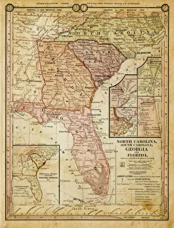
usa - southern states 1884map of north carolina, south carolina, georgia and florida 1884
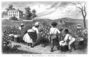
Cotton plantation USA engraving 1873Facts for Farmers - Materials fror Land-owners about Domestic Animals, Gardens and Vineyards, Edited by Solon Robinson in Two Volumens New York, A.J.Johnson 1873
A Cotton PressIllustration of a short staple cotton press at work in South Carolina circa 1880. (Photo by Kean Collection/Getty Images)
Boneyard LightThe Morris Island Light House shot from the Boneyard
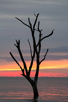
edisto island treeA dead tree shot at Edisto Island
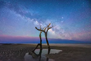
Edisto Island milky wayThe Milky way rising above edisto island
arther ravenel bridge light trailsLight Trails shot at arther ravenel jr bridge!
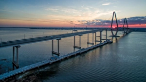
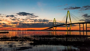
arther ravenel bridge sunsetA sunset at arther ravenel bridge located in charleston, sc
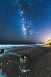
charleston milky wayThe Charleston milky way
Morris IslandSunrise at Morris Island
Hell at Morris Island
Edisto Island CloudscapeA sunrise at Edisto Island with a nice cloudscape
The Sun and the MoonThe sun and the moon shot at Folly Beach, SC!
Folly DollyAnother day in Paradise at Folly Beach
GlowA gorguoes glow behind a small tree at St. Helena Island
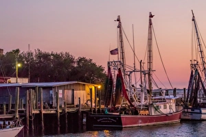
Shrimp Boats during sunset at Shem Creek, SC
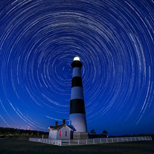
A Starry Night at Bodie Island Light HouseA Starry night at Bodie Island Light House!
arther ravenel bridge at twilight hourThe arther ravenel jr bridge shot at twilight
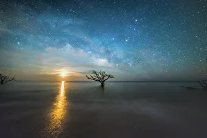
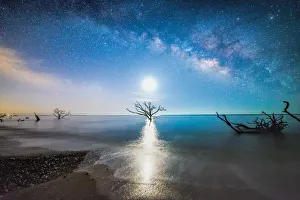
milkyway shoreThe milky way rising above Edisto Island with the moon directly above a dead tree out in the ocean