mail_outline sales@mediastorehouse.com
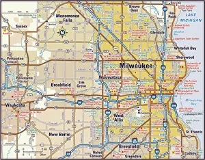
Milwaukee, Wisconsin Area Street Map
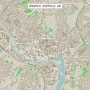
Ipswich Suffolk UK City Street MapVector Illustration of a City Street Map of Ipswich, Suffolk, UK. Included files are EPS (v10) and Hi-Res JPG. Data courtesy from Ordnance Survey: VectorMap District https
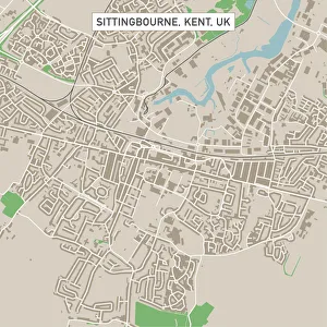
Sittingbourne Kent UK City Street MapVector Illustration of a City Street Map of Sittingbourne, Kent, UK. Included files are EPS (v10) and Hi-Res JPG. Data courtesy from Ordnance Survey: VectorMap District https
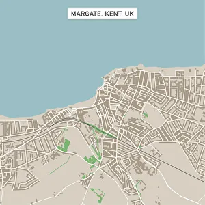
Margate Kent UK City Street MapVector Illustration of a City Street Map of Margate, Kent, UK. Included files are EPS (v10) and Hi-Res JPG. Data courtesy from Ordnance Survey: VectorMap District https
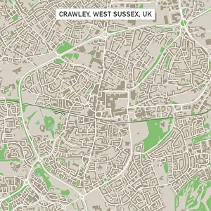
Crawley West Sussex UK City Street MapVector Illustration of a City Street Map of Crawley, West Sussex, UK. Included files are EPS (v10) and Hi-Res JPG. Data courtesy from Ordnance Survey: VectorMap District https
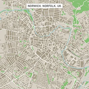
Norwich Norfolk UK City Street MapVector Illustration of a City Street Map of Norwich, Norfolk, UK. Included files are EPS (v10) and Hi-Res JPG. Data courtesy from Ordnance Survey: VectorMap District https
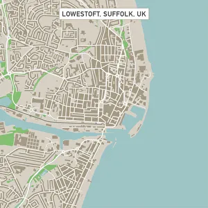
Lowestoft Suffolk UK City Street MapVector Illustration of a City Street Map of Lowestoft, Suffolk, UK. Included files are EPS (v10) and Hi-Res JPG. Data courtesy from Ordnance Survey: VectorMap District https
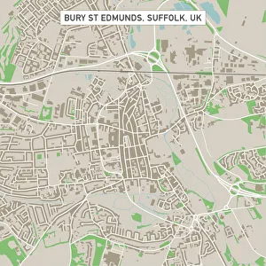
Bury St Edmunds Suffolk UK City Street MapVector Illustration of a City Street Map of Bury St Edmunds, Suffolk, UK. Included files are EPS (v10) and Hi-Res JPG. Data courtesy from Ordnance Survey: VectorMap District https
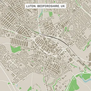
Luton Bedfordshire UK City Street MapVector Illustration of a City Street Map of Luton, Bedfordshire, UK. Included files are EPS (v10) and Hi-Res JPG. Data courtesy from Ordnance Survey: VectorMap District https
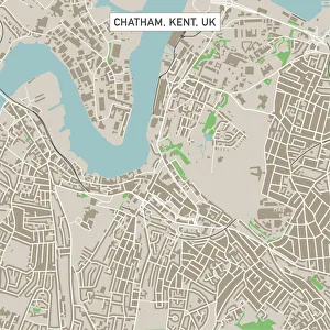
Chatham Kent UK City Street MapVector Illustration of a City Street Map of Chatham, Kent, UK. Included files are EPS (v10) and Hi-Res JPG. Data courtesy from Ordnance Survey: VectorMap District https
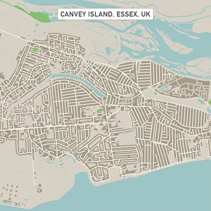
Canvey Island Essex UK City Street MapVector Illustration of a City Street Map of Canvey Island, Essex, UK. Included files are EPS (v10) and Hi-Res JPG. Data courtesy from Ordnance Survey: VectorMap District https
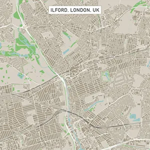
Ilford London UK City Street MapVector Illustration of a City Street Map of Ilford, London, UK. Included files are EPS (v10) and Hi-Res JPG. Data courtesy from Ordnance Survey: VectorMap District https
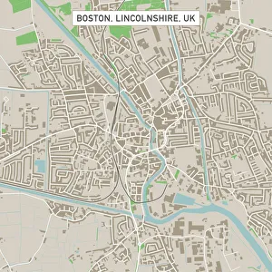
Boston Lincolnshire UK City Street MapVector Illustration of a City Street Map of Boston, Lincolnshire, UK. Included files are EPS (v10) and Hi-Res JPG
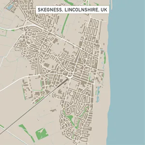
Skegness Lincolnshire UK City Street MapVector Illustration of a City Street Map of Skegness, Lincolnshire, UK. Included files are EPS (v10) and Hi-Res JPG. Data courtesy from Ordnance Survey: VectorMap District https
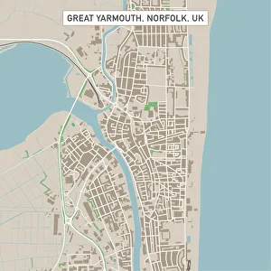
Great Yarmouth Norfolk UK City Street MapVector Illustration of a City Street Map of Great Yarmouth, Norfolk, UK. Included files are EPS (v10) and Hi-Res JPG. Data courtesy from Ordnance Survey: VectorMap District https
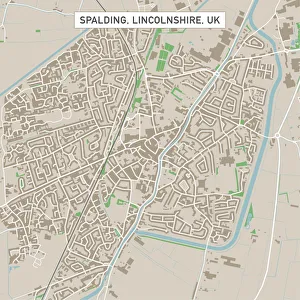
Spalding Lincolnshire UK City Street MapVector Illustration of a City Street Map of Spalding, Lincolnshire, UK. Included files are EPS (v10) and Hi-Res JPG. Data courtesy from Ordnance Survey: VectorMap District https
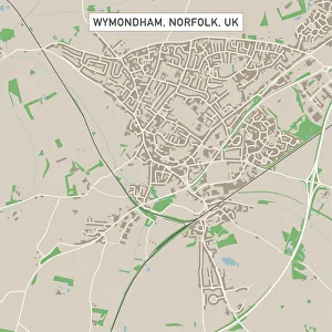
Wymondham Norfolk UK City Street MapVector Illustration of a City Street Map of Wymondham, Norfolk, UK. Included files are EPS (v10) and Hi-Res JPG. Data courtesy from Ordnance Survey: VectorMap District https
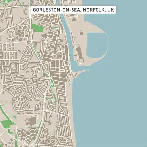
Gorleston-on-Sea Norfolk UK City Street MapVector Illustration of a City Street Map of Gorleston-on-Sea, Norfolk, UK. Included files are EPS (v10) and Hi-Res JPG. Data courtesy from Ordnance Survey: VectorMap District https
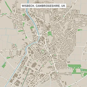
Wisbech Cambridgeshire UK City Street MapVector Illustration of a City Street Map of Wisbech, Cambridgeshire, UK. Included files are EPS (v10) and Hi-Res JPG. Data courtesy from Ordnance Survey: VectorMap District https
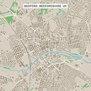
Bedford Bedfordshire UK City Street MapVector Illustration of a City Street Map of Bedford, Bedfordshire, UK. Included files are EPS (v10) and Hi-Res JPG. Data courtesy from Ordnance Survey: VectorMap District https
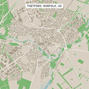
Thetford Norfolk UK City Street MapVector Illustration of a City Street Map of Thetford, Norfolk, UK. Included files are EPS (v10) and Hi-Res JPG. Data courtesy from Ordnance Survey: VectorMap District https
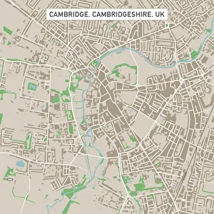
Cambridge Cambridgeshire UK City Street MapVector Illustration of a City Street Map of Cambridge, Cambridgeshire, UK. Included files are EPS (v10) and Hi-Res JPG. Data courtesy from Ordnance Survey: VectorMap District https
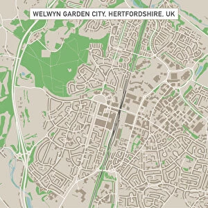
Welwyn Garden City Hertfordshire UK City Street MapVector Illustration of a City Street Map of Welwyn Garden City, Hertfordshire, UK. Included files are EPS (v10) and Hi-Res JPG
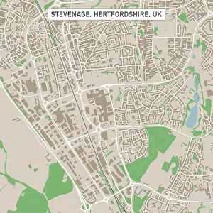
Stevenage Hertfordshire UK City Street MapVector Illustration of a City Street Map of Stevenage, Hertfordshire, UK. Included files are EPS (v10) and Hi-Res JPG. Data courtesy from Ordnance Survey: VectorMap District https
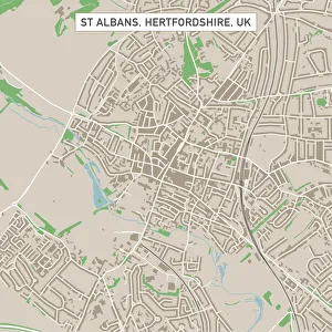
St Albans Hertfordshire UK City Street MapVector Illustration of a City Street Map of St Albans, Hertfordshire, UK. Included files are EPS (v10) and Hi-Res JPG. Data courtesy from Ordnance Survey: VectorMap District https
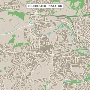
Colchester Essex UK City Street MapVector Illustration of a City Street Map of Colchester, Essex, UK. Included files are EPS (v10) and Hi-Res JPG. Data courtesy from Ordnance Survey: VectorMap District https
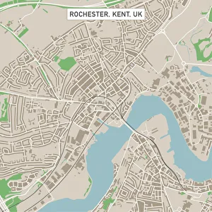
Rochester Kent UK City Street MapVector Illustration of a City Street Map of Rochester, Kent, UK. Included files are EPS (v10) and Hi-Res JPG. Data courtesy from Ordnance Survey: VectorMap District https
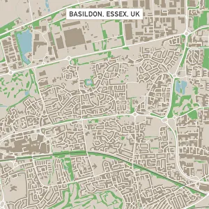
Basildon Essex UK City Street MapVector Illustration of a City Street Map of Basildon, Essex, UK. Included files are EPS (v10) and Hi-Res JPG. Data courtesy from Ordnance Survey: VectorMap District https
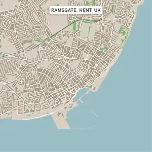
Ramsgate Kent UK City Street MapVector Illustration of a City Street Map of Ramsgate, Kent, UK. Included files are EPS (v10) and Hi-Res JPG. Data courtesy from Ordnance Survey: VectorMap District https
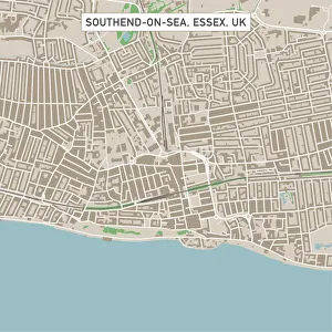
Southend-on-Sea Essex UK City Street MapVector Illustration of a City Street Map of Southend-on-Sea, Essex, UK. Included files are EPS (v10) and Hi-Res JPG. Data courtesy from Ordnance Survey: VectorMap District https
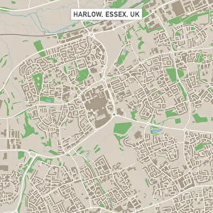
Harlow Essex UK City Street MapVector Illustration of a City Street Map of Harlow, Essex, UK. Included files are EPS (v10) and Hi-Res JPG. Data courtesy from Ordnance Survey: VectorMap District https
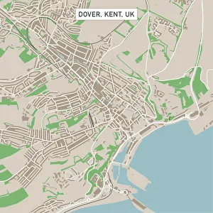
Dover Kent UK City Street MapVector Illustration of a City Street Map of Dover, Kent, UK. Included files are EPS (v10) and Hi-Res JPG. Data courtesy from Ordnance Survey: VectorMap District https
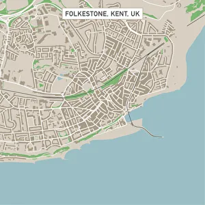
Folkestone Kent UK City Street MapVector Illustration of a City Street Map of Folkestone, Kent, UK. Included files are EPS (v10) and Hi-Res JPG. Data courtesy from Ordnance Survey: VectorMap District https
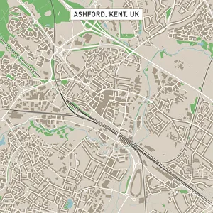
Ashford Kent UK City Street MapVector Illustration of a City Street Map of Ashford, Kent, UK. Included files are EPS (v10) and Hi-Res JPG. Data courtesy from Ordnance Survey: VectorMap District https
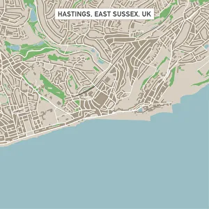
Hastings East Sussex UK City Street MapVector Illustration of a City Street Map of Hastings, East Sussex, UK. Included files are EPS (v10) and Hi-Res JPG. Data courtesy from Ordnance Survey: VectorMap District https
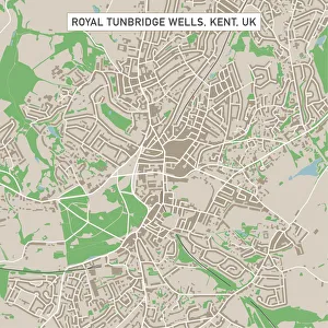
Royal Tunbridge Wells Kent UK City Street MapVector Illustration of a City Street Map of Royal Tunbridge Wells, Kent, UK. Included files are EPS (v10) and Hi-Res JPG. Data courtesy from Ordnance Survey: VectorMap District https
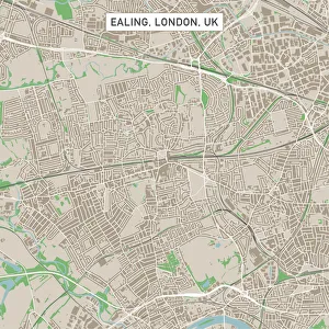
Ealing London UK City Street MapVector Illustration of a City Street Map of Ealing, London, UK. Included files are EPS (v10) and Hi-Res JPG. Data courtesy from Ordnance Survey: VectorMap District https
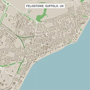
Felixstowe Suffolk UK City Street MapVector Illustration of a City Street Map of Felixstowe, Suffolk, UK. Included files are EPS (v10) and Hi-Res JPG. Data courtesy from Ordnance Survey: VectorMap District https
Clacton-on-Sea Essex UK City Street MapVector Illustration of a City Street Map of Clacton-on-Sea, Essex, UK. Included files are EPS (v10) and Hi-Res JPG. Data courtesy from Ordnance Survey: VectorMap District https
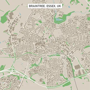
Braintree Essex UK City Street MapVector Illustration of a City Street Map of Braintree, Essex, UK. Included files are EPS (v10) and Hi-Res JPG. Data courtesy from Ordnance Survey: VectorMap District https
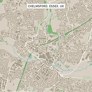
Chelmsford Essex UK City Street MapVector Illustration of a City Street Map of Chelmsford, Essex, UK. Included files are EPS (v10) and Hi-Res JPG. Data courtesy from Ordnance Survey: VectorMap District https
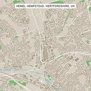
Hemel Hempstead Hertfordshire UK City Street MapVector Illustration of a City Street Map of Hemel Hempstead, Hertfordshire, UK. Included files are EPS (v10) and Hi-Res JPG
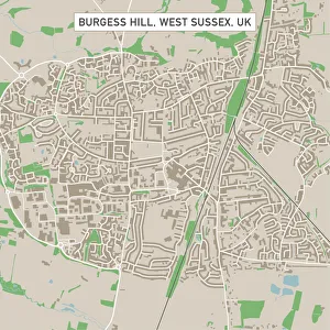
Burgess Hill West Sussex UK City Street MapVector Illustration of a City Street Map of Burgess Hill, West Sussex, UK. Included files are EPS (v10) and Hi-Res JPG. Data courtesy from Ordnance Survey: VectorMap District https
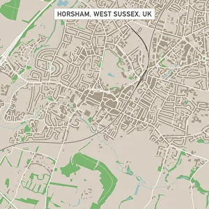
Horsham West Sussex UK City Street MapVector Illustration of a City Street Map of Horsham, West Sussex, UK. Included files are EPS (v10) and Hi-Res JPG. Data courtesy from Ordnance Survey: VectorMap District https
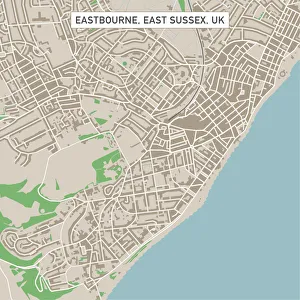
Eastbourne East Sussex UK City Street MapVector Illustration of a City Street Map of Eastbourne, East Sussex, UK. Included files are EPS (v10) and Hi-Res JPG. Data courtesy from Ordnance Survey: VectorMap District https
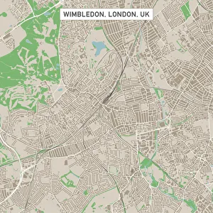
Wimbledon London UK City Street MapVector Illustration of a City Street Map of Wimbledon, London, UK. Included files are EPS (v10) and Hi-Res JPG. Data courtesy from Ordnance Survey: VectorMap District https
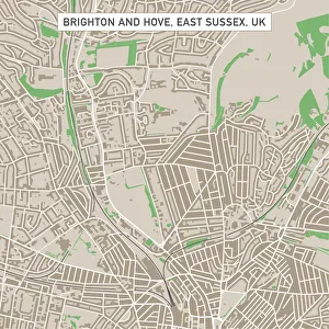
Brighton And Hove East Sussex UK City Street MapVector Illustration of a City Street Map of Brighton And Hove, East Sussex, UK. Included files are EPS (v10) and Hi-Res JPG
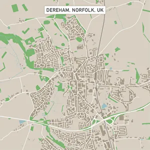
Dereham Norfolk UK City Street MapVector Illustration of a City Street Map of Dereham, Norfolk, UK. Included files are EPS (v10) and Hi-Res JPG. Data courtesy from Ordnance Survey: VectorMap District https