mail_outline sales@mediastorehouse.com
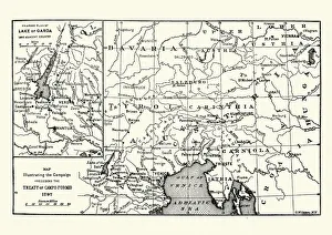
Map of the Campaign preceding the Treaty of Camp-formioVintage engraving of a Map of the Campaign preceding the Treaty of Camp-formio, 1797
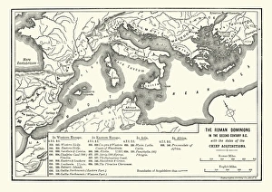
Map of Roman dominions in the Second Century BCVintage engraving of Map of Ancient Roman dominions in the Second Century BC
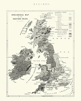
Victorian Geological Map of the British IslesVintage engraving of a Victorian Geological Map of the British Isles
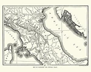
Map of Ancient Northern and Central ItalyVintage engraving of a Map of Ancient Northern and Central Italy
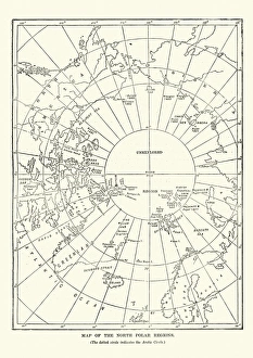
Victorian map of the North Polar RegionsVintage engraving showing a Victorian map of the North Polar Regions
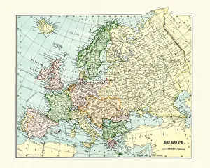
Antique Map of Europe 1880s
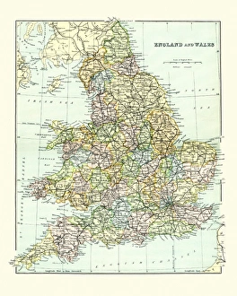
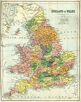
Antique Map of England and Wales 1880sVintage 19th Century map of England and Wales
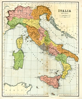
Antique Map of Ancient ItalyVintage engraving showing a Antique Map of Ancient Italy, 1864
Antique map of England and Wales, 1864
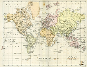
Antique Map of the WorldVintage map of the World from 1884
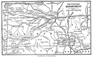
Missouri CampaignsVintage engraving from 1863 of a map of the Missouri Campaigns from the time of the American Civil War
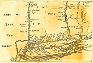
Vintage Map of New York at the beginning of the 18th Century. from 1880
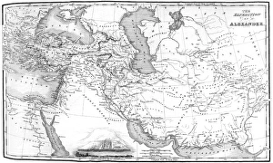
Alexander the Greats EmpireVintage map showing the ruot eof Alexander the Great as he conqured the Middle East
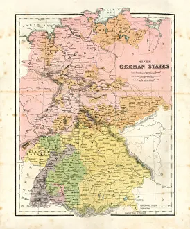
Antique map of Minor German StatesAntique map of the Minor German States from 1864
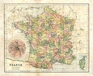
Antique map of France from 1864
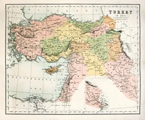
Antique Map of TurkeyAntique map of Turkey from 1867
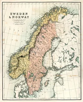
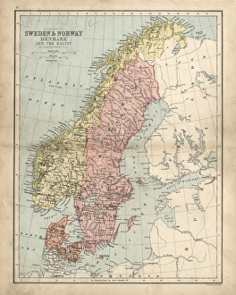
Antique Map of Sweden and NorwayAntique map of Sweden and Norway from 1867
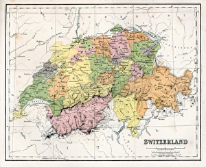
Antique Map of SwitzerlandAntique map of Switzerland from 1867
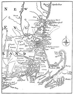
Vintage Map of New England at the beginning of the 18th century
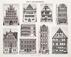
Antique European Buildings engraving 1897Antique European Buildings engraving
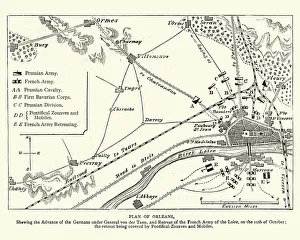
Franco Prussian War - Plan of Second Battle of OrleansVintage engraving of a scene from the Franco Prussian War. Plan of the Second Battle of Orleans, 1870
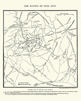
Map of the Battle of Bull RunVintage engraving of a Map of the Battle of Bull Run, The Century Magazine, 1884
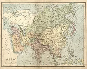
Antique map of Asia in the 19th Century, 1873Vintage engraving of a Victorian Antique map of Asia in the 19th Century, 1873
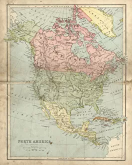
Antique damaged map of North America in the 19th CenturyVintage engraving of a Antique map of North America in the 19th Century, 1873
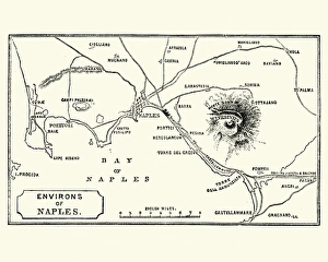
Map of Environs of Naples and Mount Vesuvius 1872Vintage engraving of Map of Environs of Naples and Mount Vesuvius 1872
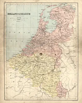
Antique damaged map of Holland & Belgium 19th CenturyVintage engraving of a Antique damaged map of Holland & Belgium in the 19th Century, 1873
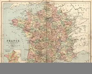
Antique damaged map of France in the 19th CenturyVintage engraving of a Antique damaged map of France in the 19th Century, 1873
Antique damaged map of Swden Norway Denmark 19th Century
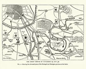
Franco Prussian War Battle plan of Siege of ParisVintage engraving of a scene from the Franco Prussian War. Battle plan of Siege of Paris
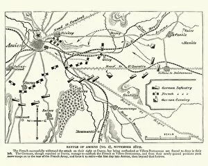
Franco Prussian War plan of the Battle of AmiensVintage engraving of a scene from the Franco Prussian War. plan of the Battle of Amiens
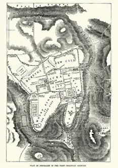
Plan of Jerusalem in the 1st CenturyVintage engraving of a Plan of Jerusalem in the 1st Century
BrigVintage engraving of Brig ship
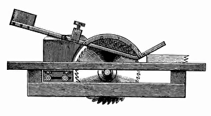
Circular Saw protective cap
Horizontal frame for woods
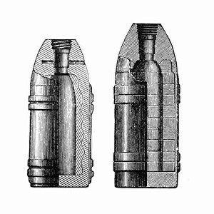
ProjectilesVintage engraving of a bullet, Shrapnel and Segment Shells
Jousting ArmorAntique illustration of a Jousting Armor
Windy seaShip on a windy day
Giant ground sloth, Megatherium (Mylodon robustus)
Steam elevator from Otis brothers in New York
Ore procession facility
19th Century MineVintage engraving of men sifting ore at a 19th Century Mine
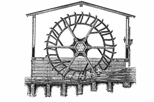
Water WheelVintage engraving of a 19th Century Water Wheel
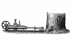
Tree cutting steam machine
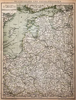
West Russia and Baltic provinces
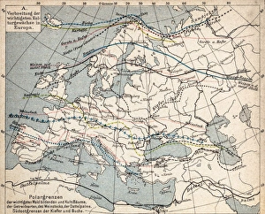
Map of plant geography
Ship WreakVintage engraving from 1898 showing people shooting rocket toward Ship Wreak
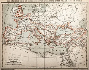
Roman empire under Trajan
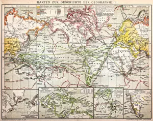
Maps for history of geography