mail_outline sales@mediastorehouse.com
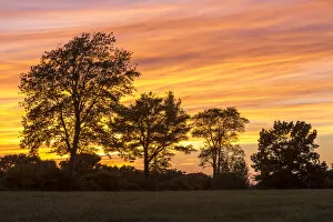
Trees at dusk on Sagamore Hill in Hamilton, Massachusetts, USASunset or sundown is the daily disappearance of the Sun below the western half of the horizon, i.e. at an azimuth greater than 180 degrees, as a result of Earths rotation
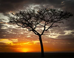
Sunrise, Masai Mara National Reserve, KenyaThe Masai Mara National Reserve (also known as Masai Mara and by the locals as The Mara) is a large game reserve in Narok County, Kenya, contiguous with the Serengeti National Park in Mara Region
Panoramic of God beams over desert at sunset, Namib-Naukluft Park, NamibiaThe Namib Naukluft National Park is a national park of Namibia encompassing part of the Namib Desert (considered the worlds oldest desert) and the Naukluft mountain range
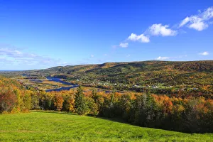
Fall colors and Margaree river, Cabot Trail, Cape Breton, Nova Scotia, CanadaMargaree river is a river on Cape Breton Island in Nova Scotia. The northeast branch of the river derives from the watershed of the Cape Breton Highlands
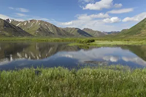
Landscape with lake in Tombstone Territorial Park, Yukon Territory, CanadaTombstone Territorial Park is a park of the Yukon Territory, Canada. It is located in central Yukon, near the southern end of the Dempster Highway, stretching from km. 50.5 to km. 115.0
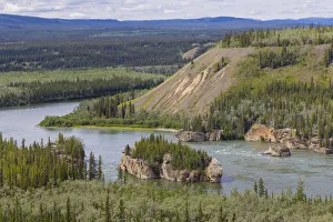
Landscape with Five Finger Rapids and Yukon River, Yukon Territory, CanadaFive Finger Rapids are located on the Yukon River, Yukon, Canada. Four islands divide the river into five narrow channels of which only the eastern is passable
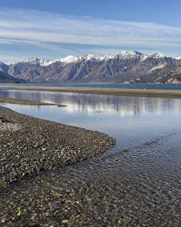
St. Elias Range and Kluane Lake in Kluane National Park, Yukon Territory, CanadaKluane National Park and Reserve are two units of Canadas national park system, located in the extreme southwestern corner of the territory of Yukon
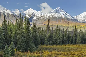
Landscape with St. Elias Range in Kluane National Park, Yukon Territory, CanadaKluane National Park and Reserve are two units of Canadas national park system, located in the extreme southwestern corner of the territory of Yukon
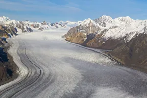
St. Elias Mountains and Kaskawulsh Glacier in Kluane National Park, Yukon Territory, CanadaKluane National Park and Reserve are two units of Canadas national park system, located in the extreme southwestern corner of the territory of Yukon
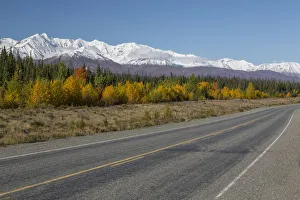
St. Elias Range and highway in Kluane National Park, Yukon Territory, CanadaKluane National Park and Reserve are two units of Canadas national park system, located in the extreme southwestern corner of the territory of Yukon
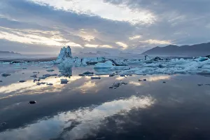
Lake Jokulsarlon and Ice from Breidamerkurjohull Glacier, Skaftafell National Park, Vatnajokull National ParkJokulsarlon is a large glacial lake in southeast Iceland, on the edge of Vatnajokull National Park. Situated at the head of the Breithamerkurjokull glacier
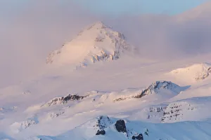
Mountains near glacier glowing in dawns light, Vatnajokull Glacier, Skaftafell National Park, Southwest IcelandVatnajokull also known as the Vatna Glacier in English, is the largest and most voluminous ice cap in Iceland, and one of the largest in area in Europe
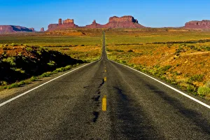
Highway through Monument Valley, Arizona, USAMonument Valley is a region of the Colorado Plateau characterized by a cluster of vast sandstone buttes, the largest reaching 1, 000 ft above the valley floor
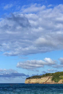
Cliffs of Miners Beach, Pictured Rocks National Lakeshore, Michigan, USAPictured Rocks National Lakeshore is a U.S. National Lakeshore on the shore of Lake Superior in the Upper Peninsula of Michigan, United States
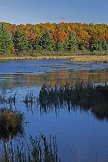
Doe Lake on sunny day, Hiawatha National Forest, Upper Peninsula, Michigan, USAHiawatha National Forest is a 894, 836 acre (362, 127 ha) National Forest in the Upper Peninsula of the state of Michigan in the United States. Commercial logging is conducted in some areas
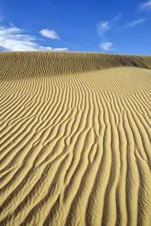
Ripples in sand, Mesquite Flat Sand Dunes, Death Valley National Park, California, USAThe Mesquite Flat Sand Dunes are at the northern end of the valley floor and are nearly surrounded by mountains on all sides
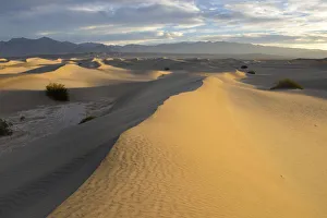
Landscape with Mesquite Flat Sand Dunes at sunrise, Death Valley National Park, California, USAThe Mesquite Flat Sand Dunes are at the northern end of the valley floor and are nearly surrounded by mountains on all sides
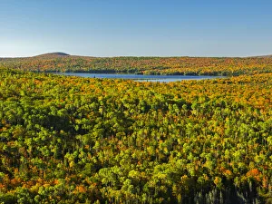
View from Brockway Mountain at forest landscape, Keweenaw Peninsula, Michigan, USAThe Keweenaw Peninsula is the northernmost part of Michigans Upper Peninsula. It projects into Lake Superior and was the site of the first copper boom in the United States
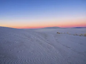
Sand dune patterns in White Sands National Monument, New Mexico, USAWhite Sands National Monument is a U.S. National Monument located in the state of New Mexico on the north side of Route 70 about 16 miles (26 km)
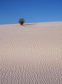
Sand Dune Patterns and Yucca Plants in White Sands National Monument, New Mexico, USAWhite Sands National Monument is a U.S. National Monument located in the state of New Mexico on the north side of Route 70 about 16 miles (26 km)
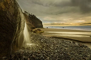
Hug Point Falls flows onto beach, Hug Point State Park, Oregon, USAHug Point State Recreation Site is a state park on the northern Oregon Coast in the U.S. state of Oregon. Administered by the Oregon Parks and Recreation Department
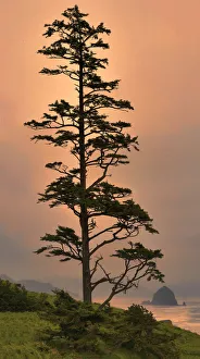
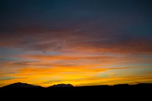
Tree against sunset, Newport, Oregon Coast, Oregon, USAOregon Coast is a region of the U.S. state of Oregon. It runs generally north south along the Pacific Ocean, forming the western border of the state
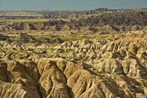
Pinnacles viewpoint in Badlands National Park, South Dakota, USABadlands National Park is a United States National Park that is located in southwestern South Dakota. This park is marked by rugged terrain
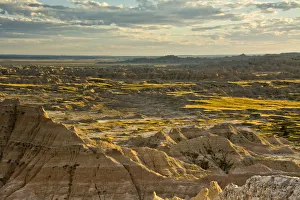
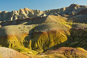
Hay Butte viewpoint, Badlands National Park, South Dakota, USABadlands National Park is a United States National Park that is located in southwestern South Dakota. This park is marked by rugged terrain
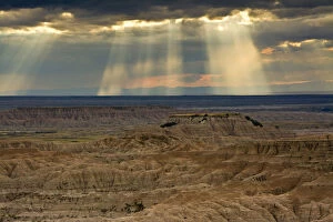
Approaching storm and sunbeams, Badlands National Park, South Dakota, USABadlands National Park is a United States National Park that is located in southwestern South Dakota. This park is marked by rugged terrain
Sage Creek Rim Road in Badlands National Park, South Dakota, USABadlands National Park is a United States National Park that is located in southwestern South Dakota. This park is marked by rugged terrain
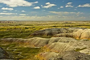
Colorful hills of Badlands LoopTrail, Badlands National Park, South Dakota, USABadlands National Park is a United States National Park that is located in southwestern South Dakota. This park is marked by rugged terrain
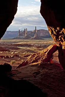
Monument Valley seen from cave, Utah, USAMonument Valley is a region of the Colorado Plateau characterized by a cluster of vast sandstone buttes, the largest reaching 1, 000 ft (300 m) above the valley floor
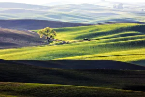
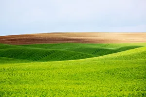
Lone tree among wheat fields of Palouse region, Washington State, USAThe Palouse is a region of the northwestern United States, encompassing parts of southeastern Washington, north central Idaho and, by some definitions, parts of northeast Oregon
Landscape with wheat and fallow fields of Palouse region, Washington State, USAThe Palouse is a region of the northwestern United States, encompassing parts of southeastern Washington, north central Idaho and, by some definitions, parts of northeast Oregon
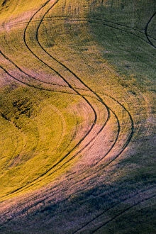
High angle view of tracks in field of wheat in Palouse region, Washington State, USAThe Palouse is a region of the northwestern United States, encompassing parts of southeastern Washington, north central Idaho and, by some definitions, parts of northeast Oregon
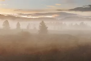
Foggy landscape of Grand Teton National Park at sunrise, Wyoming, USAGrand Teton National Park is a United States National Park in northwestern Wyoming. At approximately 310, 000 acres (480 sq mi, 130, 000 ha, 1, 300 km2)
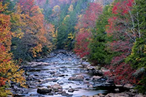
Rocky stream and autumn forest in Blackwater Falls State Park, Tucker County, West Virginia, USABlackwater Falls State Park is located in the Allegheny Mountains of Tucker County, West Virginia, USA. The centerpiece of the Park is Blackwater Falls
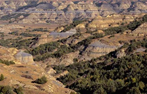
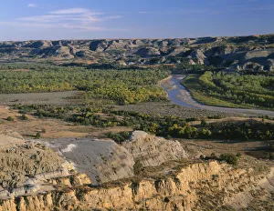
View from Bentonitic Clay Overlook on forest and eroded formations with gray colored exposed bentonite clayTheodore Roosevelt National Park is a United States National Park comprising three geographically separated areas of badlands in western North Dakota. The park was named for U.S
Valley of Little Missouri River and sedimentary hills in North Unit of Theodore Roosevelt National Park, North DakotaTheodore Roosevelt National Park is a United States National Park comprising three geographically separated areas of badlands in western North Dakota. The park was named for U.S
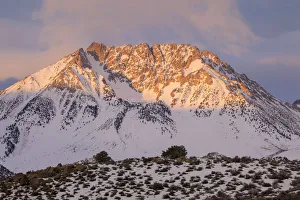
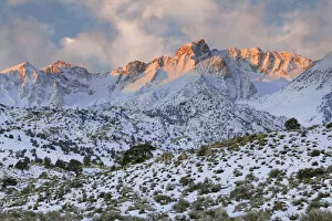
Sunrise on Basin Mountain, Sierra Nevada Range, California, USA
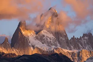
Fitz Roy covered with snow, Patagonia, Argentina
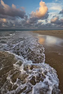
Remote sandy beach on uninhabited island with incoming tide, Pacific Islands, Tonga
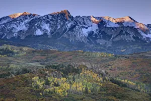
Mountain and valley landscape at sunrise, San Juan Mountains, Colorado, USA
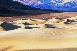
Mesquite Sand Dunes with Grapevine Mountains in background, Death Valley, California, USA
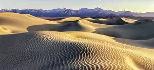
Landscape of Mesquite Sand Dunes, Death Valley, California, USA
Sunrise over Henry Mountains seen from Studhorse Ridge, Grand Staircase Escalante, Utah, USA
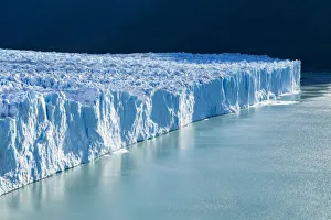
Large glacier in Los Glaciares National Park, Santa Cruz Province, Patagonia, Argentina
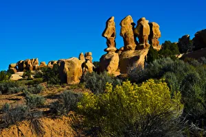
Hoodoos of Devils Garden, Hole in rock Road, Grand Staircase-Escalante, Utah, USA
Sunrise on Mt. Humphreys, Sierra Nevada Mountains, California, USA
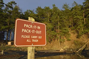
Rad sign informing to take all trash from park out, James Island, San Juan Islands, Washington State, USA
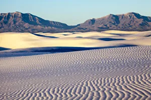
Dunes of White Sands National Monument with rocky mountains in background, New Mexico, USA
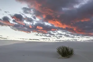
Clouds lit by sunrise over White Sands National Monument, New Mexico, USA