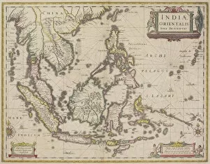
antique, archival, border, burma, cambodia, cartography, country, document, geography, historic, historical, india orientalis, indian ocean, indonesia, islands, latitude, legend, longitude, malaysia
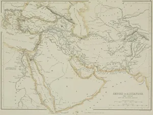
Antique map of the Empire of Alexander the Great
afghanistan, antique, arabia, arabian, azerbijan, black, border, cartography, caspian, coordinates, countries, document, empire of alexander the great, geography, historic, historical, iran, iraq
arabia, archival, asia, border, cartography, caspian sea, coordinates, document, geography, historic, historical, insets, iran, iraq, israel, jordan, latitude, legend, longitude, map, mediterranean