mail_outline sales@mediastorehouse.com
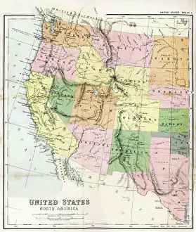
Antique Map of Western USAAntique Map from 1867 of Western United States of America
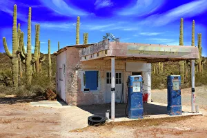
Retro Style Desert Scene with Old Gas Station and Saguaro Cactus on a sunny day
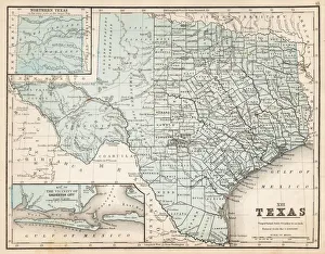
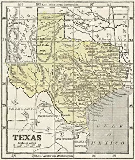
Map of Texas 1867Mitchells Modern Atlas - Published by E.H. Buttler & Co - Philadelphia 1867
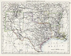
United States South West Central map 1897The World-Wide Atlas of Modern Geography, Political and Physical W. & A.K. Johnston - London 1897
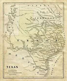
Map of Texas 1856Colton and Fitchs Modern School Geography by George W. Fitch - New York 1856
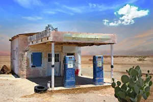
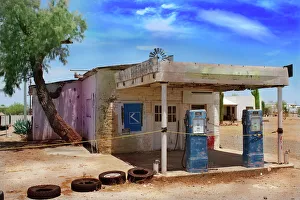
Retro Style Scene of old gas station in Arizona DesertOld gas station with prickly pear cactus in vast desert landscape
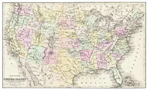
Map of USA 1877Warrens Common School Geography 1877
Map of Texas 1855System of Geography for the use of schools by Sidney E. Morse - Published by Harper & Brothers - New York 1855
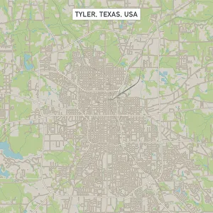
Tyler Texas US City Street MapVector Illustration of a City Street Map of Tyler, Texas, USA. Scale 1:60, 000. All source data is in the public domain. U.S
Old abandoned gas station in Arizona desertOld abandoned gas station building in Quartzsite, Arizona desert with two blue retro gas pumps. Bright sunny day. Salt Cedar tree and cactus in background
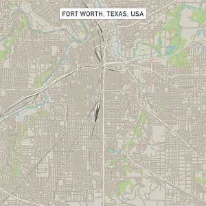
Fort Worth Texas US City Street MapVector Illustration of a City Street Map of Fort Worth, Texas, USA. Scale 1:60, 000. All source data is in the public domain. U.S
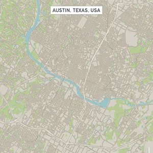
Austin Texas US City Street MapVector Illustration of a City Street Map of Austin, Texas, USA. Scale 1:60, 000. All source data is in the public domain. U.S
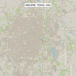
Abilene Texas US City Street MapVector Illustration of a City Street Map of Abilene, Texas, USA. Scale 1:60, 000. All source data is in the public domain. U.S
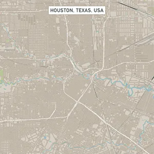
Houston Texas US City Street MapVector Illustration of a City Street Map of Houston, Texas, USA. Scale 1:60, 000. All source data is in the public domain. U.S
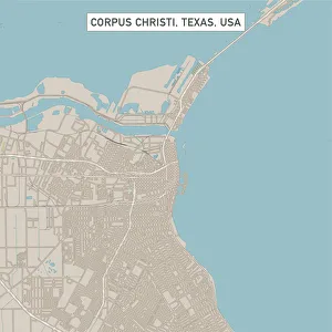
Corpus Christi Texas US City Street MapVector Illustration of a City Street Map of Corpus Christi, Texas, USA. Scale 1:60, 000. All source data is in the public domain. U.S
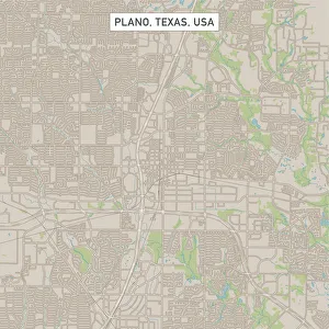
Plano Texas US City Street MapVector Illustration of a City Street Map of Plano, Texas, USA. Scale 1:60, 000. All source data is in the public domain. U.S
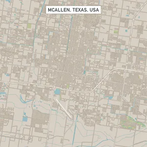
McAllen Texas US City Street MapVector Illustration of a City Street Map of McAllen, Texas, USA. Scale 1:60, 000. All source data is in the public domain. U.S
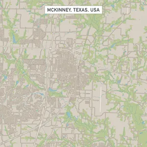
McKinney Texas US City Street MapVector Illustration of a City Street Map of McKinney, Texas, USA. Scale 1:60, 000. All source data is in the public domain. U.S
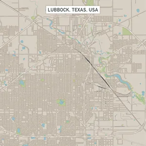
Lubbock Texas US City Street MapVector Illustration of a City Street Map of Lubbock, Texas, USA. Scale 1:60, 000. All source data is in the public domain. U.S
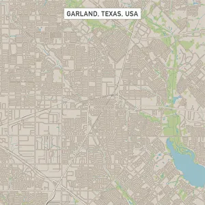
Garland Texas US City Street MapVector Illustration of a City Street Map of Garland, Texas, USA. Scale 1:60, 000. All source data is in the public domain. U.S
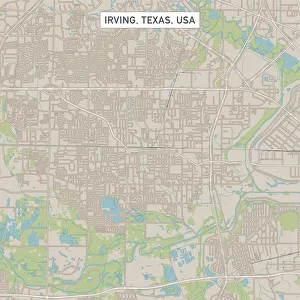
Irving Texas US City Street MapVector Illustration of a City Street Map of Irving, Texas, USA. Scale 1:60, 000. All source data is in the public domain. U.S
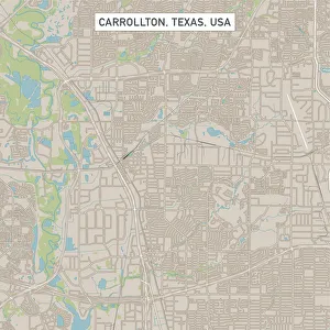
Carrollton Texas US City Street MapVector Illustration of a City Street Map of Carrollton, Texas, USA. Scale 1:60, 000. All source data is in the public domain. U.S
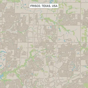
Frisco Texas US City Street MapVector Illustration of a City Street Map of Frisco, Texas, USA. Scale 1:60, 000. All source data is in the public domain. U.S
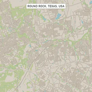
Round Rock Texas US City Street MapVector Illustration of a City Street Map of Round Rock, Texas, USA. Scale 1:60, 000. All source data is in the public domain. U.S
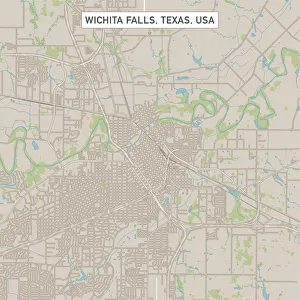
Wichita Falls Texas US City Street MapVector Illustration of a City Street Map of Wichita Falls, Texas, USA. Scale 1:60, 000. All source data is in the public domain. U.S
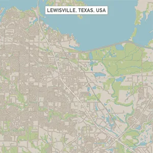
Lewisville Texas US City Street MapVector Illustration of a City Street Map of Lewisville, Texas, USA. Scale 1:60, 000. All source data is in the public domain. U.S
The Urban Shapes of the Dallas SkylineDallas is a a modern metropolis in the US state of Texas
Double Exposure Abstract Architecture Dallas Texas
USS Enterprise Aircraft Carrier, TXBoat, Coast, Day, Defense, Government, Marine Transportation, Military, Navy, Ocean, Outdoor, Patriotic, Sea, Ship, War, Water, Security, Texas, United States, Seascape, North America, Carrier
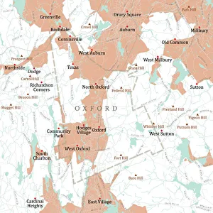
MA Worcester Oxford Vector Road Map. All source data is in the public domain. U.S. Census Bureau Census Tiger. Used Layers: areawater, linearwater, roads, rails, cousub, pointlm, uac10
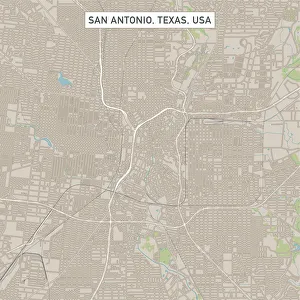
San Antonio Texas US City Street MapVector Illustration of a City Street Map of San Antonio, Texas, USA. Scale 1:60, 000. All source data is in the public domain. U.S
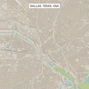
Dallas Texas US City Street MapVector Illustration of a City Street Map of Dallas, Texas, USA. Scale 1:60, 000. All source data is in the public domain. U.S
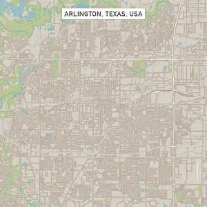
Arlington Texas US City Street MapVector Illustration of a City Street Map of Arlington, Texas, USA. Scale 1:60, 000. All source data is in the public domain. U.S
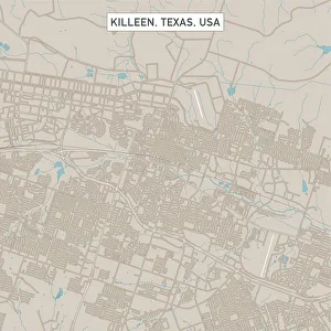
Killeen Texas US City Street MapVector Illustration of a City Street Map of Killeen, Texas, USA. Scale 1:60, 000. All source data is in the public domain. U.S
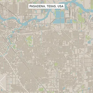
Pasadena Texas US City Street MapVector Illustration of a City Street Map of Pasadena, Texas, USA. Scale 1:60, 000. All source data is in the public domain. U.S
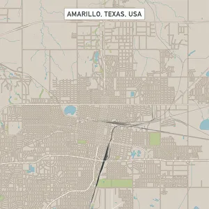
Amarillo Texas US City Street MapVector Illustration of a City Street Map of Amarillo, Texas, USA. Scale 1:60, 000. All source data is in the public domain. U.S
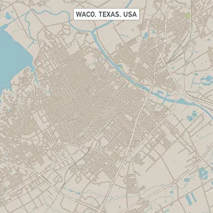
Waco Texas US City Street MapVector Illustration of a City Street Map of Waco, Texas, USA. Scale 1:60, 000. All source data is in the public domain. U.S
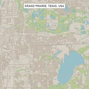
Grand Prairie Texas US City Street MapVector Illustration of a City Street Map of Grand Prairie, Texas, USA. Scale 1:60, 000. All source data is in the public domain. U.S
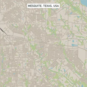
Mesquite Texas US City Street MapVector Illustration of a City Street Map of Mesquite, Texas, USA. Scale 1:60, 000. All source data is in the public domain. U.S
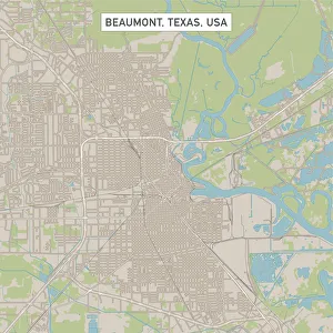
Beaumont Texas US City Street MapVector Illustration of a City Street Map of Beaumont, Texas, USA. Scale 1:60, 000. All source data is in the public domain. U.S
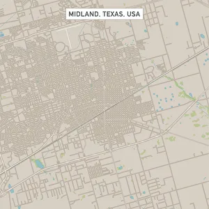
Midland Texas US City Street MapVector Illustration of a City Street Map of Midland, Texas, USA. Scale 1:60, 000. All source data is in the public domain. U.S
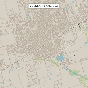
Odessa Texas US City Street MapVector Illustration of a City Street Map of Odessa, Texas, USA. Scale 1:60, 000. All source data is in the public domain. U.S
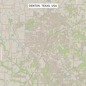
Denton Texas US City Street MapVector Illustration of a City Street Map of Denton, Texas, USA. Scale 1:60, 000. All source data is in the public domain. U.S
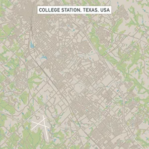
College Station Texas US City Street MapVector Illustration of a City Street Map of College Station, Texas, USA. Scale 1:60, 000. All source data is in the public domain. U.S
Pearland Texas US City Street MapVector Illustration of a City Street Map of Pearland, Texas, USA. Scale 1:60, 000. All source data is in the public domain. U.S
Richardson Texas US City Street MapVector Illustration of a City Street Map of Richardson, Texas, USA. Scale 1:60, 000. All source data is in the public domain. U.S
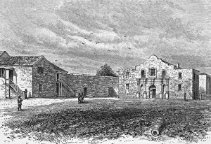
The AlamoAn engraving of the Alamo, a Franciscan mission in San Antonio, Texas, that was the scene of a seige during the Texan war for independence in 1836
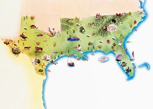
Map of Southern United States of America, with illustrations of distinguishing features and landmarks