mail_outline sales@mediastorehouse.com
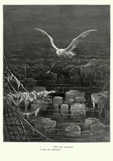
Rime of the Ancient Mariner - I shot AlbatrossVintage engraving by Gustave Dore of a scene from the Rime of the Ancient Mariner, With my crossbow I shot the Albatross. The Rime of the Ancient Mariner is the longest major poem by the English poet
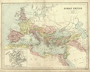
Antique map of the Roman Empire, with a detail on Rome
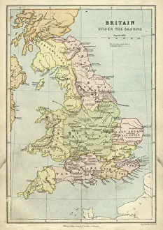
Antique map of Britain under the Anglo Saxons
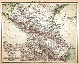
Old Caucasus mapAntique map of Caucasus
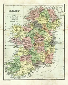
Antique map of Ireland, 1864
Prima Ballerina Russian Ballet Dancer Anna Pavlova1924: Russian Ballet dancer Anna Pavlova (1882 - 1931), regarded as the prima ballerina of her era. (Photo by James Abbe/General Photographic Agency/Getty Images)
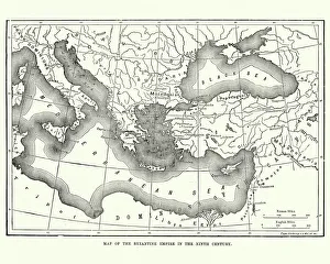
Map of the Byzantine Empire in the 9th CenturyVintage engraving of a Map of the Byzantine Empire in the 9th Century
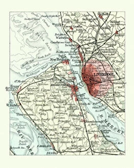
Antique map, Liverpool and Birkenhead, England, 19th CenturyVintage engraving of a Antique map, Liverpool and Birkenhead, England, 19th Century
Human Anatomy - Backbone including Ribs and PelvisVintage engraving of the human Backbone including Ribs and Pelvis. 19th Century
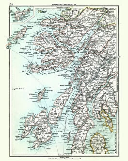
Antique map, Scotland, Jura, Mull, Argyll, Islay 19th CenturyVintage engraving of a Antique map, Scotland, Jura, Mull, Argyll, Islay 19th Century
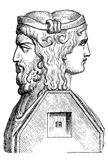
Roman God JanusIllustration of a Roman God Janus
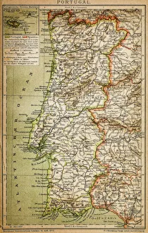
Map of PortugalAntique illustration engraving map og Portugal
Salisbury cathedral, Wiltshire, EnglandSalisbury cathedral in Salisbury, Wiltshire. The cathedral is one of the best examples of Early English architecture. Due to the short period of time that it was in
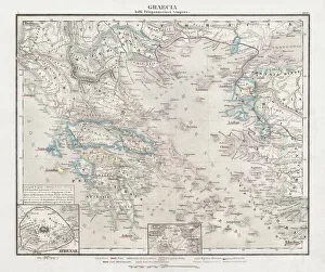
Greece at the beginning of the Peloponnesian War (431-404 BC)Antique Map of Greece at the beginning of the Peloponnesian War (431 - 404 BC) with the different tribal groups. Steel engraving with hand colored borderlines, published in 1861
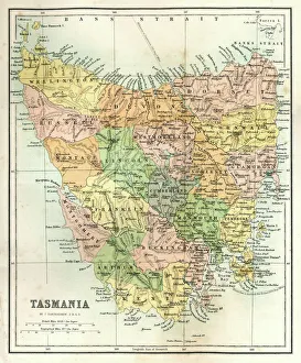
Antique Map of TasmaniaAntique map of Tasmania from 1867
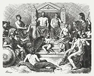
Greek gods in the Olymp, Greek mythology, published in 1880The Greek gods in the Olymp. Greek mythology. Wood engraving, published in 1880
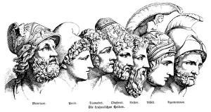
Heroes Of The Trojan WarIllustration of a Heroes Of The Trojan War
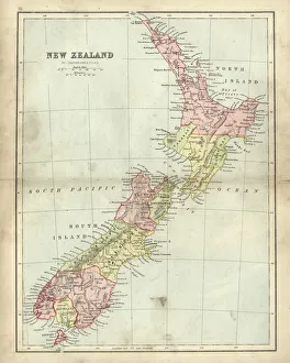
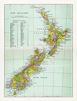
Antique map of New Zealand in the 19th Century, 1873Vintage engraving of a Antique map of New Zealand in the 19th Century, 1873
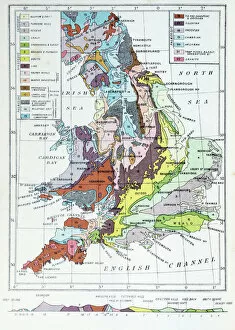
Antique colored illustrations: Geological map of England and Wales
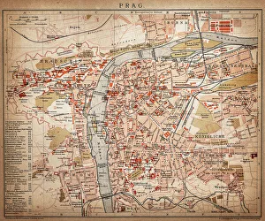
PragueAntique map of Prague from 1898
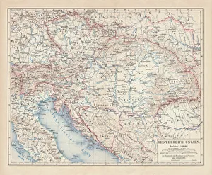
Austro-Hungarian Empire, Habsburg Monarchy, lithograph, published in 1877Ancient map of Austro-Hungarian Empire. Habsburg Monarchy. Lithograph, published in 1877
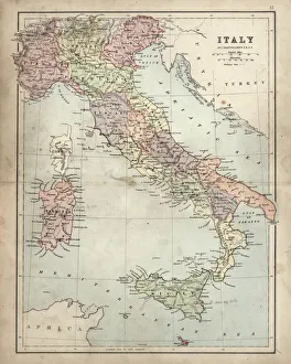
Antique Damaged Map of Italy 19th CenturyAntique damaged map of Italy 19th Century
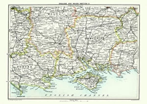
Map of South East England, Hampshire, Dorset, Wiltshire 1891Antique Map of Map of South East England, showing Hampshire, Dorset, Wiltshire, and the Isle of Wight 1891
Antique Map of New ZealandVintage map of New Zealand, from 1894
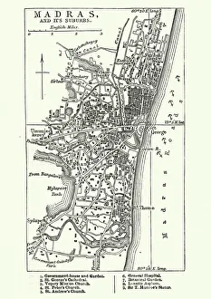
Map of Madras (Chennai), India, 19th CenturyVintage engraving of Map of Madras (Chennai), India, 19th Century
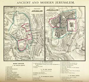
Ancient and Modern Jerusalem Map EngravingEngraved illustration of Ancient and Modern Jerusalem Map Engraving from The Popular Pictorial Bible, Containing the Old and New Testaments, Published in 1862. Copyright has expired on this artwork
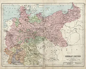
Antique damaged map of German Empire 19th Century
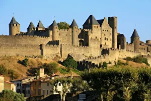
View of Carcassonne, France (Unesco world heritage)
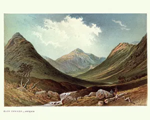
Glen Sannox, Isle of Arran, Scotland, 19th CenturyVintage engraving of a landscape of Glen Sannox, Isle of Arran, Scotland, 19th Century
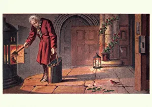
Victorian church warden lighting fire on Christmas EveVintage engraving of from the childrens story of The Robins Christmas Eve, 19th Century
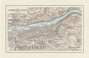
Historical city map of Heidelberg, Baden-WAOErttemberg, Germany, lithograph, published 1897Historical city map of Heidelberg, Baden-WAOErttemberg, Germany. Lithograph, published in 1897
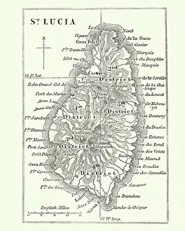
Map of Saint Lucia, 19th CenturyVintage engraving of Map of Saint Lucia, 19th Century
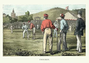
Victorian cricket match, 19th CenturyVintage woodcut illustration of a Victorian cricket match, 19th Century
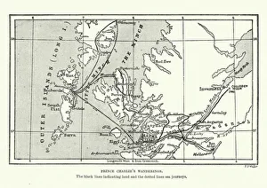
Map of Bonnie Prince Charlies WanderingsVintage caricature of Map of Bonnie Prince Charlies Wanderings after his defeat at the Battle of Culloden in 1746
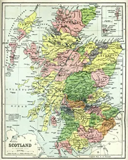
Antique map of Scotland, 1864
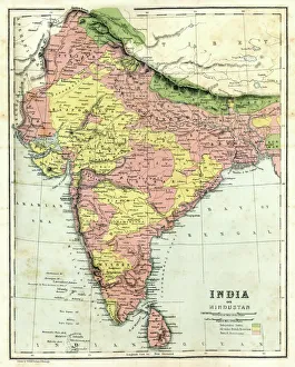
Antique map of India, 1864
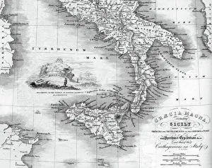
Vintage map of Magna Graecia, showing the settlements of the ancient greeks in Italy. Magna GrA|cia is the name of the coastal areas of Southern Italy on the Tarentine Gulf that was extensively
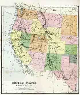
Antique Map of Western USAAntique Map from 1867 of Western United States of America
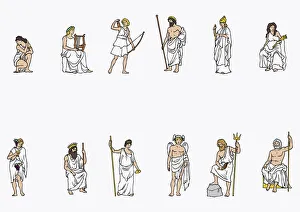
Illustration of Greek gods
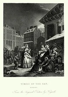
William Hogarth Four Times of the Day - MorningVintage engraving of showing a scene from William Hogarths Four Times of the Day. They are humorous depictions of life in the streets of London, the vagaries of fashion
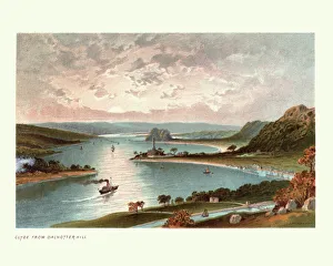
The River Clyde from Dalnotter Hill, Scotland, 19th CenturyVintage colour engraving of The River Clyde from Dalnotter Hill, Scotland, 19th Century
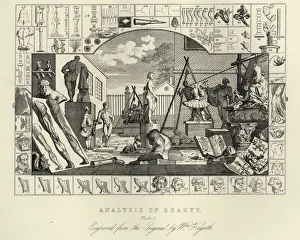
William Hogarth The Analysis of Beauty, Plate 1Vintage engraving of William Hogarth The Analysis of Beauty, Plate 1. The Analysis of Beauty is a book written by the 18th-century artist and writer William Hogarth, published in 1753
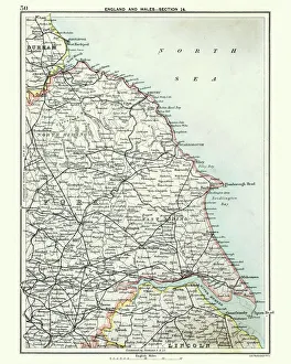
Antique map, North and East Yorkshire 19th CenturyVintage engraving of a Antique map, North and East Yorkshire 19th Century
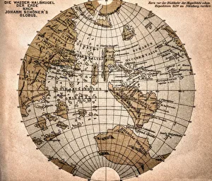
World map from 1520Western hemisphere of the Johannes SchAoner globe from 1520. expedition
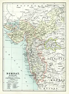
Antique map of Bombay, India, 19th CenturyAntique map of Bombay, Berar, and part of central India from 1891
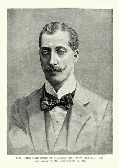
Prince Albert Victor, Duke of Clarence and AvondaleVintage engraving of Prince Albert Victor, Duke of Clarence and Avondale. 1864 to 14 January 1892, was the eldest son of Albert Edward, Prince of Wales (later King Edward VII)
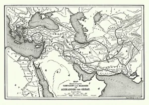
Ancient History - Map of Alexander the Great CampaignsVintage engraving of a map of the campaigns and marches of Alexander the Great
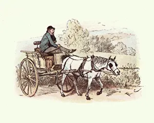
Victorian man driving a horse and cartVintage engraving of Victorian man driving a horse and cart. Strange Adventures of a Dog cart, by Randolph Caldecott