mail_outline sales@mediastorehouse.com
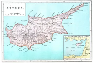
Map of CyprusVintage 19th Century map of Cyprus in the eastern Mediterranean Sea
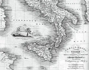
Vintage map of Magna Graecia, showing the settlements of the ancient greeks in Italy. Magna GrA|cia is the name of the coastal areas of Southern Italy on the Tarentine Gulf that was extensively
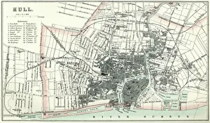
Map of HullVintage map from 1880 of Hull in the East Riding of Yorkshire, England. The city of Hull has served as market town, military supply port, trading hub, fishing and whaling centre
Hermes and the Infant DionysusAntique illustration of a Hermes and the Infant Dionysus
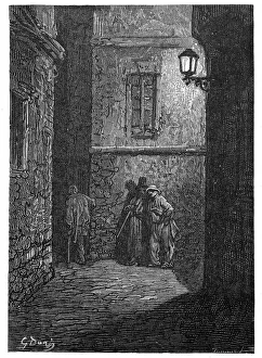
Victorian London - A shady placeVintage engraving showing a scene from 19th Century London England. A dark alley in Whitechapel circa 1870
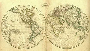
Vintage Map of the WorldVintage map of the world from 1837
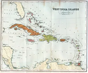
Vintage map of the West India Islands 1860s
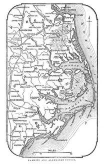
Map of Pamlico and Albemarle SoundsVintage engraving from 1863 of a map of Map of Pamlico and Albemarle Sounds at the time of the American Civil War
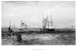
Liverpool from the Sea"Vintage engraving from 1880 of Liverpool a city and metropolitan borough of Merseyside, England, along the eastern side of the Mersey Estuary
Japanese Woodblock Print by Hiroshige"Japanese scene from the master Utagawa Hiroshige 1797aa1858 forms part of my own private collection of original woodblock prints
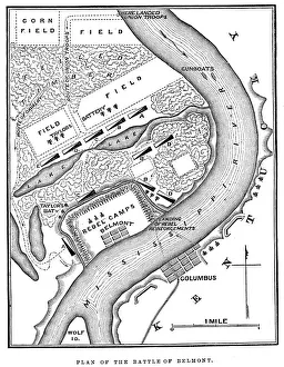
Battle of BelmontVintage engraving from 1863 of a map of the Battle of Belmont which was fought on November 7, 1861, in Mississippi County, Missouri. It was the first combat test in the American Civil War for Brig
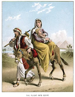
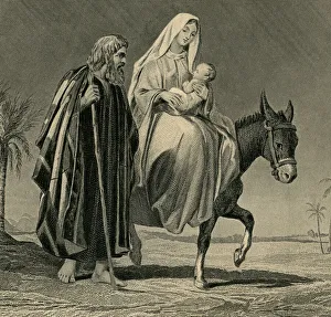
Joseph and Marys Flight into EgyptVintage colour lithograph from 1882 Joseph and Mary fleeing to Egypt with the baby Jesus
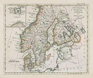
Antique map of Denmark, Norway, Sweden and FinlandWonderful hand coloured antique map, circa 1780 - 1800
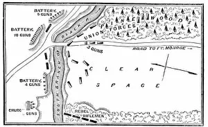
Battle of Big BethelVintage engraving from 1863 of a map of the Battle of Big Bethel also known as the Battle of Bethel Church or Great Bethel was an American Civil War battle that took place on June 10, 1861
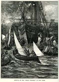
SS Great Western at New YorkVintage engraving showing the arrival of the SS Great Western at New York. SS Great Western of 1838, was an oak-hulled paddle-wheel steamship; the first purpose-built for crossing the Atlantic
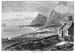
Tristan da CunhaVintage engraving from 1878 showing a view of Tristan da Cunha a remote volcanic group of islands in the south Atlantic Ocean and the main island of that group
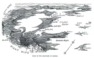
Blockade of BostonVintage engraving from 1861 showing the Plan of the Blockade of Boston during the American Revolutionary War
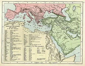
Old Testament MapVintage biblical map from 1879 showing the gentile countries and nations of the Old Testament
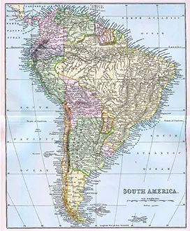
Map of South America 19th CenturyVintage map of South America from the 19th Century
Matterhorn or Mont Cervin"Vintage Colour Lithograph from 1884 of the Matterhorn (Monte Cervino or Mont Cervin), a mountain in the Pennine Alps on the border between Switzerland and Italy
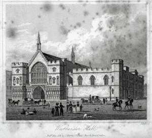
Westminster Hall" Vintage engraving from 1831 of Westminster Hall, London, England the oldest existing part of the Palace of Westminster, was erected in 1097
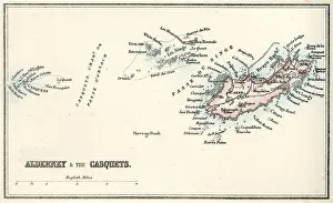
Map of Alderney and the Casquets" Vintage map from 1880 of Alderney and the Casquets. Alderney is the most northerly of the Channel Islands. It is part of the Bailiwick of Guernsey, a British Crown dependency
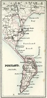
Map of Portland" Vintage map from 1880 of Portland a limestone tombolo or tied island, 6 kilometres long by 2.4 kilometres wide, in the English Channel."
Victorian London - Victoria EmbankmentVintage engraving showing a scene from 19th Century London England. Showing the Victoria Embankment at night
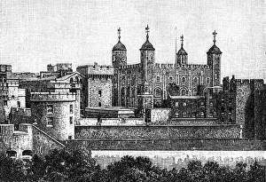
Tower of London, seen from the land side
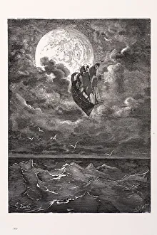
Voyage to the moon" Voyage to the moon, a scene from the Adventures of Baron Munchausen. Engraving from 1870. Engraving by Gustave Dore, Photo by D Walker."
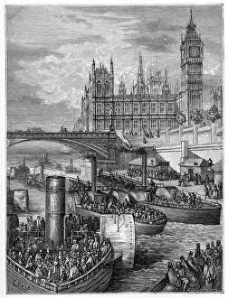
Victorian London - Westminster StairsVintage engraving showing a scene from 19th Century London England. Showing the Westminster stairs with steamers leaving
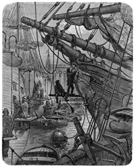
Victorian London - Docks and The ConcordiaVintage engraving showing a scene from 19th Century Victorian London England. Showing London Docks and the ship Concordia
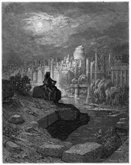
Victorian London - The New ZealanderVintage engraving showing a scene from 19th Century London England. Macaulays New Zealander visiting future London. Macaulays dream of the far future
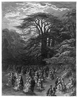
Victorian London - Chiswick FeteVintage engraving showing a scene from 19th Century London England. Chiswick Fete
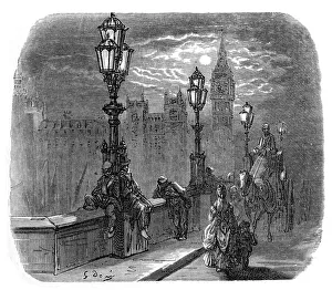
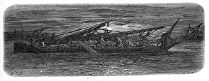
Victorian London - Between the bridgesVintage engraving showing a scene from 19th Century London England. Showing a barge moving down the River Thames at night
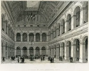
Interior of the Exchange, Paris" Vintage engraving from 1849 showing the Interior of the Exchange, Paris, France"
The Flight into Egypt" The flight into Egypt engraved by J.B Allen ( 1880) from the original by Henry Warren (1794-1879) with Jesus, Marie and Joseph.Moses:"
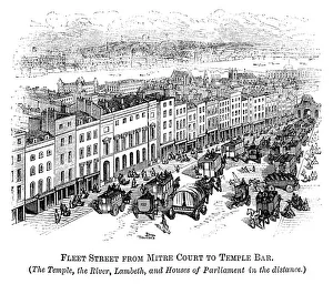
Fleet Street with Temple Bar (Crystal Palace in distance) 1871Fleet Street in the City of London, from Mitre Court to Temple Bar, with The Temple and River Thames. The narrow and traffic-limiting Temple Bar (one of the historic entrances to the City of London)
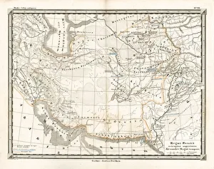
Antique Map of the Persian EmpireAntique Map from 1862 of the Persian Empire, the time of Alexander the Great. Maps text is written in Latin
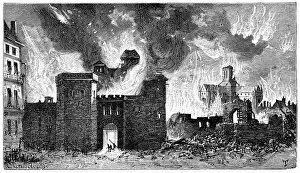
Great Fire of London" Vintage engraving from 1878 of the Great Fire of London. The Great Fire of London was a major conflagration that swept through the central parts of the English city of London, from Sunday
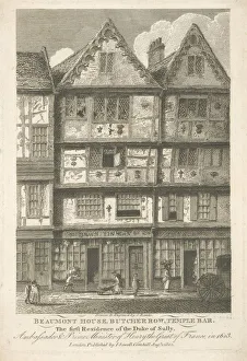
Old London Building 1802Beaumont House, Butcher Row, Temple Bar, ašetching Published in London ašView of the old houses on Butcher Row; street traders on pavement in front
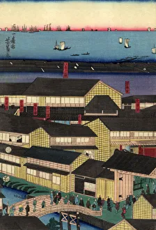
Traditional Japanese Woodblock Yokohama BayYoshikazuUtagawaa(active c.1850-c.1870) He is known as a major print maker of Yokohama-e (Yokohama prints) that depict Western people and cultures
Chinese Emperor seatedA Chinese Emperor or High official seated at court, an original painting Circa 1830 as verified by Sunderland Museum of Oriental Art, England
Japanese Woodblock female at nightJapanese scene from the master Kunisada 1786-1865, a woodblock print, circa 1845 from the Edo period, showing a female figure sitting by an open window in traditional Kimono by moonlight
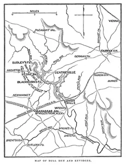
Battle of Bull RunVintage engraving from 1863 of a map of Bull Run and its environs at the time of the American Civil War. The First Battle of Bull Run
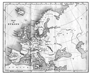
Vintage Map of Europe Mid 19th CenturyVinateg Map of Europe Mid 19th Century, circa 1850
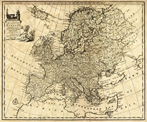
Antique Map of Europe 1744An engraved map of Europe with ornamental cartouche and relief shown pictorially by Emanuel Bowen 1744, London, Geographer to His Majesty
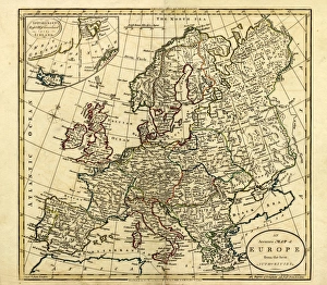
Antique Map of Europe, 1785An accurate map of Europe from the best authorities. London: C. Dilly & G. Robinson: 1785. Original size: 35.7 x 37.4 cm. Coloured, Inset: Spitsbergen, East and West Greenland, and Iceland
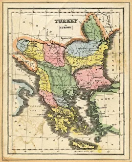
Turkey in EuropeVintage map of Turkey in Europe.Engraved, Published and Edited in 1845in the Pictorial Sunday-Book by J.Morrison&CoRestored By PictoreVery high resolution ( XXXL)
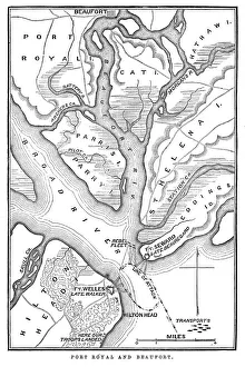
Battle of Port RoyalVintage engraving from 1863 of a map of the Battle of Port Royal which was one of the earliest amphibious operations of the American Civil War