mail_outline sales@mediastorehouse.com
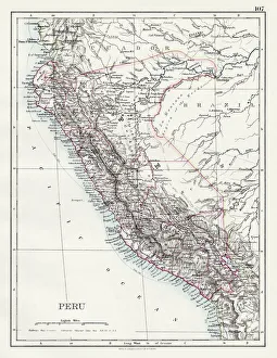
Peru map 1897The World-Wide Atlas of Modern Geography, Political and Physical W. & A.K. Johnston - London 1897
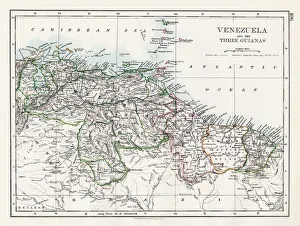
Venezuela and the Guayanas map 1897The World-Wide Atlas of Modern Geography, Political and Physical W. & A.K. Johnston - London 1897
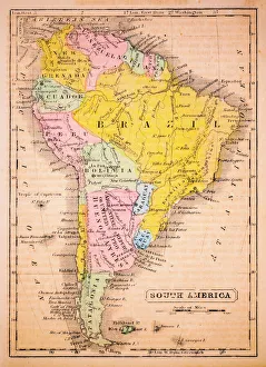
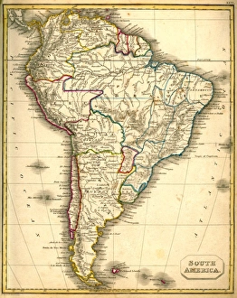
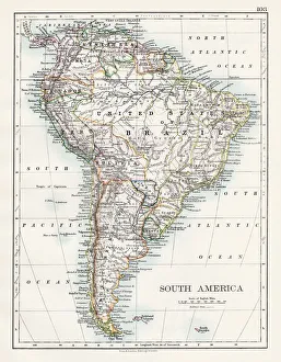
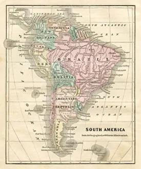
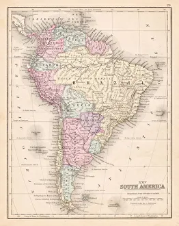
South America 1852 Map
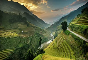
Rice terraces in Mu Cang Chai, North Vietnam
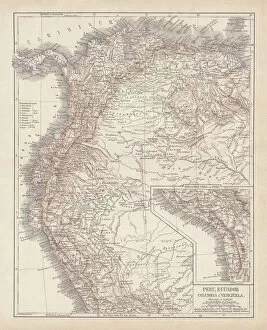
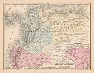
Peru, Ecuador, Colombia, Venezuela, lithograph, published in 1877Ancient map of Peru, Ecuador, Colombia, and Venezuela. Lithograph, published in 1877
South America Map Illustration, Travel, Exploration, Antique 1871 IllustrationColor stock photo of an antique South America map illustration. Salvaged from an 1871 geography book
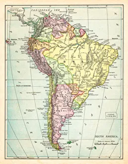
Map of South America 1895The Rand-McNally Grammar School Geography 1895 - Chicago & New York
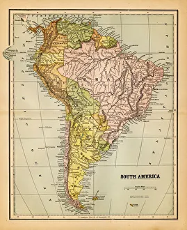
Map of South America 1877Warrens Common School Geography 1877
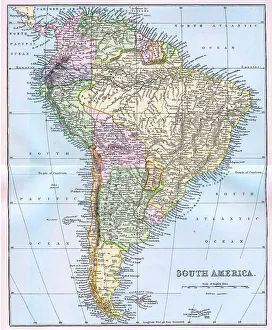
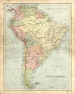
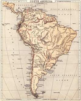
Map of South America 19th CenturyVintage map of South America from the 19th Century
old map of south americaan old south american map (1881)
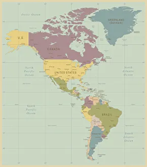
Vintage Map of North and South America534055040
south america 1883an old south american map (1883)
Engraving: South AmericaEngraved illustrations of South America from Iconographic Encyclopedia of Science, Literature and Art, Published in 1851. Copyright has expired on this artwork. Digitally restored
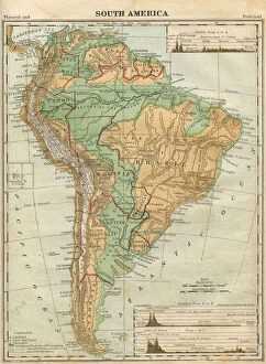
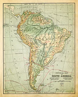
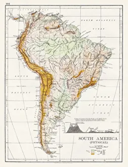
South America Physical map 1897The World-Wide Atlas of Modern Geography, Political and Physical W. & A.K. Johnston - London 1897
Antquie Map of South AmericaVintage map of South America from 1837
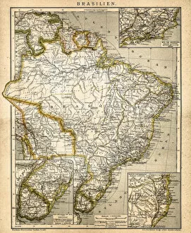
Antique damaged map of South America in the 19th CenturyVintage engraving of a Antique map of South America in the 19th Century, 1873
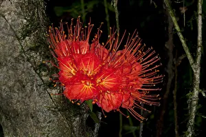
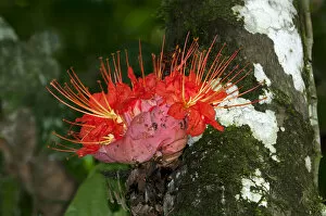
Panama Flame Tree or Rose of Venezuela -Brownea macrophylla-, Tiputini rain forest, Yasuni National Park, Ecuador, South America
Unexpected ViewpointsHigh angle view of a winding staircase
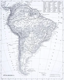
South America map 1897The World-Wide Atlas of Modern Geography, Political and Physical W. & A.K. Johnston - London 1897
Map of South America 1869Cornells Grammars-School Geography - S.S. Cornell - New York D. Appleton and Company 1869
Map of South America 1855System of Geography for the use of schools by Sidney E. Morse - Published by Harper & Brothers - New York 1855
Map of South America 1856Colton and Fitchs Modern School Geography by George W. Fitch - New York 1856
Voyages of Christopher Columbus, wood engraving, published c. 1882Map with the routes of the four voyages of Christopher Columbus in the Caribbean Sea. Wood engraving, published c. 1882
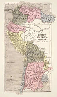
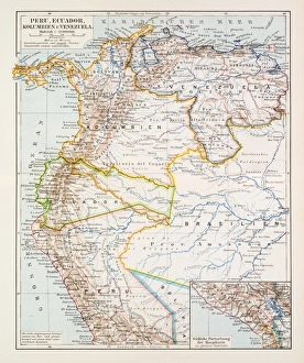
Map of Peru Ecuador Venezuela 1896Map of Peru Ecuador Venezuela
Colombia Ecuador Venezuela map 1867Mitchellas Modern Atlas - Published by E.H. Butler and Co - Philadelphia 1867
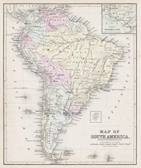
South America map 1867Mitchellas Modern Atlas - Published by E.H. Butler and Co - Philadelphia 1867
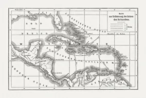
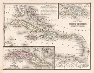
West Indies map 1867Mitchellas Modern Atlas - Published by E.H. Butler and Co - Philadelphia 1867
South America mapAntique illustration of a South America map
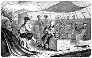
De Clie on voyages to Martinique with coffee plantsAntique illustration of a De Clie on voyages to Martinique with coffee plants
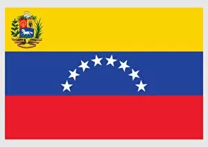
Illustration of state, war and naval flag of Venezuela, a horizontal tricolor of yellow, blue, and red, eigtt five-pointed stars, and coat of arms on field
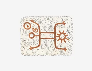
Illustration of cave painting found in Venezuela
Rose of Venezuela -Brownea macrophylla-, blossom, cauliflorous, Tiputini rainforest, Yasuni National Park, Ecuador, South America
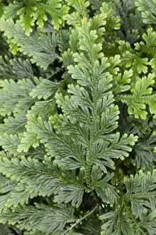
Moss Fern -Selaginella haematodes-, deposits in Ecuador, Venezuela
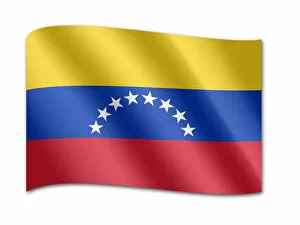
Flag of Venezuela
Scarlet ibis (Eudocimus ruber)standing amidst green plants
Black-necked stilts (Himantopus mexicanus)at waters edge, Venezuela
Jabiru stork (Jabiru mycteria) wading on floodplain, Venezuela
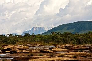
canaimaTravelling around Canaima
CanaimaCamino