mail_outline sales@mediastorehouse.com
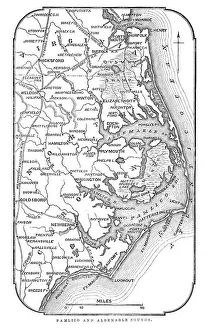
Map of Pamlico and Albemarle SoundsVintage engraving from 1863 of a map of Map of Pamlico and Albemarle Sounds at the time of the American Civil War
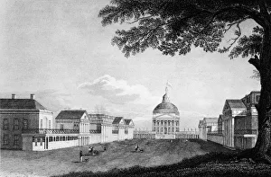
The Lawn At The University Of VirginiaEngraving shows the main lawn and quadrangle of the campus of the University of Virginia, Charlottesville, Virginia, circa 1830s
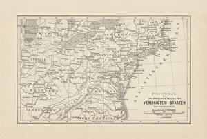
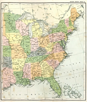
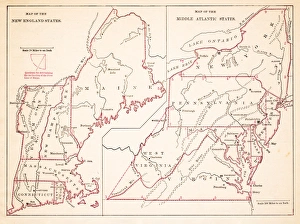
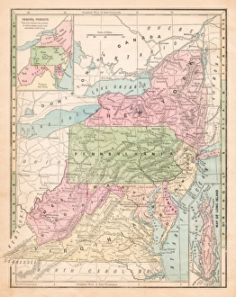
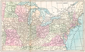
Map of Northeast United States, published in 1882Map of the Northeast United States of America. Wood engraving, published in 1882
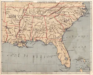
Map of USA Southern states 1869Cornells Grammars-School Geography - S.S. Cornell - New York D. Appleton and Company 1869
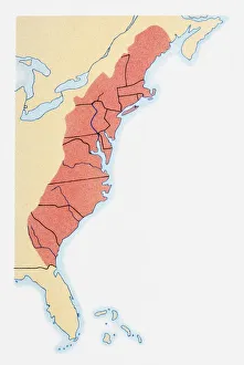
Illustration of states on East Coast of the USA
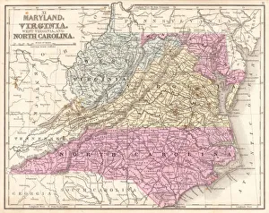
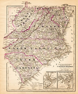
Map of Maryland Virginia North Carolina 1867Mitchells Modern Atlas - Published by E.H. Buttler & Co - Philadelphia 1867
Map of New England by Explorer John Smith, Circa 1624Beautifully Illustrated Antique Engraved Victorian Illustration of Historical Map of New England from Explorer Captain John Smith, Circa 1624. Source: Original edition from my own archives
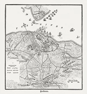
Battle of Yorktown in 1781, wood engraving, published in 1884Plan of the Battle of Yorktown during the American Revolutionary War in 1781. Wood engraving, published in 1884
Antquie Map of the United StatesVintage map of the United States of America from 1837
Antique Map of Eastern USAAntique Map from 1867 of Eastern United States of America
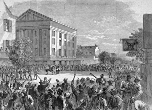
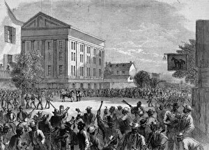
Soldiers Dispese Black Riots, VA, 1867Illustration of soldiers dispersing a riot by Black people during the American Reconstruction period, Richmond, Virginia, 1867. (Kean Collection/Getty Images)
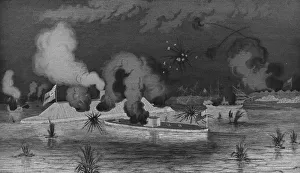
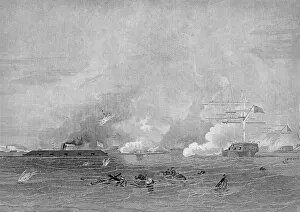
Battle Between The Monitor & Merrimack In The Civil WarEngraving of the battle between the Confederate navy ship, the Merrimack and the Union ship, the Monitor, during the American Civil War in Hampton Roads, Virginia, March 9, 1862
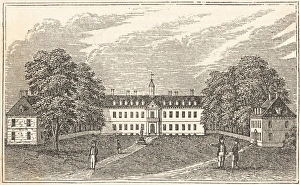
The College Of William & MaryEngraving shows the Wren Building and quadrangle of the campus of the College of William & Mary, Williamsburg, Virginia, 1845
Hydes Mill in Fall ColorsWisconsins roads along miles and miles of magnificent scenery through deep woods, broad vistas from high ridges and rock bluffs over deep clear brooks
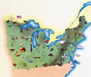
USA, Northern States of America, map with illustrations showing distinguishing features
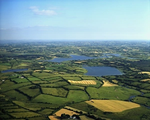
Cavan Lakes, Virginia, Co Cavan, Ireland
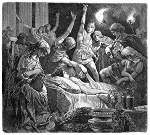
Death of VirginiaIllustration of a Death of Virginia
Map of Middle states USA 1883Warrens Common School Geography
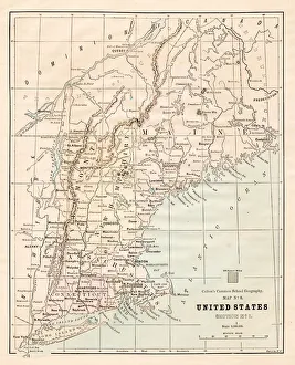
North Eastern States USA map 1881Coltons Common School Geography 1881 New York Sheldon and Co
Virginia North Carolina map 1881Coltons Common School Geography 1881 New York Sheldon and Co
Southern States 1852 Map
United States 1852 Map
United States of America, Atlantic coast, lithograph, published in 1878United States of America, Atlantic coast. Lithograph, published in 1878
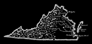
Antique Virginia MapVirginia Map, - Antique style. Includes mountains and water bodies. - vector illustration
Winters bonesA crow looks back over his shoulder as it stands on a horizontal bough of an old, gnarled oak tree. The strong tree and crow silhouettes stand out against a soft pastel blue-grey layers of mountains
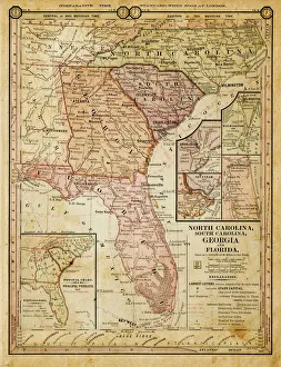
usa - southern states 1884map of north carolina, south carolina, georgia and florida 1884
USA middle states map 1875The Independent Course Comprehensive Geography by James Monteith, A.S. Barnes & Co, New York & Chicago 1875
Routes of travel in the United States map 1875The Independent Course Comprehensive Geography by James Monteith, A.S. Barnes & Co, New York & Chicago 1875
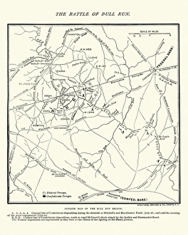
Map of the Battle of Bull RunVintage engraving of a Map of the Battle of Bull Run, The Century Magazine, 1884
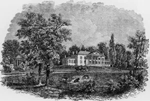
Exterior View Of MontpilierExterior view of Montpilier, the home of American president James Madison, Orange, Virginia, early 1800s. Cows graze across the street and a horse-drawn carriage rides past
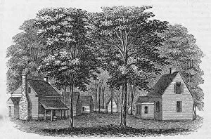
Home Of John RandolphEngraving of Roanoke, the country home of American politician John Randolph (1773 - 1833), Virginia. (Kean Collection/Getty Images)
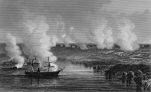
The Battle of Malvern HillEngraving depicts the USS Monitor and its escourts, including the USS Galena, as it provids coverage for General George McClellan (1826 - 1885)
Naval Combat Between The Monitor & MerrimackEngraving of the battle between the Confederate navy ship, the Merrimack and the Union ship, the Monitor, during the American Civil War in Hampton Roads, Virginia, March 9, 1862
Race Riots In Richmond, VirginiaIllustration depicting American soldiers dispersing crowds of Black people rioting in Richmond, Virginia during the American Reconstruction period, May 11, 1867
Mabry MillThe Beautiful Mabry Mill