mail_outline sales@mediastorehouse.com
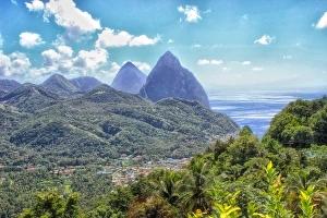
The Pitons, Soufrière, St LuciaThe volcanic mountainous peaks known as the Pitons are now a UNESCO World Heritage Site. They dominate the surrounding landscape
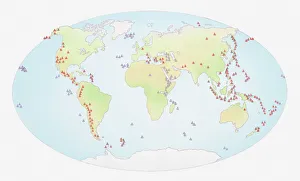
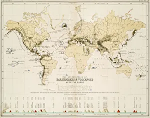
Illustration of world map showing sites of volcanic activity
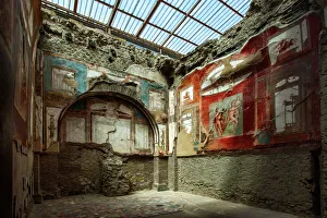
Painted Murals And Frescoes Inside A Room At The Ancient Roman Ruins At Herculaneum (Ercolano), Campania, ItalyLocated in the shadow of Mount Vesuvius, Herculaneum (Ercolano) was an ancient Roman town destroyed by volcanic pyroclastic flows in 79 AD
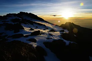
Sunrise on the Crater Rim of Kibo PeakMt. Kilimanjaro, Tanzania
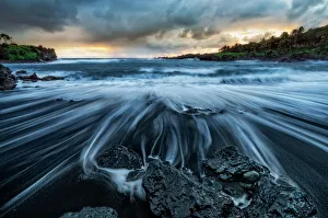
Waianapanapa SunriseThe Road to Hana is an amazing and probably Mauis most popular drive. One of the must stops on the way is the black sand beach. The water is cold, treacherous and shark infested
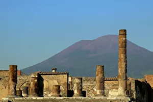
Pompeii and Mount Vesuvius as a dramatic backdrop
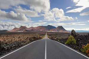
Timanfaya National Park, Lanzarote, SpainThe road from the Timanfaya National Park on Lanzarote going back towards Yaiza
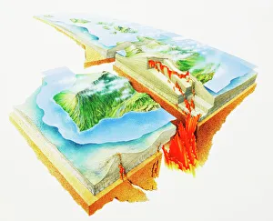
Lava Eruptions, cross-section, elevated view
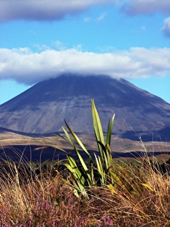
Tongario National Park in New Zealand, localized in the north island he is classified at the UNESCO
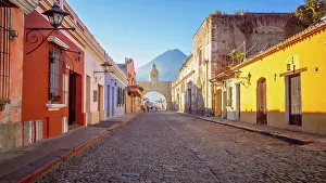
Street in La Antigua Guatemala, Antigua Guatemala, Sacatepequez, Guatemala, Latin AmericaLa Antigua Guatemala is city in the central highlands of Guatemala famous for its well-preserved Spanish Mudejar-influenced Baroque architecture as well as a number of spectacular ruins of colonial
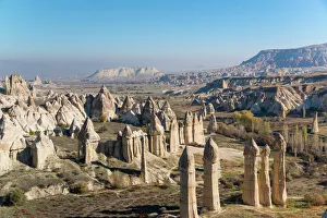
The Love valley CappadociaThe Love Valley in Goreme National Park (Goreme Milli Parklar in Turkish) UNESCO World Heritage Site
Mount Vesuviuscirca 1935: Smoke emissions from the Italian volcano Mount Vesuvius, near the Bay of Naples. (Photo by General Photographic Agency/Getty Images)
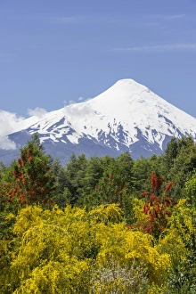
Puyehue volcano in the evening light, Puyehue, Los Lagos Region, Chile
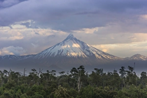
Osorno volcano, at the front a Chilean Firebush, also Notro or Ciruelillo -Embothrium coccineum-, Puerto Varas, Los Lagos Region, Chile
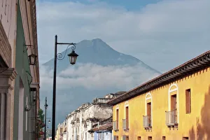
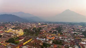
Aerial view, Antigua, GuatemalaElevated view of La Merced Church and the city of Antigua, Guatemala, Volcan de Agua at background. It is probably the most beautiful church in Antigua, it was was finished in 1767
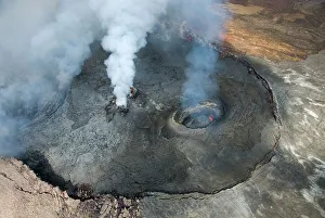
Kilauea volcano, Big Island, Hawaii, United States
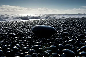
Surf, black pebbles on the lava beach of Reynisfjara near Vik i Myrdal, South Coast, Iceland
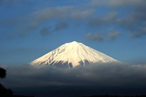
Mount Fuji on cloudsI took this picture in Fujinomiya city with a telephoto lens
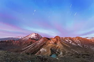
Awesome dawn over volcanic landscape, TongariroView of snowcapped Mt. Ngauruhoe (Mt Doom) volcano, Red Crater and Emerald lakes, at dawn, Tongariro crossing, Tongariro National Park, North Island, New Zealand
Snaefellsjokull Glacier, IcelandClose-up of Snaefellsjokull Glacier, Snaefellsnes Peninsula, Iceland
Halslon Reservoir, ash and gas cloud of the Holuhraun fissure eruption, near the volcano Baroarbunga, highlands, Northeast Iceland, Iceland
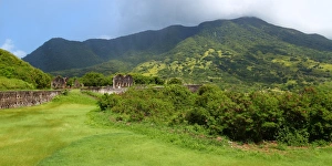
Mount Liamuiga - St Kitts
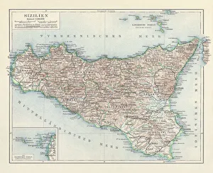
Topographic map of Sicily, Italy, lithograph, published in 1897Topographic map of Sicily, Italy - largest island in the Mediterranean Sea. Lithograph, published in 1897
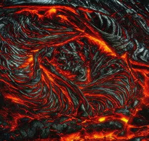
Kilauea Lava Flow #4Red Hot glowing Lava flow from the 61G Kilauea Flow located on the Big Island of Hawaii. Hawaii Volcanoes National Park, Big Island, Hawaii, United States
Arco de Santa Catalina Street (Santa Catalina Arch) Antigua GuatemalaSanta Catalina's Arch or Arco de Santa Catalina is probably the most iconic place in Antigua Guatemala, it was was built in 1693 - 1694 to allow nuns to cross the street without being seen
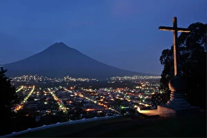
The Agua volcano ringed by clouds at duskAntigua, Guatemala
Agua Volcano at dusk, Sacatepequez, Guatemala, Latin AmericaVolcan de Agua is a stratovolcano located in the department of Sacatepequez in Guatemala. It has been inactive since the mid 16th century. Attitude 3, 760 meters
Majestic ├×j├│rs├í River Aerial, IcelandThe majestic ├×j├│rs├í is Icelands longest and second-most voluminous river. At 230 kilometres (143 miles) long, it runs through the south of the country
Map of the world 1861Map of the world - The distribution of Earthquakes and Volcanoes over the globe
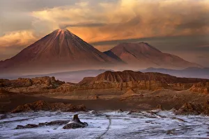
Atacama DesertDawn light in the Valle de la Luna (Valley of the Moon) near San Pedro de Atacama in the Atacama Desert in Northern Chile
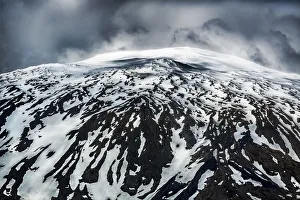
B├ír├░arbungaAerial view of B├ír├░arbunga glacier and volcano in Iceland. Snow covered mountain/glacier with visible ash from Eyjafjallaj├Âkull volcano blast. Iceland Landscape
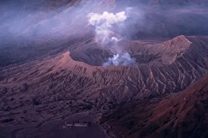
Bromo volcano eruptingerupting, mt bromo, volcano, mountain, nature, bromo-tengger-semeru n, Pete Lomchid Landscape Photography, 1127233789
Ol Doinya L Engai, TanzaniaAn erupting vent on the summit of Ol Doinya L Engai ejects lava
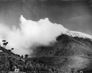
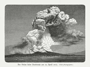
Mount Vesuvius on April 26, 1872, wood engraving, published 1897Mount Vesuvius at the eruption on April 26, 1872. Wood engraving after a photograph, published in 1897
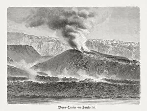
Thera crater on Santorini, Greece, wood engraving, published in 1897Thera crater on the Greek island Santorini. Wood engraving after a photograph, published in 1897