mail_outline sales@mediastorehouse.com
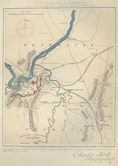
Great Railroad TriangleA topographical map of the ground on which the battles of Chickamauga and Ringgold were fought for the possession of the great railroad triangle of Tennessee and Georgia during the US civil war
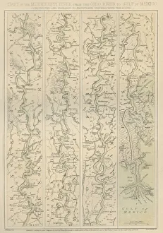
Mississippi RiverChart of the Mississippi River from the Ohio river to the Gulf of Mexico constructed and engraved to illustrate The War with the South, circa 1860s. (Photo by Archive Photos/Getty Images)
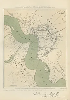
Port HudsonA topographical map of Port Hudson and its vicinity, showing Earthworks that were in existence at the time of its fall during the US civil war, circa 1860s. (Photo by Archive Photos/Getty Images)
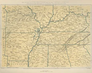
South West AmericaMap of the South Western part of the United States constructed and engraved to illustrate The War with the South, circa 1860s. (Photo by Archive Photos/Getty Images)
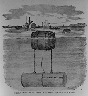
Infernal MachineAn engraving of an infernal machine in the Potomac, near Acquia Creek during the US civil war, circa 1862. (Photo by Archive Photos/Getty Images)
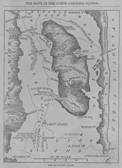
Roanoke IslandA map of Roanoke Island during the US civil war, circa 1860s. (Photo by Archive Photos/Getty Images)
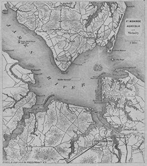
Fort MonroeA map of Fort Monroe Norfold and vicinity during the US civil war, circa 1860s. (Photo by Archive Photos/Getty Images)
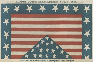
Stars And StripesAn illustration of a Stars and Stripes Bed quilt showing the influence of the civil war on household articles, from Petersons magazine, circa July 1861. (Photo by Archive Photos/Getty Images)
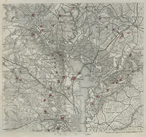
WashingtonA map of Washington and vicinity during the US civil war, circa 1860s. (Photo by Archive Photos/Getty Images)
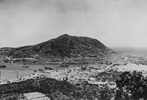
BusanA view over the South Korean city of Busan (formerly Pusan) with the island of Yeongdo in the background, during the Korean War, 19th July 1950