mail_outline sales@mediastorehouse.com
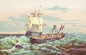
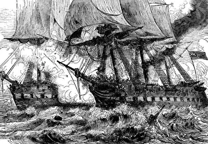
USS Constitution Fighting The HMS Guerriere In The War Of 1812USS Constitution vs HMS Guerriere in the War of 1812
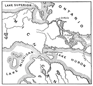
Antique Map of the Mackinac Island Area during the War of 1812 - 19th CenturyVintage map showing early territorial borders and military positions in the Mackinac area during the War of 1812. Vintage etching circa late 19th century
USS Constitution vs HMS Guerriere During the War of 1812 - 19th CenturyUSS Constitution vs HMS Guerriere During the War of 1812 (circa 19th century). Vintage etching circa late 19th century
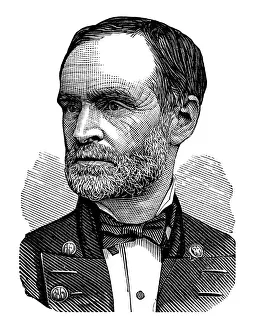
General William Tecumseh Sherman" Portrait of General William Tecumseh Sherman 1820aa1891) was an American soldier, businessman, educator and author
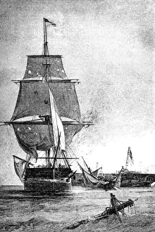
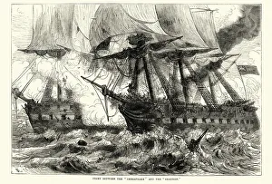
Capture Of The USS Chesapeake By The HMS Shannon During The War Of 1812The American USS Chesapeake captured by the British HMS Shannon during the War of 1812. Image from 1899
Battle between HMS Shannon and USS Chesapeake, 1813Vintage engraving of Battle between HMS Shannon and USS Chesapeake, 1813
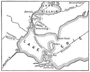
Antique Map of Detroit Area during the War of 1812 - 19th CenturyVintage map showing early territorial borders and military positions in the Detroit area during the War of 1812. Vintage etching circa late 19th century
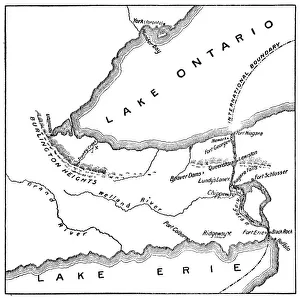
Antique Map of Niagara River Area during the War of 1812 - 19th CenturyVintage map showing early territorial borders and military positions in the Niagara River area during the War of 1812. Vintage etching circa late 19th century
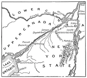
Antique Map of St. Lawrence Area during the War of 1812 - 19th CenturyVintage map showing early territorial borders and military positions in the St Lawrence area during the War of 1812. Vintage etching circa late 19th century