mail_outline sales@mediastorehouse.com
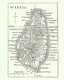
Map of Saint Lucia, 19th CenturyVintage engraving of Map of Saint Lucia, 19th Century
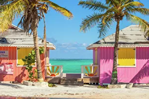
Colorful buildings on the Turks and Caicos islandsLocated in the Blue hills Road neighborhood of Providenciales. Vivid blue of the Caribbean sky and sea with the white sands of Grace bay beach, Turks & Caicos, and bright yellow beach umbrellas
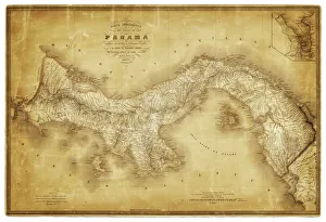
Map of Panama 1864Map of Panama - combined with 2 different texture overlays
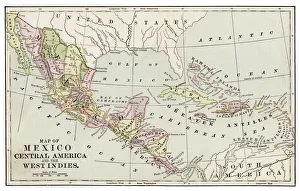
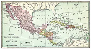
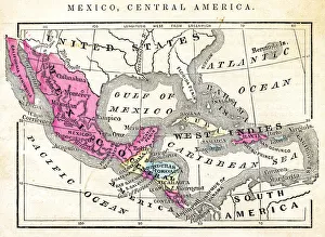
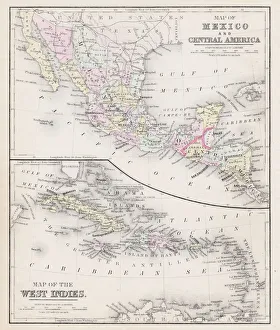
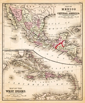
Map of Mexico and Central America 1889Indiana Educational Series The Complete Geography - Indianapolis 1889
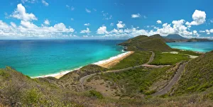
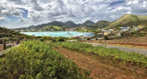
St Kitts - Nevis viewFrom this view you can see North Frigate bay as well as Friars Bay, with the island of Nevis in the distance
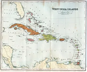
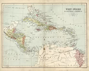
Vintage map of the West India Islands 1860s
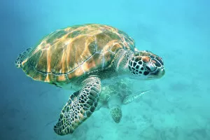
Two sea turtlesClose up of two sea turtles in Caribbean, Barbados, West Indies
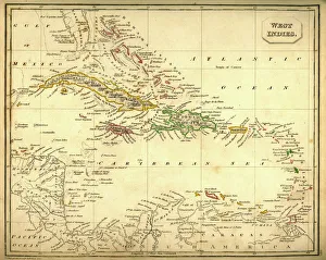
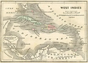
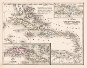
Antquie Map of The West IndiesVintage map of The West Indies from 1837
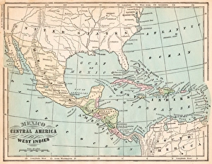
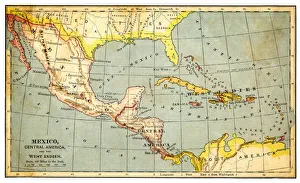
Mexico and West indies map 1875The Independent Course Comprehensive Geography by James Monteith, A.S. Barnes & Co, New York & Chicago 1875
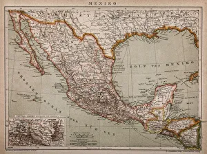
Map of MexicoAntique map of Mexico
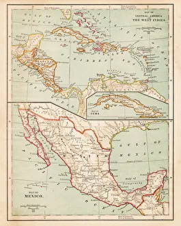
1883 Map Of Central America
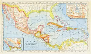
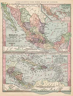
Map of Mexico and West Indies 1895The Rand-McNally Grammar School Geography 1895 - Chicago & New York
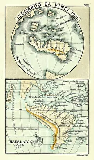
Antique Map by Leonardo Da Vinci 1515 and the Hauslab Globe
Map of Mexico and West Indies 1889Comprehensive Geography by James Monteith - American Book Company 1882, 1889
Map of Mexico Central America of 1877The Eclectic Elementary Geography by Wilson & Hinkle / Cincinnati -New York 1881
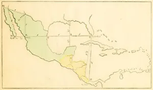
Map of Mexico and Central America 1871Colton and Fitchs Introductory School Geography - New York: Sheldon and Company 1871
Map of West Indies 1894Johnsons Universal Cyclopedia - Volume VIII New York - A. J. Johnson Company 1894
Map of Mexico and West indies 1883The Eclectic Elementary Geography by Van Antwerp, Bragg & C0 / Cincinnati -New York 1883
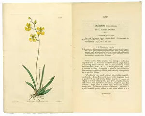
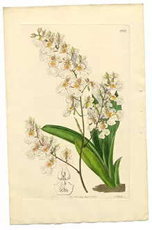
Gynandria Monandria, Victorian Botanical Illustration, Oncidium, Oncidium Lemonianum, 1835Very Rare, Beautifully Illustrated Antique Engraved and Hand Colored Victorian Botanical Illustration of Oncidium, Oncidium Lemonianum, Gynandria Monandria Victorian Botanical Illustration, 1835
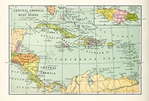
Antique Map of Central America and West IndesVintage map of Central America and West Indes, from 1894
Map of Mexico and West Indies 1877Warrens Common School Geography 1877
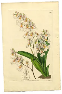
Oncidium, Oncidium Pulchellum, Gynandria Monandria Victorian Botanical Illustration, 1835Very Rare, Beautifully Illustrated Antique Engraved and Hand Colored Victorian Botanical Illustration of Oncidium, Oncidium Pulchellum, Gynandria Monandria Victorian Botanical Illustration, 1835
Gynandria Monandria Victorian Botanical Illustration, Oncidium, Oncidium Pulchellum, 1835Very Rare, Beautifully Illustrated Antique Engraved and Hand Colored Victorian Botanical Illustration of Oncidium, Oncidium Pulchellum, Gynandria Monandria Victorian Botanical Illustration, 1835
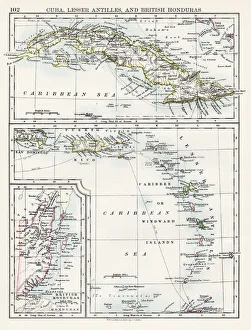
Cuba lesser antilles map 1897The World-Wide Atlas of Modern Geography, Political and Physical W. & A.K. Johnston - London 1897
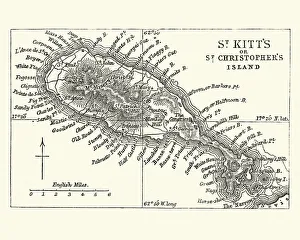
Map of Saint Kitts, 19th CenturyVintage engraving of a Map of Saint Kitts, 19th Century. Saint Kitts and Nevis, also known as the Federation of Saint Christopher and Nevis, [4] is an island country in the West Indies
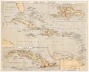
West indies map 1897The World-Wide Atlas of Modern Geography, Political and Physical W. & A.K. Johnston - London 1897
Pinel Island Pinel Bay Saint Martin Sint Maarten CaribbeanA dramatic view of the Pinel Bay, Pinel Island, ilet de Pinel, Petite Clef, Rue de Grande Caye as seen from a high vantage point. Island of Saint Martin Sint Maarten, Caribbean
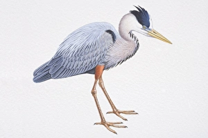
Great Blue Heron (Ardea herodias), with long legs and silver-blue feathers, side view
Baby monkey portraitYoung green monkey held by mother. Barbados, Caribbean, West Indies
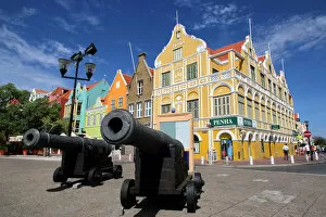
Stores on Handelskade, Punda District, Willemstad, Curacao, Netherlands Antillies, West Indies, CaribbeanThe Historic Area of Willemstad, Inner City and Harbour, CuraAzao is an outstanding example of European colonial history in the Caribbean
Antique map of West Indies and Central America, 19th Century, 1873
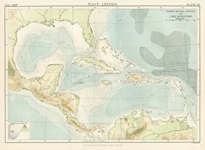
West Indies map 1885Encyclopedia Britannica 9th Edition New York Charles Scribners and Sons 1885 Vol XXIV
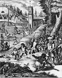
Pirates In The West IndiesIllustration depicting pirates in the West Indies capturing the citizens and putting them to death and torture. West Indies. Date unknown. (Photo by Fotosearch/Getty Images)
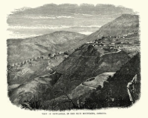
Newcastle, in the Blue Mountains, Jamaica, 19th CenturyVintage engraving of Newcastle, in the Blue Mountains, Jamaica, 19th Century
Arctostaphylos tomentosa Victorian Botanical Illustration, Downy Bearberry, Bearberry, 1835Very Rare, Beautifully Illustrated Antique Engraved and Hand Colored Victorian Botanical Illustration of Downy Bearberry, Bearberry, Arctostaphylos tomentosa Victorian Botanical Illustration, 1835
Diadelphia Decandria Victorian Botanical Illustration, Kennedya Marryattae, Kennedya, 1835Very Rare, Beautifully Illustrated Antique Engraved and Hand Colored Victorian Botanical Illustration of Kennedya Marryattae, Kennedya, Diadelphia Decandria Victorian Botanical Illustration, 1835
Map of Mexico and West Indies 1883Warrens Common School Geography
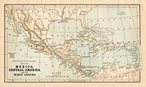
Mexico and Central America map 1881Coltons Common School Geography 1881 New York Sheldon and Co
West Indies map 1869Cornells Grammars-School Geography - S.S. Cornell - New York D. Appleton and Company 1869
West Indies map 1855System of Geography for the use of schools by Sidney E. Morse - Published by Harper & Brothers - New York 1855
West Indies map 1856Colton and Fitchs Modern School Geography by George W. Fitch - New York 1856
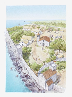
Illustration of the city Columbus began to build when he returned to Hispaniola
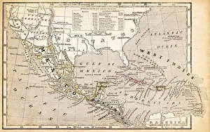
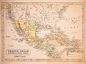
Mexico, Texas, Guatimala and West Indies 1852 Map
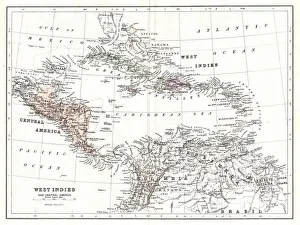
Central America and West Indies map 1875The Independent Course Comprehensive Geography by James Monteith, A.S. Barnes & Co, New York & Chicago 1875
West Indies map 1867Mitchellas Modern Atlas - Published by E.H. Butler and Co - Philadelphia 1867
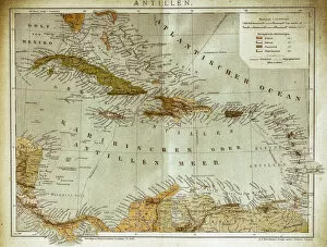
West indies, Antilles mapIllustration of a West indies, Antilles map
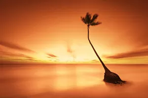
Alone palm tree on a secluded beachAlone palm tree located on a secluded Bavaro Beach, Punta Cana, Dominican Republic. A long exposure at sunrise creates a surreal and idyllic mood
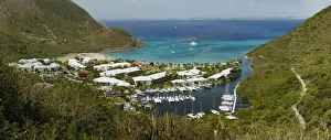
Day time at Rocher de l ansi MarcelA beautiful Cove, Resort, and Marina located on Anse Marcel, Saint Martin Located on the North Shore of Saint Martin / Sint Maarten