mail_outline sales@mediastorehouse.com
275 Items
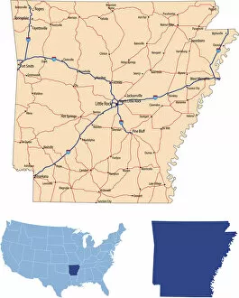
Arkansas road mapillustration of Arkansas state road map for your design and products
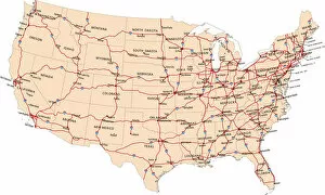
USA highway mapillustration of USA highway map for your design and products
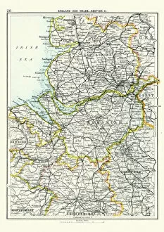
Antique map, Lancashire, Cheshire, Stafford, Liverpool, 19th CenturyVintage engraving of a Antique map, Lancashire, Cheshire, Stafford, Liverpool, Shropshire, Derby, England 19th Century
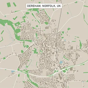
Dereham Norfolk UK City Street MapVector Illustration of a City Street Map of Dereham, Norfolk, UK. Included files are EPS (v10) and Hi-Res JPG. Data courtesy from Ordnance Survey: VectorMap District https
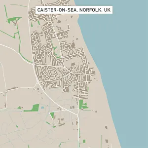
Caister-on-Sea Norfolk UK City Street MapVector Illustration of a City Street Map of Caister-on-Sea, Norfolk, UK. Included files are EPS (v10) and Hi-Res JPG. Data courtesy from Ordnance Survey: VectorMap District https
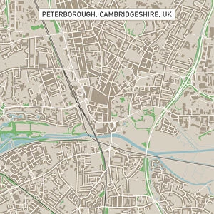
Peterborough Cambridgeshire UK City Street MapVector Illustration of a City Street Map of Peterborough, Cambridgeshire, UK. Included files are EPS (v10) and Hi-Res JPG
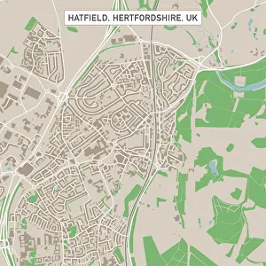
Hatfield Hertfordshire UK City Street MapVector Illustration of a City Street Map of Hatfield, Hertfordshire, UK. Included files are EPS (v10) and Hi-Res JPG. Data courtesy from Ordnance Survey: VectorMap District https
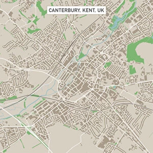
Canterbury Kent UK City Street MapVector Illustration of a City Street Map of Canterbury, Kent, UK. Included files are EPS (v10) and Hi-Res JPG. Data courtesy from Ordnance Survey: VectorMap District https
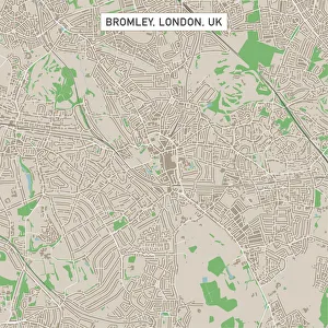
Bromley London UK City Street MapVector Illustration of a City Street Map of Bromley, London, UK. Included files are EPS (v10) and Hi-Res JPG
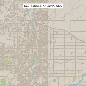
Scottsdale Arizona US City Street MapVector Illustration of a City Street Map of Scottsdale, Arizona, USA. Scale 1:60, 000. All source data is in the public domain. U.S
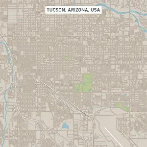
Tucson Arizona US City Street MapVector Illustration of a City Street Map of Tucson, Arizona, USA. Scale 1:60, 000. All source data is in the public domain. U.S
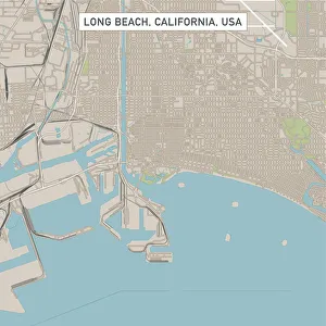
Long Beach California US City Street MapVector Illustration of a City Street Map of Long Beach, California, USA. Scale 1:60, 000. All source data is in the public domain. U.S
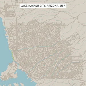
Lake Havasu City Arizona US City Street MapVector Illustration of a City Street Map of Lake Havasu City, Arizona, USA. Scale 1:60, 000. All source data is in the public domain. U.S
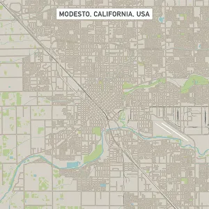
Modesto California US City Street MapVector Illustration of a City Street Map of Modesto, California, USA. Scale 1:60, 000. All source data is in the public domain. U.S
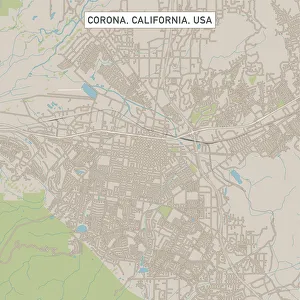
Corona California US City Street MapVector Illustration of a City Street Map of Corona, California, USA. Scale 1:60, 000. All source data is in the public domain. U.S
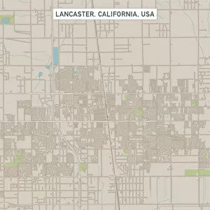
Lancaster California US City Street MapVector Illustration of a City Street Map of Lancaster, California, USA. Scale 1:60, 000. All source data is in the public domain. U.S
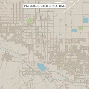
Palmdale California US City Street MapVector Illustration of a City Street Map of Palmdale, California, USA. Scale 1:60, 000. All source data is in the public domain. U.S
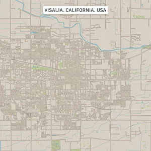
Visalia California US City Street MapVector Illustration of a City Street Map of Visalia, California, USA. Scale 1:60, 000. All source data is in the public domain. U.S
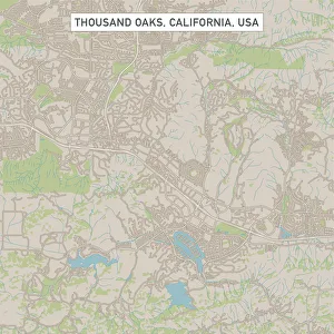
Thousand Oaks California US City Street MapVector Illustration of a City Street Map of Thousand Oaks, California, USA. Scale 1:60, 000. All source data is in the public domain. U.S
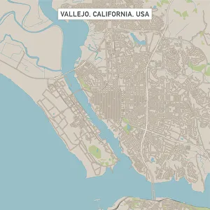
Vallejo California US City Street MapVector Illustration of a City Street Map of Vallejo, California, USA. Scale 1:60, 000. All source data is in the public domain. U.S
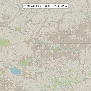
Simi Valley California US City Street MapVector Illustration of a City Street Map of Simi Valley, California, USA. Scale 1:60, 000. All source data is in the public domain. U.S
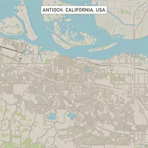
Antioch California US City Street MapVector Illustration of a City Street Map of Antioch, California, USA. Scale 1:60, 000. All source data is in the public domain. U.S
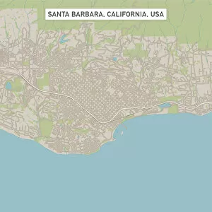
Santa Barbara California US City Street MapVector Illustration of a City Street Map of Santa Barbara, California, USA. Scale 1:60, 000. All source data is in the public domain. U.S
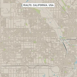
Rialto California US City Street MapVector Illustration of a City Street Map of Rialto, California, USA. Scale 1:60, 000. All source data is in the public domain. U.S
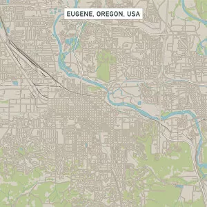
Eugene Oregon US City Street MapVector Illustration of a City Street Map of Eugene, Oregon, USA. Scale 1:60, 000. All source data is in the public domain. U.S
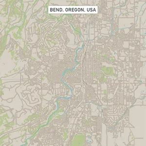
Bend Oregon US City Street MapVector Illustration of a City Street Map of Bend, Oregon, USA. Scale 1:60, 000. All source data is in the public domain. U.S
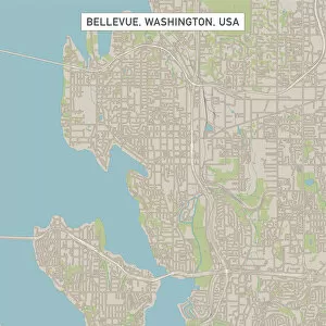
Bellevue Washington US City Street MapVector Illustration of a City Street Map of Bellevue, Washington, USA. Scale 1:60, 000. All source data is in the public domain. U.S
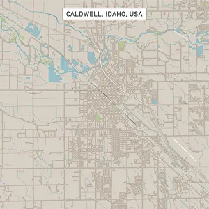
Caldwell Idaho US City Street MapVector Illustration of a City Street Map of Caldwell, Idaho, USA. Scale 1:60, 000. All source data is in the public domain. U.S
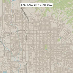
Salt Lake City Utah US City Street MapVector Illustration of a City Street Map of Salt Lake City, Utah, USA. Scale 1:60, 000. All source data is in the public domain. U.S
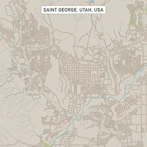
Saint George Utah US City Street MapVector Illustration of a City Street Map of Saint George, Utah, USA. Scale 1:60, 000. All source data is in the public domain. U.S
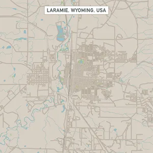
Laramie Wyoming US City Street MapVector Illustration of a City Street Map of Laramie, Wyoming, USA. Scale 1:60, 000. All source data is in the public domain. U.S
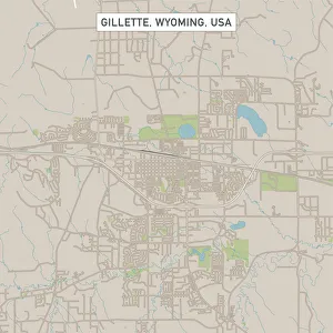
Gillette Wyoming US City Street MapVector Illustration of a City Street Map of Gillette, Wyoming, USA. Scale 1:60, 000. All source data is in the public domain. U.S
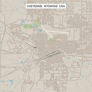
Cheyenne Wyoming US City Street MapVector Illustration of a City Street Map of Cheyenne, Wyoming, USA. Scale 1:60, 000. All source data is in the public domain. U.S
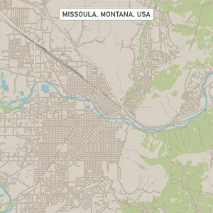
Missoula Montana US City Street MapVector Illustration of a City Street Map of Missoula, Montana, USA. Scale 1:60, 000. All source data is in the public domain. U.S
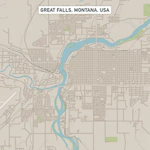
Great Falls Montana US City Street MapVector Illustration of a City Street Map of Great Falls, Montana, USA. Scale 1:60, 000. All source data is in the public domain. U.S
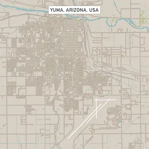
Yuma Arizona US City Street MapVector Illustration of a City Street Map of Yuma, Arizona, USA. Scale 1:60, 000. All source data is in the public domain. U.S
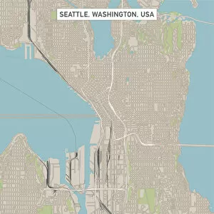
Seattle Washington US City Street MapVector Illustration of a City Street Map of Seattle, Washington, USA. Scale 1:60, 000. All source data is in the public domain. U.S
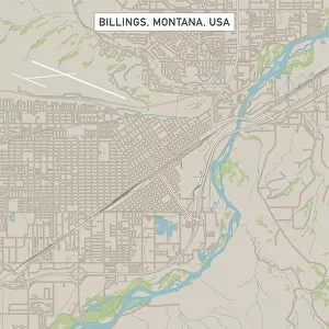
Billings Montana US City Street MapVector Illustration of a City Street Map of Billings, Montana, USA. Scale 1:60, 000. All source data is in the public domain. U.S
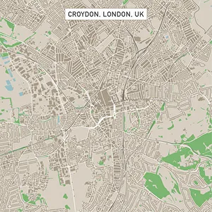
Croydon London UK City Street MapVector Illustration of a City Street Map of Croydon, London, UK. Included files are EPS (v10) and Hi-Res JPG. Data courtesy from Ordnance Survey: VectorMap District https
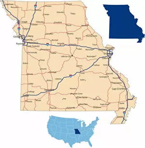
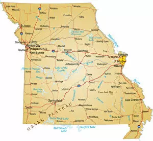
Missouri road mapillustration of Missouri state road map for your design and products
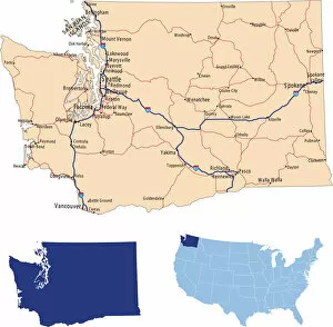
Washington road mapillustration of Washington state road map for your design and products
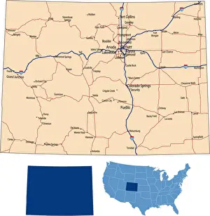
Colorado road mapillustration of Colorado state road map for your design and products
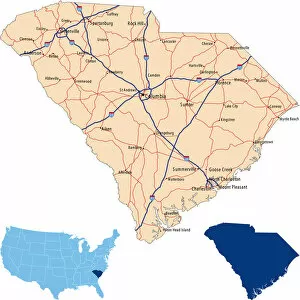
South Carolina road mapillustration of South Carolina state road map for your design and products
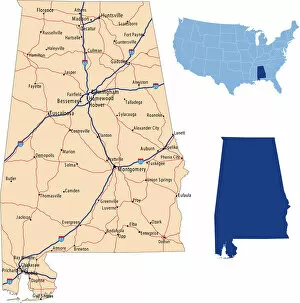
Alabama road mapillustration of Alabama state road map for your design and products
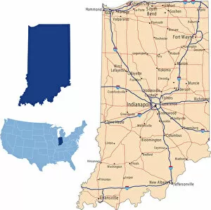
Indiana road mapillustration of Indiana state road map for your design and products
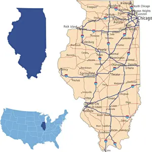
Illinois road mapillustration of Illinois state road map for your design and products
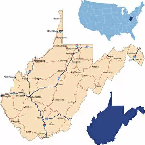
West Virginia road mapillustration of West Virginia state road map for your design and products
Missouri map design with white backgroundVector illustration of map of Missouri with major roads, rivers and lakes