mail_outline sales@mediastorehouse.com
275 items
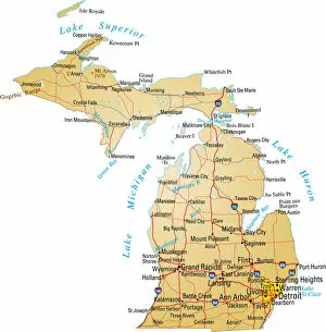
A detailed map of Michigan AmericaVector illustration of map of Michigan with major roads, rivers and lakes
California lemmons illustration 1892Report of the Secretary of Agriculture 1892 by United States. Department of Agriculture
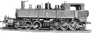
Double locomotive of the Gotthard RailwayIllustration from 19th century
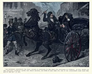
Charles Dickens, Nicholas Nickleby, Sir Mulberry, shortening his whipVintage engraving of a scene from the Charles Dickens novel Nicholas Nickleby. Illustration by Fred Barnard. Sir Mulberry, shortening his whip
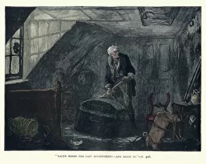
Charles Dickens, Nicholas Nickleby, Ralph makes one last AppointmentVintage engraving of a scene from the Charles Dickens novel Nicholas Nickleby. Illustration by Fred Barnard. Ralph makes one last Appointmenta'and keeps it
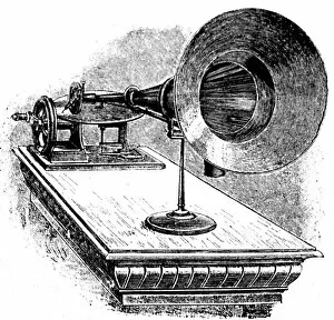
GramophoneIllustration from 19th century
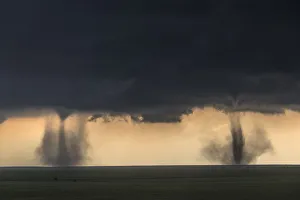
Twin Tornadoes, Colorado USAMay 28th, Washington County, Colorado chase day, with the stunning sister tornadoes
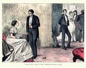
Dickenss Great Expectations, Why should I look at himVintage engraving of a scene from the Charles Dickenss Great Expectations. Illustrated by by F. A. Fraser. Why should I look at him ? returned Estella
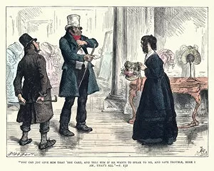
Charles Dickens, Nicholas Nickleby, give him that ere cardVintage engraving of a scene from the Charles Dickens novel Nicholas Nickleby. Illustration by Fred Barnard. You can just give him that ere card and tell him if he wants to speak to me
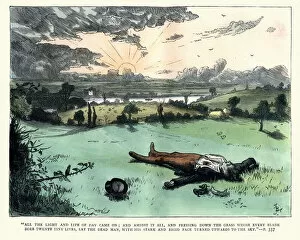
Charles Dickens, Nicholas Nickleby, lay the dead manVintage engraving of a scene from the Charles Dickens novel Nicholas Nickleby. Illustration by Fred Barnard. All the light and life of day came on and amidst it all
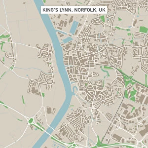
Kingas Lynn Norfolk UK City Street MapVector Illustration of a City Street Map of Kingas Lynn, Norfolk, UK. Included files are EPS (v10) and Hi-Res JPG. Data courtesy from Ordnance Survey: VectorMap District https
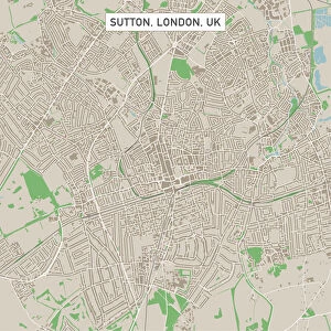
Sutton London UK City Street MapVector Illustration of a City Street Map of Sutton, London, UK. Included files are EPS (v10) and Hi-Res JPG. Data courtesy from Ordnance Survey: VectorMap District https
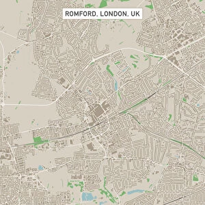
Romford London UK City Street MapVector Illustration of a City Street Map of Romford, London, UK. Included files are EPS (v10) and Hi-Res JPG. Data courtesy from Ordnance Survey: VectorMap District https
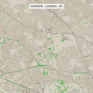
Harrow London UK City Street MapVector Illustration of a City Street Map of Harrow, London, UK. Included files are EPS (v10) and Hi-Res JPG. Data courtesy from Ordnance Survey: VectorMap District https
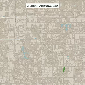
Gilbert Arizona US City Street MapVector Illustration of a City Street Map of Gilbert, Arizona, USA. Scale 1:60, 000. All source data is in the public domain. U.S
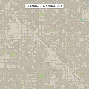
Glendale Arizona US City Street MapVector Illustration of a City Street Map of Glendale, Arizona, USA. Scale 1:60, 000. All source data is in the public domain. U.S
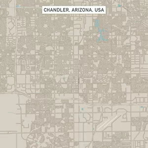
Chandler Arizona US City Street MapVector Illustration of a City Street Map of Chandler, Arizona, USA. Scale 1:60, 000. All source data is in the public domain. U.S
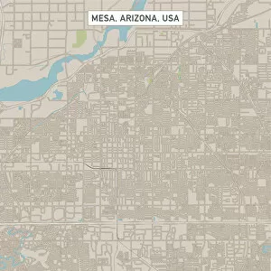
Mesa Arizona US City Street MapVector Illustration of a City Street Map of Mesa, Arizona, USA. Scale 1:60, 000. All source data is in the public domain. U.S
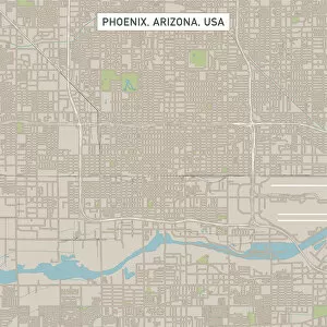
Phoenix Arizona US City Street MapVector Illustration of a City Street Map of Phoenix, Arizona, USA. Scale 1:60, 000. All source data is in the public domain. U.S
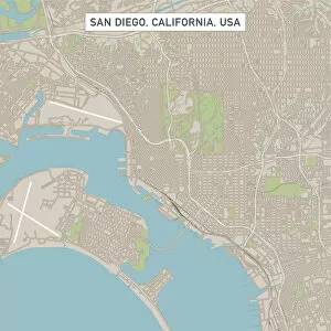
San DiegoCaliforniaUSCityStreetMap_60000Vector Illustration of a City Street Map of San Diego, California, USA. Scale 1:60, 000. All source data is in the public domain. U.S
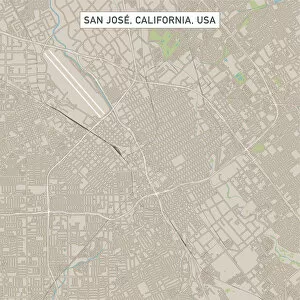
San Jose California US City Street MapVector Illustration of a City Street Map of San Jose, California, USA. Scale 1:60, 000. All source data is in the public domain. U.S
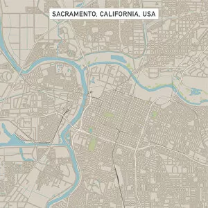
Sacramento California US City Street MapVector Illustration of a City Street Map of Sacramento, California, USA. Scale 1:60, 000. All source data is in the public domain. U.S
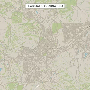
Flagstaff Arizona US City Street MapVector Illustration of a City Street Map of Flagstaff, Arizona, USA. Scale 1:60, 000. All source data is in the public domain. U.S
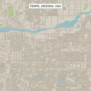
Tempe Arizona US City Street MapVector Illustration of a City Street Map of Tempe, Arizona, USA. Scale 1:60, 000. All source data is in the public domain. U.S
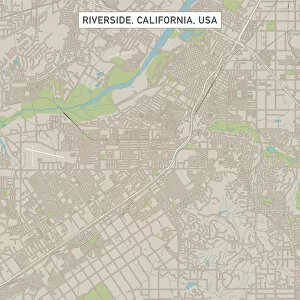
Riverside California US City Street MapVector Illustration of a City Street Map of Riverside, California, USA. Scale 1:60, 000. All source data is in the public domain. U.S
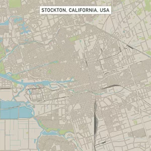
Stockton California US City Street MapVector Illustration of a City Street Map of Stockton, California, USA. Scale 1:60, 000. All source data is in the public domain. U.S
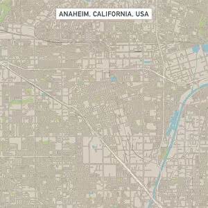
Anaheim California US City Street MapVector Illustration of a City Street Map of Anaheim, California, USA. Scale 1:60, 000. All source data is in the public domain. U.S
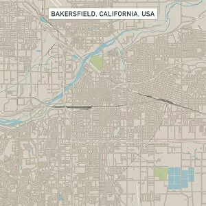
Bakersfield California US City Street MapVector Illustration of a City Street Map of Bakersfield, California, USA. Scale 1:60, 000. All source data is in the public domain. U.S
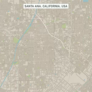
Santa Ana California US City Street MapVector Illustration of a City Street Map of Santa Ana, California, USA. Scale 1:60, 000. All source data is in the public domain. U.S
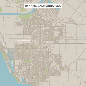
Oxnard California US City Street MapVector Illustration of a City Street Map of Oxnard, California, USA. Scale 1:60, 000. All source data is in the public domain. U.S
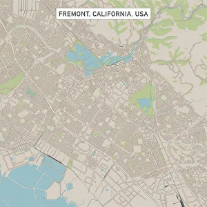
Fremont California US City Street MapVector Illustration of a City Street Map of Fremont, California, USA. Scale 1:60, 000. All source data is in the public domain. U.S
Fontana California US City Street MapVector Illustration of a City Street Map of Fontana, California, USA. Scale 1:60, 000. All source data is in the public domain. U.S
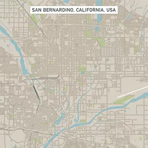
San Bernardino California US City Street MapVector Illustration of a City Street Map of San Bernardino, California, USA. Scale 1:60, 000. All source data is in the public domain. U.S
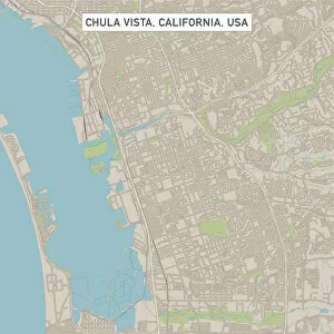
Chula Vista California US City Street MapVector Illustration of a City Street Map of Chula Vista, California, USA. Scale 1:60, 000. All source data is in the public domain. U.S
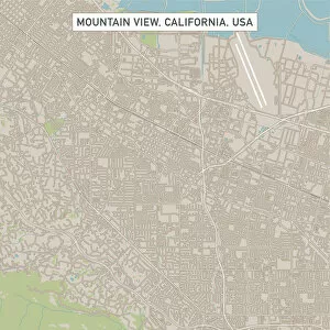
Mountain View California US City Street MapVector Illustration of a City Street Map of Mountain View, California, USA. Scale 1:60, 000. All source data is in the public domain. U.S
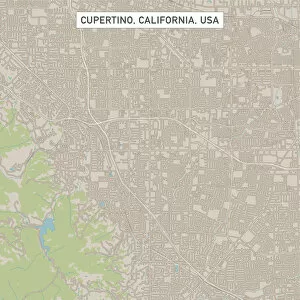
Cupertino California US City Street MapVector Illustration of a City Street Map of Cupertino, California, USA. Scale 1:60, 000. All source data is in the public domain. U.S
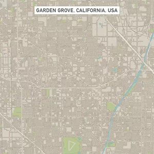
Garden Grove California US City Street MapVector Illustration of a City Street Map of Garden Grove, California, USA. Scale 1:60, 000. All source data is in the public domain. U.S
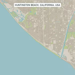
Huntington Beach California US City Street MapVector Illustration of a City Street Map of Huntington Beach, California, USA. Scale 1:60, 000. All source data is in the public domain. U.S
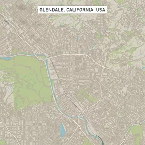
Glendale California US City Street MapVector Illustration of a City Street Map of Glendale, California, USA. Scale 1:60, 000. All source data is in the public domain. U.S
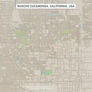
Rancho Cucamonga California US City Street MapVector Illustration of a City Street Map of Rancho Cucamonga, California, USA. Scale 1:60, 000. All source data is in the public domain. U.S
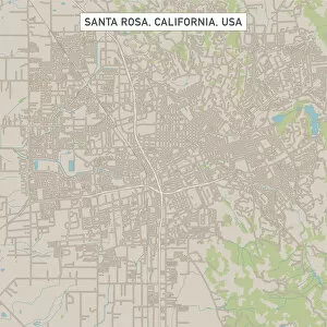
Santa Rosa California US City Street MapVector Illustration of a City Street Map of Santa Rosa, California, USA. Scale 1:60, 000. All source data is in the public domain. U.S
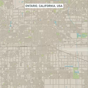
Ontario California US City Street MapVector Illustration of a City Street Map of Ontario, California, USA. Scale 1:60, 000. All source data is in the public domain. U.S
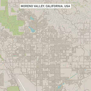
Moreno Valley California US City Street MapVector Illustration of a City Street Map of Moreno Valley, California, USA. Scale 1:60, 000. All source data is in the public domain. U.S
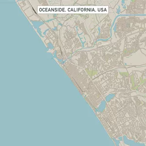
Oceanside California US City Street MapVector Illustration of a City Street Map of Oceanside, California, USA. Scale 1:60, 000. All source data is in the public domain. U.S
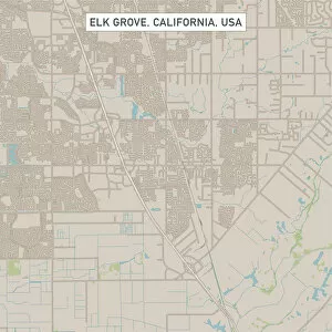
Elk Grove California US City Street MapVector Illustration of a City Street Map of Elk Grove, California, USA. Scale 1:60, 000. All source data is in the public domain. U.S
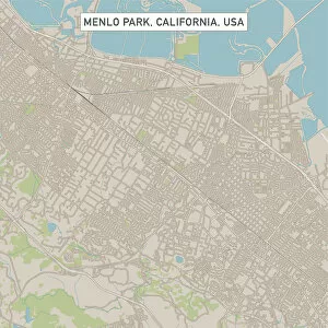
Menlo Park California US City Street MapVector Illustration of a City Street Map of Menlo Park, California, USA. Scale 1:60, 000. All source data is in the public domain. U.S
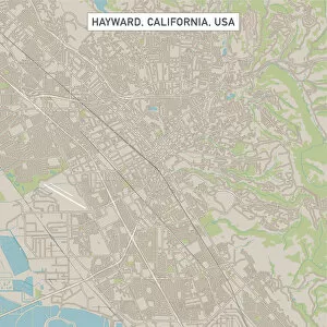
Hayward California US City Street MapVector Illustration of a City Street Map of Hayward, California, USA. Scale 1:60, 000. All source data is in the public domain. U.S
Sunnyvale California US City Street MapVector Illustration of a City Street Map of Sunnyvale, California, USA. Scale 1:60, 000. All source data is in the public domain. U.S