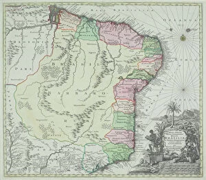
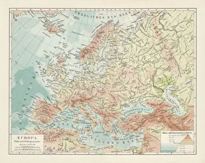
antique, archival, brasil, brasilia, brazil, cartography, cartouche, colored, decorative, distribution, districts, elegant, geography, historic, indigenous peoples, key, legend, location, map
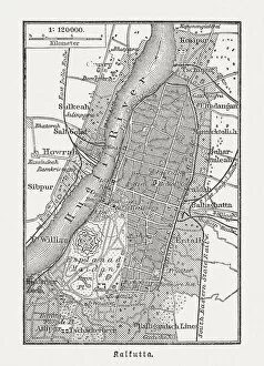
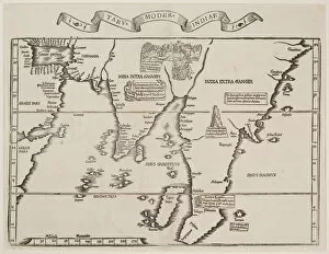
16th century, antique, archival, bangladesh, banner, bay of bengal, border, cartography, ceylon, country, document, geography, historic, historical, india, indian ocean, latitude, legend, map
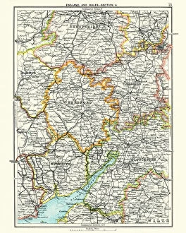
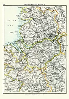
Antique map, Hereford, Worester, Monmouth, Gloucester, Shropshire, 19th Century
Antique map, Hereford, Worester, Monmouth, Gloucester, Shropshire, England and Wales 19th Century
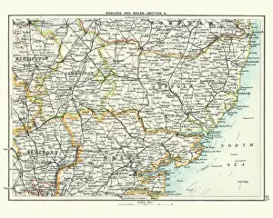
Antique map, Cambridge, Hertford, Essex, Suffolk, England 19th Century
Vintage engraving of a Antique map, Cambridge, Hertford, Essex, Suffolk, England 19th Century
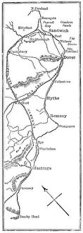
Antique map, Lancashire, Cheshire, Stafford, Liverpool, 19th Century
Vintage engraving of a Antique map, Lancashire, Cheshire, Stafford, Liverpool, Shropshire, Derby, England 19th Century