mail_outline sales@mediastorehouse.com
3,678 Poster Prints
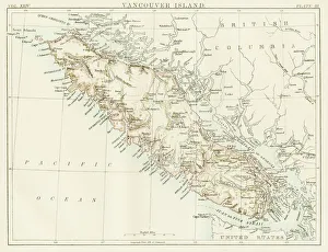
Vancouver island map 1885Encyclopedia Britannica 9th Edition New York Charles Scribners and Sons 1885 Vol XXIV
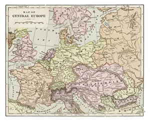
Map of central Europe 1889Indiana Educational Series The Complete Geography - Indianapolis 1889
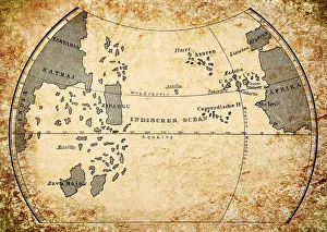
Paolo dal Pozzo Toscanelli map of earth from 15th centuryIllustration of a Paolo dal Pozzo Toscanelli map of earth from 15th century
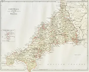
Cornwall map 1884Encyclopedia Britannica 9th Edition New York Charles Scribners and Sons 1884 Vol VI
Antique map of Hadrians wall
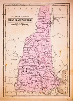
New Hampshire 1852 Map
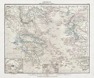
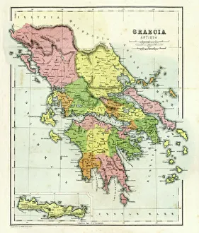
Greece at the beginning of the Peloponnesian War (431-404 BC)Antique Map of Greece at the beginning of the Peloponnesian War (431 - 404 BC) with the different tribal groups. Steel engraving with hand colored borderlines, published in 1861
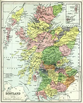
Antique map of Scotland, 1864
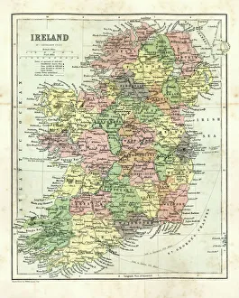
Antique map of Ireland, 1864
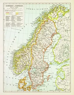
Map of Sweden and Norway 1897Map of Sweden and Norway
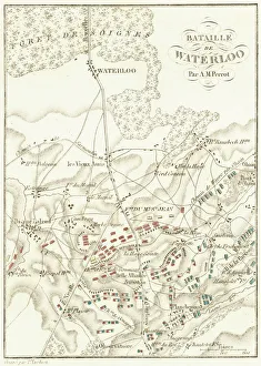
Battle Of WaterlooA plan of the Battle of Waterloo in present-day Belgium during the Napoleonic Wars, 18th June 1815. Here an Anglo-Allied army under the command of the Duke of Wellington defeated the Imperial French
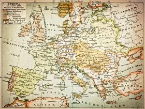
Map of Europe 1721
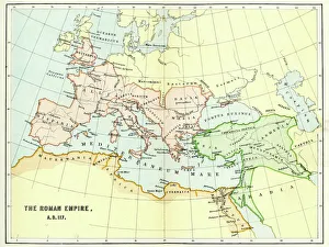
Map of the Roman Empire in AD 117Vintage engraving of a Map of the Roman Empire in AD 117
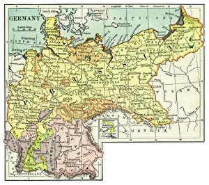
Map of Germany 1889Comprehensive Geography by James Monteith - American Book Company 1882, 1889
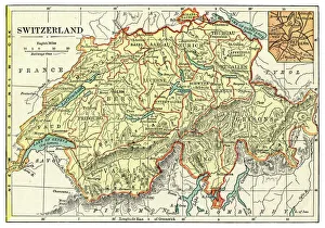
Map of Switzerland 1889Comprehensive Geography by James Monteith - American Book Company 1882, 1889
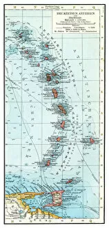
Lesser Antilles map 1896Andres Allgemeiner Handatlas - Bielefeld und Leipzig 1896
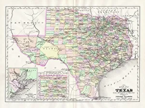
Map of Texas 1894Johnsons Universal Cyclopedia - Volume VIII New York - A. J. Johnson Company 1894
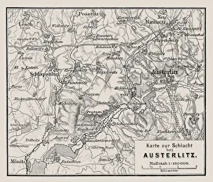
Map of the Battle of Austerlitz also known as the Battle of the Three EmperorsIllustration of a Map of the Battle of Austerlitz also known as the Battle of the Three Emperors
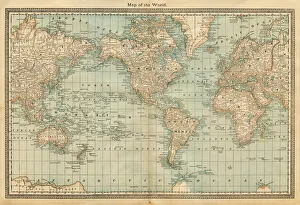
map of the world 1882map of the world - 1882
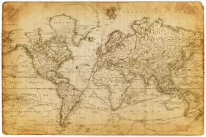
Map of the world 1800
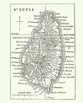
Map of Saint Lucia, 19th CenturyVintage engraving of Map of Saint Lucia, 19th Century
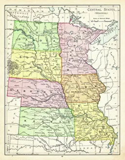
Map of central states USA 1895The Rand-McNally Grammar School Geography 1895 - Chicago & New York
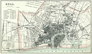
Map of HullVintage map from 1880 of Hull in the East Riding of Yorkshire, England. The city of Hull has served as market town, military supply port, trading hub, fishing and whaling centre
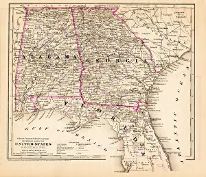
Alabama Florida Georgia map 1881Coltons Common School Geography 1881 New York Sheldon and Co
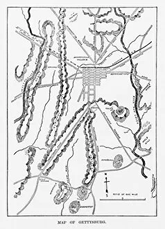
Battle of Gettysburg Map, July 3, 1863 Civil War EngravingEngraving of the Map of the Battle of Gettysburgs, Pennsylvania, July 3, 1863 Civil War Engraving from Famous Leaders and Battle Scenes of the Civil War, Published in 1864
Old Map ElementsOld map icons, eps 9
Antique map of Ancient Greece, 1864
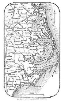
Map of Pamlico and Albemarle SoundsVintage engraving from 1863 of a map of Map of Pamlico and Albemarle Sounds at the time of the American Civil War
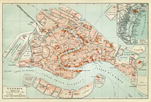
Map of Venice 1897Map of the city of Venice, Italy
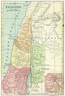
Palestine map 1875The Independent Course Comprehensive Geography by James Monteith, A.S. Barnes & Co, New York & Chicago 1875
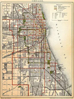
Chicago mapAntique illustration of a Chicago map
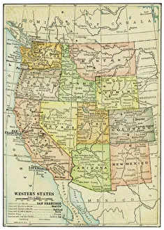
USA Western states map 1898Map from Physical Geography by R. S. Tarr - The MacMillan Company - London 1898
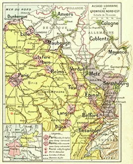
France Alsace-Lorraine map 1887Map from La Premiere Annee de Geographie par P. Foncin - Paris 1887
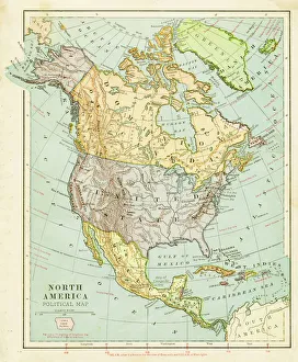
Map of North America 1899Maurys Geographical Series Manual of Geography - New York 1899
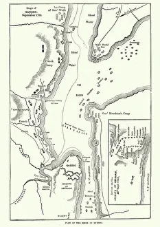
Map of the Siege of Quebec, Canada 1759Vintage engraving of a Map of the Siege of Quebec, Canada 1759. The Battle of the Plains of Abraham, also known as the Battle of Quebec was a pivotal battle in the Seven Years War
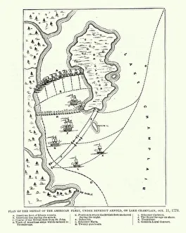
Map of the Battle of Valcour Island, 1776Vintage engraving of Map of the Battle of Valcour Island, 1776. The naval Battle of Valcour Island, also known as the Battle of Valcour Bay, took place on October 11, 1776, on Lake Champlain
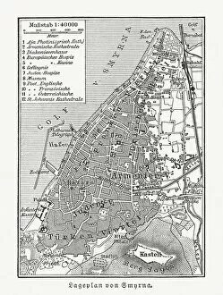
Historical city map of Smyrna (Izmir), Turkey, woodcut, published 1897Historical city map of Smyrna (Izmir), Turkey. Wood engraving, published in 1897
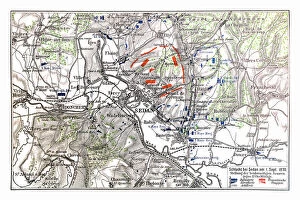
Map of Battle of Sedan, it was fought during the Franco-Prussian War from 1 to 2 September 1870Illustration of a Battle of Sedan was fought during the Franco-Prussian War from 1 to 2 September 1870. It resulted in the capture of Emperor Napoleon III and large numbers of his troops
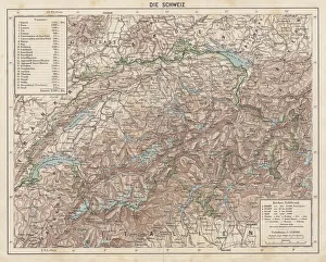
Switzerland, Topographic map, published in 1881Topographic map of Switzerland. Facsimile, published in 1881
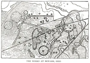
woodcut map illustration of Newark Earthworks, OhioWoodcut map of Newark Earthworks, Ohio, USA. Built during Hopewell culture. 1889 facsimile of 1862 map in Prehistoric Man by Daniel Wilson
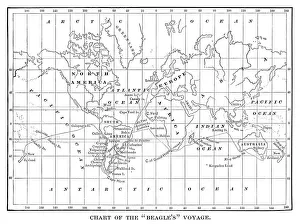
Chart of the Beagles voyage. Charles Darwin travel map - Scanned 1880 Engraving
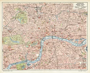
London city map 1895Meyers Konversations-Lexikon. Ein Nachschlagewerk des allgemeinen Wissens, 5th edition 17 volumes Bibliographisches Institut - Leipzig 1895-1897
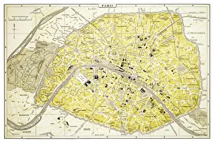
Map of Paris 1894map/plan of the city of Paris, France
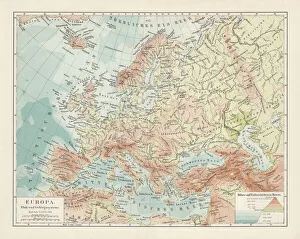
Topographic map of Europe, lithograph, published in 1897Topographic map of Europe. Lithograph, published in 1897
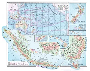
Map of Oceania 1877Warrens Common School Geography 1877
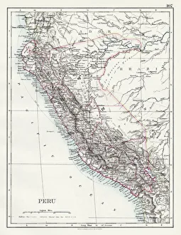
Peru map 1897The World-Wide Atlas of Modern Geography, Political and Physical W. & A.K. Johnston - London 1897
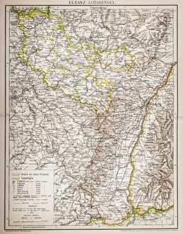
Alsace-Lorraine map 1880Illustration of a Alsace-Lorraine map 1880
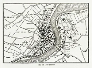
Map of Londonderry, Derry, Donegal, Northern Ireland, Victorian Engraving, 1840Very Rare, Beautifully Illustrated Antique Engraving of Map of Londonderry, Derry, Donegal, Northern Ireland, Victorian Engraving, 1840. Source: Original edition from my own archives