mail_outline sales@mediastorehouse.com
3,678 Framed Prints
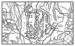
Old engraved map of Battle of Naseby (14. 06. 1645) - part of First English Civil WarCopyright has expired on this artwork. From my own archives, digitally restored. The Battle of Naseby took place on Saturday 14 June 1645 during the First English Civil War
Old engraved illustration of Battle of Zenta, also known as the Battle of Senta, was fought on 11 September 1697Copyright has expired on this artwork. From my own archives, digitally restored
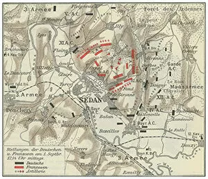
Old engraved map of Battle of Sedan, fought during the Franco-Prussian War from 1 to 2 September 1870Copyright has expired on this artwork. From my own archives, digitally restored
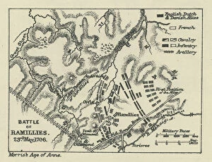
Old engraved map of Battle of Ramillies (23. 05. 1706) - battle of the War of the Spanish SuccessionCopyright has expired on this artwork. From my own archives, digitally restored
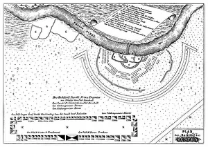
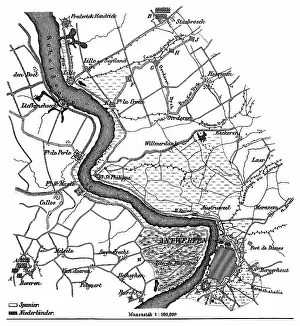
Old engraved map of the siege of Antwerp by Alexander Farnese from 10. 07. 1584 to 17. 08. 1585Copyright has expired on this artwork. From my own archives, digitally restored
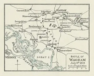
Old engraved map of Battle of Wagram (5 and 6 July 1809)Copyright has expired on this artwork. From my own archives, digitally restored
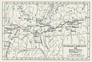
Old engraved illustration of Russian Campaign (1812), French occupation of Moscow, March of Napoleon to MoscowCopyright has expired on this artwork. From my own archives, digitally restored
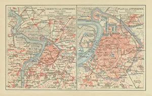
Old chromolithograph map of Antwerp, largest city in Belgium, capital of Antwerp Province in the Flemish RegionCopyright has expired on this artwork. From my own archives, digitally restored
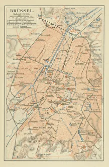
Old chromolithograph map of Brussels, officially the Brussels-Capital RegionCopyright has expired on this artwork. From my own archives, digitally restored
Old chromolithograph map of Vienna, national capital, largest city, and one of nine states of AustriaCopyright has expired on this artwork. From my own archives, digitally restored
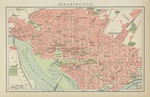
Old engraved map of City of Washington, USACopyright has expired on this artwork. From my own archives, digitally restored
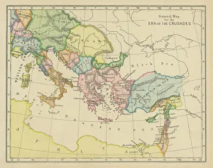
Old chromolithograph general map of era of the CrusadesCopyright has expired on this artwork. From my own archives, digitally restored
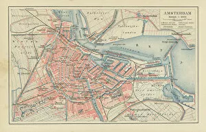
Old chromolithograph map of Amsterdam, capital and most populous city of the NetherlandsCopyright has expired on this artwork. From my own archives, digitally restored
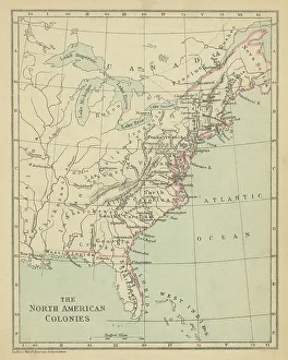
Old chromolithograph map the North American ColoniesCopyright has expired on this artwork. From my own archives, digitally restored
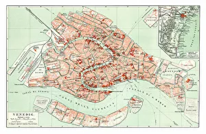
Old chromolithograph map of Venice, ItalyCopyright has expired on this artwork. From my own archives, digitally restored
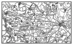
Old engraved map of the Battle of Kolin on 18 June 1757 saw 54, 000 Austrians under Count von Daun defeat 34Copyright has expired on this artwork. From my own archives, digitally restored
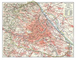
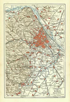
Old chromolithograph map of surroundings of Vienna, national capital, largest city, and one of nine states of AustriaCopyright has expired on this artwork. From my own archives, digitally restored
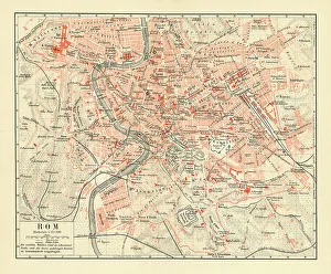
Old chromolithograph map of Rome, ItalyCopyright has expired on this artwork. From my own archives, digitally restored
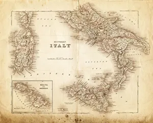
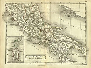
map of italy 1855an old map of southern italy (inset showing malta) - 1855
Map of Iltaly 1894Der Menfch Vol 2 by Johannes Ranke - Leipzig 1894
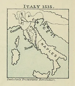
Old chromolithograph map of Italy in 1515Antique Illustration. Copyright has expired on this artwork. From my own archives, digitally restored
Antique map of Central Italy in Ancient times, Roman, Italiae Antiquae pars mediaVintage illustration of Antique map of Central Italy in Ancient times, Italiae Antiquae pars media. Atlas of Ancient Geography. By Samuel Butler
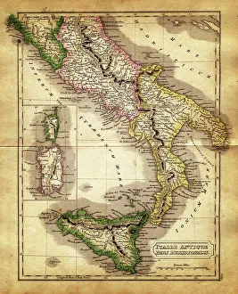
map of italy during the Roman Empiremap of antique italy during the Roman Empire, Meridional parts - Sardinia, Corsica and Sicily
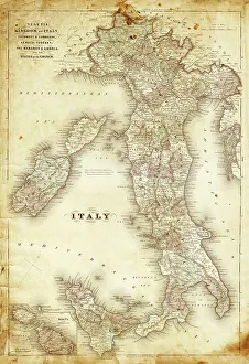
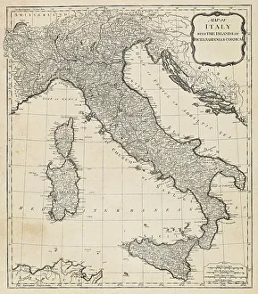
map of italy 1863an old map of italy - 1863
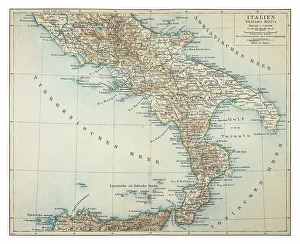
Map of southern Italy 1895
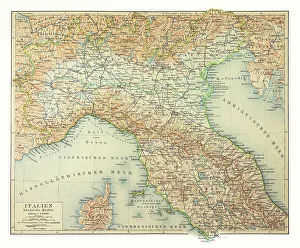
Map of northern Italy 1895
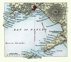
Antique map of Bay of Naples, Italy, Mount Vesuvius, Capri, 19th Century
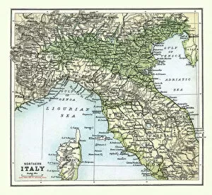
Antique map of Northern Italy, 19th Century, 1890s, Aosta Valley, Piedmont, Liguria, Lombardy, Tuscany, Veneto
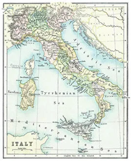
Old chromolithograph map of Italy and IslandsAntique Illustration. Copyright has expired on this artwork. From my own archives, digitally restored
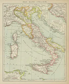
Old engraved map of the Old ItalyCopyright has expired on this artwork. From my own archives, digitally restored
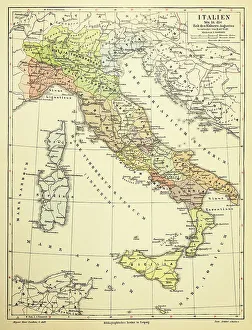
Map of Italy 1895
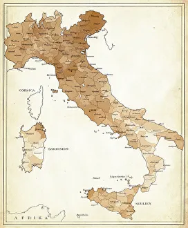
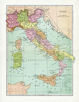
Antique Map of ItalyVintage map of Italy, from 1894
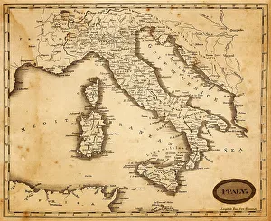
map of italy 1812an old map of italy - 1812
Antique Map of Italy - 18th CenturyVintage map of Italy. Vintage etching circa late 18th century
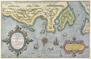
Dutch Trade Map of the Baltic SeaDutch Trade map of the Baltic Sea (hand-coloured engraving) During the last decades of the 16th century and throughout the 17th century Dutch merchants
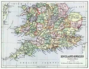
Old chromolithograph map of England and Wales (Southern sheet)Antique Illustration, Copyright has expired on this artwork. From my own archives, digitally restored
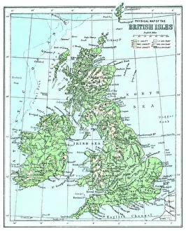
Old chromolithograph map of physical map of the British IslesAntique Illustration, Copyright has expired on this artwork. From my own archives, digitally restored
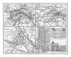
Old chromolithograph illustration of railway network in Berlin, London, Vienna and New YorkCopyright has expired on this artwork. From my own archives, digitally restored
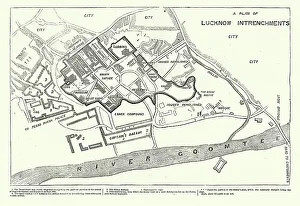
Map of The Residency, Lucknow during the Indian Rebellion, or Sepoy Mutiny of 1857, Victorian military historyVintage illustration Map of The Residency, Lucknow during the Indian Rebellion, or Sepoy Mutiny of 1857, Victorian military history
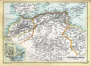
Old Antique map of North Africa, Morocco, Algeria, Tunisia, Libya, detail of Tunis, 1890s, Victorian 19th Century history
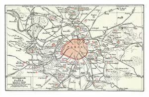
Old chromolithograph map of Paris, capital and most populous city of FranceAntique Illustration, Copyright has expired on this artwork. From my own archives, digitally restored
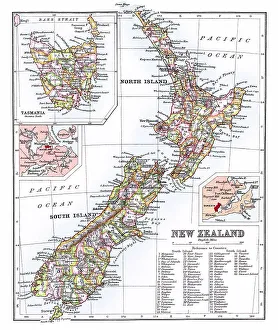
Old chromolithograph map of New Zealand IslandsAntique Illustration, Copyright has expired on this artwork. From my own archives, digitally restored
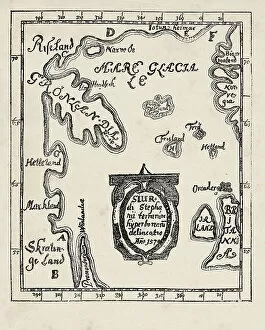
Map of America Greenland Ireland and Great Britain 1570 by Sigur Stephanius 1570 North Atlantic map from the Icelandic geographer Sigurd Stephanius, showing part of western Norway ( Norvegia )
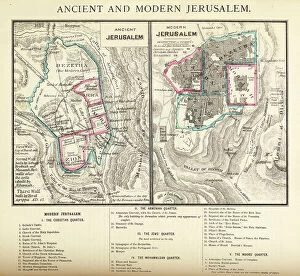
Antique Engraving: Ancient and Modern Jerusalem Map EngravingEngraved illustration of Ancient and Modern Jerusalem Map Engraving from The Popular Pictorial Bible, Containing the Old and New Testaments, Published in 1862. Copyright has expired on this artwork
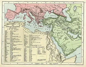
Old Testament MapVintage biblical map from 1879 showing the gentile countries and nations of the Old Testament
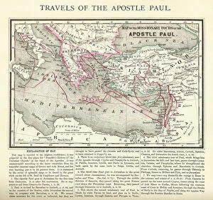
Antique Engraving: Travels of The Apostle Paul Map EngravingEngraved illustration of the Travels of The Apostle Paul Map Engraving from The Popular Pictorial Bible, Containing the Old and New Testaments, Published in 1862
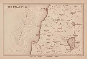
Historical map of North Palestine, lithograph, published in 1891Historical map of North Palestine. Lithograph, published in 1891
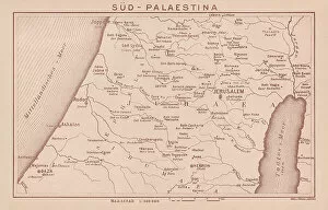
Historical map of South Palestine, lithograph, published in 1891Historical map of Sourth Palestine. Lithograph, published in 1891