mail_outline sales@mediastorehouse.com
3,749 Photographic Prints
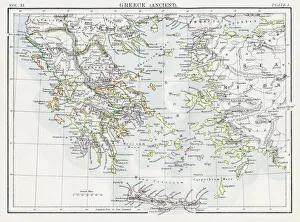
Map of Ancient Greece 1883Encyclopedia Britannica 9th Edition New York Samuel L. Hall 1883 Vol XI
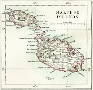
Maltese islands map 1883Encyclopedia Britannica 9th Edition New York Samuel L. Hall 1883 Vol XV
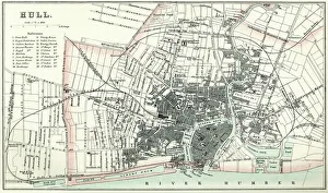
Map of HullVintage map from 1880 of Hull in the East Riding of Yorkshire, England. The city of Hull has served as market town, military supply port, trading hub, fishing and whaling centre
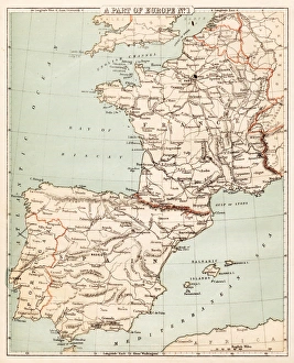
Map of Spain and France 1869Cornells Grammars-School Geography - S.S. Cornell - New York D. Appleton and Company 1869
Antique map of Hadrians wall
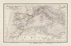
Roman Republic and Carthage during the Second Punic War (218-201-BC)Ancient map of the Roman Republic and Carthage during the Second Punic War (218 to 201 BC). Legend in Latin language. Steel engraving with hand colored borderlines, published in 1861
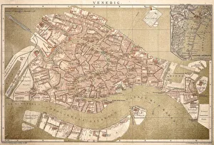
Map of Venice 1898Antique illustration of a Map of Venice 1898
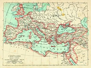
Roman Empire at its height under emperor Trajan 117 ADMap of ancient rome The Roman Empire at its height Emperor Trajan (ruled 98 - 117 AD) was Romes most expansionist ruler, his death marking the high water mark of Romes size
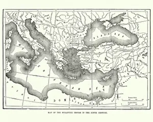
Map of the Byzantine Empire in the 9th CenturyVintage engraving of a Map of the Byzantine Empire in the 9th Century
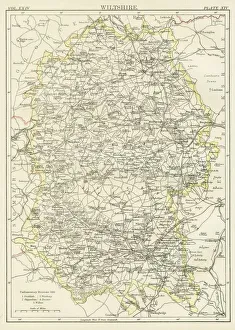
Wiltshire map 1885Encyclopedia Britannica 9th Edition New York Charles Scribners and Sons 1885 Vol XXIV
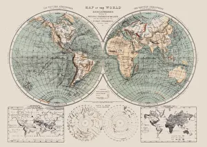
Map of the world 1869Cornells Grammars-School Geography - S.S. Cornell - New York D. Appleton and Company 1869
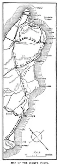
Map of the Cinque Ports (Victorian engraving)An old map of the Cinque Ports, which are five historic ports on the south-eastern corner of Kent, England. The Confederation of Cinque Ports (Cinque is pronounced asinka)
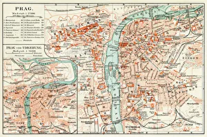
Prague map 1896Meyers Konversations-Lexikon
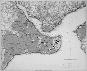
Antique map of Constantinople, present day Istanbul
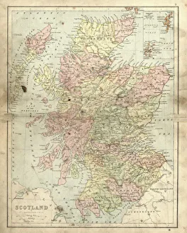
Antique damaged map of Scotland in the 19th CenturyVintage engraving of a Antique damaged map of Scotland in the 19th Century, 1873
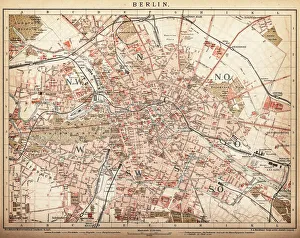
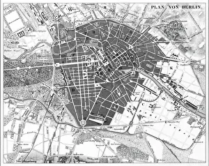
Map of Berlin 1898Historic city map of Berlin, Germany. Lithograph, published in 1898
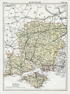
Map of Hampshire 1883Encyclopedia Britannica 9th Edition New York Samuel L. Hall 1883 Vol XI
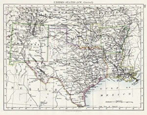
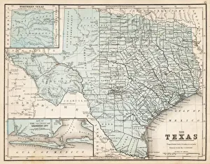
United States South West Central map 1897The World-Wide Atlas of Modern Geography, Political and Physical W. & A.K. Johnston - London 1897
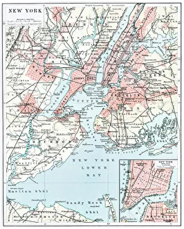
Map of New York city 1896Ilustration of a Map of New York city 1896
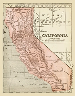
Old map of California 1855System of Geography for the use of schools by Sidney E. Morse - Published by Harper & Brothers - New York 1855
Berlin, Germany MapEngraved illustrations of a Map of the City of Berlin, Germany from Iconographic Encyclopedia of Science, Literature and Art, Published in 1851. Copyright has expired on this artwork
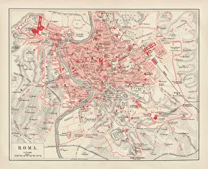
City map of Rome, lithograph, published in 1878City map of Rome, Italy. Lithograph, published in 1878
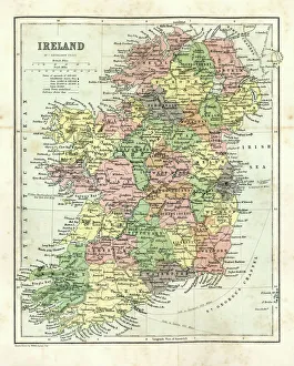
Antique map of Ireland, 1864
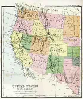
Antique Map of Western USAAntique Map from 1867 of Western United States of America
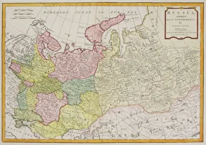
Antique map of Russia
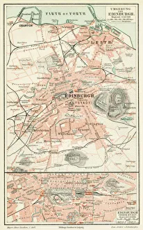
Edinburgh city map 1895Meyers Konversations-Lexikon. Ein Nachschlagewerk des allgemeinen Wissens, 5th edition 17 volumes Bibliographisches Institut - Leipzig 1895-1897
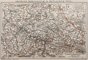
Kingdom of Saxony, Eastern partAntique illustration of a Kingdom of Saxony, Eastern part
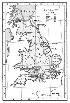
Old map of England in 550Antique Illustration, Copyright has expired on this artwork. From my own archives, digitally restored
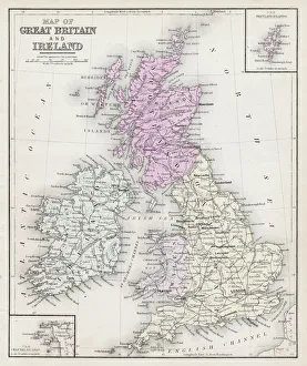
Map of Great Britain and Ireland 1877Warrens Common School Geography 1877
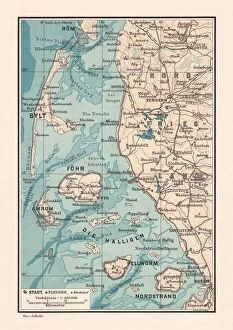
Northern Friesland (Nordfriesland), and islands, Schleswig-Holstein, Germany, lithograph, published 1887North Frisian Islands and Northern Friesland (Nordfriesland), the northernmost district of Germany, part of the state of Schleswig-Holstein. Lithograph, published in 1887
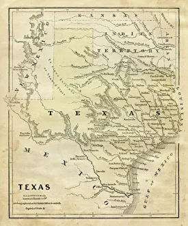
Map of Texas 1867Mitchells Modern Atlas - Published by E.H. Buttler & Co - Philadelphia 1867
Map of Texas 1856Colton and Fitchs Modern School Geography by George W. Fitch - New York 1856
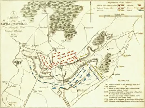
Battle Of WaterlooA plan of the Battle of Waterloo in present-day Belgium during the Napoleonic Wars, 18th June 1815. Here an Anglo-Allied army under the command of the Duke of Wellington defeated the Imperial French
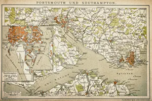
Portsmouth and SouthamptonAntique map of a Portsmouth and Southampton
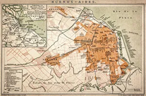
Buenos Aires mapAntique engraving map of Buenos Aires
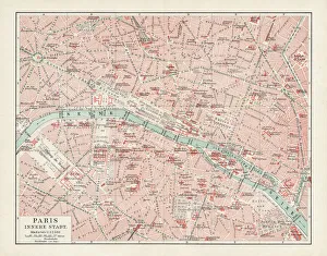
Map of Paris 1900Meyers hand-Atlas Leipzig und Wien Verlag des Bibliographischen Instituts 1900
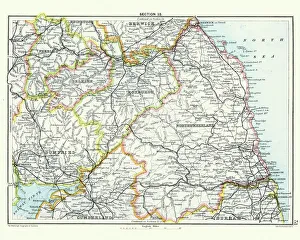
Antique map, Northumberland, Roxburgh, Cumberland 19th CenturyVintage engraving of a Antique map, Northumberland, Roxburgh, Cumberland, Dumfries, Selkirk, Berwick 19th Century
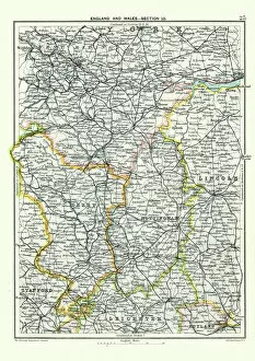
Antique map, West Yorkshire, Derby, Nottingham, Lincoln, 19th CenturyVintage engraving of a Antique map, West Yorkshire, Derby, Nottingham, Lincoln, Stafford, Leicester, Rutland, England. 19th Century
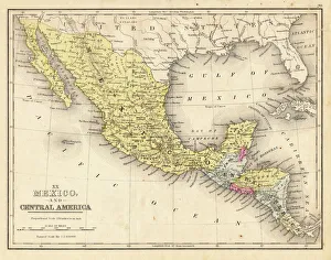
Mexico and Central America map 1867Mitchellas Modern Atlas - Published by E.H. Butler and Co - Philadelphia 1867
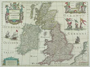
1643, antiquity, archival, british isles, cartography, england, europe, geographical, geography, historical, map, nobody, old-fashioned, text, uk, vintage, Antique Maps, 89687337
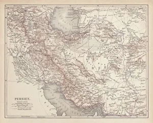
Ancient map of Persia, lithograph, published in 1877Ancient map of Persia. Lithograph, published in 1877
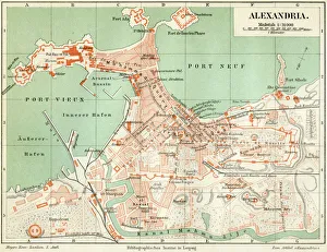
Plan of the old city Alexandria 1895Meyers Konversations-Lexikon. Ein Nachschlagewerk des allgemeinen Wissens, 5th edition 17 volumes Bibliographisches Institut - Leipzig 1895-1897
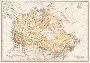
Map of Canada 1878Encyclopedia Britannica 9th Edition Vol II New York, Samuel Hall 1878
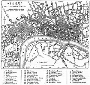
Map of London in the 17th CenturyVintage Map of London in the 17th Century
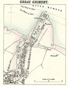
Map of Grimsby" Vintage engraving from 1880 of Great Grimsby a seaport on the Humber Estuary in Lincolnshire, England."
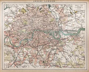
Historic map of London (18th Century)map/plan of the inner city of London from 1898
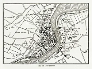
Map of Londonderry, Derry, Donegal, Northern Ireland, Victorian Engraving, 1840Very Rare, Beautifully Illustrated Antique Engraving of Map of Londonderry, Derry, Donegal, Northern Ireland, Victorian Engraving, 1840. Source: Original edition from my own archives
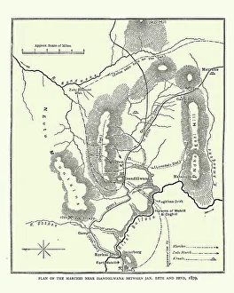
Map of the area around Isandlwana, Anglo-Zulu War, 1879Vintage engraving of Map of the area around Isandlwana, Anglo-Zulu War, 1879