mail_outline sales@mediastorehouse.com
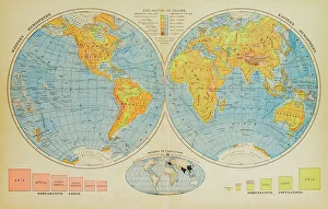
3,748 Canvas Prints
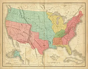
Map of United States 1876Map of United States showing the territorial growth between 1780 and 1876
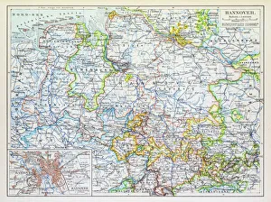
Map of Hannover 1895Map of Hannover, Germany
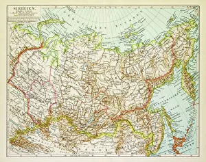
Map of Siberia 1895Map of Siberia
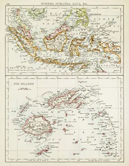
Map of Fiji Sumatra Borneo 1897Map of Fiji, Borneo, Sumatra, java
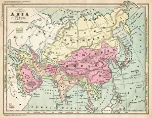
Asia map 1875The Independent Course Comprehensive Geography by James Monteith, A.S. Barnes & Co, New York & Chicago 1875
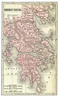
Ancient Greece map 1875The Independent Course Comprehensive Geography by James Monteith, A.S. Barnes & Co, New York & Chicago 1875
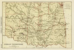
USA indian territories map 1881Encyclopedia Britannica 9th Edition Vol XII Philadelphia j.M. Stoddart & Co 1881
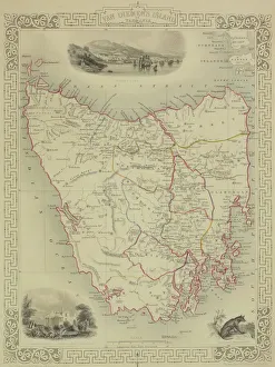
Antique map of Tasmania
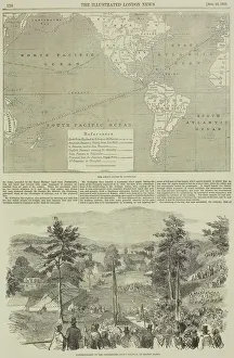
Page from the Illustrated London News with map
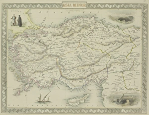
Antique map of Asia Minor
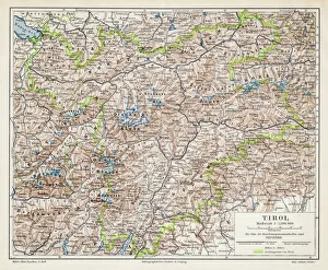
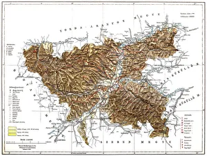
Tyrol map 1895Meyers Konversations-Lexikon. Ein Nachschlagewerk des allgemeinen Wissens, 5th edition 17 volumes Bibliographisches Institut - Leipzig 1895-1897
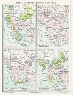
Turkey Ottoman Empire map 1895Meyers Konversations-Lexikon. Ein Nachschlagewerk des allgemeinen Wissens, 5th edition 17 volumes Bibliographisches Institut - Leipzig 1895-1897
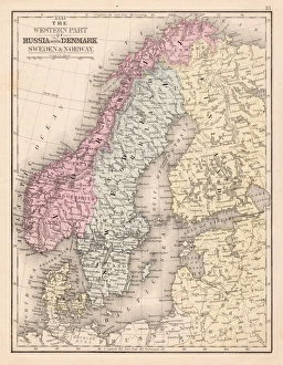
Denmark Sweden Norway map 1867Mitchellas Modern Atlas - Published by E.H. Butler and Co - Philadelphia 1867
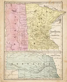
Dakota Missesota Nebraska map 1867Mitchellas Modern Atlas - Published by E.H. Butler and Co - Philadelphia 1867
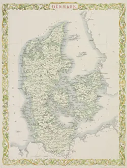
Antique map of Denmark
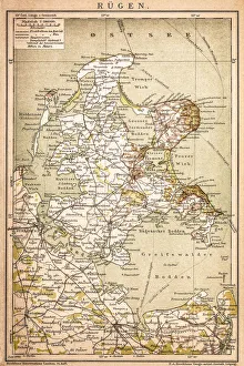
RAOEgenAntique map of RAOEgen
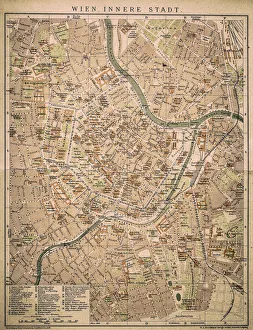
Vienna inner cityAntique map of Vienna from 1898
RomaniaAntique map of Romania
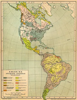
American ethnographic mapIllutration of American ethnographic map
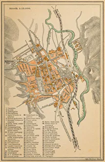
Map of KosiceAntique illustration of a map of Kosice
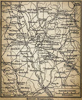
Potteries mapAntique illustration of a Potteries map
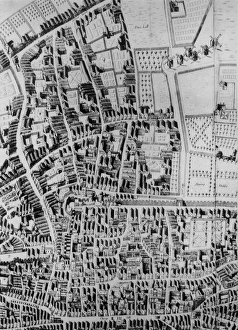
Old City Of LondonA map of the City of London, showing Bunhill Fields, Moorfields and the Old Artillery Yard, 1658. From Richard Newcourts Plan of London (Photo by Hulton Archive/Getty Images)
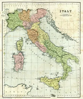
Antique map of Italy, 1864
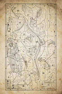
Antique illustration on yellow aged paper: zodiac astrology constellations (series 6)Antique illustration on yellow aged paper: zodiac astrology constellations (series of 12)
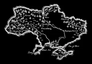
Antique Ukraine MapUkraine Map, - Antique style. Includes mountains and water bodies. High detail - vector illustration
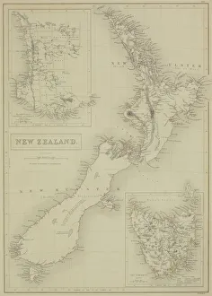
Antique map of New Zealand
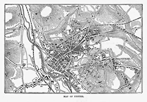
Map of Exeter in Devon, England Victorian Engraving, 1840Very Rare, Beautifully Illustrated Antique Engraving of Map of Exeter in Devon, England Victorian Engraving, 1840. Source: Original edition from my own archives
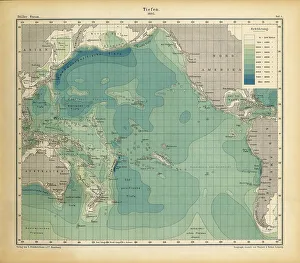
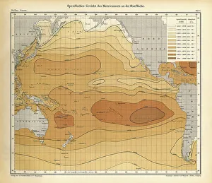
1883 World Map with Populations and specifications of depth and heights
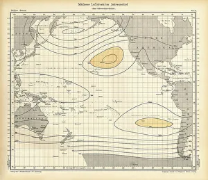
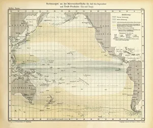
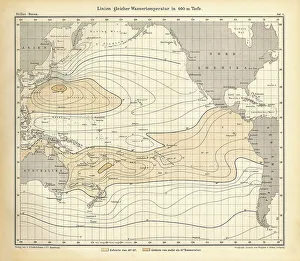
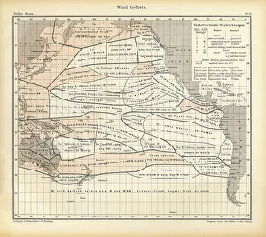
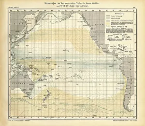
Chart of Weather Patterns in the Pacific Ocean, German Antique Victorian Engraving, 1896Beautifully Illustrated Antique Engraved Victorian Illustration of Antique Chart of Weather Patterns in the Pacific Ocean, German Antique Victorian Engraving, 1896
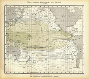
Chart of Weather Patterns in the Pacific Ocean in August, German Antique Victorian Engraving, 1896Beautifully Illustrated Antique Engraved Victorian Illustration of Antique Chart of Weather Patterns in the Pacific Ocean, German Antique Victorian Engraving, 1896
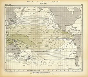
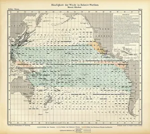
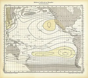
Chart of Weather Patterns in the Pacific Ocean for November, German Antique Victorian Engraving, 1896Beautifully Illustrated Antique Engraved Victorian Illustration of Antique Chart of Weather Patterns in the Pacific Ocean, German Antique Victorian Engraving, 1896
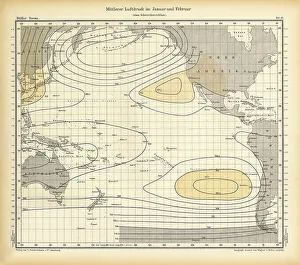
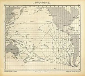
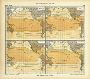
Chart of Weather Patterns in the Pacific Ocean in January and February, German Antique Victorian Engraving, 1896Beautifully Illustrated Antique Engraved Victorian Illustration of Antique Chart of Weather Patterns in the Pacific Ocean, German Antique Victorian Engraving, 1896
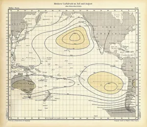
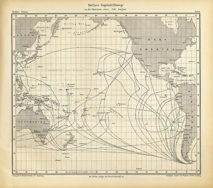
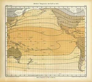
Chart of Weather Patterns in the Pacific Ocean in July and August, German Antique Victorian Engraving, 1896Beautifully Illustrated Antique Engraved Victorian Illustration of Antique Chart of Weather Patterns in the Pacific Ocean, German Antique Victorian Engraving, 1896
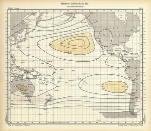
Chart of Weather Patterns in the Pacific Ocean in May, German Antique Victorian Engraving, 1896Beautifully Illustrated Antique Engraved Victorian Illustration of Antique Chart of Weather Patterns in the Pacific Ocean, German Antique Victorian Engraving, 1896
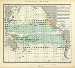
Chart of Weather Patterns in the Pacific Ocean in April, German Antique Victorian Engraving, 1896Beautifully Illustrated Antique Engraved Victorian Illustration of Antique Chart of Weather Patterns in the Pacific Ocean, German Antique Victorian Engraving, 1896
Chart of Weather Patterns in the Pacific Ocean in October, German Antique Victorian Engraving, 1896Beautifully Illustrated Antique Engraved Victorian Illustration of Antique Chart of Weather Patterns in the Pacific Ocean, German Antique Victorian Engraving, 1896
Chart of Weather Patterns in the Pacific Ocean in November, German Antique Victorian Engraving, 1896Beautifully Illustrated Antique Engraved Victorian Illustration of Antique Chart of Weather Patterns in the Pacific Ocean, German Antique Victorian Engraving, 1896