mail_outline sales@mediastorehouse.com
Choose a picture from our collection for your Wall Art and Photo Gifts
1,517 Framed Prints
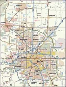
Denver, Colorado area map2011 edition
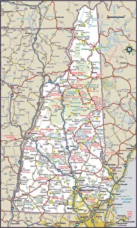
New Hampshire Highway MapReference Maps, Top Sellers Art Prints, 103312572
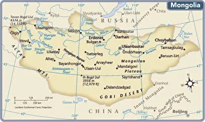
Mongolia country map2011 edition
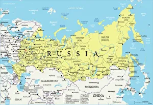
Map of RussiaReference Map of Russia
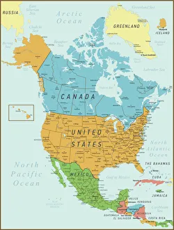
North America Map. Vintage Map with United States, Canada, Mexico and riversNorth America Map with United States, Canada, Mexico and Cuba Map was found
California Highway MapReference Maps, Top Sellers Art Prints, 103312667
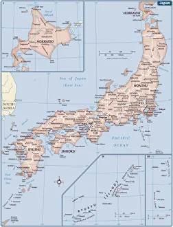
Japan country map2011 edition
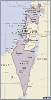
Israel Country Map 2011 EditionIsrael is a country in the Middle East, located at the eastern end of the Mediterranean Sea. It is bounded to the north by Lebanon, to the northeast by Syria, to the east and southeast by Jordan
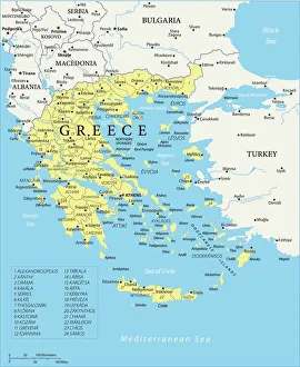
Map of Greece - Vector illustration
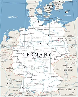
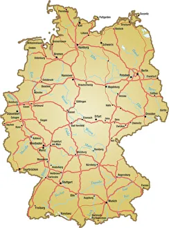
Map of Germany - Vector illustration
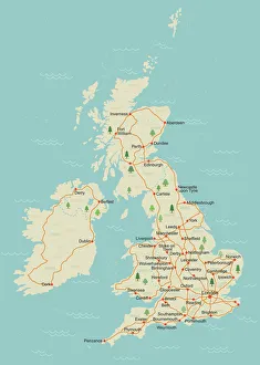
Simple UK mapA simple UK map with roads and major towns and cities named. There is a very slight grunge texture on sea and land, this is on separate layers and are easy to remove. 11 layers in all
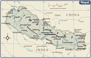
Nepal country map2011 edition
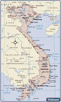
Vietnam country map2011 edition
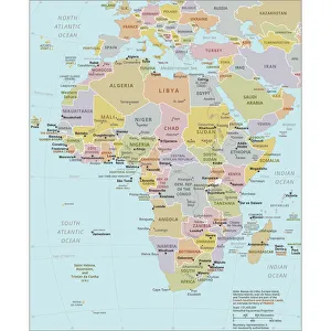
Political Map of AfricaVector Illustration of the policital map of Africa Reference map as created by the US Central Intelligence Agency
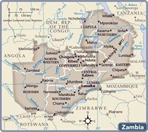
Zambia country map2011 edition
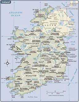
Ireland country map2011 edition
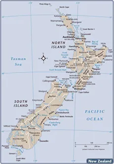
New Zealand country map2011 edition
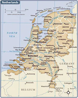
Netherlands country map2011 edition
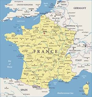
Map of France - Vector illustration
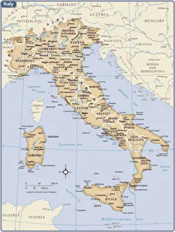
Italy country map2011 edition
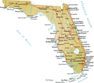
Map of FloridaVector illustratio of map of Florida with major roads, rivers and lakes
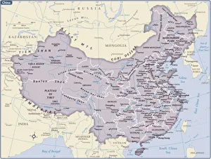
China country map2011 edition
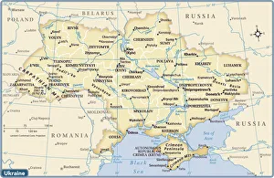
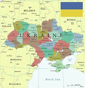
Ukraine country map2011 edition
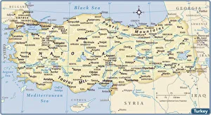
Turkey country map2011 edition
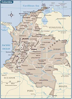
Colombia country map2011 edition
Ukraine Reference Map
Map of Germany with all names of the main citiesvector illustration of map of germany with major roads, lakes and rivers
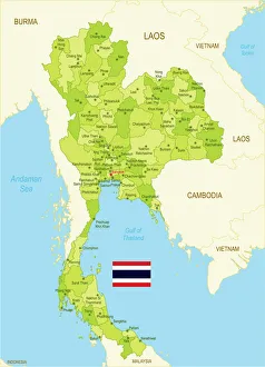
Flat map of Thailand with flagDetailed map of Thailand with surroundings, provinces, capital and flag
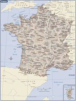
France country map2011 edition
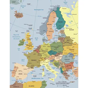
Political map of EuropeVector illustration of the policital map of Europe Reference map was created by the US Central Intelligence Agency and is available as a public domain map at the University of Texas Libraries
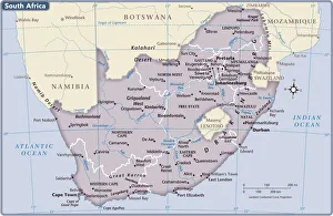
South Africa country map2011 edition
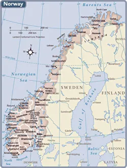
Norway country map2011 edition
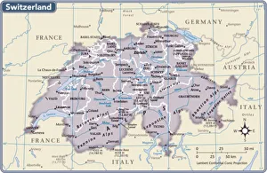
Switzerland country map2011 edition
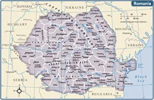
Romania country map2011 edition
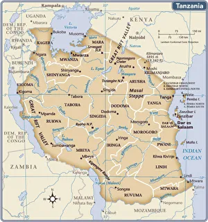
Tanzania country map2011 edition
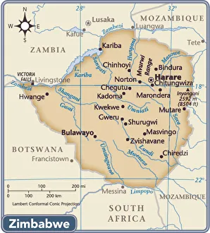
Zimbabwe country map2011 edition
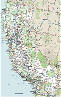
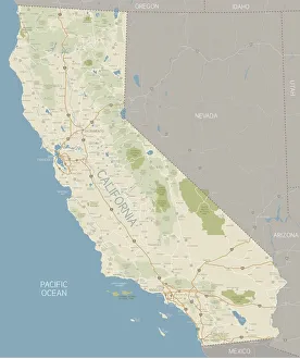
California MapA detailed map of California state with cities, roads, major rivers, and lakes plus National Parks and National Forests. Includes neighboring states and surrounding water
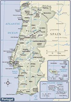
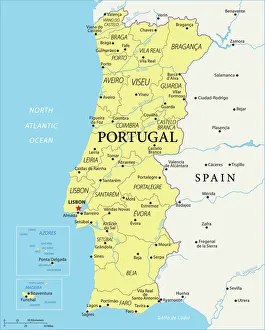
Portugal country map2011 edition
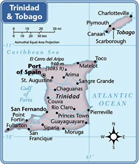
Trinidad and Tobago country map2011 edition
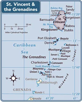
St. Vincent and the Grenadines country map2011 edition
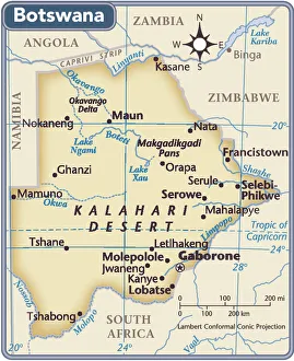
Botswana country map2011 edition
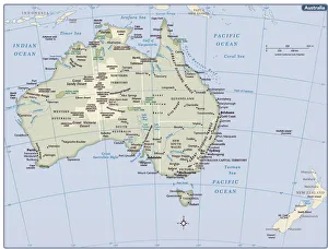
Australia country map2011 edition
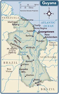
Guyana country map2011 edition
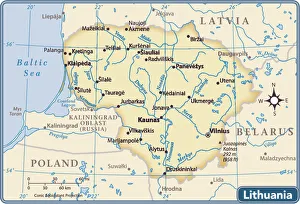
Lithuania country map2011 edition
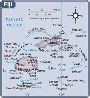
Fiji Country MapLocated in the continent of Oceania, Fiji covers 18, 274 square kilometers of land, making it the 158th largest nation in terms of land area
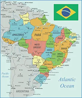
Brazil Map with Rivers and National FlagVintage Map of Brazil. Vector Illustration with Rivers and National Flag
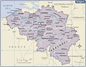
Belgium country map2011 edition
Portugal Reference Maps977815000