mail_outline sales@mediastorehouse.com
1,517 Framed Prints
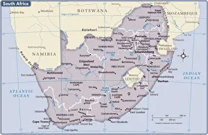
South Africa country map2011 edition
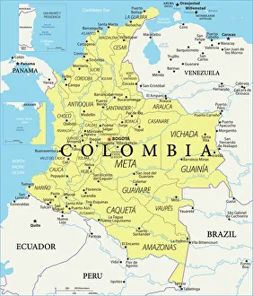
Colombia Reference Map
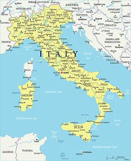
Italy Reference Map950857450
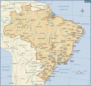
Brazil country map2011 edition
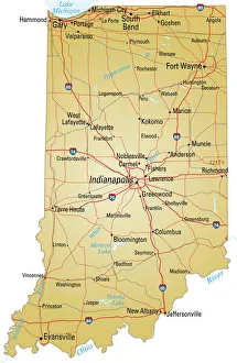
Map of IndianaVector illustration of map of Indiana with major roads, rivers and lakes
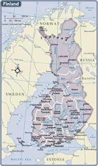
Finland country map2011 edition
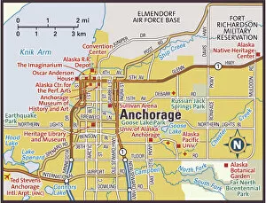
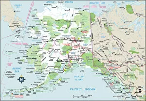
Anchorage, Alaska area map2011 edition
103312677Reference Maps, 103312677
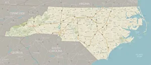
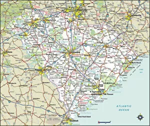
North Carolina MapA detailed map of North Carolina state with cities, roads, major rivers, and lakes. Includes neighboring states and surrounding water
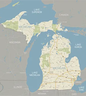
Michigan MapA detailed map of the Michigan. Includes major highways, cities, rivers and lakes. Elements are grouped and separate for easy color changes
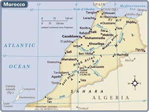
Morocco country map2011 edition
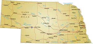
Map of NebraskaVector illustration of map of Nebraska with major roads, rivers and lakes
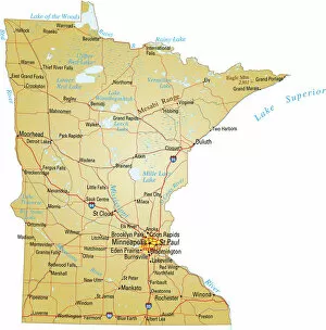
Map of MinnesotaVector illustration of map of Minnesota with major roads, rivers and lakes
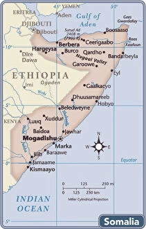
Somalia country map2011 edition
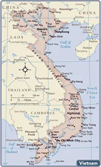
Vietnam country map2011 edition
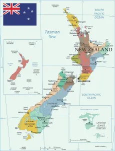
Map of New ZealandLabelled Map of New Zealand with flag illustration
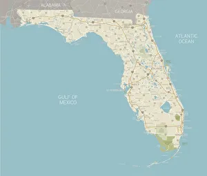
Florida State MapA detailed map of Florida state with cities, roads, major rivers, and lakes plus National Parks and National Forests. Includes neighboring states and surrounding water
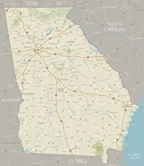
Georgia MapA detailed map of Georgia state with cities, roads, major rivers, and lakes. Includes neighboring states and surrounding water
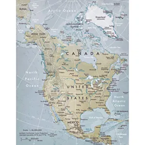
Physical map of North AmericaVector illustration of the physical map of North America Reference map was created by the US Central Intelligence Agency and is available as a public domain map at the University of Texas Libraries
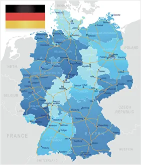
Germany - road mapHighly detailed map of Germany with roads, administrative divisions and cities
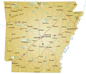
Map of ArkansasVector illustration of map of Arkansas with major roads, rivers and lakes
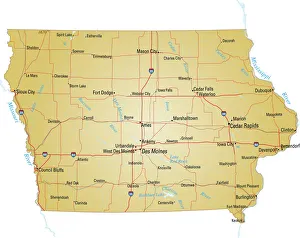
Map of IowaVector illustration of map of Iowa with major roads, rivers and lakes
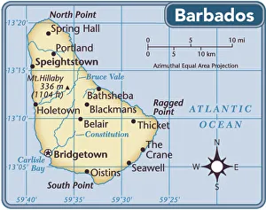
Barbados country map2011 edition
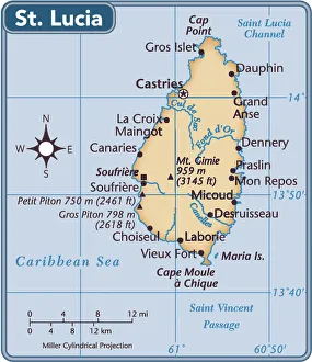
St. Lucia country map2011 edition
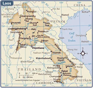
Laos country map2011 edition
103312563Reference Maps, 103312563
103312560Reference Maps, 103312560
103312664Reference Maps, 103312664
103312681Reference Maps, 103312681
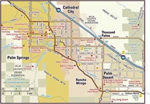
Palm Springs area map2010 edition
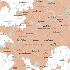
MA Middlesex Westford Vector Road Map. All source data is in the public domain. U.S. Census Bureau Census Tiger. Used Layers: areawater, linearwater, roads, rails, cousub, pointlm, uac10
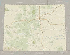
Colorado MapA detailed map of Colorado state with cities, roads, major rivers, national forests, monuments, and major lakes. Includes neighboring states and surrounding water
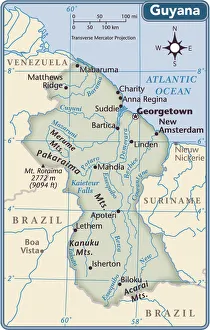
Guyana country map2011 edition
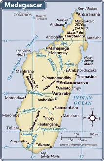
Madagascar country map2011 edition
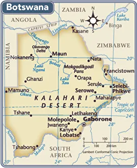
Botswana country map2011 edition
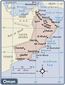
Oman country map2011 edition
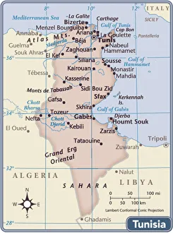
Tunisia country map2011 edition
103312666Reference Maps, 103312666
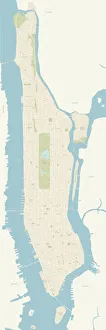
Map of ManhattanA very detailed map of Manhattan in New York City. Includes all roads and highways. Also includes parks, neighborhoods and points of interest
Sacramento Downtown MapA detailed map of downtown Sacramento. Includes freeways, main roads, as well as parks and points of interest, all on separate layers. Includes CS3 file and an extra-large JPG
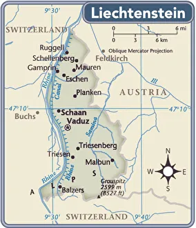
Liechtenstein country map2011 edition
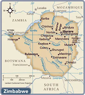
Zimbabwe country map2011 edition
103745761Reference Maps, 103745761
103745673Reference Maps, 103745673
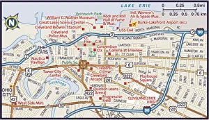
Downtown Cleveland, Ohio2011 edition
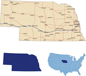
Nebraska road mapillustration of Nebraska state road map for your design and products
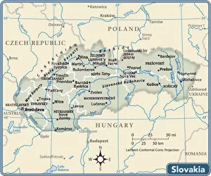
Slovakia country map2011 edition
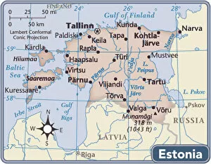
Estonia country map2011 edition