mail_outline sales@mediastorehouse.com
800 Framed Prints
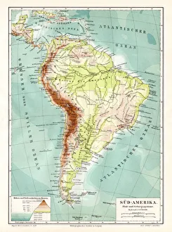
South America geological map 1895Meyers Konversations-Lexikon. Ein Nachschlagewerk des allgemeinen Wissens, 5th edition 17 volumes Bibliographisches Institut - Leipzig 1895-1897
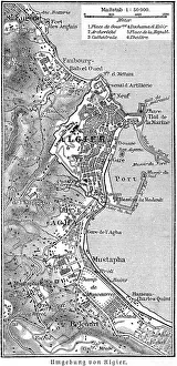
Algeria surroundings map 1895Meyers Konversations-Lexikon. Ein Nachschlagewerk des allgemeinen Wissens, 5th edition 17 volumes Bibliographisches Institut - Leipzig 1895-1897
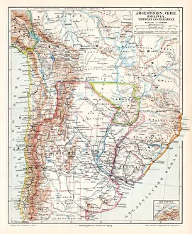
Argentina Chile Bolivia map 1895Meyers Konversations-Lexikon. Ein Nachschlagewerk des allgemeinen Wissens, 5th edition 17 volumes Bibliographisches Institut - Leipzig 1895-1897
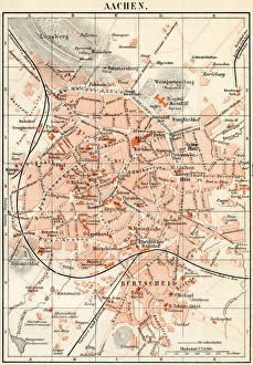
Aachen city map 1895Meyers Konversations-Lexikon. Ein Nachschlagewerk des allgemeinen Wissens, 5th edition 17 volumes Bibliographisches Institut - Leipzig 1895-1897
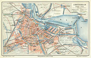
Amsterdam city map 1895Meyers Konversations-Lexikon. Ein Nachschlagewerk des allgemeinen Wissens, 5th edition 17 volumes Bibliographisches Institut - Leipzig 1895-1897
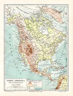
North America geological map 1895Meyers Konversations-Lexikon. Ein Nachschlagewerk des allgemeinen Wissens, 5th edition 17 volumes Bibliographisches Institut - Leipzig 1895-1897
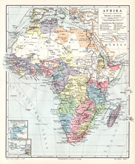
Africa political map 1895Meyers Konversations-Lexikon. Ein Nachschlagewerk des allgemeinen Wissens, 5th edition 17 volumes Bibliographisches Institut - Leipzig 1895-1897
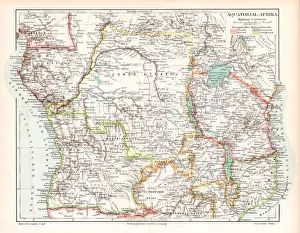
Equatorial Guinea map 1895Meyers Konversations-Lexikon. Ein Nachschlagewerk des allgemeinen Wissens, 5th edition 17 volumes Bibliographisches Institut - Leipzig 1895-1897
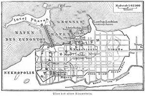
Plan of the old city Alexandria 1895Meyers Konversations-Lexikon. Ein Nachschlagewerk des allgemeinen Wissens, 5th edition 17 volumes Bibliographisches Institut - Leipzig 1895-1897
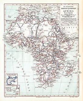
Main research trips in Africa 1895Meyers Konversations-Lexikon. Ein Nachschlagewerk des allgemeinen Wissens, 5th edition 17 volumes Bibliographisches Institut - Leipzig 1895-1897
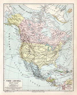
North America political map 1895Meyers Konversations-Lexikon. Ein Nachschlagewerk des allgemeinen Wissens, 5th edition 17 volumes Bibliographisches Institut - Leipzig 1895-1897
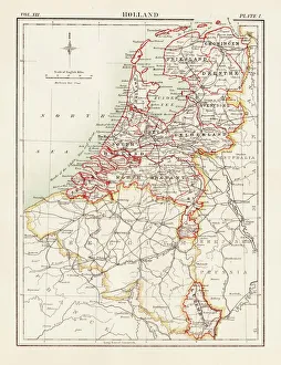
Holland map 1881Encyclopedia Britannica 9th Edition Vol XII Philadelphia j.M. Stoddart & Co 1881
Iowa USA map 1881Encyclopedia Britannica 9th Edition Vol XII Philadelphia j.M. Stoddart & Co 1881
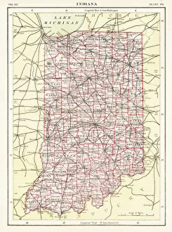
Indiana USA map 1881Encyclopedia Britannica 9th Edition Vol XII Philadelphia j.M. Stoddart & Co 1881
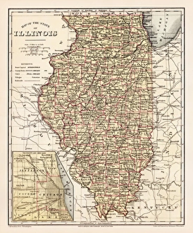
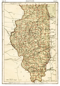
Illinois map 1881Encyclopedia Britannica 9th Edition Vol XII Philadelphia j.M. Stoddart & Co 1881
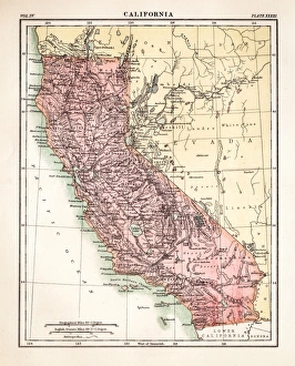
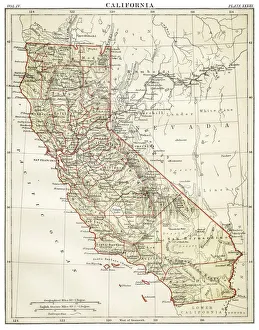
California map engraving 1877Encyclopedia Britannica 9th Edition Vol IV Philadelphia j.M. Stoddart & Co 1877
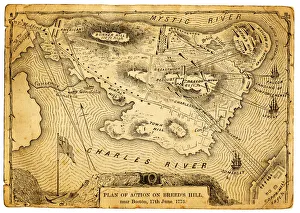
Plan of action at the Battle on Breeds HillVintage engraving of the Plan of action at the Battle of Breeds Hill (also known as the Battle of Bunker Hill), Near Boston on 17th June 1775. Part of the American War of IndependenceView more
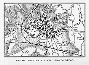
Map of Coventry in Warwickshire, England Victorian Engraving, 1840Very Rare, Beautifully Illustrated Antique Engraving of Map of Coventry in Warwickshire, England Victorian Engraving, 1840. Source: Original edition from my own archives
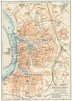
DAOEsseldorf map 1895Meyers Konversations-Lexikon. Ein Nachschlagewerk des allgemeinen Wissens, 5th edition 17 volumes Bibliographisches Institut - Leipzig 1895-1897
State and private railways map 1895Meyers Konversations-Lexikon. Ein Nachschlagewerk des allgemeinen Wissens, 5th edition 17 volumes Bibliographisches Institut - Leipzig 1895-1897
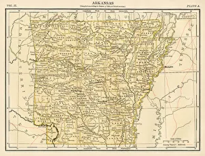
Arkansas map 1878Encyclopedia Britannica 9th Edition Vol II New York, Samuel Hall 1878
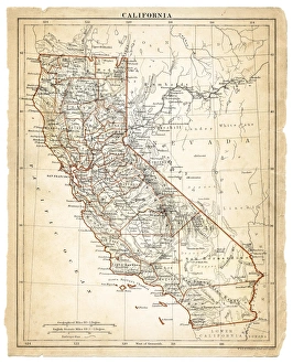
Map of California 1878Encyclopedia Britannica 9th Edition Vol II New York, Samuel Hall 1878
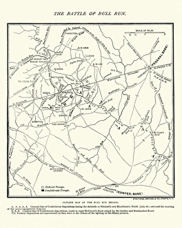
Map of the Battle of Bull RunVintage engraving of a Map of the Battle of Bull Run, The Century Magazine, 1884
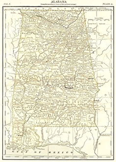
Alabama map 1878Encyclopedia Britannica 9th Edition Vol I New York, Samuel Hall 1878
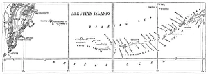
Aleutian islands map 1878Encyclopedia Britannica 9th Edition Vol I New York, Samuel Hall 1878
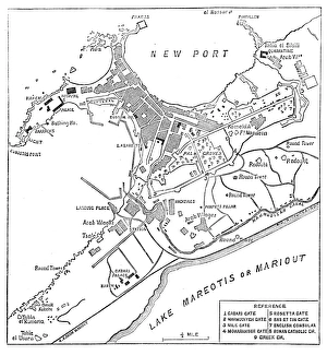
Alexandria map 1878Encyclopedia Britannica 9th Edition Vol I New York, Samuel Hall 1878
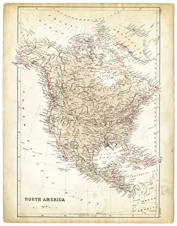
North America map 1878Encyclopedia Britannica 9th Edition Vol I New York, Samuel Hall 1878
South America map 1878Encyclopedia Britannica 9th Edition Vol I New York, Samuel Hall 1878
Antique damaged map of North America in the 19th CenturyVintage engraving of a Antique map of North America in the 19th Century, 1873
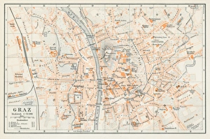
Graz Austria map 1895Encyclopedia Britannica 9th Edition Vol I New York, Samuel Hall 1878
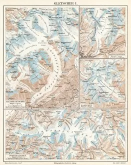
Glacier lithograph 1895Encyclopedia Britannica 9th Edition Vol I New York, Samuel Hall 1878
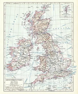
Great Britain and England map 1895Encyclopedia Britannica 9th Edition Vol I New York, Samuel Hall 1878
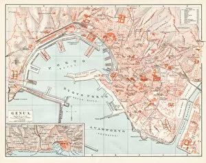
Genoa Itlay map 1895Encyclopedia Britannica 9th Edition Vol I New York, Samuel Hall 1878
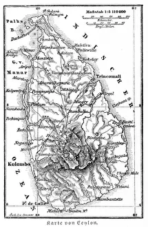
Srilanka former Ceylon map 1895Meyers Konversations-Lexikon. Ein Nachschlagewerk des allgemeinen Wissens, 5th edition 17 volumes Bibliographisches Institut - Leipzig 1895-1897
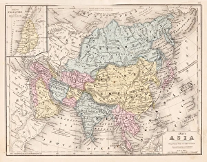
Asia map 1867Mitchellas Modern Atlas - Published by E.H. Butler and Co - Philadelphia 1867
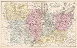
Ohio Indiana Illinois map 1867Mitchellas Modern Atlas - Published by E.H. Butler and Co - Philadelphia 1867
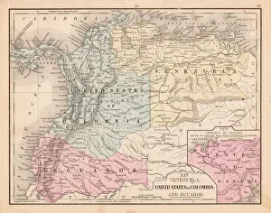
Colombia Ecuador Venezuela map 1867Mitchellas Modern Atlas - Published by E.H. Butler and Co - Philadelphia 1867
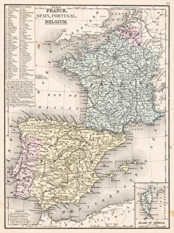
Spain France Portugal map 1867Mitchellas Modern Atlas - Published by E.H. Butler and Co - Philadelphia 1867
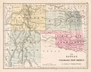
Kansas Colorado New Mexico map 1867Mitchellas Modern Atlas - Published by E.H. Butler and Co - Philadelphia 1867
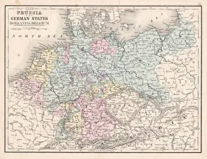
Prussia and German states map 1867Mitchellas Modern Atlas - Published by E.H. Butler and Co - Philadelphia 1867
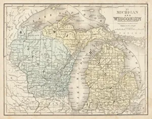
Wisconsin MIchigan map 1867Mitchellas Modern Atlas - Published by E.H. Butler and Co - Philadelphia 1867
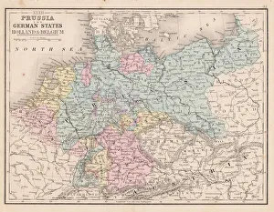
Prussia and german states map 1867Mitchellas Modern Atlas - Published by E.H. Butler and Co - Philadelphia 1867
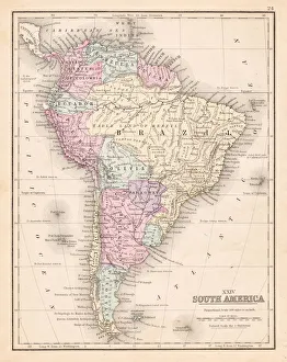
South America map 1867Mitchellas Modern Atlas - Published by E.H. Butler and Co - Philadelphia 1867
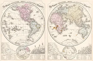
Easter hemisphere map 1867Mitchellas Modern Atlas - Published by E.H. Butler and Co - Philadelphia 1867
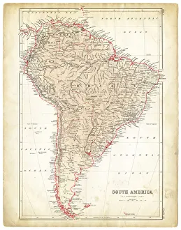
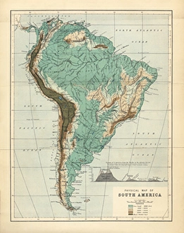
South America Physical Map, Engraving, 1892Very rare, beautifully detailed engraving of South America Physical Map, Engraving, Published in 1892. Original edition from my own archives. Copyright has expired on this artwork. Digitally restored
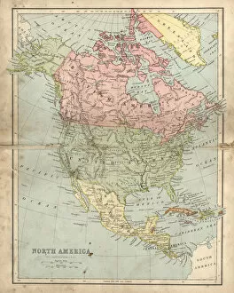
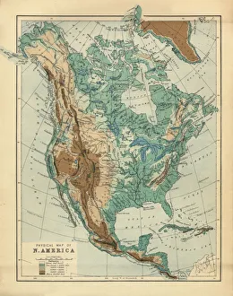
North America Physical Map, Engraving, 1892Very rare, beautifully detailed engraving of North America Physical Map, Engraving, Published in 1892. Original edition from my own archives. Copyright has expired on this artwork. Digitally restored