mail_outline sales@mediastorehouse.com
800 Framed Prints
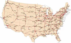
USA highway mapillustration of USA highway map for your design and products
Map of Midwest USAChicago
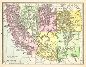
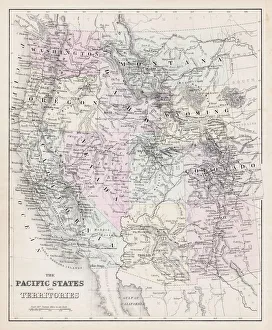
Map of Pacific States USA 1895The Rand-McNally Grammar School Geography 1895 - Chicago & New York
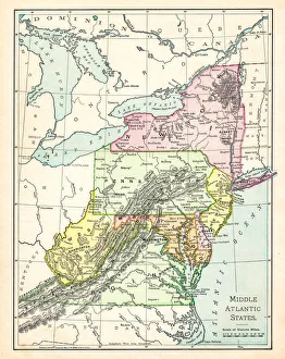
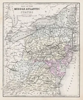
Map of middle atlantic states USA 1895The Rand-McNally Grammar School Geography 1895 - Chicago & New York
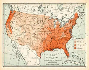
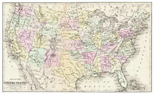
Map of United States 1895The Rand-McNally Grammar School Geography 1895 - Chicago & New York
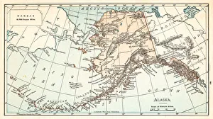
Map of Alaska 1895The Rand-McNally Grammar School Geography 1895 - Chicago & New York
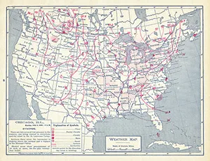
Weather map of United States 1895The Rand-McNally Grammar School Geography 1895 - Chicago & New York
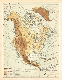
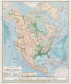
Physical map of North America 1895The Rand-McNally Grammar School Geography 1895 - Chicago & New York
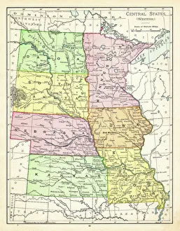
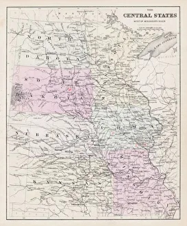
Map of central states USA 1895The Rand-McNally Grammar School Geography 1895 - Chicago & New York
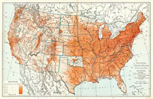
Political Map of United States 1895The Rand-McNally Grammar School Geography 1895 - Chicago & New York
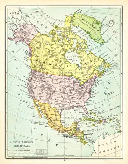
Political Map of North America 1895The Rand-McNally Grammar School Geography 1895 - Chicago & New York
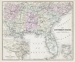
Map of Southern States USA 1877Warrens Common School Geography 1877
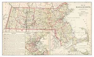
Map of Massachusetts 1877Warrens Common School Geography 1877
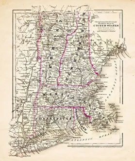
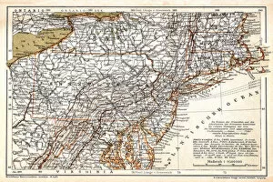
Map Middle atlantic states 1877Warrens Common School Geography 1877
Map of USA 1877Warrens Common School Geography 1877
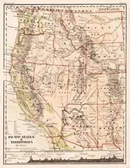
Map of Pacific States USA 1877Warrens Common School Geography 1877
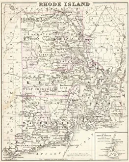
Rhode Island map 1877Warrens Common School Geography 1877
Map of central States USA 1877Warrens Common School Geography 1877
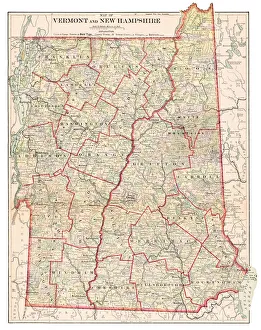
Vermont and New Hampshire 1877Warrens Common School Geography 1877
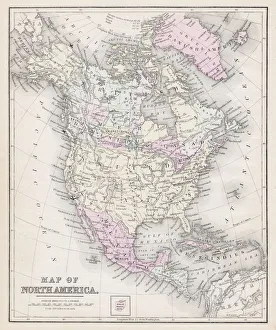
Map of North America 1877Warrens Common School Geography 1877
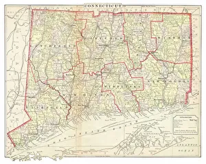
Map of Connecticut 1877Warrens Common School Geography 1877
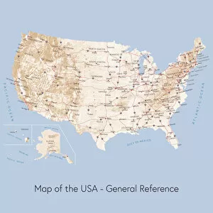
Map of the USA general referenceVector illustration of a map of the United States of America. The reference map used in the creation of this illustration is public domain map available at the University of Texas website: http
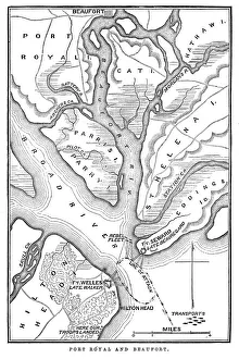
Battle of Port RoyalVintage engraving from 1863 of a map of the Battle of Port Royal which was one of the earliest amphibious operations of the American Civil War
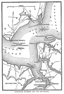
Fort Monroe and its environsVintage engraving from 1863 of a map of Fort Monroe and its environs. Fort Monroe played an important role in the American Civil War
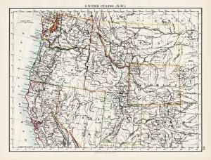
United States North West map 1897The World-Wide Atlas of Modern Geography, Political and Physical W. & A.K. Johnston - London 1897
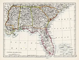
United States South East map 1897The World-Wide Atlas of Modern Geography, Political and Physical W. & A.K. Johnston - London 1897
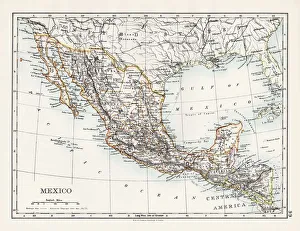
Mexico map 1897The World-Wide Atlas of Modern Geography, Political and Physical W. & A.K. Johnston - London 1897
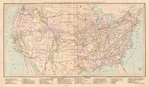
USA Railroad map 1881Coltons Common School Geography 1881 New York Sheldon and Co
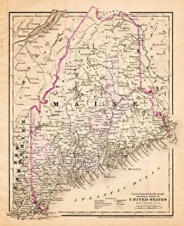
Maine USA map 1881Coltons Common School Geography 1881 New York Sheldon and Co
USA Pacific states map 1867Guyots Geographical Series The Earth and its inhabitants 1867 New York
USA map Vermont, Connecticut 1881Coltons Common School Geography 1881 New York Sheldon and Co
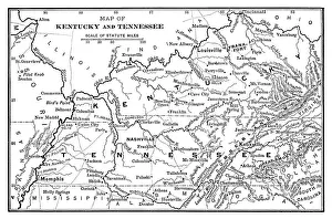
Map of Kentucky and Tennessee - Scanned 1886 Map
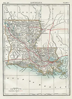
Map of Louisiana 1883Encyclopedia Britannica 9th Edition New York Samuel L. Hall 1883 Vol XV
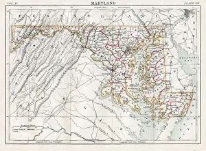
Map of Maryland 1883Encyclopedia Britannica 9th Edition New York Samuel L. Hall 1883 Vol XV
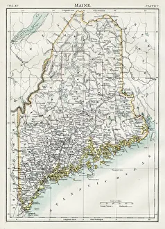
Map of Maine 1883Encyclopedia Britannica 9th Edition New York Samuel L. Hall 1883 Vol XV
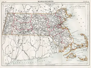
Map of Massachusetts 1883Encyclopedia Britannica 9th Edition New York Samuel L. Hall 1883 Vol XV
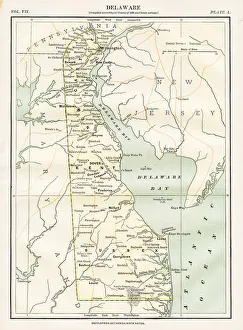
Map of Delaware 1883Encyclopedia Britannica 9th Edition New York Samuel L. Hall 1883 Vol VII
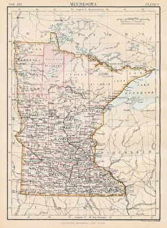
Minnesota map 1883Encyclopedia Britannica 9th Edition New York Samuel L. Hall 1883 Vol XVI
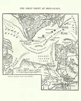
Map of the Battle of Hampton RoadsVintage engraving of a Map of the Battle of Hampton Roads, often referred to as either the Battle of the Monitor and Merrimack (or Virginia) or the Battle of Ironclads
North Eastern States USA mapIllustration of a North Eastern States USA map
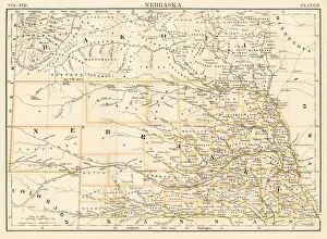
Nebraska map 1884Encyclopedia Britannica 9th Edition New York Charles Scribners and Sonsl 1884 Vol XVII
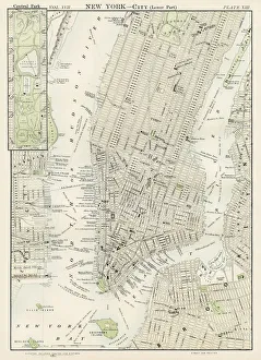
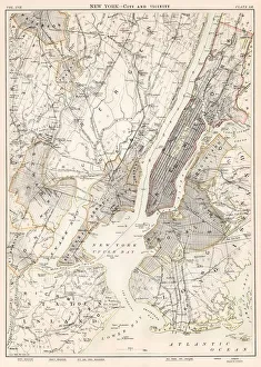
New York city map 1884Encyclopedia Britannica 9th Edition New York Charles Scribners and Sonsl 1884 Vol XVII
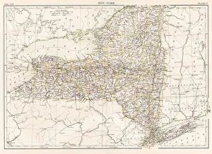
New York map 1884Encyclopedia Britannica 9th Edition New York Charles Scribners and Sonsl 1884 Vol XVII
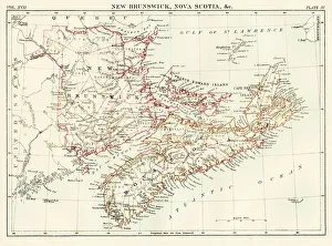
New Brunswick Nova Scotia map 1884Encyclopedia Britannica 9th Edition New York Charles Scribners and Sonsl 1884 Vol XVII
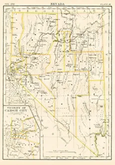
Nevada map 1884Encyclopedia Britannica 9th Edition New York Charles Scribners and Sonsl 1884 Vol XVII