mail_outline sales@mediastorehouse.com
800 Items
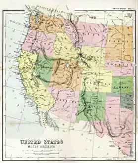
Antique Map of Western USAAntique Map from 1867 of Western United States of America
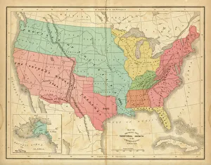
Map of United States 1876Map of United States showing the territorial growth between 1780 and 1876
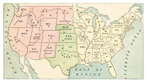
United States map 1875The Independent Course Comprehensive Geography by James Monteith, A.S. Barnes & Co, New York & Chicago 1875
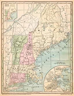
USA New England states map 1875The Independent Course Comprehensive Geography by James Monteith, A.S. Barnes & Co, New York & Chicago 1875
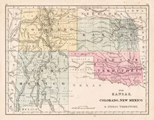
Kansas Colorado New Mexico map 1867Mitchellas Modern Atlas - Published by E.H. Butler and Co - Philadelphia 1867
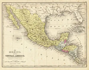
Mexico and Central America map 1867Mitchellas Modern Atlas - Published by E.H. Butler and Co - Philadelphia 1867
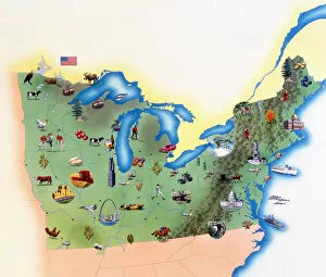
USA, Northern States of America, map with illustrations showing distinguishing features
Corbis CollectionFine Art Storehouse Corbis Collection
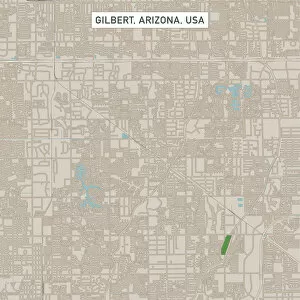
Gilbert Arizona US City Street MapVector Illustration of a City Street Map of Gilbert, Arizona, USA. Scale 1:60, 000. All source data is in the public domain. U.S
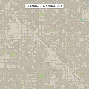
Glendale Arizona US City Street MapVector Illustration of a City Street Map of Glendale, Arizona, USA. Scale 1:60, 000. All source data is in the public domain. U.S
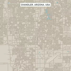
Chandler Arizona US City Street MapVector Illustration of a City Street Map of Chandler, Arizona, USA. Scale 1:60, 000. All source data is in the public domain. U.S
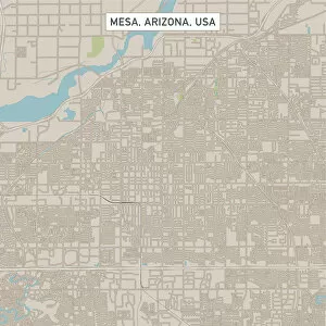
Mesa Arizona US City Street MapVector Illustration of a City Street Map of Mesa, Arizona, USA. Scale 1:60, 000. All source data is in the public domain. U.S
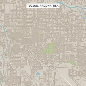
Tucson Arizona US City Street MapVector Illustration of a City Street Map of Tucson, Arizona, USA. Scale 1:60, 000. All source data is in the public domain. U.S
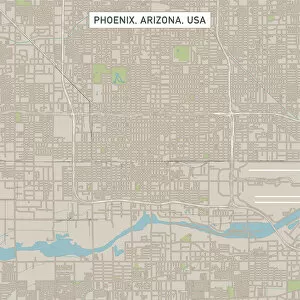
Phoenix Arizona US City Street MapVector Illustration of a City Street Map of Phoenix, Arizona, USA. Scale 1:60, 000. All source data is in the public domain. U.S
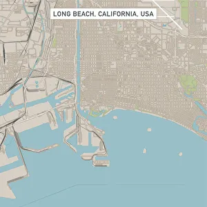
Long Beach California US City Street MapVector Illustration of a City Street Map of Long Beach, California, USA. Scale 1:60, 000. All source data is in the public domain. U.S
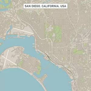
San DiegoCaliforniaUSCityStreetMap_60000Vector Illustration of a City Street Map of San Diego, California, USA. Scale 1:60, 000. All source data is in the public domain. U.S
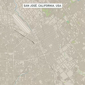
San Jose California US City Street MapVector Illustration of a City Street Map of San Jose, California, USA. Scale 1:60, 000. All source data is in the public domain. U.S
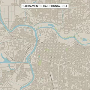
Sacramento California US City Street MapVector Illustration of a City Street Map of Sacramento, California, USA. Scale 1:60, 000. All source data is in the public domain. U.S
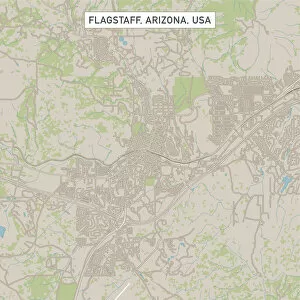
Flagstaff Arizona US City Street MapVector Illustration of a City Street Map of Flagstaff, Arizona, USA. Scale 1:60, 000. All source data is in the public domain. U.S
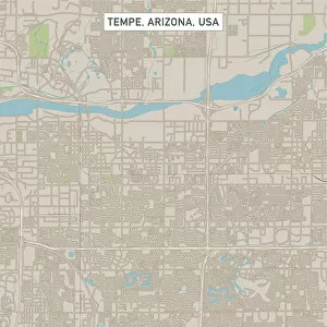
Tempe Arizona US City Street MapVector Illustration of a City Street Map of Tempe, Arizona, USA. Scale 1:60, 000. All source data is in the public domain. U.S
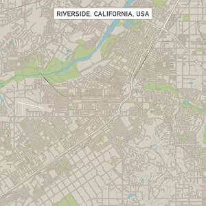
Riverside California US City Street MapVector Illustration of a City Street Map of Riverside, California, USA. Scale 1:60, 000. All source data is in the public domain. U.S
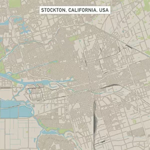
Stockton California US City Street MapVector Illustration of a City Street Map of Stockton, California, USA. Scale 1:60, 000. All source data is in the public domain. U.S
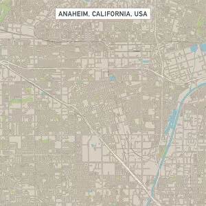
Anaheim California US City Street MapVector Illustration of a City Street Map of Anaheim, California, USA. Scale 1:60, 000. All source data is in the public domain. U.S
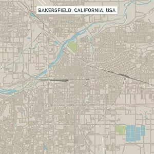
Bakersfield California US City Street MapVector Illustration of a City Street Map of Bakersfield, California, USA. Scale 1:60, 000. All source data is in the public domain. U.S
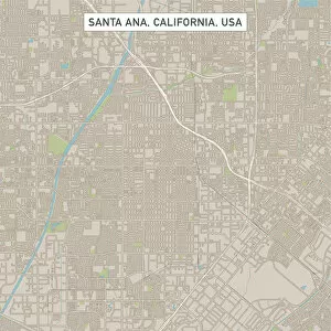
Santa Ana California US City Street MapVector Illustration of a City Street Map of Santa Ana, California, USA. Scale 1:60, 000. All source data is in the public domain. U.S
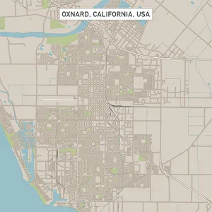
Oxnard California US City Street MapVector Illustration of a City Street Map of Oxnard, California, USA. Scale 1:60, 000. All source data is in the public domain. U.S
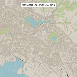
Fremont California US City Street MapVector Illustration of a City Street Map of Fremont, California, USA. Scale 1:60, 000. All source data is in the public domain. U.S
Fontana California US City Street MapVector Illustration of a City Street Map of Fontana, California, USA. Scale 1:60, 000. All source data is in the public domain. U.S
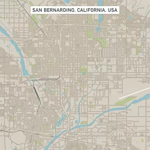
San Bernardino California US City Street MapVector Illustration of a City Street Map of San Bernardino, California, USA. Scale 1:60, 000. All source data is in the public domain. U.S
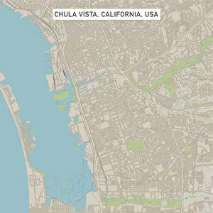
Chula Vista California US City Street MapVector Illustration of a City Street Map of Chula Vista, California, USA. Scale 1:60, 000. All source data is in the public domain. U.S
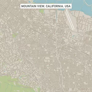
Mountain View California US City Street MapVector Illustration of a City Street Map of Mountain View, California, USA. Scale 1:60, 000. All source data is in the public domain. U.S
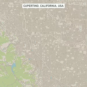
Cupertino California US City Street MapVector Illustration of a City Street Map of Cupertino, California, USA. Scale 1:60, 000. All source data is in the public domain. U.S
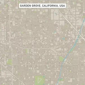
Garden Grove California US City Street MapVector Illustration of a City Street Map of Garden Grove, California, USA. Scale 1:60, 000. All source data is in the public domain. U.S
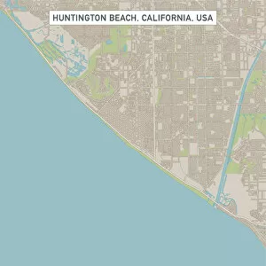
Huntington Beach California US City Street MapVector Illustration of a City Street Map of Huntington Beach, California, USA. Scale 1:60, 000. All source data is in the public domain. U.S
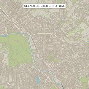
Glendale California US City Street MapVector Illustration of a City Street Map of Glendale, California, USA. Scale 1:60, 000. All source data is in the public domain. U.S
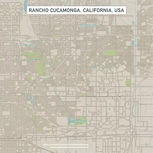
Rancho Cucamonga California US City Street MapVector Illustration of a City Street Map of Rancho Cucamonga, California, USA. Scale 1:60, 000. All source data is in the public domain. U.S
Santa Rosa California US City Street MapVector Illustration of a City Street Map of Santa Rosa, California, USA. Scale 1:60, 000. All source data is in the public domain. U.S
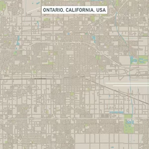
Ontario California US City Street MapVector Illustration of a City Street Map of Ontario, California, USA. Scale 1:60, 000. All source data is in the public domain. U.S
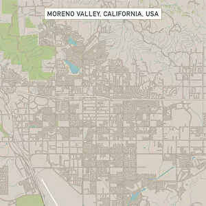
Moreno Valley California US City Street MapVector Illustration of a City Street Map of Moreno Valley, California, USA. Scale 1:60, 000. All source data is in the public domain. U.S
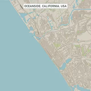
Oceanside California US City Street MapVector Illustration of a City Street Map of Oceanside, California, USA. Scale 1:60, 000. All source data is in the public domain. U.S
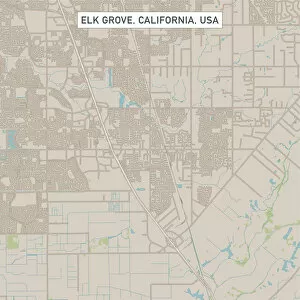
Elk Grove California US City Street MapVector Illustration of a City Street Map of Elk Grove, California, USA. Scale 1:60, 000. All source data is in the public domain. U.S
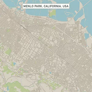
Menlo Park California US City Street MapVector Illustration of a City Street Map of Menlo Park, California, USA. Scale 1:60, 000. All source data is in the public domain. U.S
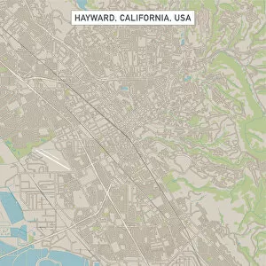
Hayward California US City Street MapVector Illustration of a City Street Map of Hayward, California, USA. Scale 1:60, 000. All source data is in the public domain. U.S
Sunnyvale California US City Street MapVector Illustration of a City Street Map of Sunnyvale, California, USA. Scale 1:60, 000. All source data is in the public domain. U.S
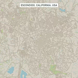
Escondido California US City Street MapVector Illustration of a City Street Map of Escondido, California, USA. Scale 1:60, 000. All source data is in the public domain. U.S
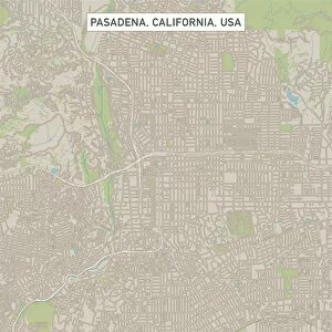
Pasadena California US City Street MapVector Illustration of a City Street Map of Pasadena, California, USA. Scale 1:60, 000. All source data is in the public domain. U.S
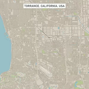
Torrance California US City Street MapVector Illustration of a City Street Map of Torrance, California, USA. Scale 1:60, 000. All source data is in the public domain. U.S
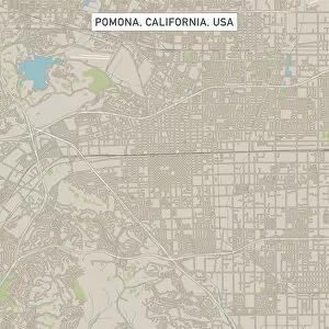
Pomona California US City Street MapVector Illustration of a City Street Map of Pomona, California, USA. Scale 1:60, 000. All source data is in the public domain. U.S