mail_outline sales@mediastorehouse.com
139 items
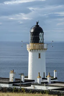
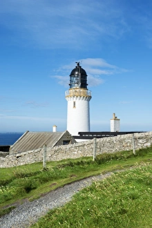
Lighthouse, Dunnet Head peninsula, northern coast of Scotland, Scotland, United Kingdom, Europe
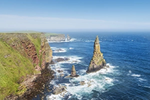
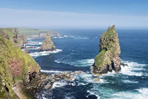
Rugged coastal landscape with the Duncansby Stacks, rock pinnacles, at Duncansby Head, Caithness, Scotland, United Kingdom, Europe
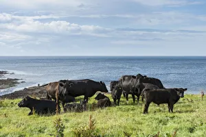
Black Aberdeen Angus cattle grazing on a pasture on the north coast of Scotland, Caithness, Scotland, United Kingdom, Europe
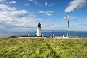
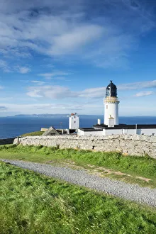
Dunnet Head lighthouse on the north coast of Scotland, Caithness, Scotland, United Kingdom, Europe
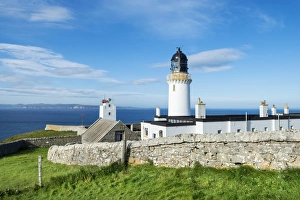
Dunnet Head lighthouse on the north coast of Scotland, Orkney Islands at back on the horizon, Caithness, Scotland, United Kingdom, Europe
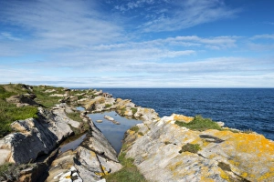
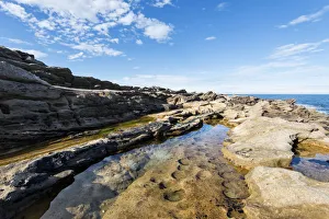
Rugged coastline on the Moray Firth at Tarbat Ness, Scotland, United Kingdom, Europe
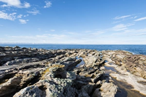
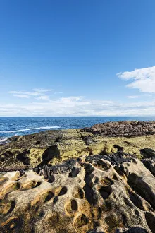
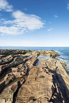
Rugged coastline with eroded sandstone on the Moray Firth at Tarbat Ness, Scotland, United Kingdom, Europe
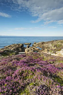
Rugged coastal landscape with flowering heather -Ericaceae- on the Moray Firth at Tarbat Ness, Scotland, United Kingdom, Europe
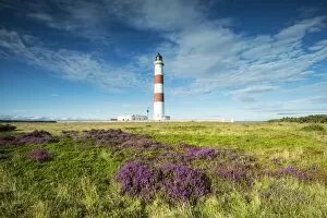
The Tarbat Ness lighthouse on the Moray Firth, Scotland, United Kingdom, Europe
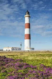
Tarbat Ness lighthouse on the Moray Firth, Scotland, United Kingdom, Europe
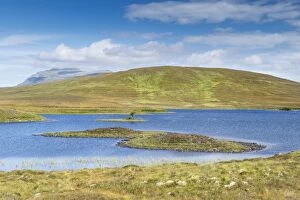
Loch Mudale, the 927 m high Ben Hope Mountain on the horizon, Altnaharra, Northern Highlands, Scotland, United Kingdom
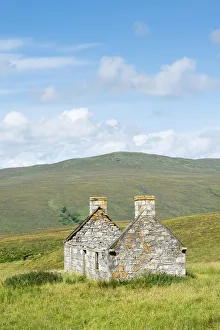
Abandoned and dilapidated cottage from the time of the Highland Clearances, Alltnacaillich, Northern Highlands, Scotland, United Kingdom
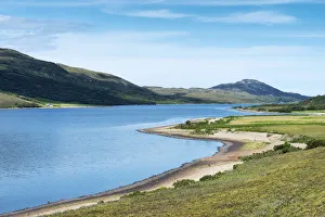
The 9. 5 km long and 1. 2 km wide freshwater Loch Hope, Inverhope, Northern Highlands, Scotland, United KingdomThe 9.5 km long and 1.2 km wide freshwater Loch Hope, Inverhope, Northern Highlands, Scotland, United Kingdom
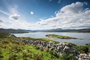
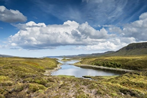
The 16 km long and 2. 5 km wide fjord of Loch Eriboll, Heilam, Northern Highlands, Northern Highlands, ScotlandThe 16 km long and 2.5 km wide fjord of Loch Eriboll, Heilam, Northern Highlands, Northern Highlands, Scotland, United Kingdom
Lochan Havurn, Polla, Northern Highlands, Scotland, United Kingdom
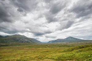
Valley of Strath Dionard with the mountains of Cranstackie, 801m, left, and Foinaven, 911m, right, Durness, Schottisches Hochland, Scotland, United Kingdom
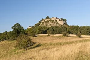
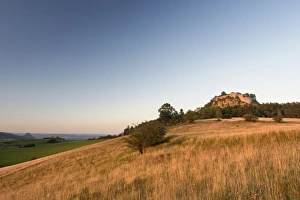
View of a rough pasture with the Hegau volcano and the Hohentwiel ruins, Baden-Wuerttemberg, Germany, Europe
View of the volcanic landscape of the Hegau region with the mountains Hohenstoffeln, Hohenhewen and Hohenkraehen, from left, Baden-Wuerttemberg, Germany, Europe
View of a rough pasture with the Hegau volcano in the evening light and the Hohentwiel ruins, Baden-Wuerttemberg, Germany, Europe
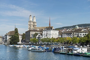
View from Quaibruecke bridge over the Limmat river to the marina with the Limmat quay, the twin towers of the Grossmuenster church at back, Zurich, Canton of Zurich, Switzerland, Europe
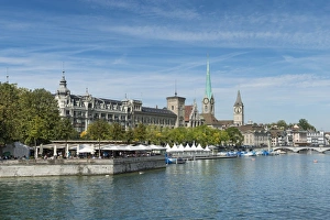
View from Quaibruecke bridge over the Limmat river, beer garden on the island auf Bauschaenzli, Stadthausquai and the Metropol Building, Fraumuenster Church and the spire of St
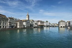
View of the Limmat river with the old town promenade, Zurich, Canton Zurich, Switzerland, Europe
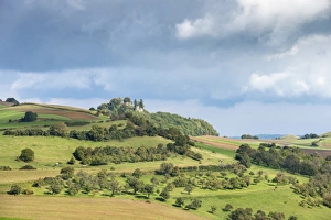
Agricultural land in the hills of the Hegau region with fields, orchards and pastures, Maegdeberg hill with castle ruins at back, Baden-Wuerttemberg, Germany, Europe
Parish Church of St. Mauritius in the Hegau village of Weiterdingen, Baden-Wuerttemberg, Germany, Europe
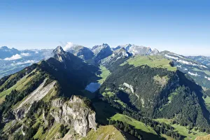
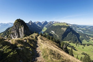
View from Hoher Kasten mountain, 1794m, in the Appenzell Alps, Lake Saemtisersee in the center, canton of Appenzell Inner-Rhodes, Switzerland, Europe
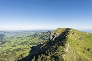
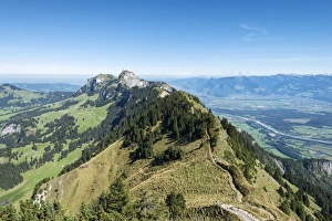
View of the Appenzellerland region as seen from Hoher Kasten mountain, 1794m, Kamor mountain, 1751m, on the right, canton of Appenzell Inner-Rhodes, Switzerland, Europe
View of Kamor mountain, 1751m, as seen from Hoher Kasten mountain, 1794m, canton of Appenzell Inner-Rhodes, Switzerland, Europe
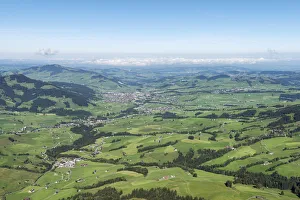
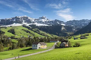
View of the Appenzellerland region and the town of Appenzell as seen from Hoher Kasten mountain, 1794m, canton of Appenzell Inner-Rhodes, Switzerland, Europe
View of the Appenzell Alps as seen from the geological mountain trail, lake Saemtisersee below, canton of Appenzell Inner-Rhodes, Switzerland, Europe
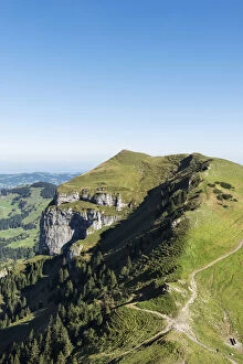
View seen from the geological mountain trail, Appenzell Alps, leading to the Hoher Kasten mountain, 1794m, canton of Appenzell Inner-Rhodes, Switzerland, Europe
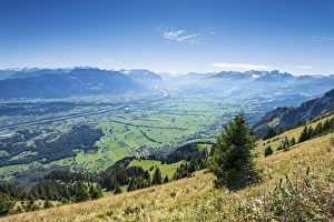
View of the Rhine valley as seen from the geological mountain trail, canton of Appenzell Inner-Rhodes, Switzerland, Europe
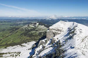
A cloud hanging next to Staubernkanzel mountain, 1860m, Kreuzberge mountains at the back, canton of Appenzell Innerrhoden, Switzerland, Europe
Snow-covered Saentis mountain, 2501m, seen from the southeast, canton of Appenzell Innerrhoden, Switzerland, Europe
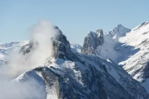
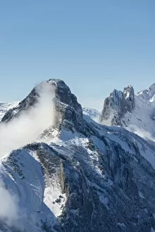
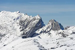
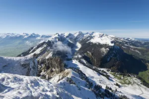
Distinctive mountains in the Appenzell Alps, canton of Appenzell Innerrhoden, Switzerland, Europe
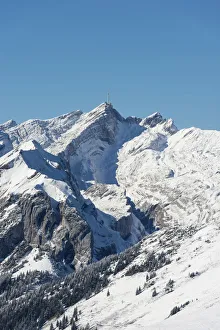
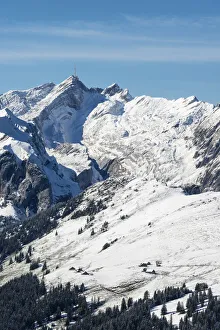
The 1751m high, snow-capped Kamor mountain in the Appenzell Alps, canton of Appenzell Innerrhoden, Switzerland, Europe
Snow-covered Saentis mountain, 2501m, after an early onset of winter, seen from the southeast, canton of Appenzell Innerrhoden, Switzerland, Europe
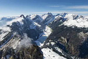
The snow-covered Appenzell Alps and lake Saemtisersee, canton of Appenzell Innerrhoden, Switzerland, Europe
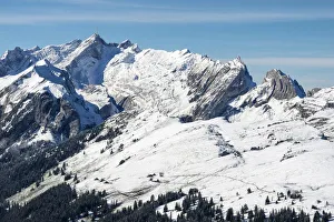
Snow-covered Saentis mountain, 2501m, seen from the southeast, Alpsigel below, canton of Appenzell Innerrhoden, Switzerland, Europe
The Appenzell Alps with snowy Saentis on the top left, canton of Appenzell Innerrhoden, Switzerland, Europe
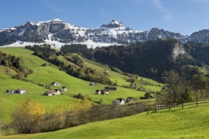
Green pastures in Appenzellerland in front of the snow-capped Appenzell Alps, Canton of Appenzell-Innerrhoden, Switzerland, Europe