mail_outline sales@mediastorehouse.com
800 Items
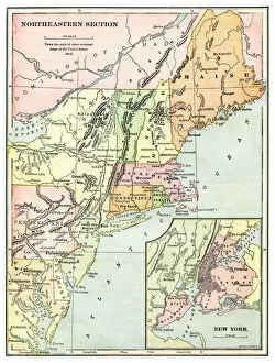
Map of the USA Northeastern section 1897Natural Elementary Geography by Redway and Hinman - NY/Cincinnati/Chicago 1897
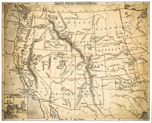
Map of USA Pacific states 1897Natural Elementary Geography by Redway and Hinman - NY/Cincinnati/Chicago 1897
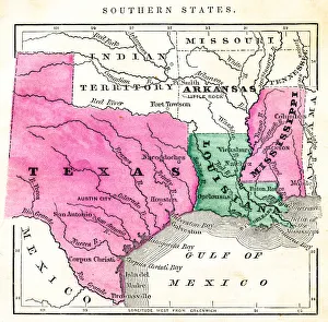
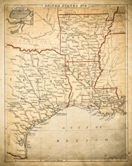
Map of USA southern states 1871Colton and Fitchs Introductory School Geography - New York: Sheldon and Company 1871
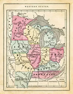
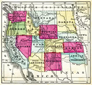
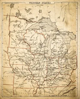
Map of USA western states 1871Colton and Fitchs Introductory School Geography - New York: Sheldon and Company 1871
Map of USa western pacific states 1871Colton and Fitchs Introductory School Geography - New York: Sheldon and Company 1871
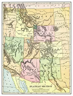
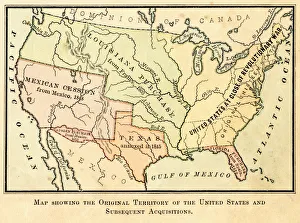
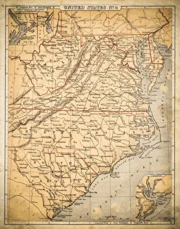
Map of the original USA territory 1881Appletons American Standard Geographies - New York 1881 - d. Appleton and Company
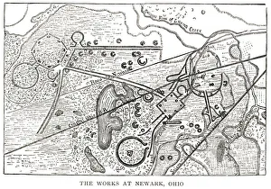
woodcut map illustration of Newark Earthworks, OhioWoodcut map of Newark Earthworks, Ohio, USA. Built during Hopewell culture. 1889 facsimile of 1862 map in Prehistoric Man by Daniel Wilson
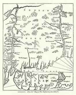
Map of Connecticut, USA, after john Seller, 17th CenturyVintage engraving of Map of Connecticut, USA, after john Seller, 17th Century
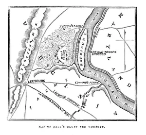
Map of Balls Bluff" Vintage engraving from 1863 of a map of Balls Bluff at the time of the American Civil War. The Battle of Balls Bluff, also known as the Battle of Harrisons Island or the Battle of Leesburg
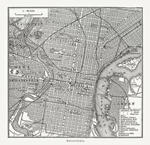
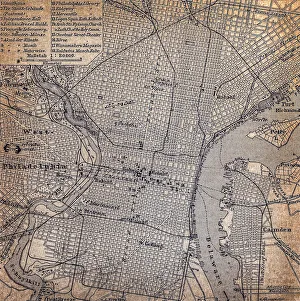
Historical city map of Philadelphia, Pennsylvania, USA, wood engraving, published in 1897Historical city map of Philadelphia, Pennsylvania, USA. Wood engraving, published in 1897
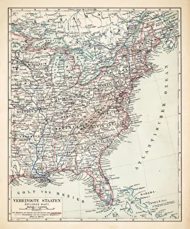
Map of USA Eastern States 1900Meyers hand-Atlas Leipzig und Wien Verlag des Bibliographischen Instituts 1900
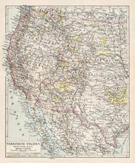
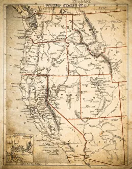
Map of USA Western States 1900Meyers hand-Atlas Leipzig und Wien Verlag des Bibliographischen Instituts 1900
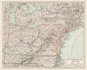
Map of usa north east states 1900Meyers hand-Atlas Leipzig und Wien Verlag des Bibliographischen Instituts 1900
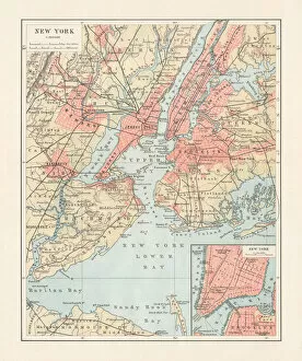
Historical map of New York City, USA, lithograph, published 1897Historical city map of New York City, USA. Lithograph, published in 1897
USA Pacidic States map of 1869Cornells Grammar School Geography By S.S. Cornell - New York 1869
USA Pacific States map of 1869Cornells Grammar School Geography By S.S. Cornell - New York 1869
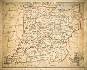
USA East North central map of 1869Cornells Grammar School Geography By S.S. Cornell - New York 1869
USA Western States map of 1869Cornells Grammar School Geography By S.S. Cornell - New York 1869
USA Southern States map of 1869Cornells Grammar School Geography By S.S. Cornell - New York 1869
USA West Central States map of 1869Cornells Grammar School Geography By S.S. Cornell - New York 1869
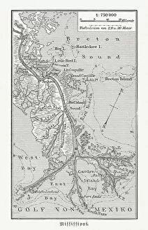
Mouth of the Mississippi river, Louisiana, USA, woodcut, published 1897Map of the mouth of the Mississippi river, Louisiana, USA. Wood engraving, published in 1897
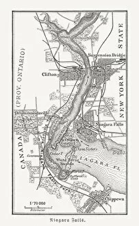
Map of the Niagara Falls, Canada, USA, woodcut, published 1897Map of the Niagara Falls, Canada, USA. Wood engraving, published in 1897
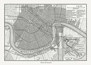
Historical city map of New Orleans, Louisiana, USA, published 1897Historical city map of New Orleans, Louisiana, USA. Wood engraving, published in 1897
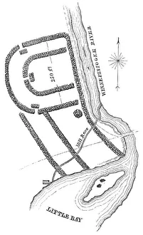
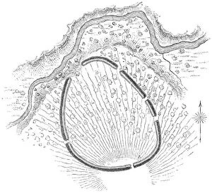
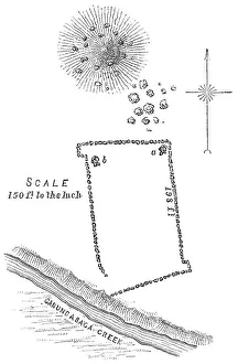
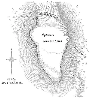
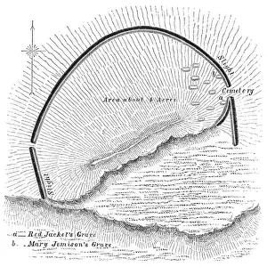
Squier Map of Aquadoctan Village near Laconia in Belknap County, New Hampshire, USAThe Aquadoctan Village near Laconia in Belknap County, New Hampshire, United States of America. Map by Ephraim George Squier (circa mid 19th century). Vintage etching circa mid 19th century
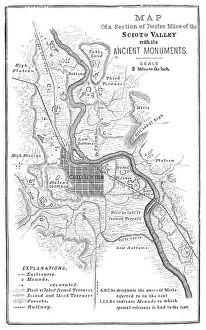
Squier Map of Hopewell Culture National Historical Park in Ross County, Ohio, USAMap of the Scioto River Valley around Chillicothe in Ross County, New York, United States of America. Map by Ephraim George Squier
Squire Map of the Bone Fort near Oakfield in Genesee County, New York, USAThe Bone Fort near Oakfield in Genesee County, New York, United States of America. Map by Ephraim George Squier (circa mid 19th century). Vintage etching circa mid 19th century
Squier Map of Kanadaseaga Fort near Geneva in Ontario County, New York, USAKanadaseaga Fort near Geneva in Ontario County, New York, United States of America. Map by Ephraim George Squier (circa mid 19th century). Vintage etching circa mid 19th century
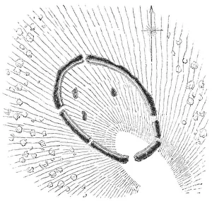
Squier Map of Ganondagan Fort near Victor in Ontario County, New York, USAGanondagan State Historic Site near Victor in Ontario County, New York, United States of America. Map by Ephraim George Squier (circa mid 19th century). Vintage etching circa mid 19th century
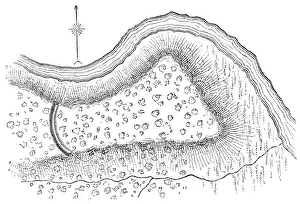
Squier Map of Seneca Fort near Clarence in Erie County, New York, USASeneca Fort near Clarence in Erie County, New York, United States of America. Map by Ephraim George Squier (circa mid 19th century). Vintage etching circa mid 19th century
Squier Map of Cayugan Fort near Auburn in Cayuga County, New York, USACayugan Fort near Auburn in Cayuga County, New York, United States of America. Map by Ephraim George Squier (circa mid 19th century). Vintage etching circa mid 19th century
Squier Map of Indian Hill Fort near Minden in Montgomery County, New York, USAThe Indian Hill Fort near Minden in Montgomery County, New York, United States of America. Map by Ephraim George Squier (circa mid 19th century). Vintage etching circa mid 19th century
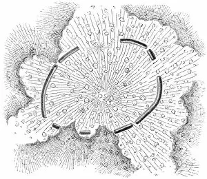
Squier Map of Eaton Site Seneca Fort near Buffalo in Erie County, New York, USAEaton Site Seneca fortified village near Buffalo in Erie County, New York, United States of America. Map by Ephraim George Squier (circa mid 19th century). Vintage etching circa mid 19th century
Map of Philadelphia 1898Antique illustration engraving of a Map of Philadelphia 1898
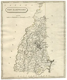
Antique map of New Hampshire USA 19th century 1819This is a copperplate engraving, a 19th century map of New Hampshire in the United States of America, with hand-coloured borders with Canada, Maine, Massachusetts and Vermont
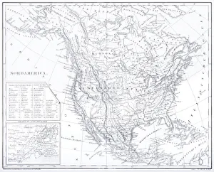
Engraving: Map of North AmericaEngraved illustrations of the Theory of the Art of Drawing from Iconographic Encyclopedia of Science, Literature and Art, Published in 1851. Copyright has expired on this artwork. Digitally restored
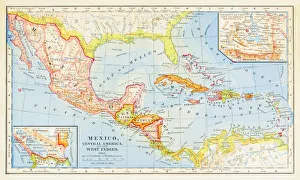
1883 Map Of Central America
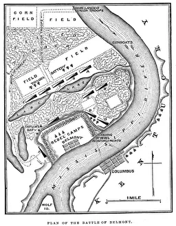
Battle of BelmontVintage engraving from 1863 of a map of the Battle of Belmont which was fought on November 7, 1861, in Mississippi County, Missouri. It was the first combat test in the American Civil War for Brig
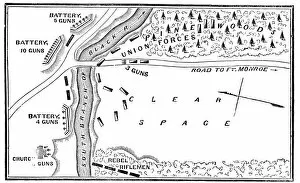
Battle of Big BethelVintage engraving from 1863 of a map of the Battle of Big Bethel also known as the Battle of Bethel Church or Great Bethel was an American Civil War battle that took place on June 10, 1861
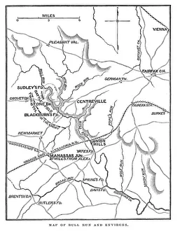
Battle of Bull RunVintage engraving from 1863 of a map of Bull Run and its environs at the time of the American Civil War. The First Battle of Bull Run
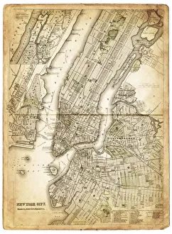
map of new york city 1874very old map showing new york city, new jersey, and hoboken) 1874 - composite with grunge sepia paper
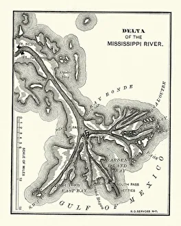
Map of the Delta of the Mississippi river, 19th CenturyVintage engraving of a Map of the Delta of the Mississippi river, 19th Century
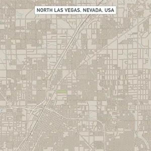
North Las Vegas Nevada US City Street MapVector Illustration of a City Street Map of North Las Vegas, Nevada, USA. Scale 1:60, 000. All source data is in the public domain. U.S
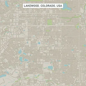
Lakewood Colorado US City Street MapVector Illustration of a City Street Map of Lakewood, Colorado, USA. Scale 1:60, 000. All source data is in the public domain. U.S
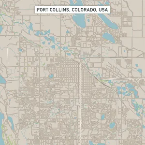
Fort Collins Colorado US City Street MapVector Illustration of a City Street Map of Fort Collins, Colorado, USA. Scale 1:60, 000. All source data is in the public domain. U.S
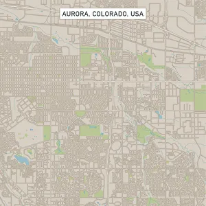
Aurora Colorado US City Street MapVector Illustration of a City Street Map of Aurora, Colorado, USA. Scale 1:60, 000. All source data is in the public domain. U.S
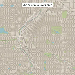
Denver Colorado US City Street MapVector Illustration of a City Street Map of Denver, Colorado, USA. Scale 1:60, 000. All source data is in the public domain. U.S
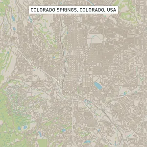
Colorado Springs Colorado US City Street MapVector Illustration of a City Street Map of Colorado Springs, Colorado, USA. Scale 1:60, 000. All source data is in the public domain. U.S
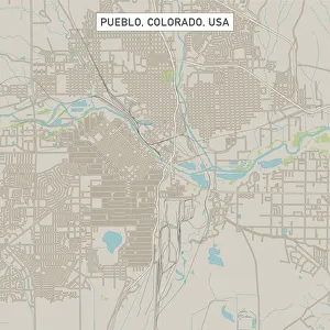
Pueblo Colorado US City Street MapVector Illustration of a City Street Map of Pueblo, Colorado, USA. Scale 1:60, 000. All source data is in the public domain. U.S