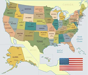
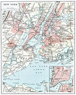
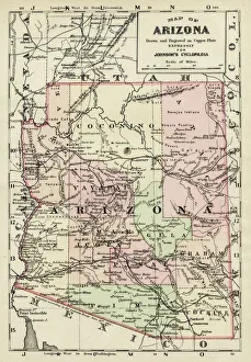
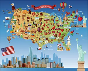
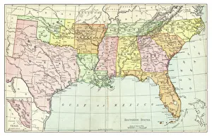
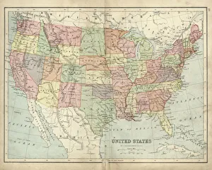
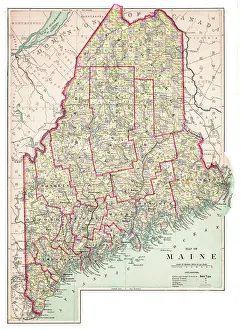
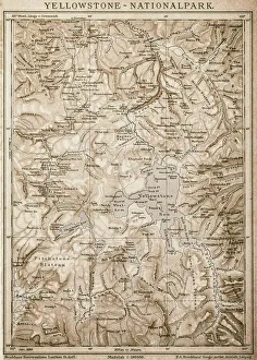
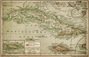
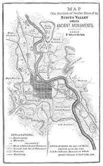
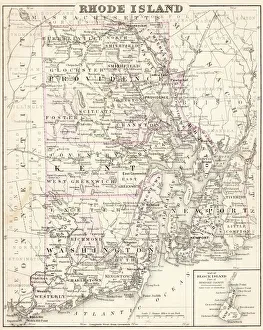
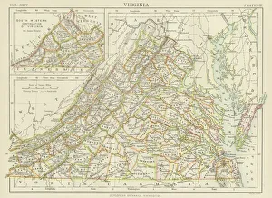
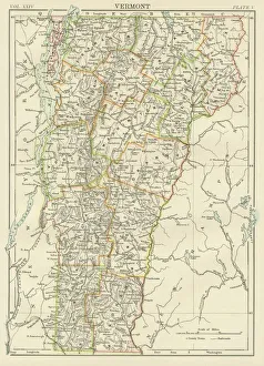
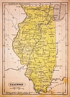
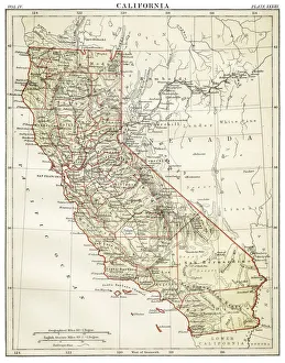
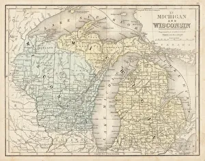
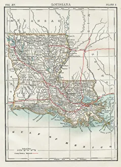
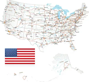
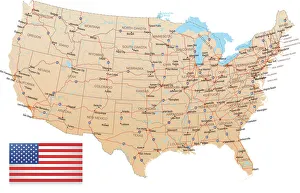
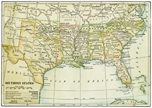
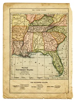
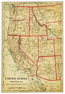
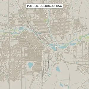
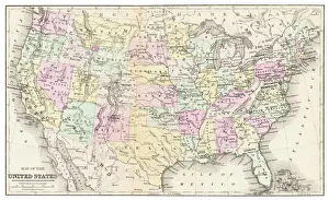
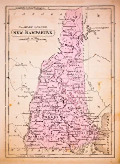
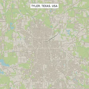
Home > Map > USA Maps

USA Maps Collection

A collection of highly detailed United States maps including antique engravings, reference, road and streets, illustrations and satellite maps

Choose a picture from our USA Maps Collection for your Wall Art and Photo Gifts

Officially the United States of America (abbreviated to America, USA or US), the physical environment of the USA ranges from the Arctic to the subtropical, from the moist rain forest to the arid desert, from the rugged mountain peak to the flat prairie.

799 items

USA Maps Collection: USA Southern States Historical Maps

USA Southern States Historical Maps Collection
27 items

Background imageUSA Maps Collection: USA Map - illustration

USA Map - illustration
Colored Map of the United States

Background imageUSA Maps Collection: Map of New York city 1896

Map of New York city 1896
Ilustration of a Map of New York city 1896

Background imageUSA Maps Collection: Arizona map 1893

Arizona map 1893
Johnsonas Universal Cyclopedia - Charles Kendall - New York 1893

Background imageUSA Maps Collection: Cartoon map of USA

Cartoon map of USA

Background imageUSA Maps Collection: Map of Southern States USA 1895

Map of Southern States USA 1895
The Rand-McNally Grammar School Geography 1895 - Chicago & New York

Background imageUSA Maps Collection: Antique map of USA in the 19th Century, 1873

Antique map of USA in the 19th Century, 1873
Vintage engraving of a Antique map of United States of America in the 19th Century, 1873

Background imageUSA Maps Collection: Map of Maine USA 1883

Map of Maine USA 1883
Warrens Common School Geography

Background imageUSA Maps Collection: England and Wales map 1875

England and Wales map 1875
The Independent Course Comprehensive Geography by James Monteith, A.S. Barnes & Co, New York & Chicago 1875

Background imageUSA Maps Collection: Map of the Battle of Hampton Roads

Map of the Battle of Hampton Roads
Vintage engraving of a Map of the Battle of Hampton Roads, often referred to as either the Battle of the Monitor and Merrimack (or Virginia) or the Battle of Ironclads

Background imageUSA Maps Collection: Iowa 1852 Map

Iowa 1852 Map

Background imageUSA Maps Collection: Map of Maine 1883

Map of Maine 1883
Encyclopedia Britannica 9th Edition New York Samuel L. Hall 1883 Vol XV

Background imageUSA Maps Collection: Great Britain and England map 1895

Great Britain and England map 1895
Encyclopedia Britannica 9th Edition Vol I New York, Samuel Hall 1878

Background imageUSA Maps Collection: Map of Yellowstone National Park, USA

Map of Yellowstone National Park, USA

Background imageUSA Maps Collection: Caribbean map

Caribbean map
Antique map of Cuba, Jamaica, Puerto Rico

Background imageUSA Maps Collection: Squier Map of Hopewell Culture National Historical Park in Ross County, Ohio, USA

Squier Map of Hopewell Culture National Historical Park in Ross County, Ohio, USA
Map of the Scioto River Valley around Chillicothe in Ross County, New York, United States of America. Map by Ephraim George Squier

Background imageUSA Maps Collection: Rhode Island map 1877

Rhode Island map 1877
Warrens Common School Geography 1877

Background imageUSA Maps Collection: Virginia map 1885

Virginia map 1885
Encyclopedia Britannica 9th Edition New York Charles Scribners and Sons 1885 Vol XXIV

Background imageUSA Maps Collection: Vermont USA map 1885

Vermont USA map 1885
Encyclopedia Britannica 9th Edition New York Charles Scribners and Sons 1885 Vol XXIV

Background imageUSA Maps Collection: Illinois 1852 Map

Illinois 1852 Map

Background imageUSA Maps Collection: Holland map 1881

Holland map 1881
Encyclopedia Britannica 9th Edition Vol XII Philadelphia j.M. Stoddart & Co 1881

Background imageUSA Maps Collection: Map of California 1878

Map of California 1878
Encyclopedia Britannica 9th Edition Vol II New York, Samuel Hall 1878

Background imageUSA Maps Collection: Wisconsin MIchigan map 1867

Wisconsin MIchigan map 1867
Mitchellas Modern Atlas - Published by E.H. Butler and Co - Philadelphia 1867

Background imageUSA Maps Collection: Map of Louisiana 1883

Map of Louisiana 1883
Encyclopedia Britannica 9th Edition New York Samuel L. Hall 1883 Vol XV

Background imageUSA Maps Collection: Highly detailed USA Road Map

Highly detailed USA Road Map
Highly detailed map of United States with roads, states, big cities, rivers and some other objects

Background imageUSA Maps Collection: USA - Highway Map

USA - Highway Map
Highly detailed map of United States with roads, states, big cities, rivers and some other objects

Background imageUSA Maps Collection: USA southern states map 1898

USA southern states map 1898
Map from Physical Geography by R. S. Tarr - The MacMillan Company - London 1898

Background imageUSA Maps Collection: the southern states usa map

the southern states usa map
southern states usa - east coast, mexican gulf and atlantic ocean (1876)

Background imageUSA Maps Collection: Map of Western states USA 1876

Map of Western states USA 1876
Maurys Geographical Series - The Word we live in by M.F. Maury LLD - New York and Baltimore 1876

Background imageUSA Maps Collection: Pueblo Colorado US City Street Map

Pueblo Colorado US City Street Map
Vector Illustration of a City Street Map of Pueblo, Colorado, USA. Scale 1:60, 000. All source data is in the public domain. U.S

Background imageUSA Maps Collection: Map of USA 1877

Map of USA 1877
Warrens Common School Geography 1877

Background imageUSA Maps Collection: New Hampshire 1852 Map

New Hampshire 1852 Map

Background imageUSA Maps Collection: Tyler Texas US City Street Map

Tyler Texas US City Street Map
Vector Illustration of a City Street Map of Tyler, Texas, USA. Scale 1:60, 000. All source data is in the public domain. U.S

Background imageUSA Maps Collection: Map of central states USA 1895

Map of central states USA 1895
The Rand-McNally Grammar School Geography 1895 - Chicago & New York

Background imageUSA Maps Collection: Alabama Florida Georgia map 1881

Alabama Florida Georgia map 1881
Coltons Common School Geography 1881 New York Sheldon and Co

Background imageUSA Maps Collection: Map of Kentucky and Tennessee 1855

Map of Kentucky and Tennessee 1855
System of Geography for the use of schools by Sidney E. Morse - Published by Harper & Brothers - New York 1855

Background imageUSA Maps Collection: Battle of Gettysburg Map, July 3, 1863 Civil War Engraving

Battle of Gettysburg Map, July 3, 1863 Civil War Engraving
Engraving of the Map of the Battle of Gettysburgs, Pennsylvania, July 3, 1863 Civil War Engraving from Famous Leaders and Battle Scenes of the Civil War, Published in 1864

Background imageUSA Maps Collection: Map of Pamlico and Albemarle Sounds

Map of Pamlico and Albemarle Sounds
Vintage engraving from 1863 of a map of Map of Pamlico and Albemarle Sounds at the time of the American Civil War

Background imageUSA Maps Collection: Chicago map

Chicago map
Antique illustration of a Chicago map

Background imageUSA Maps Collection: USA Western states map 1898

USA Western states map 1898
Map from Physical Geography by R. S. Tarr - The MacMillan Company - London 1898

Background imageUSA Maps Collection: woodcut map illustration of Newark Earthworks, Ohio

woodcut map illustration of Newark Earthworks, Ohio
Woodcut map of Newark Earthworks, Ohio, USA. Built during Hopewell culture. 1889 facsimile of 1862 map in Prehistoric Man by Daniel Wilson

Background imageUSA Maps Collection: Minot North Dakota US City Street Map

Minot North Dakota US City Street Map
Vector Illustration of a City Street Map of Minot, North Dakota, USA. Scale 1:60, 000. All source data is in the public domain. U.S

Background imageUSA Maps Collection: Minneapolis Minnesota US City Street Map

Minneapolis Minnesota US City Street Map
Vector Illustration of a City Street Map of Minneapolis, Minnesota, USA. Scale 1:60, 000. All source data is in the public domain. U.S

Background imageUSA Maps Collection: Brookings South Dakota US City Street Map

Brookings South Dakota US City Street Map
Vector Illustration of a City Street Map of Brookings, South Dakota, USA. Scale 1:60, 000. All source data is in the public domain. U.S

Background imageUSA Maps Collection: Waterloo Iowa US City Street Map

Waterloo Iowa US City Street Map
Vector Illustration of a City Street Map of Waterloo, Iowa, USA. Scale 1:60, 000. All source data is in the public domain. U.S

Background imageUSA Maps Collection: Murrieta California US City Street Map

Murrieta California US City Street Map
Vector Illustration of a City Street Map of Murrieta, California, USA. Scale 1:60, 000. All source data is in the public domain. U.S

Background imageUSA Maps Collection: Medford Oregon US City Street Map

Medford Oregon US City Street Map
Vector Illustration of a City Street Map of Medford, Oregon, USA. Scale 1:60, 000. All source data is in the public domain. U.S

Background imageUSA Maps Collection: Casper Wyoming US City Street Map

Casper Wyoming US City Street Map
Vector Illustration of a City Street Map of Casper, Wyoming, USA. Scale 1:60, 000. All source data is in the public domain. U.S


All Professionally Made to Order for Quick Shipping