mail_outline sales@mediastorehouse.com
799 Items
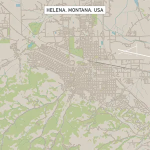
Helena Montana US City Street MapVector Illustration of a City Street Map of Helena, Montana, USA. Scale 1:60, 000. All source data is in the public domain. U.S
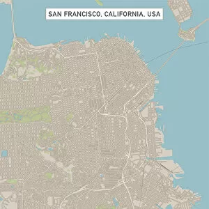
San Francisco California US City Street MapVector Illustration of a City Street Map of San Francisco, California, USA. Scale 1:60, 000. All source data is in the public domain. U.S
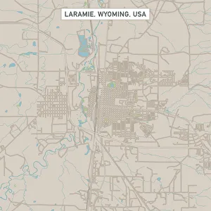
Laramie Wyoming US City Street MapVector Illustration of a City Street Map of Laramie, Wyoming, USA. Scale 1:60, 000. All source data is in the public domain. U.S
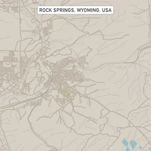
Rock Springs Wyoming US City Street MapVector Illustration of a City Street Map of Rock Springs, Wyoming, USA. Scale 1:60, 000. All source data is in the public domain. U.S
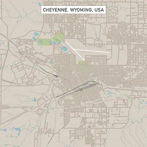
Cheyenne Wyoming US City Street MapVector Illustration of a City Street Map of Cheyenne, Wyoming, USA. Scale 1:60, 000. All source data is in the public domain. U.S
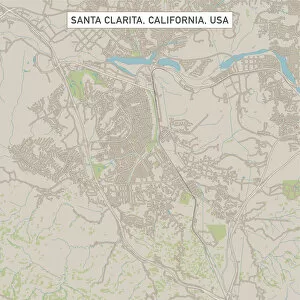
Santa Clarita California US City Street MapVector Illustration of a City Street Map of Santa Clarita, California, USA. Scale 1:60, 000. All source data is in the public domain. U.S
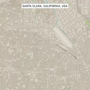
Santa Clara California US City Street MapVector Illustration of a City Street Map of Santa Clara, California, USA. Scale 1:60, 000. All source data is in the public domain. U.S
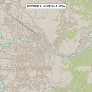
Missoula Montana US City Street MapVector Illustration of a City Street Map of Missoula, Montana, USA. Scale 1:60, 000. All source data is in the public domain. U.S
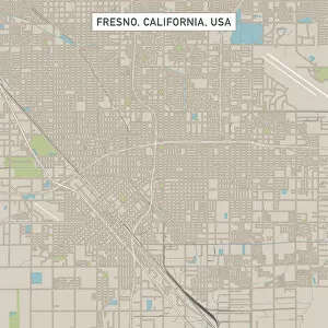
Fresno California US City Street MapVector Illustration of a City Street Map of Fresno, California, USA. Scale 1:60, 000. All source data is in the public domain. U.S
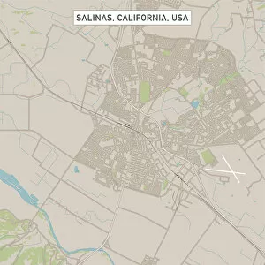
Salinas California US City Street MapVector Illustration of a City Street Map of Salinas, California, USA. Scale 1:60, 000. All source data is in the public domain. U.S
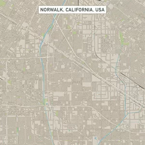
Norwalk California US City Street MapVector Illustration of a City Street Map of Norwalk, California, USA. Scale 1:60, 000. All source data is in the public domain. U.S
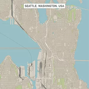
Seattle Washington US City Street MapVector Illustration of a City Street Map of Seattle, Washington, USA. Scale 1:60, 000. All source data is in the public domain. U.S
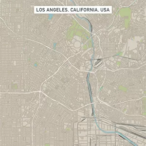
Los Angeles California US City Street MapVector Illustration of a City Street Map of Los Angeles, California, USA. Scale 1:60, 000. All source data is in the public domain. U.S
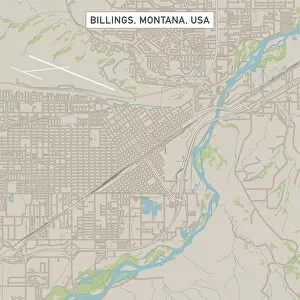
Billings Montana US City Street MapVector Illustration of a City Street Map of Billings, Montana, USA. Scale 1:60, 000. All source data is in the public domain. U.S
Palo Alto California US City Street MapVector Illustration of a City Street Map of Palo Alto, California, USA. Scale 1:60, 000. All source data is in the public domain. U.S
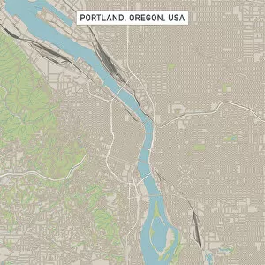
Portland Oregon US City Street MapVector Illustration of a City Street Map of Portland, Oregon, USA. Scale 1:60, 000. All source data is in the public domain. U.S
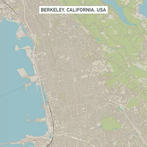
Berkeley California US City Street MapVector Illustration of a City Street Map of Berkeley, California, USA. Scale 1:60, 000. All source data is in the public domain. U.S
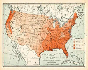
Map of United States 1895The Rand-McNally Grammar School Geography 1895 - Chicago & New York
Old map of the Ohio River between Indiana and Kentucky - Scanned 1887 map
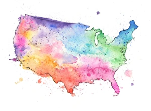
Map of United States with Watercolor Texture - Raster IllustrationAn abstract map of the United States with a multicoloured, rainbow hand painted watercolor texture. Map is isolated on a white background. Raster illustration
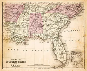
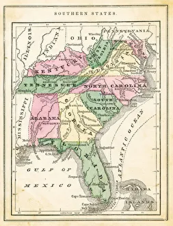
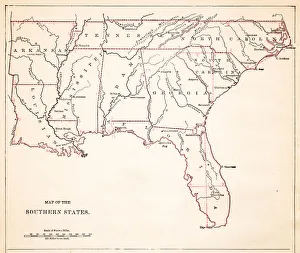
Map of Southern states USA 1883Warrens Common School Geography
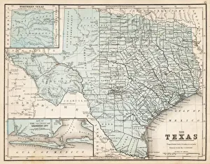
Map of Texas 1867Mitchells Modern Atlas - Published by E.H. Buttler & Co - Philadelphia 1867
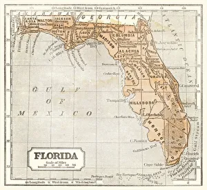
Map of Florida 1855System of Geography for the use of schools by Sidney E. Morse - Published by Harper & Brothers - New York 1855
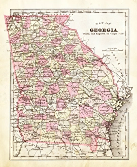
Map of Georgia 1894Map of the state of Georgia, USA
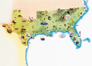
Map of Southern United States of America, with illustrations of distinguishing features and landmarks
Antique map: North America
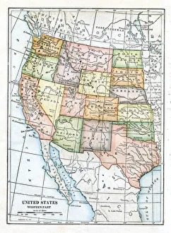
USA Western states map 1898Map from Physical Geography by R. S. Tarr - The MacMillan Company - London 1898
Map of USA 1877Warrens Common School Geography 1877
Map of USA 1889Comprehensive Geography by James Monteith - American Book Company 1882, 1889
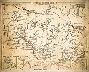
Map of USA North Central States 1877The Eclectic Elementary Geography by Wilson & Hinkle / Cincinnati -New York 1881
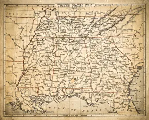
Map of USA Southern states 1871Colton and Fitchs Introductory School Geography - New York: Sheldon and Company 1871
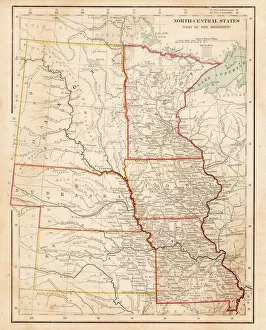
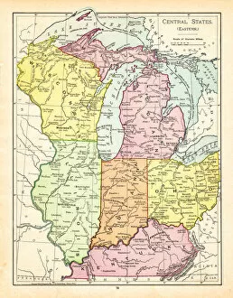
Map of central states USA 1895The Rand-McNally Grammar School Geography 1895 - Chicago & New York
USA East North central map of 1869Cornells Grammar School Geography By S.S. Cornell - New York 1869
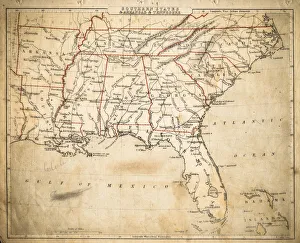
USA Southern States map of 1869Cornells Grammar School Geography By S.S. Cornell - New York 1869
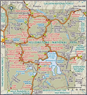
Yellowstone National ParkDetailed map of Yellowstone National Park
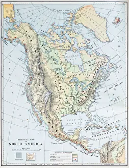
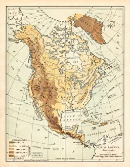
Physical map of North America 1895The Rand-McNally Grammar School Geography 1895 - Chicago & New York
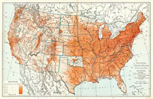
Political Map of United States 1895The Rand-McNally Grammar School Geography 1895 - Chicago & New York
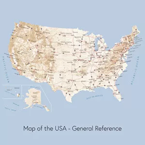
Map of the USA general referenceVector illustration of a map of the United States of America. The reference map used in the creation of this illustration is public domain map available at the University of Texas website: http
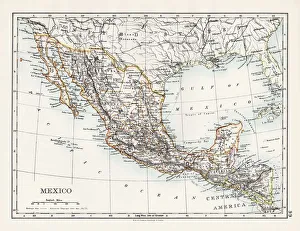
Mexico map 1897The World-Wide Atlas of Modern Geography, Political and Physical W. & A.K. Johnston - London 1897
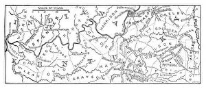
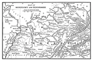
Map of Kentucky and Tennessee - Scanned 1886 Map
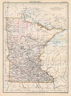
Minnesota map 1883Encyclopedia Britannica 9th Edition New York Samuel L. Hall 1883 Vol XVI
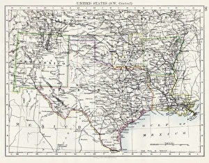
United States South West Central map 1897The World-Wide Atlas of Modern Geography, Political and Physical W. & A.K. Johnston - London 1897
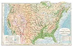
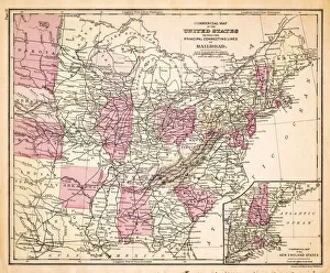
Map of Railroads USA 1883Warrens Common School Geography
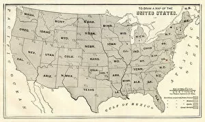
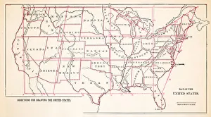
Drawing Map of Southern states USA 1883Warrens Common School Geography
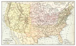
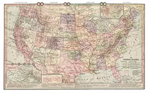
Map of United States 1883Warrens Common School Geography