mail_outline sales@mediastorehouse.com
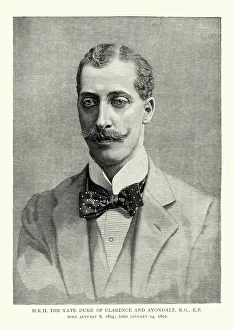
Prince Albert Victor, Duke of Clarence and AvondaleVintage engraving of Prince Albert Victor, Duke of Clarence and Avondale. 1864 to 14 January 1892, was the eldest son of Albert Edward, Prince of Wales (later King Edward VII)
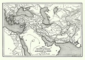
Ancient History - Map of Alexander the Great CampaignsVintage engraving of a map of the campaigns and marches of Alexander the Great
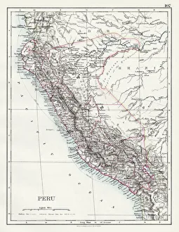
Peru map 1897The World-Wide Atlas of Modern Geography, Political and Physical W. & A.K. Johnston - London 1897
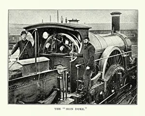
GWR Iron Duke Class Steam LocomotiveVintage engraving of a GWR Iron Duke Class Steam Locomotive. The Great Western Railway Iron Duke Class 4-2-2 was a class of broad gauge steam locomotives for express passenger train work
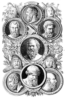
Famous Greek poets and philosophersIllustration of a famous Greek poets and philosophers
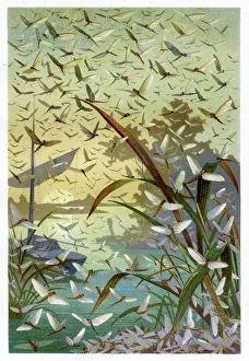
Mayflies Chromolithograph 1884Brehms Thierleben (Tierleben). Allgemeine Kunde des Thierreichs. Vierte Abtheilung - Wirbellofe Thiere. Leipzig Verlag, 1884
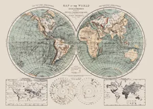
Map of the world 1869Cornells Grammars-School Geography - S.S. Cornell - New York D. Appleton and Company 1869
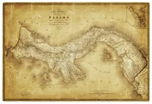
Map of Panama 1864Map of Panama - combined with 2 different texture overlays
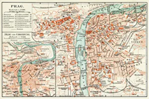
Prague map 1896Meyers Konversations-Lexikon
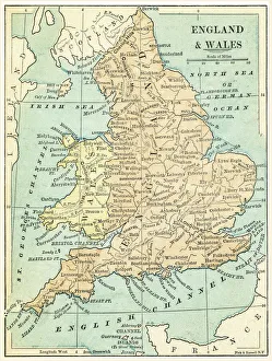
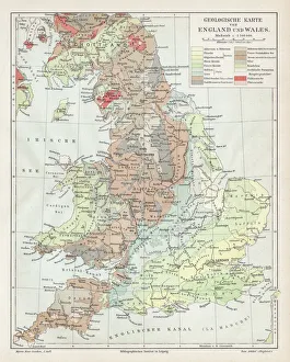
England and Wales map 1875The Independent Course Comprehensive Geography by James Monteith, A.S. Barnes & Co, New York & Chicago 1875
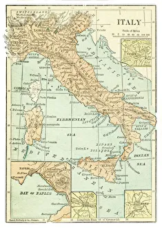
Italy map 1875The Independent Course Comprehensive Geography by James Monteith, A.S. Barnes & Co, New York & Chicago 1875
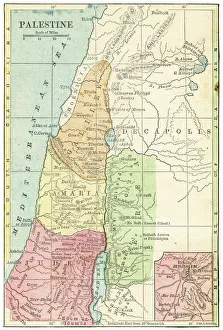
Palestine map 1875The Independent Course Comprehensive Geography by James Monteith, A.S. Barnes & Co, New York & Chicago 1875
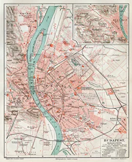
Budapest city map 1895Meyers Konversations-Lexikon. Ein Nachschlagewerk des allgemeinen Wissens, 5th edition 17 volumes Bibliographisches Institut - Leipzig 1895-1897
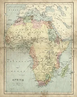
Antique map of Africa in the 19th Century, 1873Vintage engraving of a Victorian Antique map of Africa in the 19th Century, 1873
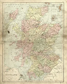
Antique damaged map of Scotland in the 19th CenturyVintage engraving of a Antique damaged map of Scotland in the 19th Century, 1873
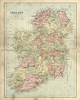
Antique damaged map of Ireland in the 19th CenturyVintage engraving of a Antique damaged map of Ireland in the 19th Century, 1873
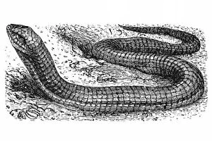
Scheltopusik, Sheltopusik, European legless lizard (Pseudopus apodus)Antique illustration of scheltopusik, Sheltopusik, European legless lizard (Pseudopus apodus)
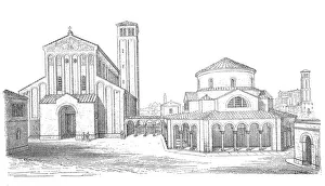
Torcello Cathedral, The Cathedral of Santa Maria Assunta (Cattedrale di Santa Maria Assunta) is a basilica church on the island of Torcello, Venice, northern Italy
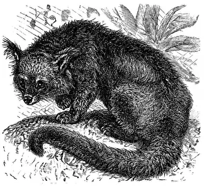
Binturong (Arctictis binturong)Illustration of a Binturong or Arctictis binturong or Asian Bearcat or Palawan Bearcat or Bearcat in the meadow
Al Khazneh (The Treasury), Petra, JordanThis little wonder measures 82 feet (25 meters) wide and 128 feet (39 meters) high. Its an absolute stunner and the first thing you see after walking through the canyon
Aster or Star Plant, Victorian Botanical IllustrationVery Rare, Beautifully Illustrated Antique Engraved Victorian Botanical Illustration of Aster or Star Plant, Victorian Botanical Illustration Plate 56
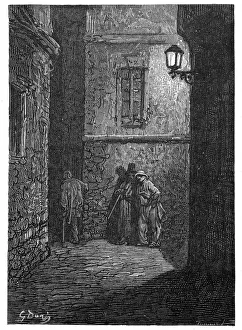
Victorian London - A shady placeVintage engraving showing a scene from 19th Century London England. A dark alley in Whitechapel circa 1870
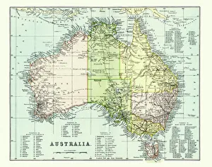
Antique Map of Australia Late 19th CenturyAntique Map of Australia in the late 19th Century
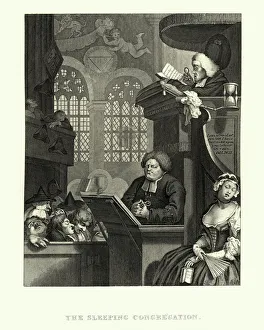
The Sleeping Congregation, William HogarthVintage engraving of The Sleeping Congregation, William Hogarth. Interior of a church where the congregation sleeps as the clergyman reads from the gospel
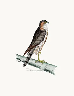
Sparrow Hawk bird of preyA photograph of an original hand-colored engraving from The History of British Birds by Morris published in 1853-1891
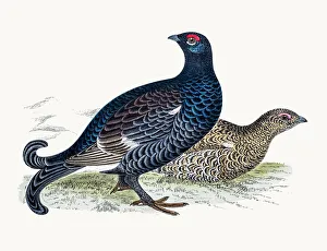
Black grouse game birdA photograph of an original hand-colored engraving from The History of British Birds by Morris published in 1853-1891
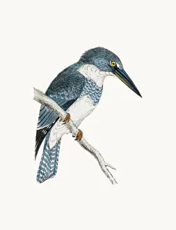
Belted kingfisher birdA photograph of an original hand-colored engraving from The History of British Birds by Morris published in 1853-1891
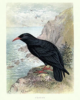
Natural History, Birds, Red-billed chough (Pyrrhocorax pyrrhocorax)Vintage engraving of a red-billed chough, Cornish chough or simply chough (Pyrrhocorax pyrrhocorax), is a bird in the crow family, one of only two species in the genus Pyrrhocorax
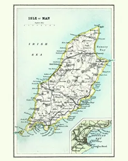
Antique map, Isle of Man 19th CenturyVintage engraving of a Isle of Man 19th Century with detail of Douglas
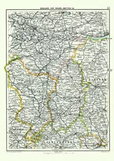
Antique map, West Yorkshire, Derby, Nottingham, Lincoln, 19th CenturyVintage engraving of a Antique map, West Yorkshire, Derby, Nottingham, Lincoln, Stafford, Leicester, Rutland, England. 19th Century
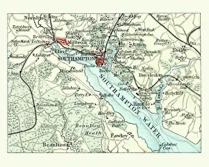
Antique map, Southampton, England, 19th CenturyVintage engraving of a Antique map Southampton, , England, 19th Century
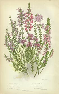
Heath, Heather, Ling, Scotland, Victorian Botanical IllustrationVery Rare, Beautifully Illustrated Antique Engraved Heath, Heather, Ling, Scotland, Victorian Botanical Illustration Victorian Botanical Illustration
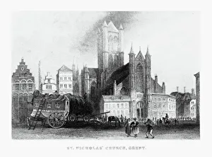
St. Nicholasa Church in Ghent, Belgium Circa 1887Beautifully Illustrated Antique Engraved Victorian Illustration of St. Nicholasa Church in Ghent, Belgium Circa 1887. Source: Original edition from my own archives
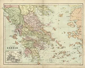
Antique map of Ancient Greece
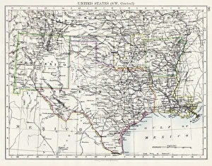
United States South West Central map 1897The World-Wide Atlas of Modern Geography, Political and Physical W. & A.K. Johnston - London 1897
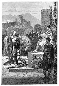
Vercingetorix surrendering to Julius CaesarIllustration of a Vercingetorix surrendering to Julius Caesar
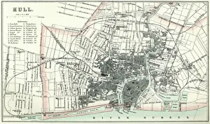
Map of HullVintage map from 1880 of Hull in the East Riding of Yorkshire, England. The city of Hull has served as market town, military supply port, trading hub, fishing and whaling centre
England and wales map 1895Meyers Konversations-Lexikon. Ein Nachschlagewerk des allgemeinen Wissens, 5th edition 17 volumes Bibliographisches Institut - Leipzig 1895-1897
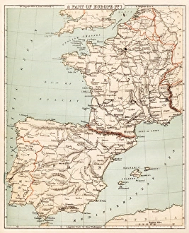
Map of Spain and France 1869Cornells Grammars-School Geography - S.S. Cornell - New York D. Appleton and Company 1869
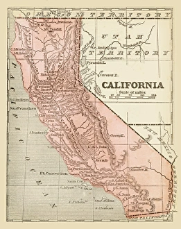
Old map of California 1855System of Geography for the use of schools by Sidney E. Morse - Published by Harper & Brothers - New York 1855
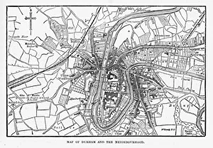
Map of the City of Durham, England Victorian Engraving, 1840Very Rare, Beautifully Illustrated Antique Engraving of Map of the City of Durham, England Victorian Engraving, 1840. Source: Original edition from my own archives
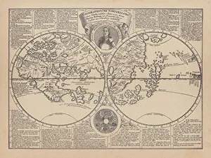
World map by Martin Behaim, 1492, wood engraving, published 1884World map by Martin Behaim, 1492. Woodcut engraving from my archive, published in 1884
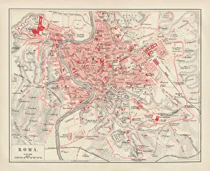
City map of Rome, lithograph, published in 1878City map of Rome, Italy. Lithograph, published in 1878
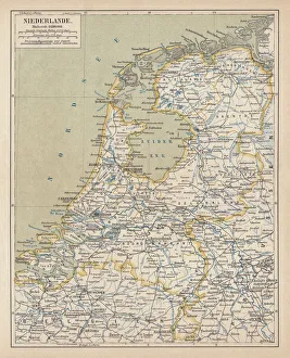
Map of the Netherlands, lithograph, published in 1877Map of the Netherlands. Lithograph, published in 1877
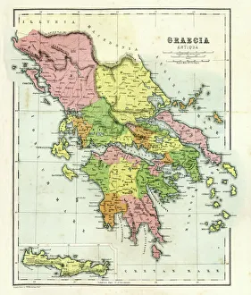
Antique map of Ancient Greece, 1864
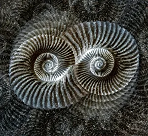
Shell fossil collageDigital illustration featuring a plaster cast of a shell fossil and sand texture
Map of Berlin 1895Map of Berlin (surroundings), Germany
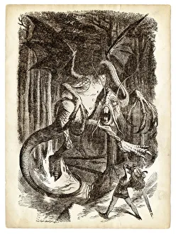
Alice and the Jabberwocky Knight engraving 1899Thought the Looking-Glass and What Alice found there