mail_outline sales@mediastorehouse.com
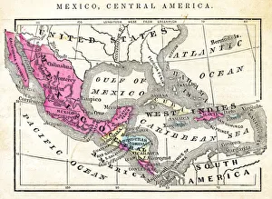
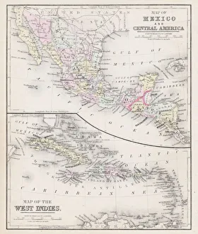
Map of Mexico and Central America 1871Colton and Fitchs Introductory School Geography - New York: Sheldon and Company 1871
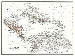
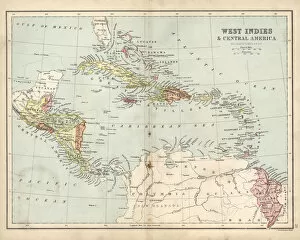
Map of West Indies 1894Johnsons Universal Cyclopedia - Volume VIII New York - A. J. Johnson Company 1894
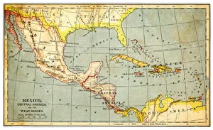
Map of Mexico and West indies 1883The Eclectic Elementary Geography by Van Antwerp, Bragg & C0 / Cincinnati -New York 1883
Lake Fishermencirca 1950: Three Mexican fishermen in separate boats at twighlight on Lake Patzcuaro. The lakes volume has recently begun to diminish at an alarming rate. (Photo by Three Lions/Getty Images)
Antique Map of Central America and West IndesVintage map of Central America and West Indes, from 1894
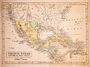
Map of Mexico and West Indies 1877Warrens Common School Geography 1877
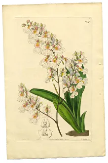
Gynandria Monandria Victorian Botanical Illustration, Oncidium, Oncidium Pulchellum, 1835Very Rare, Beautifully Illustrated Antique Engraved and Hand Colored Victorian Botanical Illustration of Oncidium, Oncidium Pulchellum, Gynandria Monandria Victorian Botanical Illustration, 1835
Capuchin monkey (Cebus capucinus) Costa RicaCapuchin monkey photographed in Costa Rica
Flag of El Salvador
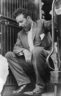
General Villa2nd July 1919: General Francisco Pancho Villa (1877 - 1923) Mexican bandit and hero of the Mexican Revolution. (Photo by Topical Press Agency/Getty Images)
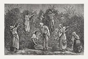
Coffee harvest in Costa Rica, wood engraving, published in 1888Coffee harvest in the Republic of Costa Rica. Wood engraving after a drawing by Paul Frenzeny (American painter, 1840 - 1902), published in 1888
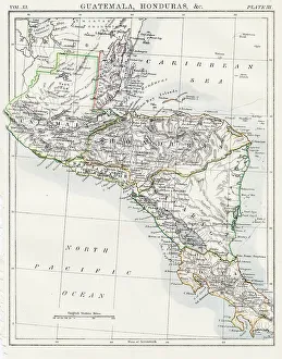
Guatemala and Honduras map 1883Encyclopedia Britannica 9th Edition New York Samuel L. Hall 1883 Vol XI
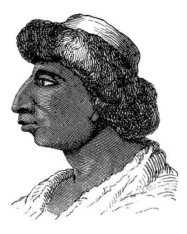
Aztec people, Mexican culture between the 14th-16th centuryIllustration of a Aztec people, Mexican culture between the 14th-16th century
Gossypium hirsutum, Upland Cotton plant
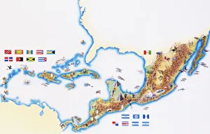
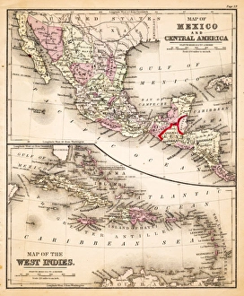
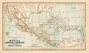
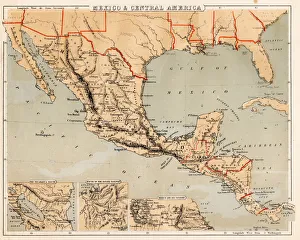
Map of Mexico, Central America and Caribbean
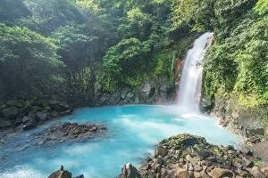
Rio Celeste waterfall, Tenorio volcano national park, Costa RicaRio Celeste waterfall, Tenorio Volcano National Park, Guanacaste, Costa Rica
Rio Celeste river in the green forest of Costa RicaRio Celeste, Tenorio Volcano National Park, Guanacaste, Costa Rica
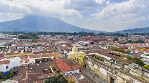
Aerial view of La Union Public Park, Antigua, GuatemalaElevated view of park at La Antigua, Guatemala. Antigua are today a favorite tourist destination. Antigua is as a partially restored colonial city with majestic churches and monasteries
Arco de Santa Catalina (Santa Catalina Arch) and Antigua City in Guatemala, High angle viewCity of Antigua and elevated view of Santa Catalins Arch or Arco de Santa Catalina. This is probably the most iconic place in Antigua Guatemala
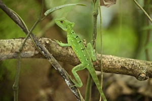
Plumed basilisk, Green basilisk, Double crested basilisk or Jesus Christ lizard -Basiliscus plumifrons-, female, perched on a branch, La Fortuna, Costa Rica, Central America
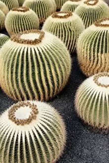
Golden Barrel Cactus, Golden Ball Cactus or Mother-in-Laws Cushion -Echinocactus grusonii-, several cacti
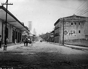
Main Streetcirca 1900: A view of the dusty Main Street of Puerto Limon, Costa Rica. (Photo by Topical Press Agency/Getty Images)
Agalychnis callidryas, Leaf, Nature, Night, Outdoors, Red, Travel Destinations, Tree, america, amphibian, animal, animal themes, animals in the wild, arboreal, arenal volcano national park
Antique map of West Indies and Central America, 19th Century, 1873
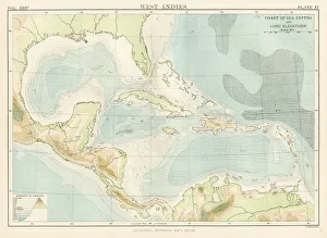
West Indies map 1885Encyclopedia Britannica 9th Edition New York Charles Scribners and Sons 1885 Vol XXIV
Central America map 1893Johnsonas Universal Cyclopedia - Charles Kendall - New York 1893
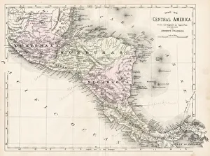
Map of Central America, 19th CenturyVintage engraving of a Map of Central America, 19th Century
Map of Mexico and West Indies 1883Warrens Common School Geography
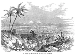
Mexico Central america scene illustration 1886Mexico Central america scene illustration Maps Monteith Physical Geography 1886
Mexico and Central America map 1881Coltons Common School Geography 1881 New York Sheldon and Co
Mexico and Central America map 1869Cornells Grammars-School Geography - S.S. Cornell - New York D. Appleton and Company 1869
Mexico and Central America map 1856Colton and Fitchs Modern School Geography by George W. Fitch - New York 1856
Voyages of Christopher Columbus, wood engraving, published c. 1882Map with the routes of the four voyages of Christopher Columbus in the Caribbean Sea. Wood engraving, published c. 1882
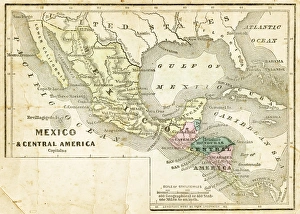
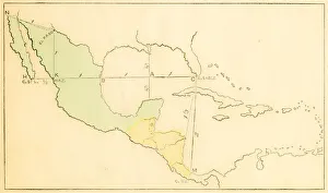
Mexico, Texas, Guatimala and West Indies 1852 Map
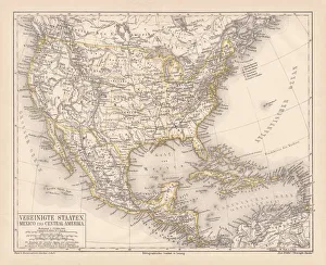
United States of America, Mexico and Central America, published in 1878United States of America, Mexico and Central America. Lithograph, published in 1878
Red-legged Honeycreeper eating banana - Costa Rica
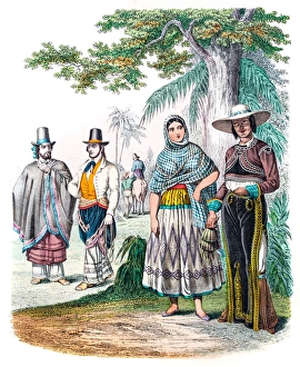
Mexicans in traditional clothes engraving 1853
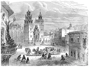
Guanajuato gran plaza Mexico engraving 1875The Independent Course Comprehensive Geography by James Monteith, A.S. Barnes & Co, New York & Chicago 1875
Farmers and cattle Mexico engraving 1875The Independent Course Comprehensive Geography by James Monteith, A.S. Barnes & Co, New York & Chicago 1875
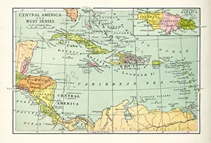
Central America and West Indies map 1875The Independent Course Comprehensive Geography by James Monteith, A.S. Barnes & Co, New York & Chicago 1875
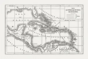
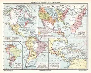
Map of Americas history 1895Meyers Konversations-Lexikon. Ein Nachschlagewerk des allgemeinen Wissens, 5th edition 17 volumes Bibliographisches Institut - Leipzig 1895-1897
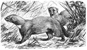
Tayra (Galictis barbara)illustration of a Tayra (Galictis barbara)
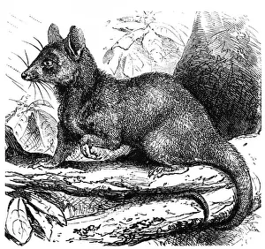
Grey opossum (Didelphys cinerea)
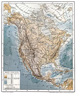
North AmericaAntique illustration of a North America
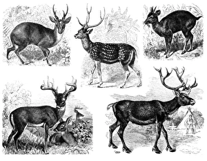
DeerAntique illustration of a deer
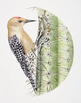
Gila Woodpecker, Melanerpes uropygialis, pecking at a cactus
Rynchops niger, Black Skimmer dipping its beak into shallow water in mid-flight
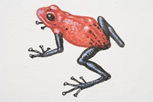
Poison-dart Frogs (Dendrobatidae)