mail_outline sales@mediastorehouse.com
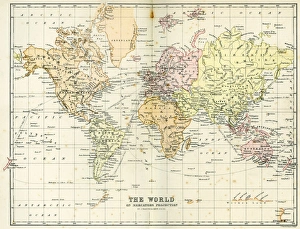
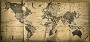
Antique Map of the WorldVintage map of the World from 1884
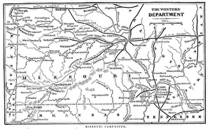
Missouri CampaignsVintage engraving from 1863 of a map of the Missouri Campaigns from the time of the American Civil War
Vintage Map of New York at the beginning of the 18th Century. from 1880
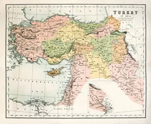
Antique Map of TurkeyAntique map of Turkey from 1867
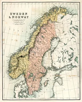
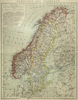
Antique Map of Sweden and NorwayAntique map of Sweden and Norway from 1867
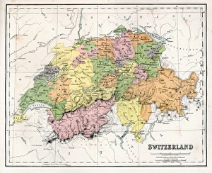
Antique Map of SwitzerlandAntique map of Switzerland from 1867
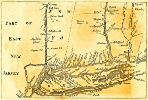
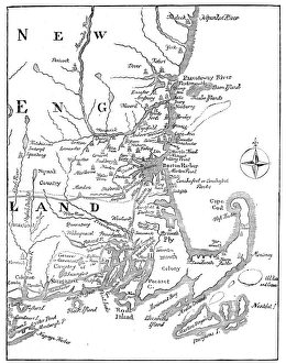
Vintage Map of New England at the beginning of the 18th century
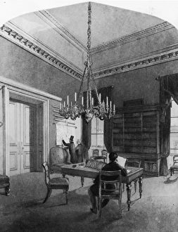
Map Roomcirca 1850: Gentlemen consulting charts in the map room of the United Service Club, Pall Mall, London. An engraving by H Melville after L L Jewett. (Photo by Hulton Archive/Getty Images)
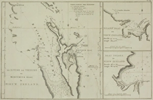
Antique charts of New Zealand
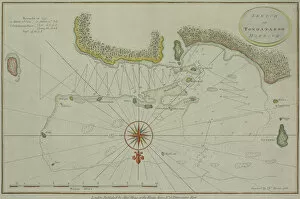
Antique map of Tongataboo in the South Pacific
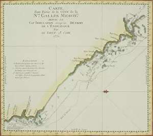
Antique map of coast of southeast Australia
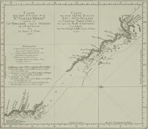
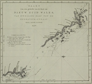
Antique map of New South Wales in Australia
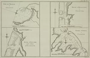
Antique maps of Tahiti and other South Pacific islands
Antique map of coast of New South Wales in Australia
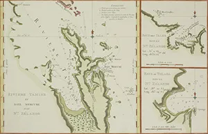
Antique maps of New Zealand
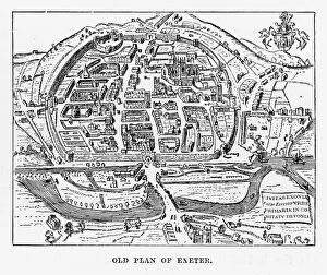
Old Plan of Exeter in Devon, England Victorian Engraving, 1840Very Rare, Beautifully Illustrated Antique Engraving of Old Plan of Exeter in Devon, England Victorian Engraving, 1840. Source: Original edition from my own archives
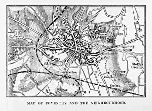
Map of Coventry in Warwickshire, England Victorian Engraving, 1840Very Rare, Beautifully Illustrated Antique Engraving of Map of Coventry in Warwickshire, England Victorian Engraving, 1840. Source: Original edition from my own archives
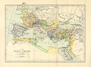
Roman Empire in the Apostolic Age Map, Engraving, 1892Very rare, beautifully detailed engraving of Roman Empire in the Apostolic Age Map, Engraving, Published in 1892. Original edition from my own archives. Copyright has expired on this artwork
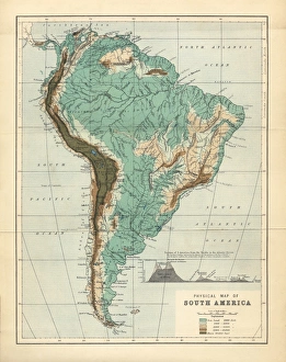
South America Physical Map, Engraving, 1892Very rare, beautifully detailed engraving of South America Physical Map, Engraving, Published in 1892. Original edition from my own archives. Copyright has expired on this artwork. Digitally restored
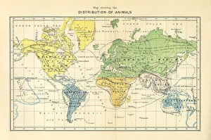
Distribution of Animals Map, Engraving, 1892Very rare, beautifully detailed engraving of North America Physical Map, Engraving, Published in 1892. Original edition from my own archives. Copyright has expired on this artwork. Digitally restored
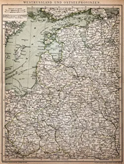
West Russia and Baltic provinces
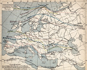
Map of plant geography
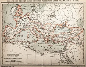
Roman empire under Trajan
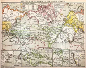
Maps for history of geography
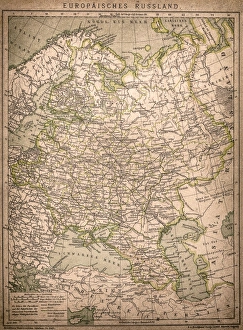
European RussiaAntique illustration of a European Russia
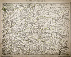
Central Russia
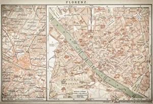
map of florenceEngraved illustrations of the City of Florence
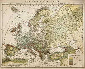
Rain map of EuropeAntique illustration of a rain map of Europe
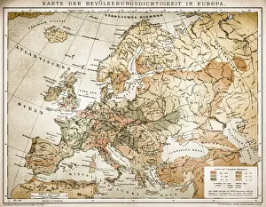
Population tightness map of Europe
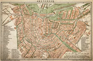
AmsterdamAntquie Map of Amsterdam
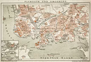
Plymouth and the surrounding area
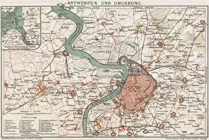
Antwerp and environmentAntique illustration of a Map of Antwerp
Sweden and NorwayAntique map of Sweden and Norway
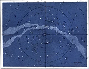
The northern skyIllustration of the northern sky
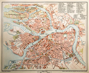
St. PetersburgAntique illustration of a St. Petersburg
Different kinds of HummingbirdsIllustration of a different kinds of Hummingbirds
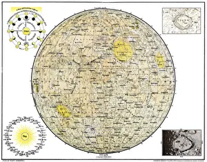
Lunar MapAntique illustration of a Lunar Map
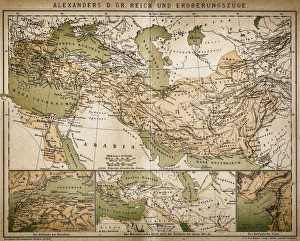
Map of Alexanders empire and conquestsAntique illustration Map of Alexanders empire and conquests
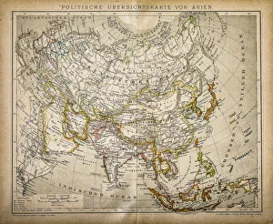
Political Map of AsiaAntique illustration of Political Map of Asia
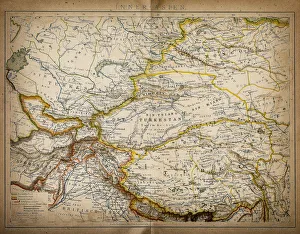
Map of inner AsiaAntique illustration of a inner Asia
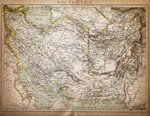
Map of West AsiaAntique illustration of a West Asia
The World mapAntique illustration of a map of the World
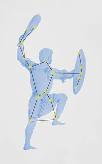
A diagram illustrating the constellation of Orion complete with image of a hunter raising a bat and shield
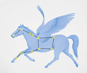
A diagram illustrating the constellation of Pegasus complete with image of a winged horse
A diagram illustrating the constellation of Ursa Major complete with image of a bear
A diagram illustrating the constellation of Canis Major complete with image of dog
A diagram illustrating the constellation of Scorpius complete with image of a scorpion
Illustration, index finger being pressed down on chart of fingerprints