mail_outline sales@mediastorehouse.com
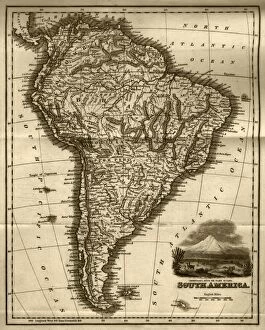
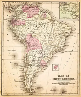
Map of South America (early 19th century steel engraving)A steel engraving of a map from the early 19th century of Brazil and Paraguay in South America, from A System of Geography, Popular and Scientific, or A Physical, Political
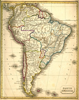
Antquie Map of South AmericaVintage map of South America from 1837
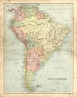
Antique damaged map of South America in the 19th CenturyVintage engraving of a Antique map of South America in the 19th Century, 1873
Magellanic Penguin (Spheniscus magellanicus), La Isla Magdalena, Patagonia, Chile, South America
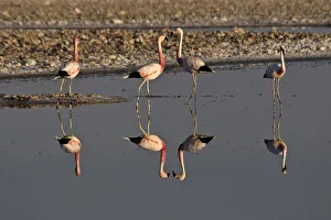
Flamingos (Phoenicopteridae), San Pedro de Atacama, Atacama Desert, Chile, South America
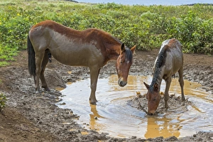
Feral horses, mud bath, Easter Island, Chile
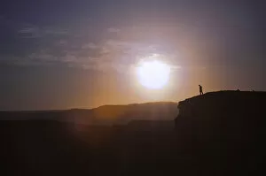
Man standing on the edge of a cliff at sunset, Valle de la Luna, San Pedro de Atacama, Chile
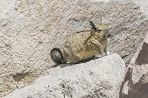
Southern viscacha -Lagidium viscacia-, Arica y Parinacota Region, Chile
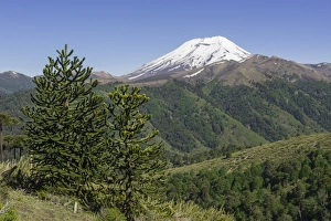
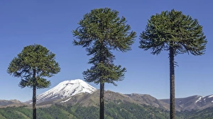
Monkey Puzzle Tree -Araucaria araucana- and Lonquimay volcano, Lonquimay, Region de la Araucania, Chile
Chilean Araucaria -Araucaria araucana- and Lonquimay volcano, Lonquimay, Araucania Region, Chile
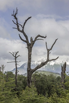
Snow-covered mountains and a dead tree, Carretera Austral, Chaiten, Los Lagos Region, Chile
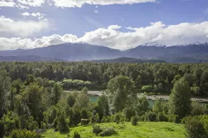
Agricultural land, forest and river, Cisnes, Region de Aysen, Chile
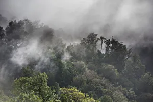
Temperate rain forest and fog, Cisnes, Aysen Province, Chile
Rano Ranaku, Easter Island
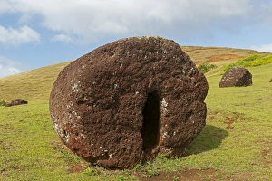
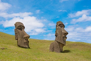
Stone sculptures, Easter Island, Chile
Row of Moai statues, Rano Raraku, Easter Island, Chile
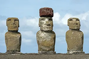
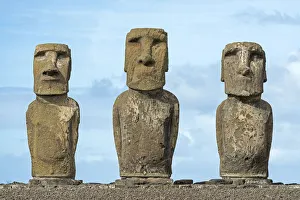
Three Moai statues, Rano Raraku, Easter Island, Chile
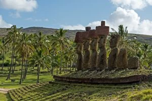
Moais, palm trees, near Anakena, Rapa Nui, Easter Island, Chile
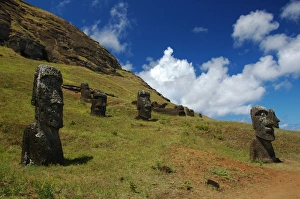
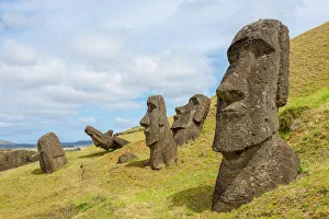
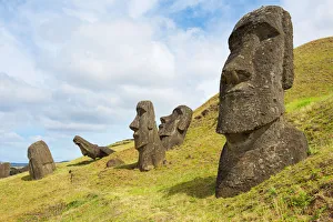
Group of Moai, Rano Raraku, Easter Island, Chile
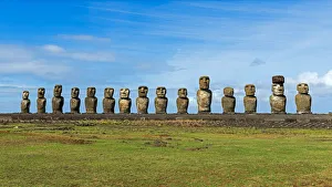
Easter Island, Ahu Tongariki, Moai portraitAhu Tongariki is the largest Ahu on Easter Island. It was substantially restored in the 1990s
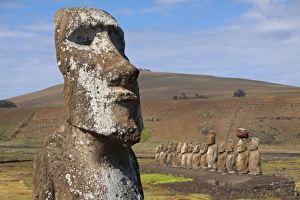
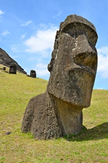
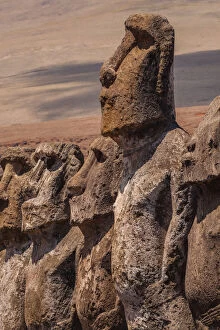
Big half buried moai portrait in Easter IslandRano Raraku was a quarry for about 500 years until the early eighteenth century, and supplied the stone from which about 95% of the islands known monolithic sculptures (moai) were carved
Two half buried huge moai statues in Easter IslandRano Raraku was a quarry for about 500 years until the early eighteenth century, and supplied the stone from which about 95% of the islands known monolithic sculptures (moai) were carved
Easter island landscape with moais in Rano RarakuRano Raraku was a quarry for about 500 years until the early eighteenth century, and supplied the stone from which about 95% of the islands known monolithic sculptures (moai) were carved
Easter island landscape. Several moai in sunny dayRano Raraku was a quarry for about 500 years until the early eighteenth century, and supplied the stone from which about 95% of the islands known monolithic sculptures (moai) were carved
Panorama of a colorful sunset in Torres del Paine, Chile
Easter Island Statues, Rano Raraku quarryRapa Nuis mysterious moai statues stand in silence. Moai, or mo ai, are monolithic human figures carved by the Rapa Nui people on Easter Island in eastern Polynesia between 1250 and 1500 A.D
The Continent of South America, Circa 1850Engraved illustrations of the Map of South America from Iconographic Encyclopedia of Science, Literature and Art, Published in 1851. Copyright has expired on this artwork. Digitally restored
Chile map 1897The World-Wide Atlas of Modern Geography, Political and Physical W. & A.K. Johnston - London 1897
South America map 1893Johnsonas Universal Cyclopedia - Charles Kendall - New York 1893
Argentina, Chile, Bolivia, Uruguay, and Paraguay, lithograph, published in 1897Argentina, Chile, Bolivia, Uruguay, and Paraguay. Lithograph, published in 1897
South America map 1881Harpers School Geography, New York, Harpers and Brothers, 1881
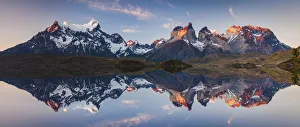
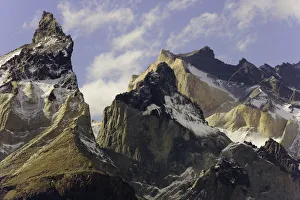
Torres del Paine, Patagonia, ChileSpectacular, smooth and colorful granite crags of mountain range, its steep granite towers known as cuernos (horns), glaciers, and cumulus clouds in blue sky
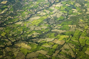
Aerial of farm fields, south of Santiago, ChileAerial view of green mosaic of farm fields intersected by roads, rivers and streams on sunny afternoon, south of Santiago, fall, Chile, South America
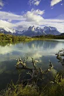
Lake Pehoe, Torres del Paine National Park, ChileSmooth colorful granite crags and glaciers of mountain range and its steep granite towers known as cuernos (horns) tower above emerald Lake Pehoe and beautiful forests of moss covered trees
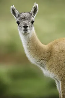
Guanaco young calf standing in grassGuanaco (Lama guanicoe) young calf standing on grassy slope close to its herd of camel-like animals, the largest mammals native to South Americas arid steppes and mountains, spring
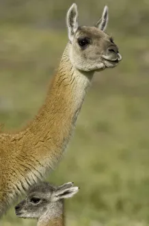
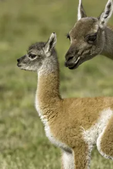
Guanaco calf and its mother on grassy slopeGuanaco (Lama guanicoe) young calf and its mother standing on grassy slope close to their herd of camel-like animals, the largest mammals native to South Americas arid steppes and mountains, spring
Guanaco female sniffing her calfGuanaco female (Lama guanicoe) tenderfly sniffing her young calf on grassy slope close to its herd of camel-like animals, the largest mammals native to South Americas arid steppes and mountains
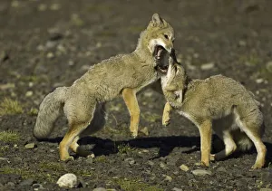
Patagonia foxes, ChileTwo Paragonian grey fox pups (Pseudalopex griseus) small canids known as zorro, playfully interacting, wrestling and leaping, fall, Torres del Paine National Park, Patagonia, Magellanes, Andes
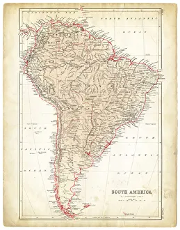
Map of South America 1883Warrens Common School Geography
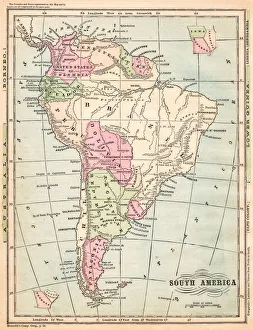
South America map 1881Coltons Common School Geography 1881 New York Sheldon and Co
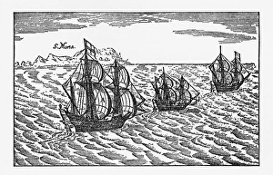
Van Noort Sailing the Strait of Magellan, Engraving of 1600Very Rare, Beautifully Illustrated Antique Engraved Victorian Illustration of Historical Engraving of Van Noort Sailing the Strait of Magellan, 1600. Copyright has expired on this artwork
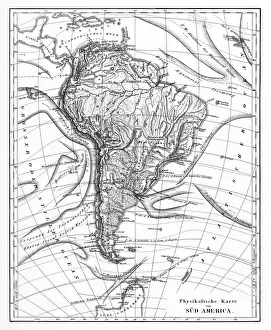
Victorian Map of North AmericaEngraved illustrations of the Physical Map of South America from Iconographic Encyclopedia of Science, Literature and Art, Published in 1851. Copyright has expired on this artwork. Digitally restored
Argentina, Bolivia, Chile, Paraguay and Uruguay, lithograph, published in 1874South American countries: Argentina, Bolivia, Chile, Paraguay and Uruguay. Lithograph, published in 1874
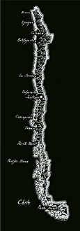
Antique ChileChile Map, - Antique style. Includes mountains and water bodies. High detail - vector illustration
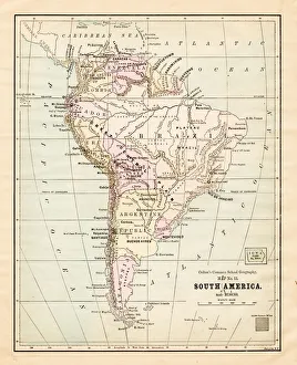
South America map 1875The Independent Course Comprehensive Geography by James Monteith, A.S. Barnes & Co, New York & Chicago 1875
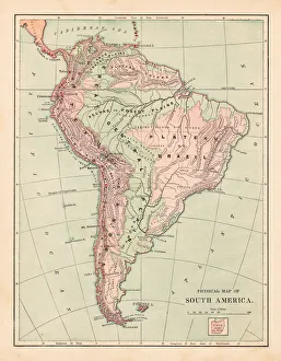
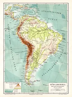
South America geological map 1895Meyers Konversations-Lexikon. Ein Nachschlagewerk des allgemeinen Wissens, 5th edition 17 volumes Bibliographisches Institut - Leipzig 1895-1897
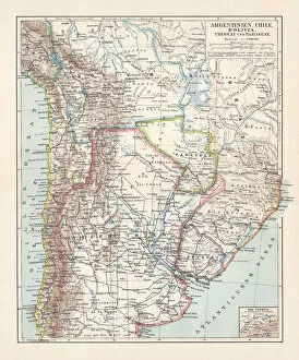
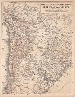
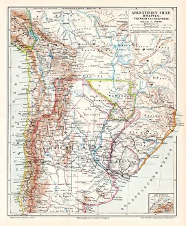
Argentina Chile Bolivia map 1895Meyers Konversations-Lexikon. Ein Nachschlagewerk des allgemeinen Wissens, 5th edition 17 volumes Bibliographisches Institut - Leipzig 1895-1897
South America map 1878Encyclopedia Britannica 9th Edition Vol I New York, Samuel Hall 1878