mail_outline sales@mediastorehouse.com
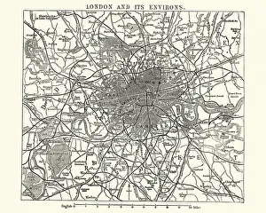
Map of Victorian London and its environs, England, 1870sVintage engraving of a Map of Victorian London and its environs, England, 1870s, 19th Century
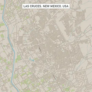
Las Cruces New Mexico US City Street MapVector Illustration of a City Street Map of Las Cruces, New Mexico, USA. Scale 1:60, 000. All source data is in the public domain. U.S
Roswell New Mexico US City Street MapVector Illustration of a City Street Map of Roswell, New Mexico, USA. Scale 1:60, 000. All source data is in the public domain. U.S
Westminster Colorado US City Street MapVector Illustration of a City Street Map of Westminster, Colorado, USA. Scale 1:60, 000. All source data is in the public domain. U.S
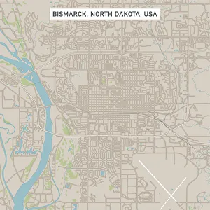
Bismarck North Dakota US City Street MapVector Illustration of a City Street Map of Bismarck, North Dakota, USA. Scale 1:60, 000. All source data is in the public domain. U.S
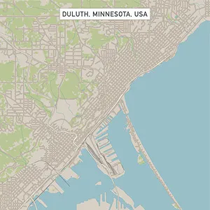
Duluth Minnesota US City Street MapVector Illustration of a City Street Map of Duluth, Minnesota, USA. Scale 1:60, 000. All source data is in the public domain. U.S
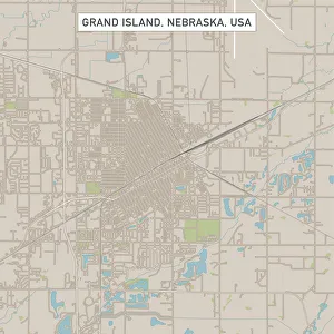
Grand Island Nebraska US City Street MapVector Illustration of a City Street Map of Grand Island, Nebraska, USA. Scale 1:60, 000. All source data is in the public domain. U.S
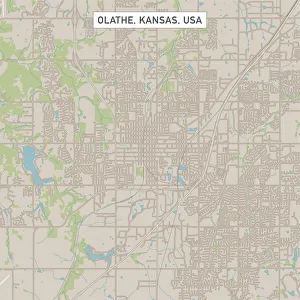
Olathe Kansas US City Street MapVector Illustration of a City Street Map of Olathe, Kansas, USA. Scale 1:60, 000. All source data is in the public domain. U.S
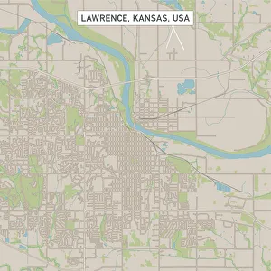
Lawrence Kansas US City Street MapVector Illustration of a City Street Map of Lawrence, Kansas, USA. Scale 1:60, 000. All source data is in the public domain. U.S
Houses of North Queensferry and the Forth bridgeNorth Queensferry, Scotland - June, 2017: Houses of North Queensferry and the Forth bridge
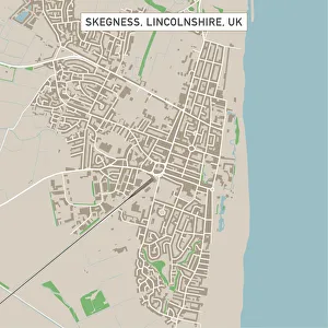
Skegness Lincolnshire UK City Street MapVector Illustration of a City Street Map of Skegness, Lincolnshire, UK. Included files are EPS (v10) and Hi-Res JPG. Data courtesy from Ordnance Survey: VectorMap District https
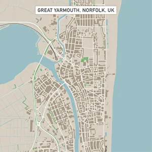
Great Yarmouth Norfolk UK City Street MapVector Illustration of a City Street Map of Great Yarmouth, Norfolk, UK. Included files are EPS (v10) and Hi-Res JPG. Data courtesy from Ordnance Survey: VectorMap District https
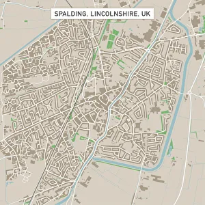
Spalding Lincolnshire UK City Street MapVector Illustration of a City Street Map of Spalding, Lincolnshire, UK. Included files are EPS (v10) and Hi-Res JPG. Data courtesy from Ordnance Survey: VectorMap District https
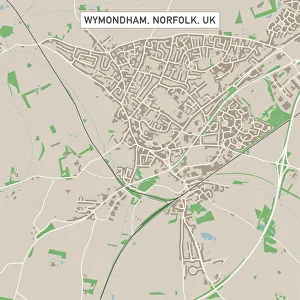
Wymondham Norfolk UK City Street MapVector Illustration of a City Street Map of Wymondham, Norfolk, UK. Included files are EPS (v10) and Hi-Res JPG. Data courtesy from Ordnance Survey: VectorMap District https
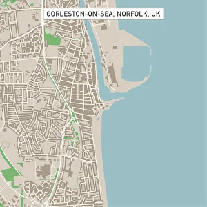
Gorleston-on-Sea Norfolk UK City Street MapVector Illustration of a City Street Map of Gorleston-on-Sea, Norfolk, UK. Included files are EPS (v10) and Hi-Res JPG. Data courtesy from Ordnance Survey: VectorMap District https
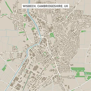
Wisbech Cambridgeshire UK City Street MapVector Illustration of a City Street Map of Wisbech, Cambridgeshire, UK. Included files are EPS (v10) and Hi-Res JPG. Data courtesy from Ordnance Survey: VectorMap District https
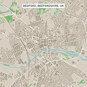
Bedford Bedfordshire UK City Street MapVector Illustration of a City Street Map of Bedford, Bedfordshire, UK. Included files are EPS (v10) and Hi-Res JPG. Data courtesy from Ordnance Survey: VectorMap District https
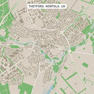
Thetford Norfolk UK City Street MapVector Illustration of a City Street Map of Thetford, Norfolk, UK. Included files are EPS (v10) and Hi-Res JPG. Data courtesy from Ordnance Survey: VectorMap District https
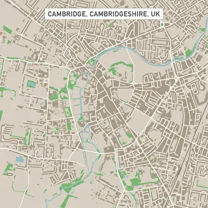
Cambridge Cambridgeshire UK City Street MapVector Illustration of a City Street Map of Cambridge, Cambridgeshire, UK. Included files are EPS (v10) and Hi-Res JPG. Data courtesy from Ordnance Survey: VectorMap District https
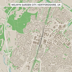
Welwyn Garden City Hertfordshire UK City Street MapVector Illustration of a City Street Map of Welwyn Garden City, Hertfordshire, UK. Included files are EPS (v10) and Hi-Res JPG
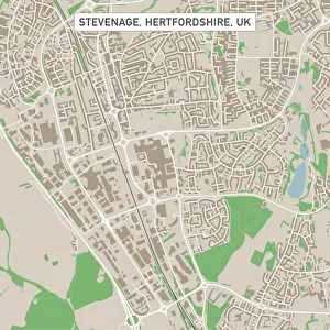
Stevenage Hertfordshire UK City Street MapVector Illustration of a City Street Map of Stevenage, Hertfordshire, UK. Included files are EPS (v10) and Hi-Res JPG. Data courtesy from Ordnance Survey: VectorMap District https
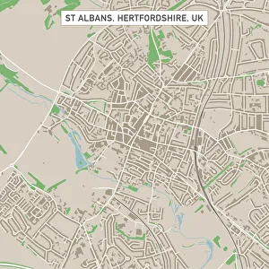
St Albans Hertfordshire UK City Street MapVector Illustration of a City Street Map of St Albans, Hertfordshire, UK. Included files are EPS (v10) and Hi-Res JPG. Data courtesy from Ordnance Survey: VectorMap District https
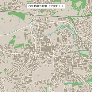
Colchester Essex UK City Street MapVector Illustration of a City Street Map of Colchester, Essex, UK. Included files are EPS (v10) and Hi-Res JPG. Data courtesy from Ordnance Survey: VectorMap District https
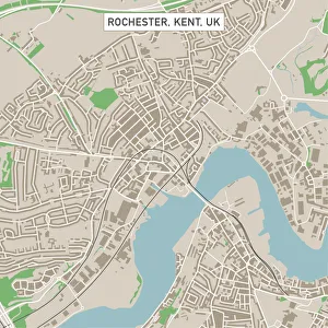
Rochester Kent UK City Street MapVector Illustration of a City Street Map of Rochester, Kent, UK. Included files are EPS (v10) and Hi-Res JPG. Data courtesy from Ordnance Survey: VectorMap District https
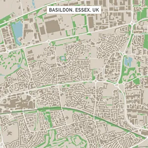
Basildon Essex UK City Street MapVector Illustration of a City Street Map of Basildon, Essex, UK. Included files are EPS (v10) and Hi-Res JPG. Data courtesy from Ordnance Survey: VectorMap District https
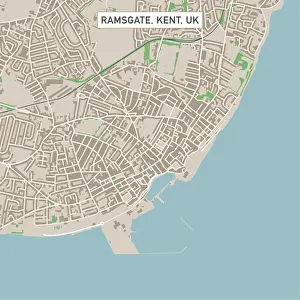
Ramsgate Kent UK City Street MapVector Illustration of a City Street Map of Ramsgate, Kent, UK. Included files are EPS (v10) and Hi-Res JPG. Data courtesy from Ordnance Survey: VectorMap District https
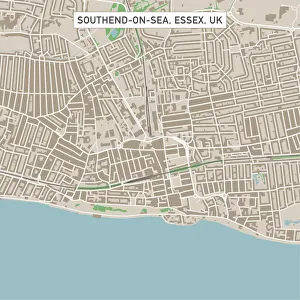
Southend-on-Sea Essex UK City Street MapVector Illustration of a City Street Map of Southend-on-Sea, Essex, UK. Included files are EPS (v10) and Hi-Res JPG. Data courtesy from Ordnance Survey: VectorMap District https
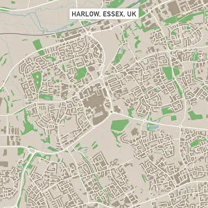
Harlow Essex UK City Street MapVector Illustration of a City Street Map of Harlow, Essex, UK. Included files are EPS (v10) and Hi-Res JPG. Data courtesy from Ordnance Survey: VectorMap District https
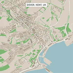
Dover Kent UK City Street MapVector Illustration of a City Street Map of Dover, Kent, UK. Included files are EPS (v10) and Hi-Res JPG. Data courtesy from Ordnance Survey: VectorMap District https
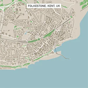
Folkestone Kent UK City Street MapVector Illustration of a City Street Map of Folkestone, Kent, UK. Included files are EPS (v10) and Hi-Res JPG. Data courtesy from Ordnance Survey: VectorMap District https
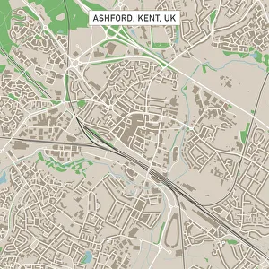
Ashford Kent UK City Street MapVector Illustration of a City Street Map of Ashford, Kent, UK. Included files are EPS (v10) and Hi-Res JPG. Data courtesy from Ordnance Survey: VectorMap District https
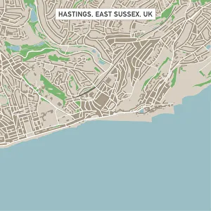
Hastings East Sussex UK City Street MapVector Illustration of a City Street Map of Hastings, East Sussex, UK. Included files are EPS (v10) and Hi-Res JPG. Data courtesy from Ordnance Survey: VectorMap District https
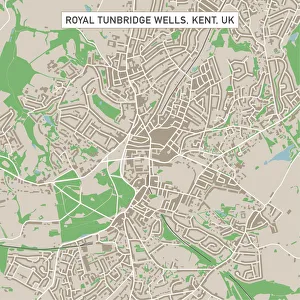
Royal Tunbridge Wells Kent UK City Street MapVector Illustration of a City Street Map of Royal Tunbridge Wells, Kent, UK. Included files are EPS (v10) and Hi-Res JPG. Data courtesy from Ordnance Survey: VectorMap District https
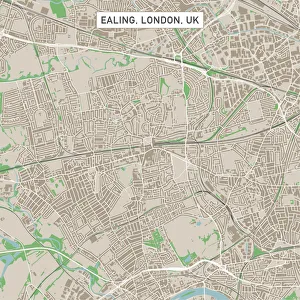
Ealing London UK City Street MapVector Illustration of a City Street Map of Ealing, London, UK. Included files are EPS (v10) and Hi-Res JPG. Data courtesy from Ordnance Survey: VectorMap District https
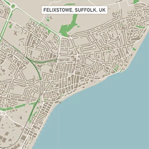
Felixstowe Suffolk UK City Street MapVector Illustration of a City Street Map of Felixstowe, Suffolk, UK. Included files are EPS (v10) and Hi-Res JPG. Data courtesy from Ordnance Survey: VectorMap District https
Clacton-on-Sea Essex UK City Street MapVector Illustration of a City Street Map of Clacton-on-Sea, Essex, UK. Included files are EPS (v10) and Hi-Res JPG. Data courtesy from Ordnance Survey: VectorMap District https
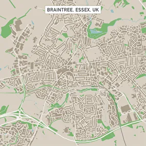
Braintree Essex UK City Street MapVector Illustration of a City Street Map of Braintree, Essex, UK. Included files are EPS (v10) and Hi-Res JPG. Data courtesy from Ordnance Survey: VectorMap District https
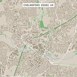
Chelmsford Essex UK City Street MapVector Illustration of a City Street Map of Chelmsford, Essex, UK. Included files are EPS (v10) and Hi-Res JPG. Data courtesy from Ordnance Survey: VectorMap District https
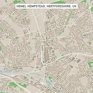
Hemel Hempstead Hertfordshire UK City Street MapVector Illustration of a City Street Map of Hemel Hempstead, Hertfordshire, UK. Included files are EPS (v10) and Hi-Res JPG
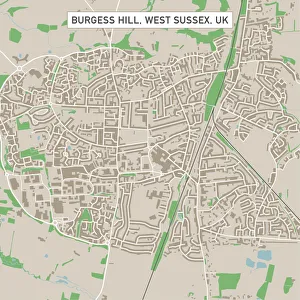
Burgess Hill West Sussex UK City Street MapVector Illustration of a City Street Map of Burgess Hill, West Sussex, UK. Included files are EPS (v10) and Hi-Res JPG. Data courtesy from Ordnance Survey: VectorMap District https
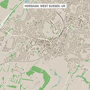
Horsham West Sussex UK City Street MapVector Illustration of a City Street Map of Horsham, West Sussex, UK. Included files are EPS (v10) and Hi-Res JPG. Data courtesy from Ordnance Survey: VectorMap District https
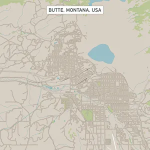
Butte Montana US City Street MapVector Illustration of a City Street Map of Butte, Montana, USA. Scale 1:60, 000. All source data is in the public domain. U.S
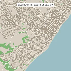
Eastbourne East Sussex UK City Street MapVector Illustration of a City Street Map of Eastbourne, East Sussex, UK. Included files are EPS (v10) and Hi-Res JPG. Data courtesy from Ordnance Survey: VectorMap District https
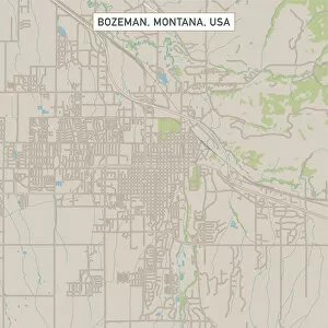
Bozeman Montana US City Street MapVector Illustration of a City Street Map of Bozeman, Montana, USA. Scale 1:60, 000. All source data is in the public domain. U.S
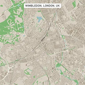
Wimbledon London UK City Street MapVector Illustration of a City Street Map of Wimbledon, London, UK. Included files are EPS (v10) and Hi-Res JPG. Data courtesy from Ordnance Survey: VectorMap District https
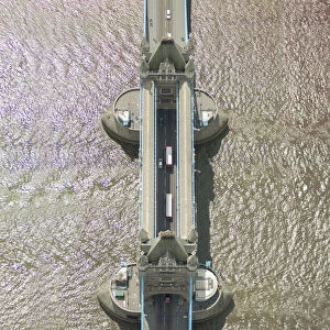
No People, Outdoors, Architecture, Travel, Tower Bridge, Square Image, London, Uk, Thames River, Capital Cities, Bridge, Aerial View, Day, Sunlight, Traffic, Communication, Transportation, City
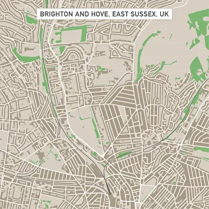
Brighton And Hove East Sussex UK City Street MapVector Illustration of a City Street Map of Brighton And Hove, East Sussex, UK. Included files are EPS (v10) and Hi-Res JPG
Eiffel tower from Champ de mars